SR 32/SR 67 in Madison and Delaware Counties

Today on a map of Indiana, there are two state highways connecting Anderson and Muncie. As the subject suggests, they are SR 32 and SR 67 (even though SR 67 actually hasn’t entered either for decades. But it wasn’t always that way.

When the Great Renumbering happened in 1926, SR 32 only connected Crawfordsville to Anderson, much like the Auto Trail of the same name. SR 67 would be applied to Ohio Avenue and Mounds Road. The original road crossed what is now the Anderson Municipal Airport to connect (as now Anderson Road) in Chesterfield to what is now SR 32. From there, SR 67 continued its journey to Muncie. While technically Mounds Road and Anderson Road are still connected, the road in place today is a replacement around the airport, as the old road west straight across what is now the runway.

At Muncie, what is now SR 32 east of the city was originally SR 28. That would change in 1931, when SR 28 (east out of Muncie) was changed to SR 32. According to the map sources that I have seen, however, the only state road connecting Anderson to Muncie was still SR 67. In 1933, the connecting road would share both the numbers 32 and 67.

Things got interesting in the Anderson area in 1934/1935. Two new state highways were being constructed along 53rd Street and 38th Street. The 53rd Street route was being added to the state highway system from SR 9 to Middletown as SR 236. The 38th Street route was, from information available, to become an Anderson bypass of SR 67. That route would travel across 38th Street to Rangeline Road, then connect to the then current SR 32/67 along Mounds Road.

Things changed again in 1936, when it was decided by the State Highway Commission to build a new state highway staying south of the Big Four (“B” Line) railroad, staying south of Daleville, and crossing Delaware County in a relatively straight line to Sharps, then turning toward, but not actually entering, Muncie until meeting SR 21/US 35. By this time, SR 236 was completed to Middletown. The new route would use 53rd Street, and the 38th Street route was removed from the pending state highway status.

53rd Street in Anderson was officially made SR 67 from SR 9 to Rangeline Road in 1937. SR 32 still used the Ohio Avenue/Mounds Road/Anderson Road route. The two state roads would reconnect using what is now Madison County Road 300 East. This short section would connect Mounds Road (SR 32) in the north to Union Township Pike (SR 67) in the south.

The new route of SR 67 would be along the corridor that is still SR 67 today across Delaware County. This would be what is also Delaware County Road 550 South to Honey Creek Road. From there, would again follow what is now SR 67 for a short distance, then the current route turns east before the 1937 route continued northeast to Fusion Road. It would then turn northeast, then north, along Madison Street, where it would combine with SR 21/US 35 into Muncie.

The new State Road 67 route would be completed by 1938. At that time, the State Road 32 route would still be located on the Mounds Road/Anderson Road route. What is now Madison County Road 100 N was given the number SR 232 from between Mounds Road (SR 32) to Union Township Pike (SR 67).

The next change would occur in 1960, when SR 32 was rerouted out of Anderson along the Third Street/University Boulevard corridor. Here it would connect to the original SR 67/32 route at Chesterfield. The old SR 32, along Ohio Avenue/Mounds Road to the Union Township Pike route of SR 67 would be changed to SR 232, which most of it is today. In 1965, the designation SR 232 would be truncated into Mound State Park, no longer connecting to a soon to disappear SR 67.

SR 67 would be rerouted along Interstate 69 from SR 9/67 between Pendleton and Anderson to near Daleville. The 1937 route of SR 67 would be returned to Madison County, and is currently referred to as Old State Road 67.

In the 21st Century, slight changes in SR 67 in Delaware County would occur, making the very long “S” curve that exists today.

The Original State Road System, as Shown in 1932

When I was writing yesterday’s blog entry, I had mentioned the fact there were two Official maps issued in 1932. The September 1932 map included something on the front that I had never seen before. It was a small map in the lower right hand corner (given the shape of the state of Indiana, this makes sense that this corner has always been used for the legend and such) that shows “pavement on original system.” Today, the whole purpose of this entry is to show that small map. It gives an idea of who much the state highway system had expanded since 1920. It didn’t include any state road numbers.

A glance at that map gives an idea of what “important” roads were not included in the original state highway system. For instance, not included in the Indianapolis area: the Crawfordsville Road (SR 34/US 136); the Michigan Road north (SR 29/US 421); and the Pendleton Pike (SR 67 and US 36). They were important roads prior to the state highway system…and became major routes after they were added.

1932 Indiana Official State Highway System inset of “Pavement On Original System.” Map was officially issued on 1 September 1932.

Keep in mind that all state roads technically ended at city limits. The Indiana State Highway Commission, when created, was not authorized to route state highways along city streets. It was up to the city to decide those routes. The state would post “trailblazers” pointing the city picked best route to get back to the official state road on the other side of the town.

West Marion County and I-465

This image has an empty alt attribute; its file name is images.jpg

The first part of the new beltway (almost) around Indianapolis started on the westside of Marion County. As mentioned in other articles, the original plan was to start Interstate 465 at Interstate 65 on the northwest side, with the replacement for State Road 100 (which I-465 officially was) heading south from there to circle around the county from there. Interchanges were planned at I-65, I-74/US 136, 10th Street, US 36 (Rockville Road), US 40 (Washington Street), Weir Cook Municipal Airport (Airport Expressway), Interstate 70, and SR 67 (Kentucky Avenue). According to USGS topo maps, like that included below, show that there was a stub ramp connecting I-465 to 62nd Street, although the ramp connecting to 62nd Street was listed as still proposed six years later.

1962 USGS topographic map showing the original interchange connection Interstate 65 and Interstate 465.

Construction started along the corridor in 1959. The Indianapolis News ran a series of pictures showing the plans set out by the State Highway Department. If you noticed the list of interchanges above, there were no plans for 56th Street or 38th Street to have ways to access 465. Bridges were to be built over 465 at 56th, 46th, 38th, 34th, and 21st Streets. (21st Street was a very special, and contentious, situation. I covered it in the article: “Building I-465 at West 21st Street. [8 May 2020]”)

Indianapolis News, 14 December 1959, showing the Indiana State Highway Department’s plans for the new Interstate 465 (also still called State Road 100 at the time) at the northern terminus of the highway.

The plans for Interstate 65 at that point were to continue to have it replace US 52 (Lafayette Road). The US 52 bypass at Lebanon was made part of the new I-65. The temporary plan was to connect I-65 just southeast of I-465 directly to US 52 until construction could continue. Then I-65 would also be US 52 from that point to northwest of Lebanon. I mention this only because the loop around Indianapolis was, apparently, easier to get approved than trying to run I-65 through town. (And since it would take another 16 years to complete, even to the point that an addition was planned to I-465 and completed before I-65 through Marion County says it all.)

It wouldn’t take long after the original plans for the interstate were laid down that changes were made. The non-planned 38th Street interchange was added to the deal. It was to be a partial cloverleaf interchange connecting to 38th Street at that point. Marion County had decided to build 38th Street from Lafayette Road east to the new White River bridge to be built by the city. At that point in history, 38th Street was a county road with nothing resembling the connections it has today as a major west side thoroughfare.

Indianapolis News, 11 December 1959, showing the future connection to 38th Street from I-465. This ramp would be built much later, when 38th Street was finally connected as a thoroughfare across Marion County.

The next interchange south of the “gonna be built someday” 38th Street was the connection to another interstate highway, Interstate 74. The plans shown in the Indianapolis News differ slightly from what was actually built. US 136 (Crawfordsville Road) is directly connected to the east end of the proposed interstate connection. This would change. It looks like the proposed interchange was moved slightly north, and Crawfordsville Road west of High School Road was turned north to connect to High School Road. This would be where US 136 would ultimately officially end.

Indianapolis News, 10 December 1959, showing the proposed connection between interstates 74 and 465. The original plan, and this was carried out, is that Interstate 74 would “travel over,” ISHD/INDOT term for multiplex, with I-465 from northwest to southeast Marion County.
1953 Topo map showing the intersection of West 10th Street and High School Road.

The next section did change, at least at one interchange, quite a bit. But before I describe that, let’s talk about the placement of I-465 from Vermont Street north to about where 16th Street would be, if it continued to High School/Girls School Road. The new interstate was planned, in that section, to be built directly over High School Road. This is not really a stretch, since High School Road, from Washington Street south to the Airport, was the original State Road 100. And I-465 was, for all intents and purposes, State Road 100 according to ISHD.

I have written a detailed history of SR 100 (SR 100: How did it come to be? [9 March 2019]) and an article about how, at one point, the connection between SR 100 on BOTH sides of Marion County were to have cloverleaf interchanges (“The Cloverleaf Interchanges at US 40 and SR 100” [20 November 2019]). If SR 100 had been completed on the west side, like it was on the north and east sides, I have no doubt that it would have followed High School Road north, probably, ultimately, to 86th Street, which was SR 100 along the northwest side.

The change in interchanges happened at 10th Street. The original plan was for a full cloverleaf interchange at that intersection. This would have pushed the eastbound 10th Street to southbound 465 ramp back closer to Glen Arm Road, where High School Road was rerouted to miss the interchange. What was ultimately built was a jumbled three-quarter cloverleaf with a flyover from westbound 10th to southbound 465.

In the end, High School Road was basically built over by 465 from Vermont to 10th Streets. 10th Street is a survey correction line, so High School actually moves slightly to the east at that point, as shown in the topo map to the left. For more information about survey lines, check out “Survey Lines and County Roads. (29 March 2019)”

Indianapolis News, 9 December 1959, showing the Indiana State Highway Department plans for I-465 from just south of the New York Central railroad tracks to just north of the Baltimore & Ohio Railroad tracks, including what was to originally be full cloverleaf interchanges at 10th Street and Rockville Road.
1953 USGS topo map of the area of Washington Street and High School Road. The area marked “Ben Davis” would be the location of the new cloverleaf interchange between US 40 and I-465.

From the looks of aerial photos in 1959 as shown in the Indianapolis News, the interchange at Washington Street was going to be very destructive. (Keep in mind that as of the writing of this article, MapIndy, my go to source for historic aerial photos of Marion County no longer offers that service. Maps are available, but the aerial photos are gone.) In addition to the shunting of Morris Street (a survey line and historic route of its own accord), most of where the interchange between US 40 and I-465 was basically what had been the town of Ben Davis.

Another thing would have to happen before this interchange would be built. It was determined, and reported, in July 1959 that an improvement of West Washington Street would have to occur before the interstate reached that point. US 40 was to be widened in the area. The work on Washington Street, however, would have to wait until sewer work in the area was completed…probably in 1961. Plans to widen Washington Street from 40 feet to 68 feet wide, with a four foot median and an eight parking lane on each side, were decided upon. Very little of that plan exists today…and if it does, it’s hard to find.

Indianapolis News, 8 December 1959, showing the proposed area of US 40 and Interstate 465.

The last area covered by the Indianapolis News in the series of articles (actually, it was the first since the editor staff decided to post them south to north, even though the interstate was built north to south!) shows the area of I-465 near Weir Cook Municipal Airport. The one change that I can see is what would become Airport Expressway (check out “Indianapolis’ Raymond Street Expressway” [4 February 2020] for the history of what started out as the Bradbury Expressway) was proposed to connect to the airport heading slightly north of due west, just above Southern Avenue. This section of the (now) Sam Jones Expressway is due east-west at the point it connects to Interstate 465. For a history of what is now Indianapolis International Airport, check out “Indianapolis Municipal Airport.” (20 August 2019)

Indianapolis News, 7 December 1959. This newspaper snippet shows the area of proposed I-465 near the (then) Weir Cook Municipal Airport (now Indianapolis International).

That covers the first of the construction of the State Road 100 replacement. I want to share this one last snippet from the Indianapolis News of 19 October 1960. It shows the construction of I-465/I-65/US 52 at 62nd Street…or the original northern end of Interstate 465.

Indianapolis News, 19 October 1960, showing the original northern end of Interstate 465.

Valley Mills (and the Naming of Southport)

I have to start to tell the story of a Decatur Township village by telling the story of another village in Perry Township. Many people looking at a map of Marion County would recognize, almost immediately, a different colored area in the south central part of the county. That area is Southport, an excluded city in Marion County. An excluded city (or town) is one in which is not included in the city of Indianapolis after the creation of UniGov. Southport has its own city government, but they also vote for the chief executive of Marion County…which happens to be the Mayor of Indianapolis, as well.

Southport was platted in 1849. Many people from the area know the story about how the city got its name. Being a Southport High School graduate, I have heard it many times. But one fact that seems to fall through the cracks when it comes to Southport is the name. Yes, it does have to do with being south. But not only its southern location in the county. It also had to do with the subject of this article. Southport is actually south of another town, in Decatur Township, called Northport.

Northport was a small village that was platted in 1839. There was very little in the area of the county that would become Northport. The Mooresville State Road, connecting Indianapolis to the Morgan County town, passed very close by to the village. A branch of that road, running along the survey line located five miles south of Indianapolis (now mostly known as Thompson Road) went directly to the little village.

The road that led to Northport would become a toll road, as would the Mooresville State Road. The road would acquire the name of “Northport and Mars Hill Road.” Today, it would be Thompson Road from Kentucky Avenue to High School Road, then Mooresville Road to Mann Road. This was the only access the town would have to the city of Indianapolis, and anywhere else, for many years to come.

In 1859, the town was replatted as the town of Fremont. This name wouldn’t last long, as there was already a Fremont post office in Indiana, located in Steuben County. That Fremont acquired its current name in 1848, and the post office of that name the same year. When the post office was to be named, the chosen title was Valley Mills.

Valley Mills would acquire a second access to the city of Indianapolis when the Indianapolis & Vincennes Railroad was chartered in 1865, and completed between 1867 and 1869. This history of the Indianapolis & Vincennes was covered on 16 August 2019. This railroad connected the tiny village in rural Decatur Township to the rest of the nation.

The road that was called the Northport and Mars Hill became a free gravel road when the county purchased it back from the toll road company. The Indianapolis & Vincennes Railroad, which helped the town grow, didn’t actually find itself as profitable as it was led to believe. But it did help people in the rural part of the county reach county government offices, and shopping, in the city. It would connect Canby, Valley Mills, Mars Hill and Maywood to the capital. Mars Hill, the town, was founded in 1911…but the area where the town was built had been already called that. The high point in the area was called Marr’s Hill, after a settler in the area.

When the Army was looking for a place to put a post in the Indianapolis area, the front runner in that race was an area near Valley Mills. The Indianapolis Journal of 17 January 1903 stated that “the proposition to establish a military post at Indianapolis has resolved itself into the simple question of how to get enough money to buy the Valley Mills site.” The installation was, as announced in the Indianapolis Journal of 7 May 1902, already named: “The decision of President Roosevelt to call the new military post to be established near the city Fort Benjamin Harrison is a thoughtful, graceful and appropriate act. Incidentally it may be remarked that it practically assures the location of the post.” It was decided later that the Valley Mills site would not be used. Instead, a site in Lawrence Township would be used.

1905 Map of the Valley Mills area of Decatur Township, Marion County.

When the interurban system was created, Valley Mills would find itself in the path of the Indianapolis and Martinsville Rapid Transit Company traction line. This was mainly due to the fact that the traction line ran parallel to the Indianapolis and Vincennes/Vandalia Railroad, just to the south of the steam railway. At least in Marion County. The traction line would soon be owned by the Terre Haute, Indianapolis & Eastern, the owner of most traction lines in and out of Indianapolis, the Indianapolis Street Railway, and the Indianapolis Traction Terminal. Stop 7 along that line was at what is now High School Road and Kentucky Avenue. Valley Mills, the village, had a stop as well. And, like Southport on the Greenwood line, it did not have a number. Stop 8 was at a point halfway between High School Road and Mendenhall Road.

Valley Mills still found itself slightly off the beaten path when it came to the road system. When the state highway system was created in 1919, the new state road 22 would use the old Mooresville State Road, which was part of the Vincennes State Road. This put Valley Mills about one half mile from the state highway system.

Around 1936, the Indiana State Highway Commission decided to widen and straighten what was by then called SR 67. The new route of the state road would, as was typical of the time, run alongside the Pennsylvania Railroad, the owners of the original Indianapolis & Vincennes. The location of the new State Road 67 was along the Indianapolis & Martinsville Traction line, which had been closed for several years at that point. The official abandonment of the traction line occurred in February 1932. Valley Mills would find itself attached to the state highway system.

Today, the area called Valley Mills is part of the unified city of Indianapolis, included in the annexation of most of Marion County into the UniGov plan. It is still served by SR 67. But, it has also been basically obliterated by the growth of the Indianapolis International Airport. Due to its nearly central location in Decatur Township, the high school serving the entire township is located near the old village. The area has become very commercialized, and to a certain extent, industrialized. Many businesses serving the airport are located in or near the town that ended up being the reason that Southport has south in its name.

1952: Another New US Highway

Between 1951 and 1952, there were a lot of highways that were added to the US Highway system by the AASHO, or American Association of State Highway Officials. The main reason for this was, quite honestly, “tourist roads.” That was the purpose of expanding US 421, mentioned in my last post, from Tennessee to Michigan City. Another addition was US 231, which crosses the state from Owensboro, Kentucky, to Lake County, Indiana.

At the time, the two major US Highways that crossed Indiana, US 31 and US 41, were very busy doing what they do best – moving travelers north and south. Both highways start in northern Michigan, with US 41 beginning in the Upper Peninsula, US 31 starting at Mackinaw City. At the other end, US 31 ends in southern Alabama, US 41 end at Miami. Both highways were essentially “tourist roads.”

Since US 41 connected Chicago and Miami, it was the US highway replacement for the Dixie Highway. And as such, was very busy. AASHO decided that it would be a good idea to create another south bound highway to funnel off traffic from the two major roads crossing Indiana. That road would be US 231.

The Lizton Daily Citizen of 17 September 1952 mentions that the new route markers for the newest US highway in Indiana were in stock and to be replaced over the next month or so. It was also mentioned that the state road numbers that were assigned to route that would become US 231 would still be there after the marking of the US route. “The newly-designated U. S. 231 will travel from Chicago, Ill. to Panama City, Fla. It is to be called a ‘tourist’ highway and is designed to relieve overloaded U. S. 41 of some of its traffic.”

US 231 started life in 1926 with the creation of the US Highway system. At the start, it began at US 90 near Marianna, Florida. Its northern end was at Montgomery, Alabama. The first expansion of the road had it ending in Panama City, Florida.

US 231 crossed into Indiana from Owensboro, Kentucky, on what was then SR 75 (now it is SR 161), then east on SR 66 to Rockport. From there, it would follow SR 45 to near Scotland, SR 157 to Bloomfield, west on SR 54 to SR 57, then north on SR 57 to its junction at SR 67.

From the junction of SR 57 and 67, the new highway would follow SR 67 into Spencer, where it would be joined with SR 43. From here, it would follow (replace) SR 43 north from Spencer to Lafayette.

Now, here is where the description of the highway in the newspaper and the actual route differ. According to the route published in the newspaper, the route would follow SR 43 all the way to Michigan City, ending there. Well, it was already mentioned that it would end in Chicago (which, by the way, it never did), not Michigan City. Also, again, as mentioned in my last blog entry, US 421 took SR 43 into Michigan City.

At Lafayette, US 231 would multiplex with US 52 to Montmorenci, where it would turn north on SR 53. Now, for those of you keeping score with the US highways in the Hoosier state, this is where, from 1934 to 1938, there was another US highway that had been removed for being too much of a duplicate. That highway, US 152, used the US 52 route from Indianapolis to Montmorenci, where it replaced SR 53 (which it was in 1933) all the way to Crown Point. In 1938, with the decommissioning of US 152, the road reverted to SR 53 again.

And in 1952, that designation was once again removed for the placement of US highway markers. This time, US 231. But, the state road number wasn’t removed immediately this time. And US 231 rolled its way along SR 53 until it entered Crown Point. From there, it connected to US 41, the road it was supposed to help relieve traffic, near St. John using what was then SR 8.

For the most part, with the major exception of two places, the US 231 route is the same as it was back then. There may have been some slight moving of the road, especially near Scotland for Interstate 69, but the minor revisions are few and far between. The major relocations are definitely major. A complete reroute in the Lafayette area, which has US 231 bypassing both Lafayette and West Lafayette. It has, in recent years, taken to carrying US 52 around the west side of the area, replacing the much celebrated US 52 bypass along Sagamore Parkway. I will be covering that bypass at a later date. Let’s just say that there was a lot of newspaper coverage of that at the time.

The other major change in the route is near the Ohio River. A new bridge spanning the river was opened in 2002. The new bridge, called the William H. Natcher, is located north of Rockport. The original US 231 route, which followed SR 66 to due north of Owensboro, Kentucky, is now SR 161 between SR 66 and the Ohio River. It should also be noted here that at Patronville, SR 75 (US 231 now SR 161) had a junction with SR 45…the route that the new US highway would follow from northeast of Rockport to Scotland. Now that junction is just with Old State Road 45.

Due to its route across the state, at 297 miles long, US 231 is the longest continuous road in the entire Hoosier State. That may seem wrong, but consider that Rockport is actually south of Evansville…and the route through the state is nowhere near straight.

US 41 in Gibson County

Princeton, IN-IL, 1:62,500 quad,
1903, USGS

While looking through old USGS topo maps, I found one that caught my interest almost immediately. I have talked over the past year or so about how the current state roads came to be as old county roads from early in Indiana’s history. One that shows this very well is what would become SR 10 in 1919 and US 41 in 1926.

The map to the left shows the county roads between Fort Branch and Hazelton in 1903. Yes, 1903. This is the USGS map, 1903 Edition of the Princeton, Indiana, 1:62500 scale. I have used Microsoft Paint to draw lines of two colors on it. The green lines show where US 41 is today, using the roads as they were in the turn of the 20th century. The blue lines show roads that would be, through history, part of US 41 before it was bypassed. The area in Princeton is harder to nail down, so I included two routes through the town. Both are possible, and since at the time of this map there was no US 41, it didn’t matter which way travelers went.

Historical Topographic Map
Collection, 1942, USGS

As is typical of the USGS, no new maps were truly drawn after 1903 at this scale…at least none that are accessible. What is shown to the right is the 1903 map updated to 1942. It shows several changes in the routing of US 41 between its creation in 1926 and 1942.

First, starting at the top, is the Hazelton Bridge. Construction started in 1921 to replace a ferry near that location. The bridge, as mentioned in the link above to another Indiana Transportation History article, carried SR 10 (and the Dixie Bee Highway, as it was known at the time) over the White River near Hazelton. The bridge was massive. Said to be one of the largest ever built (to that time) by a state highway department in the midwest.

Another section that would be moved before 1942 would be south of Patoka. The road that is now Old US 41 between Princeton and Patoka is actually a replacement. During the 1930’s and 1940’s, the Indiana State Highway Commission made it a point to shorten and straighten state highways. A lot of this put the new location of the state highway next to a section of railroad tracks.

If you have any doubt about this building technique, check out SR 67 southwest of Indianapolis (Kentucky Avenue – moved 1936), SR 67 northeast of Indianapolis (Pendleton Pike, or actually, its replacement), SR 44 from Shelbyville to Rushville (railroad tracks were in place until 1980 or so), and SR 135/252 from Trafalgar to Morgantown (road was built around 1940-1941, tracks were abandoned at very near the same time, although some remnants of those tracks still remain 80 years later).

US 41 would run beside the Chicago & Eastern Illinois tracks between Princeton and Patoka, entering Princeton north of the old route by about two blocks. South of Princeton, the old route was followed toward Fort Branch.

Historical Topographic Map Collection, 1962, USGS

By 1962, several changes were made again to US 41. From Patoka to Hazelton, the route was moved to its current location, replacing the old Hazleton bridge and widening and straightening the road most of the way. There was one section of road that was still two lanes according to the USGS maps of 1962…and that was being rectified.

The old Hazelton Bridge remained in place for years after its replacement by the Indiana State Highway Commission. It would be given to the counties for their maintenance.

At the same time, the current routing of US 41 was also completed. The USGS shows the year of the map as 1961 on the Princeton 7.5 degree quad. (The map to the left is the 1962 update of the 1959 Patoka 7.5 degree quad.)

The major point of this article is to show how the country roads looked in 1910, and before the state started taking over, to give an idea of how one got from point A to point B at that time. These maps, especially those of 1903, really show off the routes that were depended upon early in the history of Indiana. It also shows that, in Indiana, the fastest way between two points is not always a straight line.

SR 67 in Northeast Marion County

When the Great Renumbering occurred on 1 October 1926, the number 67 was assigned to the Pendleton Pike connecting Indianapolis to Pendleton, through Lawrence and Oaklandon. This would be part of the greater State Road 67 stretching from Vincennes to Muncie…and later to the Ohio State Line. But the route in Indianapolis, and northeast Marion County, would carry the road along Massachusetts Avenue to the city limits, where the name would change to Pendleton Pike.

One of the first changes would involve the adding of US 36 to the same path. Although US 36 is higher in priority, most of the businesses along the old route kept the “67” as part of their names if it included it. As a matter of fact, I find it hard to believe that even today, there are no businesses along that road that include the number “36,” at least as I can recall. But there is a Motel 6t7…with a US route shield shaped sign…as shown to the left.

Changes were being planned for the road in 1933, when it was decided that SR 67 (and as a result, US 36) would be three laned from Indianapolis to Anderson. This would result in a change in the historic path of the Pendleton Pike from northeast of the then town of Lawrence to just south of Pendleton. In Oaklandon, for instance, the old SR 67 followed the current path of Pendleton Pike to what is now Oaklandon Road (formerly Germantown Road, named after the village that is now currently under water in Geist Reservoir at the Marion-Hamilton County line). The road then went north on Germantown (Oaklandon) to Broadway, turning northeast on that street. The old connection between Broadway (old SR 67) and the current Pendleton Pike (US 36/SR 67) still can be seen northeast of Oaklandon.

In 1935, the State Highway Commission decided that the number of miles inside the City of Indianapolis that it had to maintain would best be served if the number was lower. At the time, most of the northern city limit was at 38th Street, the dividing line between the middle tier and northern tier of townships. Where the Pendleton Pike now ends, at 38th Street west of Shadeland, was where the city ended at that point in history.

A bridge contract was let to Edward F. Smith to build a five span, 217 foot long bridge over the Big Four Railroad along 38th Street west of the intersection with SR 67, which was Massachusetts Avenue/Pendleton Pike. The bridge, in 1935, cost $143,825.01. The Indianapolis News of 25 May 1935 states that “Thirty-eighth street, with this and other contemplated improvements, is to become State Road 67. Construction will start in a few days and is scheduled to be completed by November 15.” Plans to move SR 67 to the 38th Street corridor were mentioned in newspapers as far back as June 1933, when plans for a new Fall Creek bridge on 38th Street, near the State Fair Grounds, were in the works.

While construction was going on between Indianapolis and Anderson in 1935, the official detour route had changed in late June. The original detour involved taking US 40 to Greenfield, then north on SR 9 to Pendleton. The new official detour recommended using SR 13 (became SR 37, now Allisonville Road) to SR 32 in Noblesville, then SR 32 to Anderson. This was recommended over the SR 38 route to Pendleton since SR 32 was a hard surface road, and large section of the newly added SR 38 were still gravel.

By 1937, SR 67 would find itself skirting Indianapolis, at least on the north side, along 38th Street. The old SR 67, Massachusetts Avenue, would find itself labelled SR 367. The three lane project between Indianapolis and Anderson would be completed, and Oaklandon would find itself bypassed by one of the two transportation facilities that made it possible. Now, most of what is left of SR 67 on the northeast side of Marion County (Pendleton Pike from I-465 east) is at least five lanes wide…but quite a bit of it is seven.

The Beginning, and End, of SR 534

As the Indiana State Highway Commission’s inventory of state roads was growing, the thought of putting a bypass around the city of Indianapolis hit the planning sheets. The original plan started appearing on official highway maps in 1932. But little would be done for almost a decade. In 1941, the start of a bypass road was contracted…and built. But there was more to it than just a section along the east side from Fort Harrison to Nora.

Yes, that’s right. From Fort Harrison to Nora. The original road that was started in 1941 followed 56th Street from Fort Harrison out to a new construction road along what was, and still is, the Shadeland corridor. At the time, it was Shadeland Road. But that corridor only ran from 10th Street to 56th Street, creating a dead end road north of 56th Street into the Woolen Gardens. A complete history of the road is available as “SR 100: How did it come to be?

The Indianapolis News, 24 July 1941
Legal notice for contract to build SR 534 from
56th Street to Castleton.

Things started happening on the bypass route in 1941, when the first contracts were let. As is typical of the ISHC at the time, the road was contracted separately from the bridges. The first contracts for the road were let in July 1941. The legal notices were published for the contract, as shown on the left. The bids were to be in the hands of the ISHC by 5 August 1941 at 10 AM Central Standard Time (the time zone Indianapolis was in at the time). The plan was for a reinforced concrete road surface north from 56th Street to the old state road that turned west along what is now 82nd Street.

The bridge over Fall Creek was let out for contract in September 1941, with the description “structure on State Road 534” details as a five span arch bridge “over Fall Creek, 2.7 Mi. North of Lawrence.” Those spans were to be, in order: one at 40 feet; three at 80 feet, and one at 40 feet. The bridge was to be of reinforced concrete arch design. Bids were to be at the ISHC by 10 AM CST on 7 October 1941.

The next leg of the road was published for contract in December 1941, with a due date of 16 December 1941. It was to include 4.578 miles of reinforced concrete from Nora to Castleton. (For the route prior to SR 534 construction, check out 82nd and 86th Street Before SR 534 (SR 100).) This would complete the first opened section of SR 534 in Indiana.

Then World War II started.

The Indianapolis News, of 21 December 1942, opined that the ISHC was in a holding pattern when it came to the building of the bypass road. The road was not mentioned by number, but the route was discussed. “One link, approaching Ft. Benjamin Harrison by way of Allisonville and Castleton, has been completed and is in use. The belt highway, discussed for years, will extend south, intersection Roads 40, 52 and 29, until it reaches the Thompson Road, where it will continue west, intersecting Roads 31, 37 and 67.” With the Shadeland Road corridor only extending as far as 10th Street, this would require the acquisition of right-of-way and building of four miles of new road from 10th Street to Troy Avenue/Southeastern Avenue/SR 29. South from here, the road was already in place as the Five Points Road.

“At Valley Mills it will turn north, crossing roads 40, 36 and 34, eventually intersecting Road 52, where it will join the northern east-and-west link that has been built.” This would put the road along the High School Road corridor on the west side. This would also include a state road that connected US 40 to the Indianapolis Municipal Airport. That state road was designated SR 100 when it was commissioned.

“The practical value of such a construction program has long been recognized, both for ordinary traffic and for commercial vehicles that will be enabled to by-pass Indianapolis without contributing to traffic congestion be traversing the downtown streets.”

The article concluded as follows: “A belt line around Indianapolis has been considered ever since the old days of the “Dandy Trail” when gravel roads were marked and motorists wore linen dusters. The successor to that trail is one of the numerous tasks that are being held in abeyance until the war is won.”

The designation of SR 534 would be applied to the east leg from Washington Street north to 82nd Street, then along the 82nd/86th Street corridor to SR 29, Michigan Road. In the summer of 1949, the following was published in the Indianapolis News: “Some of our highways are known by name as well as number. Thus the route called State Road 534 could be more easily found if you called it Shadeland Drive. This road, leading north from Road 40, east of Indianapolis, intersects with Roads 31, 431, 37, 52 and 29 and is part of what, some day, will be a belt line around the city. But what we started out to say is that on the new Indiana highway maps it is 534 no longer. The new number is 100.”

And with that, the ISHC removed one of the “daughters” of State Road 34, stretching the SR 100 designation from a short section of High School Road to the entire bypass. Or, at least, the sections that would be completed before it was entirely replaced by Interstate 465.

End of Year 1940: ISHC Projects and Contract Bidding

On 13 December 1940, it was announced that the Indiana State Highway Commission was about to open some bidding on projects, and that the bidding would be received by 31 December. These projects included four grade separations, eight bridges and thirty miles of paving and resurfacing.

Sherman Drive and Big Four, 1937
Sherman Drive and Big Four, 1962

One of the biggest projects on the bidding list involved a city street in Indianapolis. Sherman Drive, a major thoroughfare three miles east of the center of Indianapolis, crossed the Big Four Railroad northeast of the railroad’s major yards at Beech Grove. That yard is just over one mile southeast of the Sherman Drive. According to the press release from the ISHC, “among the grade separations to be built are a 13-span structure on Sherman Drive southeast of Indianapolis, to carry traffic over the CCC & St. Louis Railroad yard.” As shown in the picture to the left, this was an at grade crossing of multiple tracks. The picture at the right shows the same area of Sherman Drive in 1962.

Another bridge project opened for bidding at this time was grade separation on the Marion State Road 9 Bypass, crossing over the Chesapeake & Ohio and the Pennsylvania Railroads. That bridge was planned to be a seven span structure. Another bridge to be built in the Marion area was a 392-foot structure over the Mississinewa River on the same SR 9 bypass. The bridge was to have a 28 foot roadway and sidewalks.

Paving projects included in this round of bidding were: 1.291 miles of US 50 realignment in Washington, Daviess County; 4.938 of SR 1 paving from Leo north to Allen-Dekalb County Line in Allen County; and paving 2.391 miles of SR 9 bypass (Baldwin Avenue) from Second Street in Marion, Grant County.

Another SR 9 project in Grant (and Huntington) County included widening and resurfacing 21.30 miles of SR 9 from 1/2 mile north of Marion to Huntington. The road was to be widened to 22-foot wide. Also in Madison County would be the widening of three miles SR 9 from SR 67 north to the Anderson city limits.

The last road project would be the widening and resurfacing of US 31 from the north edge of Franklin to the south edge of Greenwood, through Whiteland and New Whiteland. This contract would include 9.1 miles of highway.

Guard rail projects were also part of the bidding. Those installations would be in Adams, Allen, Dekalb, Elkhart, Floyd, Franklin, Grant, Hamilton, Hancock, Henry, Huntington, Jackson, Jennings, Johnson, LaGrange, Lawrence, Madison, Marion, Miami, Monroe, Morgan, Noble, Randolph, Steuben, Union, Wabash and Whitley Counties. These were on roads 3, 6, 9, 13, 15, 18, 20, 22, 24, 27, 29, 31, 37, 44, 50, 52, 67, 109, 128, 150, 209, 327, 427 and 434.

State Highway Department Construction Plans for 1963-1965

On 14 November 1961, the Indiana State Highway Department announced its plans for the construction projects for the two year period between 1 July 1963 and 30 June 1965. The two year project between 1961 and 1963 was planned to cost $268.3 million. The 1963-1965 plans would cost slightly less, at $235.2 million. The projected construction would build 408.06 miles of roads across the state.

Of that 408 miles, almost 154 miles of that would be for the interstate highway system. Put on the books to be built in that time was most of Interstate 69 in Indiana. Nearly 103 miles of that road, from Pendleton to the Indiana Toll Road, were to be placed under contract and built starting in July 1963. It would focus on two sections: Pendleton to southwest of Fort Wayne; and US 6 to the Toll Road.

Another interstate project, accounting for 17.7 miles of road, included Interstate 74 from Lizton to Crawfordsville. This was a continuation of the interstate from its then end at Lizton, which would be opened in the fall of 1961 from I-465’s west leg to Lizton.

Another interstate project included in the plan was that of Interstate 65 in Lake County from the county line to the toll road. This project included 22.7 miles of new interstate highway.

David Cohen, State Highway Commission chairman, stated that the construction of connections with I-65 and I-69 would help the “financially-ailing toll road.” In addition to the new interstate connections, the Toll Road Commission would be helped by their own lobbying. The Highway Commission had been put under pressure to slow construction on the Tri-State Highway, a toll free alternative to the turnpike. No projects involving the Tri-State were listed in the 1963-1965 plans.

Marion County would have its share of projects in the Construction Program. Interstate 465 would be the biggest recipient. Construction of the highway from Raymond Street to 56th Street was the largest part of the plan. Also, if the design and location of the east and north legs (from 56th Street to I-65 near Whitestown) was approved by federal officials, preliminary engineering and right of way acquisition would be conducted as part of this program.

At this point, the rest of I-465 (west and south legs) was opened, under construction, or in the 1961-1963 program. The plans for the east leg included 21 road and railroad grade separations and a bridge over Pendleton Pike (US 36/SR 67).

Three preliminary engineering projects involving the Marion County interstates were also included in the 1963-1965 program: I-65 north and west from 16th Street west of Methodist Hospital; I-69 from Pendleton to the north leg of I-465; and I-70 from I-465 west leg to West Street. Cohen mentioned no time table for the beginning of construction of the interstates in Indianapolis, but said that a section of I-65 from 38th Street north and west could be part of the 1965-1967 program.

There was a lot of other projects on the 1963-1965 program. SR 67 from Martinsville to Mooresville was to be expanded into a divided highway, and some of the kinks were to be eliminated. The new SR 37 from the south leg of I-465 to 38th Street, and divided highway treatment for 38th Street from Northwestern Avenue/Michigan Road to Capitol Avenue were also included. The SR 37 project was never completed.

A new SR 431 was also planned, starting at the north leg of SR 100 (86th Street) to US 31 at the north end of Carmel. This project would tie the new SR 431 to US 31 near the junction with the then current SR 431. At the time, SR 431 was Range Line Road/Westfield Blvd. The new SR 431 would become known as Keystone Avenue…now Keystone Parkway through Carmel.

Indianapolis News, 14 November 1961. This map shows the extent of the 1963-1965 State Highway Department Construction Program. Solid black lines show the 1963-1965 plans. Dotted lines show the 1961-1963 plan.

Road Trip 1926: A Recap, and a Couple of Other Articles

For those of you that found the Road Trip 1926 series interesting, I wanted to post a recap, and a link list, to all of the articles in the series, and a couple of articles that I wrote before I started posting the series.

The Road Trip 1926 series started on 14 June 2019, and ran in numeric order, with the exception of US 52 and SR 11, until 9 May 2020. Almost a year. I didn’t realize that it took that long to do the entire run.

Planned “Road Trip 1926,” SR 67, and Romona, Indiana: When I originally did the Road Trip 1926 series on Facebook, I found my attention being dragged to a point on SR 67 called Romona, a town along the old road and the Indianapolis & Vincennes Railroad. It wasn’t too long before the road was routed around Romona, and the town became a dead end at Mill Creek. I am hoping to make this particular Road Trip 1926…and plan to drag my way back to the dead end that is Romona. And an old state road bridge that is still back there. That is, if I can do it legally.

Planned “Road Trip 1926,” SR 9 and Mount Etna, Indiana: Part of the original Indianapolis-Fort Wayne State Road, the section of the original SR 9 near Mount Etna was moved for one major reason: the building of Salamonie Lake. The old road became just a bit flooded when the lake was built.

And now, the link list for the complete “Road Trip 1926” series.

SR 1
SR 2
SR 3
SR 6
SR 7
SR 9
SR 10
SR 11
US 12
SR 15
SR 16
US 20
SR 22
US 24
SR 26
US 27
SR 28
SR 29
US 30
US 31
SR 32
SR 34
SR 35
US 36
SR 37
SR 39
US 40
US 41
SR 43
SR 44
SR 45
SR 46
US 50
US 52
SR 53

SR 54
SR 55
SR 56
SR 57
SR 59
SR 61
SR 62
SR 63
SR 64
SR 65
SR 67
US 112
US 150

Indianapolis and the Original ISHC State Road System

I have posted much about the creation of the Indiana State Highway Commission. As of the posting of this article, the age of the Commission is either 103 or 101 years old. The original ISHC was established in 1917…but met with a lot of problems. It was finally nailed down in 1919 and made permanent.

This also creates a dating problem when it comes to the state highways. The first five state highways, then known as Main Market Roads, were established in 1917 with the original ISHC. Two of those original Main Market Highways connected to Indianapolis. The original National Road had been given the number Main Market Road 3. The Range Line Road, connecting Indianapolis to Peru, and through further connections, to South Bend, was given the Main Market Road 1 label.

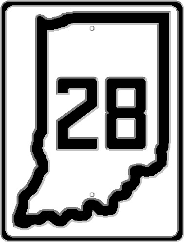
When it was finally established, the ISHC changed the name of the Main Market Road to State Road, in keeping with other states surrounding Indiana. The markers used along the roads, painted onto utility poles like the old Auto Trail markers were, resembled the image to the left…the state shape with the words “STATE ROAD” and the route number. In this case, as of 1920, State Road 2 was the original route of the Lincoln Highway through northern Indiana.

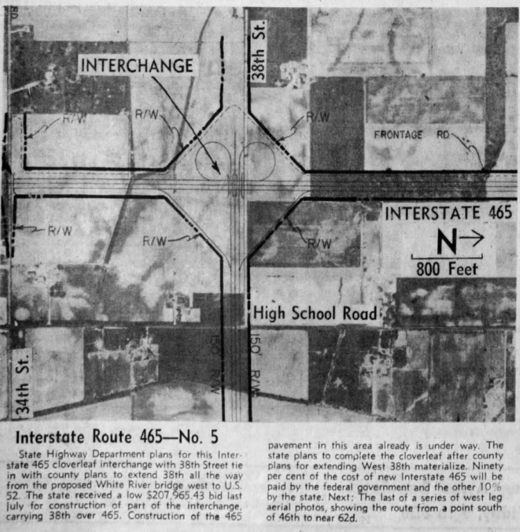
The state highway system was designed to, eventually, connect every county seat and town of over 5,000 population, to each other. Indianapolis, as the state capital and the largest city in the state, would have connections aiming in every direction. Most of those roads marked with the original numbers would still be state roads into the 1970s and early 1980s, before the Indiana Department of Highways started removing state roads inside the Interstate 465 loop…and INDOT finishing the job on 1 July 1999. These road were removed for state statutory limitation reasons, and I have discussed that in a previous blog entry. So I won’t do it here.

The original state road numbers that came to Indiana varied greatly, as did their directions. There were no set rules when it came to state road numbers. They were assigned as they came…and stayed that way until the first renumbering of 1923, or the Great Renumbering of 1926.

Let’s look at the original state roads in Marion County, some of which actually did not reach Indianapolis itself.

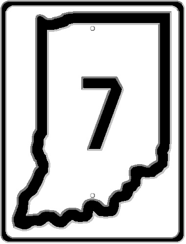
State Road 1: As mentioned before, State Road 1 was originally called Main Market Highway 1. North of Indianapolis, it followed the Range Line Road, a local Auto Trail, through Carmel, Westfield, to Kokomo and points north. The route north followed Meridian Street north to Westfield Boulevard, then Westfield Boulevard on out to Carmel and beyond. In Carmel, the old road is still called Range Line Road, and serves as the main north-south drag through the town, as it does in Westfield.

South of Indianapolis, State Road 1, like its Main Market Highway predecessor, followed the old Madison State Road out of the city to Southport, Greenwood, Franklin and Columbus. The original SR 1 route is still able to be driven through the south side of Indianapolis, with the exception of the section replaced in the 1950s by the Madison Avenue Expressway. But Old Madison Avenue exists, if you can find your way back there.

While the entirety of original State Road 1 became US 31 with the Great Renumbering, bypasses in Marion County were put in place very early. The northern section, through Broad Ripple, and Carmel was replaced as early as 1930. The southern section, including the Southport/Greenwood bypass, was put in place in the 1940s.

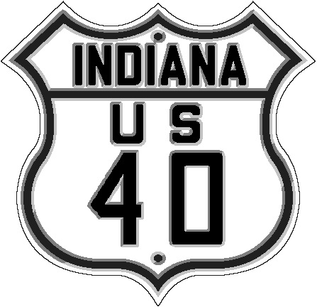
State Road 3: As mentioned above, Main Market Highway/State Road 3 followed the National Road through Marion County. One exception to this is the section of the 1830s National Road that crossed the White River downtown. That section of the old road was removed in 1904 with the demolition of the National Road covered bridge and its replacement with a new, and short lived, Washington Street bridge. With a couple of exceptions other than that (the Bridgeport straightening of the early 1930s, and the new Eagle Creek bridge built in the late 1930s), the old road was followed very accurately until the mid-1980s with the creation of White River State Park. The successor to original SR 3, US 40, was moved to make room for the park. Both US 40 and US 31 lost their designations on 1 July 1999 with the removal of those two routes inside the I-465 loop.

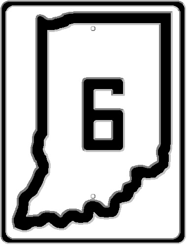
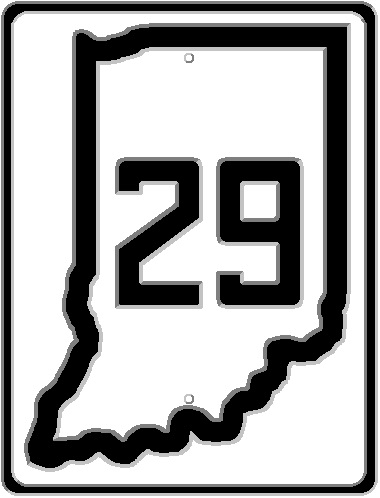
State Road 6: This old state road was a through route when it came to Marion County. From the north, it followed the route of the original Indianapolis-Lafayette State Road from Lebanon. After passing through downtown Indianapolis, it left the county using the original Michigan Road on its way to Shelbyville and Greensburg. The original State Road 6 followed the Michigan Road Auto Trail, not the Historic Michigan Road, meaning it still went to Madison, but it went by way of Versailles, which the historic road did not. With the Great Renumbering, the northern SR 6 became US 52, while the southern SR 6 became SR 29 – later to be renumbered again to US 421.

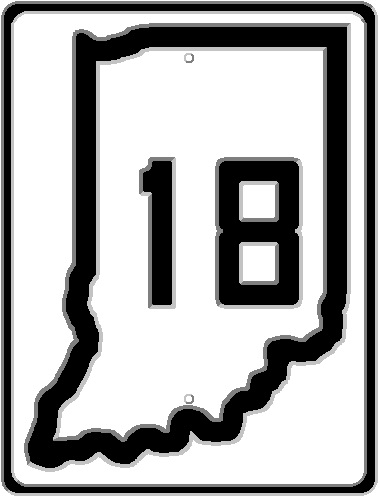
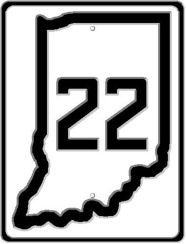
State Road 22: This road, as it was originally laid out, only lasted from 1920 to 1923. Out of Indianapolis, it followed the old Mooresville State Road through southwestern Marion County. It was designated the original route from Indianapolis to Martinsville, as described in this blog entry. This road will be discussed again a few paragraphs from now.

State Road 39: Another 1830s state road that was taken into the Indiana State Highway Commission’s custody in 1919. This road followed the old Brookville State Road from the National Road out of the county through New Palestine to Rushville and Brookville. The original end of that road, both the 1830s original and the 1919 state highway, is discussed here. The road would become, in October 1926, the other section of US 52 through Indianapolis. It would also eventually become the first state highway removed inside the I-465 loop in Marion County. And even then, it would be rerouted in the late 1990s to go the other way around the county.

That covers the 1919 highways. More would come to Marion County before 1923.

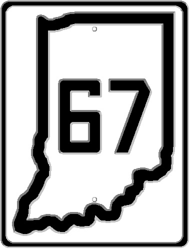
State Road 12: Originally, this road, north of Martinsville, was the old State Road 22 mentioned above. When a new SR 22 was created, the SR 12 number was continued from Martinsville to Indianapolis along the old Vincennes and Mooresville State Roads. This road, in October 1926, would become part of the new State Road 67.

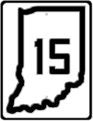
State Road 15: While the southern route of the Michigan Road was State Road 6, the northern part, heading off to Logansport, was added later and given the number State Road 15. The entire route of the historic Michigan Road would never become a state highway, but major sections did…although late in the creation of the state highway system. With the Great Renumbering, this road became SR 29, and in 1951, redesignated, like its southern half, US 421.

State Road 22: Here we go again. State Road 22 was given to the route between Indianapolis and Paoli. In 1919, that included the route along the west bank of the White River from Martinsville to Indianapolis along the Mooresville Road. This was changed by 1923 to keep SR 22 on the east side of White River, where it followed the old Paoli State Road, and the Bluff Road, through Waverly to the south edge of downtown Indianapolis at Meridian and South Streets. This was one of the routes of the Dixie Highway through Indianapolis, and would later become part of SR 37 in 1926.

State Road 31: In 1920, when this road was originally created, it turned south to connect to the National Road west of Plainfield. It had followed the Rockville Road from Montezuma to Danville, then turned southeasterly to meet State Road 3. By 1923, the road was moved from what would later become part of what is now SR 39 to continuing on the Rockville Road into Marion County. State Road 31 would meet the National Road outside the city limits of Indianapolis at what is now the intersection of Holt Road and Washington Street. It would become US 36 before it was extended along the new section of what is now Rockville Road to the intersection at Eagle Creek with Washington Street.

State Road 37: One of two state road numbers that still served Indianapolis after the road numbers were changed in October 1926 (the other being State Road 31). The original State Road 37 left Marion County in a northeasterly direction on its way to Pendleton, Anderson and Muncie. Inside the city limits, the street name was Massachusetts Avenue. When it reached the city limits, the name of the road changed to Pendleton Pike. This still occurs today, with the name change at the old city limits at 38th Street. In October 1926, the number of this road would change to State Road 67.

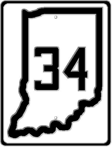
There were two other major state roads in Marion County, but they weren’t part of the state highway system until after the Great Renumbering. One was the Crawfordsville State Road, part of the original Dixie Highway, connecting Indianapolis to Crawfordsville via Speedway, Clermont, Brownsburg, and half a dozen other towns. It would be added to the state highway system by 1929 as State Road 34. The number would change later to US 136.

The other road was the original Fort Wayne State Road, also known as the Noblesville State Road, but even more commonly called the Allisonville Road. It would be added to the state highway system in 1932 as State Road 13. Less than a decade later, its number would be changed to the more familiar State Road 37.

Flooded Indiana

Weather in Indiana. Anyone that has been in the state at this time of year knows that we are entering what best can be described as the rainy season. With it comes the almost annual flooding that will inevitably occur. Flooding is something, though, that can happen at any time of the year. January is notorious for it. Though, it is not as though the flooding is a new thing. It has happened in Indiana for as long as there has been a state of Indiana. And possibly long before. Some of the floods make massive changes to the landscape of the state. Some just get a shrug of shoulders and a shake of the head.

One of the most changing floods in the modern history of Indiana has to be that of 1913. One of the most famous (road) victims of that flood had to be the Washington Street bridge in downtown Indianapolis. But the entire state was punished that January 1913. New Albany, at the Falls of The Ohio (a natural low water point in the entire river channel) almost everything south of the Southern Railroad and Pennsylvania Railroad tracks was under water. The Pennsylvania Railroad ordered that its freight house in New Albany be abandoned. Said freight house had been under five feet of water in floods of 1907. In Evansville, the Ohio Street bridge (I would assume over Pigeon Creek) is “paritally submerged by water,” according to the Evansville Press of 15 January 1913. Especially hard hit were towns along the Ohio River. Several of these would be partly wiped out. Some would be moved to higher ground.

The flood that changed Indiana the most was that of 1937. The area had been devastated by floods in 1936…but the winter of 1937 was more damaging. January 1937 saw the massive closing of state roads due to ice and flooding. The list that was published in newspapers on 23 January 1937 included large numbers of roads. Just the US Highways listed included: US 31 north and south of Seymour, south of Memphis, at Speeds and north of New Albany; US 31E north of junction with SR 231 and junction SR 62; US 41 at Hazelton and Patoka; US 50 west of Brownstown, from Lawrenceburg to Aurora, west of Washington; US 52 from Brookville to West Harrison; US 150 west of Palmyra, at Fredricksburg, at Prospect, and east of Shoals. The list of closed highway is roughly 12 column inches long in the Richmond Item of 23 January 1937. The same newspaper mentions that the only road open from Richmond to Cincinnati is US 127 through Eaton, Ohio.

The aftermath of the 1937 floods would change the landscape across the state quite a bit. In addition to plans for 13 new reservoirs (many of which would not be built), levee and bridge construction would be commenced throughout the state. It was noted that many of the city street bridges at Indianapolis were too short to be safe in case of a flood rivaling or beating that of 1913. Improvements would be planned, and budgeted, for the Warfleigh section of Indianapolis, the Fall Creek area of Indianapolis, sections of the Wabash River in Peru and Logansport, and the White River at Anderson and Muncie.

There are additional reports of flooded state roads and such from many years between 1927 and 1950. January 1932 reported that three sections of SR 37 between Bloomington and Bedford have been damaged by rock slides caused by the same rain that had that part of SR 67 between Romona and Gosport, and at Edwardsport, under water. More flooding reports appear in March 1925, March 1927, November 1927, January 1930, March 1933, May 1935, August 1938, February 1942 and April 1948. This is just a quick look at the available newspaper data.

Farmers Ferry

Greene County, 1989. A ferry across the White River, owned by Greene County, is sold to private interests. The ferry had been in roughly the same location for over 120 years. The Greene County Commissioners decided that the cost of maintenance and insurance was getting too much to keep giving the free service to the public. Slowing use didn’t help much. With no income, and an outlay of between $10,000 and $15,000 annually, the county sold the ferry, ending a service that had seen its fair share of tourists and mishaps over its history.

1950 USGS Topographical Map of Farmers and Farmers Ferry.

Farmers Ferry began life crossing the White River at the unincorporated town of Farmers, an Owen County community 12 miles south of Spencer on both the Indianapolis & Vincennes Railroad and the Indianapolis-Vincennes state road (which would, eventually, become SR 67). The town was named after a merchant in the area. The railroad, which had commenced construction in 1867, built a station at the town called Farmers Station. A post office there opened in 1869. That post office was changed from Farmers Station to Farmers in 1882, and closed in 1931.

The ferry was used, once the railroad was in operation, to move cattle and hogs across the White River to be loaded onto trains to be sold in Indianapolis. The Indianapolis Stock Yards were located close to the Indianapolis end of the I&V, making this railroad convenient for farmers in the area. The ferry service chugged along its merry way until 1918, when a change of course of the White River caused the service to migrate downstream by about one half mile into Greene County. The wooden ferry boat was replaced with a steel one in 1930. The moving of the river caused the town of Farmers, which at the turn of the 20th Century, had “three doctors, two drugstores, three groceries, and ice plant and a feed mill,” (Source: Indianapolis News, 3 August 1977) to become, by 1977, a place described as “although you can find Farmers on the official Indiana highway map, there is nothing here but a pump with no handle.”

Local residents were working on replacing the ferry as early as 1940. According to the Linton Daily Citizen of 28 February 1940, petitions had been filed with the Greene County Board of Commissioners asking for the old SR 54 bridge across the White River at Elliston be moved to replace the ferry near Farmers. Dirt approaches had been built, but the cost of moving and maintaining the bridge were too much for the county to bear. At the time, the ferry cost around $6,000 yearly.

One of the best descriptions of the Farmers Ferry was published in the Indianapolis Star of 1 February 1948. “Just south of the Owen-Greene County line a winding country road branched off Indiana Highway 67, meanders through cornfields and woodland and after a mile or so comes to an abrupt end in front of a cottage-like dwelling on the west bank of White River. Tied up at a rude landing below the little house is the Green (sic) County Navy – an unimpressive two-craft fleet but, nonetheless, the only county-owned navy in all Indiana.” The ferry operator at the time was George Baker, referred to, jokingly, as “Admiral Baker.” At the time of this article, “the officials of Greene County presently are engaged in modernizing their fleet. They have on order, with delivery promised soon, a new flagship – an all-metal 10 feet longer than the present ferry.” “I ought to get a new uniform to go with the new boat,” Baker says.

Over its history, the ferry had seen its share of mishaps. In 1957 or 1958, due to poor loading of the ferry, two loads of cattle were dumped into the river. Clyde W. Thompson, local resident, stated recalled the story that happened to his father. The cattle swam back to the bank and climbed out of the river “after their dip.” (Source: Indianapolis Star, 2 July 1989). “One ferryman had the distinction of sinking the same truck – his own – twice: once when it slipped off the ferry, and again when it rolled into the water from the bank.” A truckload of lime slipped from the ferry on 17 April 1956. (Source: Linton Daily Citizen, 18 April 1956) The truck was declared a total loss, and the load of lime was swept away by the swift currents of the White River.

The South Bend Tribune of 1 November 1981 interviewed the ferry operator at the time, Bernard Calvert. With the $700 a month he was paid to run the ferry, he was helping support poor families in Malaysia and the Philippines. His personal history was covered in that story. I don’t plan on going into it here. Suffice it to say after losing almost everything, he decided that it wasn’t going to happen again.

By the time an article was published in the Princeton Daily Clarion on 14 May 1965, there were only two intrastate ferries left in Indiana. One was Farmers. The other was southwest of Bloomfield, which had began operation in 1957 to replace a 400-foot long covered bridge built in 1889. The bridge approaches were undermined by the 1957 spring floods, forcing the county to decide a ferry was cheaper than building a new bridge. This made Greene County unique in that it operated two toll-free ferries, as the Linton Daily Citizen of 20 June 1960 pointed out, “across a stream that’s considered ‘not navigable,’ White River.” The two ferry boats were referred to as the “Greene County Navy.”

Martinsville Reporter-Times, 27 June 2004, picture showing the Farmers Ferry in 1987, two years before it was closed. The article attached to this photo is a “this week in history.”

The Farmers Ferry, by 1987, had dropped to an average usage of six people a day. The ferryman at that time, Jesse Burton, made roughly $7,000 a year to run the facility. Those people worked the fields in the area. They used the ferry to avoid the 26 mile journey to cross the river otherwise.

The Greene County Commissioners sold the ferry to Carter M. Fortune, who had just purchased a ranch along the river. The ranch, known by locals as the “Flying-T,” who sold to Fortune by the family of Clyde W. Thompson, mentioned above. Fortune’s goal was to keep the ferry active, but due to insurance concerns, only for private use. At that point, the Farmers Ferry had been listed in tourist brochures as the “last passenger ferry in Indiana.” With the closing of the Farmers Ferry, crossing the White River required travelers to either go south to Worthington, where SR 157 crosses the river, or to Freedom where the CR 590 bridge allows passage. These crossings are ten miles apart.