Fort Wayne And Southern Railroad

When one looks at a railroad map of Indiana, especially ones like one of my favorites for this subject like this from 1898 (Railroad map of Indiana. | Library of Congress (loc.gov)), it is easy to see that the numerous railroad companies sprang up independently to connect the towns of Indiana. Unfortunately, the truth is never quite that simple. Today, I want to look at a railroad that had goals of being a rather long route, but ended up being bits and pieces of other larger companies: the Fort Wayne & Southern Railroad.

The mid-1800’s were a railroad building boom in the state of Indiana. Many companies were chartered to put down rails across the state. Some of these never came to be in their original form. Others were influenced by eastern companies with loans and bond purchases to allow construction. In a special act of 15 January 1846, the Indiana General Assembly chartered a railroad company that was to connect Fort Wayne to the Ohio River at Jeffersonville. Over the years, this would be a link in the railroad system that would make Fort Wayne a major railroad hub in northern Indiana.

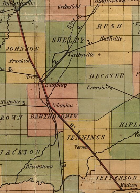
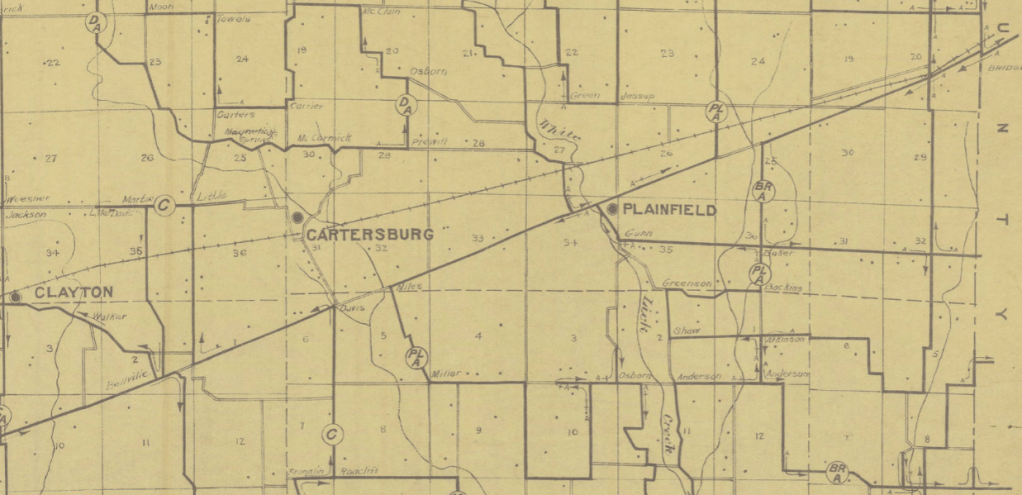
Construction started slowly on the route. The plan was to build the road from Fort Wayne, through Bluffton, Hartford City, Muncie, New Castle, Rushville, Greensburg, Vernon and Charleston to finally end at Jeffersonville. The plan sounded rather extravagant, but it made sense in the grand scheme of things. Jeffersonville, being near the Falls of the Ohio, was a natural breakpoint in traffic transiting the Ohio River from Pittsburgh to the Mississippi. Ohio River traffic, at the time, had to stop at Jeffersonville, New Albany and Louisville to change from one barge to another. Building a railroad from the Falls of the Ohio to Fort Wayne allowed, it was thought, to funnel freight into Indiana’s second largest city. Ultimately, this, along with connections to Fort Wayne from Lake Michigan, Lake Erie, and points east (like Pittsburgh), would open the markets of the city, and towns along the railroads, to the entire nation.

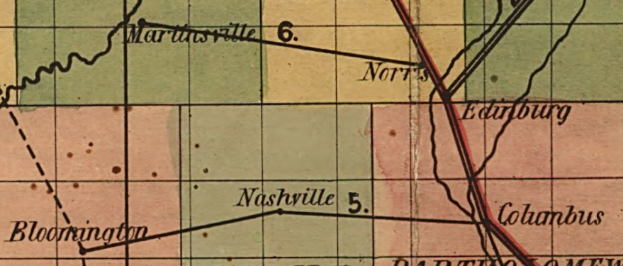
Grading was started at two different places on the planned Fort Wayne & Southern. First, a route between Fort Wayne and Muncie. Second, the road was graded between Vernon and Jeffersonville. No rail had been put down on either of these sections. The company floundered as it tried to find funding for construction.

The question that comes up is, what happened to the company? No map ever showed a single company route that connected Fort Wayne and Jeffersonville, although such a route existed through the use of three different companies.

The Fort Wayne & Southern, like many railroads in Indiana, fell into receivership. The company found itself in a situation where they were still spending money on a route that wasn’t completed, in any section, enough to allow traffic to offset the losses. The entire route was sold at foreclosure on 19 January, 1866. But that sale was set aside, and the company continued to flounder until the route was conveyed to new owners on 7 November 1868.

But unlike other railroad companies in Indiana at the time, the Fort Wayne & Southern was broken into two different sections when it changed hands.

The section from Fort Wayne to Muncie, and then further to Rushville, would become a new railroad company, the Fort Wayne, Muncie & Cincinnati Railway. In June 1869, the former Fort Wayne & Southern between Muncie and Fort Wayne would merge with the Cincinnati, Connersville & Muncie to create the Fort Wayne, Muncie & Cincinnati Railroad Company. With the addition of rails to the route, this would connect Fort Wayne to Connersville. The FtWM&C Railway did not complete any construction before the merger with the CC&M. The railroad would open nearly 64 miles of track from Muncie to Fort Wayne in 1870.

The southern section, 53 miles of graded roadbed from Vernon to Jeffersonville, was conveyed to the Ohio & Mississippi Railway Company. That company was a consolidation of several companies that would build a railroad from St. Louis, Missouri, to Cincinnati, Ohio. This would create a branch to connect the company to another point on the Ohio River.

The complete route, from Fort Wayne to Jeffersonville, would ultimately be built…but not by one company. The 16 mile section from New Castle to Muncie would be opened in 1868 under the title Cincinnati, Connersville & Muncie Railroad. The next section, from New Castle to Rushville, would be completed in 1881 by the New Castle & Rushville Railroad. This route was 24 miles in length.

Another company that came into existence in 1879 would be the Vernon, Greensburg and Rushville. It would connect the title towns with rails opening in 1881.

All of the above would complete the original plan of the Fort Wayne & Southern. It would ultimately fall into three major railroad company systems. For a while, the section from Rushville to Fort Wayne would fall under the control of the New York Central system as the Lake Erie & Western, and later, the Nickel Plate. This would end when the New York Central sold its interest in that road. The Vernon, Greensburg & Rushville would be leased by what would become the Big Four Railway. The Big Four would later replace the Nickel Plate in the New York Central system.

The Ohio & Mississippi, after several consolidations, would become a leased company called the Baltimore & Ohio Southwestern Railroad. Although still legally a separate entity, in 1925 the management of the B&OSW was replaced by management of the Baltimore & Ohio.

Today, the entire route can be seen in the Hoosier landscape. The Baltimore & Ohio section would be abandoned piecemeal in the 1980s. 28 miles from North Vernon to Nabb was abandoned in 1980, and from Nabb to Charleston following in 1985. Two very short sections in Charleston were abandoned in 2000 and 2001.

The ultimate owners of the Nickel Plate, the Norfolk & Western, would attempt to abandon what was called the New Castle branch from New Castle to Rushville. Since it was withdrawn, there is no date of that attempt in my source. Ultimately, this would happen, however.

Parts of the route that was to be covered by the Fort Wayne & Southern are still in use today as parts of the Norfolk Southern and CSX. A map is available at the Library of Congress for the railroad at A section of Colton’s large map of Indiana with the Fort Wayne and Southern Rail Road marked upon it, as located also a map of the United States showing Road and its connections together with a profile of the Ohio river and lands adjoining and a section of the double track rail road tunnel under the Ohio river at Louisville, Kentucky & Jeffersonville, Indiana for the year 1855 ending Oct. 1, W. J. Holman, President and Chief Engr. | Library of Congress.

Advertisement

Railroads of Indiana, 1850

One of the beautiful things of the internet, one of the things that make doing something like the Indiana Transportation History blog so easy, is the access to a world of information. Yes, some is accurate, and some isn’t. But my favorite resources, as I have shown over the past almost two years, is maps. While maps can be wrong at times, or more to the point, based on “future” information that doesn’t come to be, they are still a great resource if you can figure where they went wrong.

Today, I found another map that grabbed my interest. Looking at a map of railroads in Indiana, even today, there are railroads all over the state. A railroad map from the turn of the 20th Century is a spider web of routes crossing the state in all kinds of directions. But the map that I found today is one of Indiana in 1850. It is an interesting look what was, and how many changes have come about in the 170 years since it was printed.

When railroads started being built in the state, just like everywhere else, it was a jumble of little companies, usually with destination cities in the company title. There were 15 railroads on the map at the time, with some that were proposed. One of them was in Ohio, but would later be part of an Indiana system when it was completed. The map that I found showed the railroad routes as straight lines, not the actual routes themselves. I am going to cover them in the order the map numbered them.

Number 1: Madison and Indianapolis Railroad. I have covered this railroad many times, as it was the first long distance railroad built in Indiana. The engineering of this route, which included the steepest railroad tracks in the nation, was top notch at the time. Although it was originally been on the cheap, using iron strapped rails instead of the “T” rail that would become standard (and much safer) later. In the end, it would become part of the Pennsylvania Railroad.

Number 2: Shelbyville Lateral Branch. This line was built as a feeder road to the Madison & Indianapolis. Its history isn’t terribly long. It connected the Madison & Indianapolis at Edinburgh to Shelbyville, opening up farm produce from Shelby County to the world at large. The railroad, depending on what history you read because it is very spotty, would last around five years before it was abandoned.

Number 3: Shelbyville & Rushville Railroad. Shelbyville was a “rail center” for a little while in the 1850’s and 1860’s. This route connected the two title towns, opening Rush County to the markets available on the Madison & Indianapolis.

Number 4: Shelbyville & Knightstown Railroad. Another short lived railroad, that would open southern Henry County to the same markets served by the above three. This company would last less than a decade, according to the source. Again, the history is spotty about this road at best. Later, part of route would become part of a railroad again, but instead of connecting Knightstown to Shelbyville, it would connect to Rushville.

Number 5: Columbus, Nashville & Bloomington. Trying to find any history on this road is difficult at best. I am not even sure if it existed at all. This will require more research.

Number 6: Martinsville Branch Railroad. Another road, like the one above. History is hard to find like the one above. It connected the Madison & Indianapolis to Martinsville. Later, the same connection would be made, in 1853, from the M&I at Franklin to Martinsville. That railroad would would be the Fairland, Franklin & Martinsville.

Number 7: Indianapolis & Bellefontaine Railroad. This route connected Indianapolis to Pendleton, Anderson, Muncie and Winchester to ultimately Bellefontaine, Ohio. Down the road, this would be one of the founding parts of the Big Four Railroad. It is still in use today as part of CSX.

Number 8: Indianapolis & Peru Railroad. Today, this is mostly known as the Nickel Plate connecting Indianapolis, Noblesville, Tipton, Kokomo and Peru. Or at least what’s left of it. At one point, for about nine months, it was consolidated with the Madison & Indianapolis creating a route from Madison to Peru under one umbrella. Shareholders, and the courts, put an end to that marriage, creating two separate companies again.

Number 9: Indianapolis & Lafayette Railroad. Another constituent part of what would become the Big Four Railroad. At one point, at the Indianapolis end, the line came down alongside the Central Canal. It would be also be the scene of a large train wreck that would kill members of the Purdue University football team (Part 1 and Part 2).

Number 10: Lafayette & Crawfordsville Railroad. This railroad would later become part of the Chicago, Indianapolis & Louisville, later known as the Monon. At the end of this article, I will show the only proposed railroad that in included on this map, which would be a connecting route from Crawfordsville to Bedford, thus creating the remaining part of the Monon mainline through western Indiana.

Number 11: Terre Haute, Indianapolis & Richmond Railroad. The original plan for this railroad was to connect the entire state, east to west, following roughly the National Road corridor. It would never be built past Indianapolis. Over the years, it would become part of the Pennsylvania Railroad.

Number 12: New Albany & Salem Railroad. This would be the southern end of what would become the Monon. There were several companies between the New Albany & Salem and the Monon. I covered the history of the Monon in two parts, part 1 and part 2.

Number 13: Jeffersonville & Columbus Railroad. Most references to this road refer to it as the Jeffersonville, or “J.” The plan was to build the line all the way to Indianapolis. The problem came with the management of the Madison & Indianapolis. As the first railroad, the M&I assumed the attitude that they were the kings of the state’s railroads and others, especially direct competitors like the “J,” should just be good little kids and do what they are told.

There is a story about the M&I not wanting to help another railroad, because they weren’t in business to provide charity to other companies. The company they turned down would be the THI&R, which would be far more successful than the M&I in the end.

The M&I refused to cooperate with the J. So, ultimately, the J not only invested in feeder lines, taking traffic from the M&I, they started building a parallel track to the M&I. Ultimately, the J would end up buying the struggling M&I. And, like the M&I, would become part of the Pennsylvania system.

Number 14: Lawrenceburg & Greensburg Railroad. This road was built to connect the markets of Decatur and Ripley Counties to the markets at Cincinnati. Ultimately, the plan was to build the road all the way to Indianapolis, allowing a more direct route from the Hoosier capital to the Queen City of the Ohio. Traffic would be barged from Lawrenceburg to Cincinnati, which was faster than the already in place barged traffic from Madison to Cincinnati.

Number 15: Cincinnati, Hamilton & Dayton Railroad. The only reason that I am mentioning this is because it would be the foundation of what would ultimately become the Baltimore & Ohio connecting Indianapolis to Cincinnati directly.

As mentioned above, the only proposed railroad on this map is the future Monon route connecting Bedford to Crawfordsville. Several towns along the proposed route would not be serviced by any other railroad company for years. And today, most of this route no longer exists, having been given back to the locals when the bigger companies were created, and the route became excessively redundant.

There is one more transportation facility included on this map. The Wabash & Erie Canal from Evansville to Fort Wayne and beyond is marked on it.

The entire map that I used for this article is available here: Railroad map of Indiana, by Col. Thomas A. Morris, Civil Engineer, | Library of Congress (loc.gov)

A 1933 Indianapolis Map and Why It Interests Me

While roaming the Indiana State Library online collection of maps several years ago, I found a map that flat out struck me as interesting. The map was dated 1933 and was issued by the A. C. Wagner Company of Cincinnati, Ohio. Now, why would this map stand out to me, a confessed map geek? Actually, it was the way that roads on it were marked, really.

The roads that now have names, ones that are relatively well known, were marked on this map with directionals and numbers. I had never seen this system used on any other map. But as the image below states, “Roads in the County are numbered based on the house numbering system of Indianapolis.”

Index of Marion County roads as listed on the Wagner’s Map of Marion County, Indiana, 1933.
Index of Marion County roads as listed on the Wagner’s Map of Marion County, Indiana, 1933, Columns 1 and 2

To the left are just the first two columns of the above index. The roads that are marked “N. x” are actually numbered that today, as long as it is above 10. The one numbered street on this map that doesn’t have a number now is “N. 4th W.,” in Wayne Township. That is Vermont Street from Cossell Road west. The other N. numbered roads are now streets of the same number.

The east streets in the picture to the left are the interesting ones. For instance, “E. 110,” both north and south were known as Franke Road at the time of the printing of this map. Today, it is German Church Road. E. 120th is now Carroll Road, formerly known as County Line Road East.

If you know the addressing system in Indianapolis (Marion County), it is easy to figure out which road is which. E 32nd, for instance, is McFarland Road. E. 38th is Sherman Drive. And E. 40th, in Perry Township at least, is Gray Road.

Every other map of Marion County that I have ever seen includes road names, nothing like this addressing numbering system.

1933 Wagner’s Map of Marion County, Indiana, showing south central Perry Township, bordered by Shelby Street (E. 11), Edgewood Avenue (S. 60), Sherman Drive (E. 38) and County Line Road (S. 90).

But some of the modern names are included on this map. Looking at Perry Township again, from Edgewood Avenue south, Edgewood Avenue and Banta Road have names. They are also labelled as S. 60 and S. 65, as well. But the rest south of there are just given the addressing labeled names: S. 70 (Southport); S. 75 (Stop 10); S. 80 (Stop 11); S. 85 (Stop 12); and S. 90 (County Line Road).

Some roads aren’t even marked at all. The road leading north out of Southport, east of the railroad, has no marked name on the map. But looking at it, it is Main Street and Derbyshire Road. A road named, apparently, after the landowner at the corner of that road and Banta Road.

Also, US 31, which until 1941 used what is now Madison Avenue, is marked as Madison Road, its original name from the 1830’s.

If you would like to see this map in its entirety, the link is here: Wagner’s Map of Marion County, Indiana, 1933.

The Original State Road System, as Shown in 1932

When I was writing yesterday’s blog entry, I had mentioned the fact there were two Official maps issued in 1932. The September 1932 map included something on the front that I had never seen before. It was a small map in the lower right hand corner (given the shape of the state of Indiana, this makes sense that this corner has always been used for the legend and such) that shows “pavement on original system.” Today, the whole purpose of this entry is to show that small map. It gives an idea of who much the state highway system had expanded since 1920. It didn’t include any state road numbers.

A glance at that map gives an idea of what “important” roads were not included in the original state highway system. For instance, not included in the Indianapolis area: the Crawfordsville Road (SR 34/US 136); the Michigan Road north (SR 29/US 421); and the Pendleton Pike (SR 67 and US 36). They were important roads prior to the state highway system…and became major routes after they were added.

1932 Indiana Official State Highway System inset of “Pavement On Original System.” Map was officially issued on 1 September 1932.

Keep in mind that all state roads technically ended at city limits. The Indiana State Highway Commission, when created, was not authorized to route state highways along city streets. It was up to the city to decide those routes. The state would post “trailblazers” pointing the city picked best route to get back to the official state road on the other side of the town.

West Marion County and I-465

This image has an empty alt attribute; its file name is images.jpg

The first part of the new beltway (almost) around Indianapolis started on the westside of Marion County. As mentioned in other articles, the original plan was to start Interstate 465 at Interstate 65 on the northwest side, with the replacement for State Road 100 (which I-465 officially was) heading south from there to circle around the county from there. Interchanges were planned at I-65, I-74/US 136, 10th Street, US 36 (Rockville Road), US 40 (Washington Street), Weir Cook Municipal Airport (Airport Expressway), Interstate 70, and SR 67 (Kentucky Avenue). According to USGS topo maps, like that included below, show that there was a stub ramp connecting I-465 to 62nd Street, although the ramp connecting to 62nd Street was listed as still proposed six years later.

1962 USGS topographic map showing the original interchange connection Interstate 65 and Interstate 465.

Construction started along the corridor in 1959. The Indianapolis News ran a series of pictures showing the plans set out by the State Highway Department. If you noticed the list of interchanges above, there were no plans for 56th Street or 38th Street to have ways to access 465. Bridges were to be built over 465 at 56th, 46th, 38th, 34th, and 21st Streets. (21st Street was a very special, and contentious, situation. I covered it in the article: “Building I-465 at West 21st Street. [8 May 2020]”)

Indianapolis News, 14 December 1959, showing the Indiana State Highway Department’s plans for the new Interstate 465 (also still called State Road 100 at the time) at the northern terminus of the highway.

The plans for Interstate 65 at that point were to continue to have it replace US 52 (Lafayette Road). The US 52 bypass at Lebanon was made part of the new I-65. The temporary plan was to connect I-65 just southeast of I-465 directly to US 52 until construction could continue. Then I-65 would also be US 52 from that point to northwest of Lebanon. I mention this only because the loop around Indianapolis was, apparently, easier to get approved than trying to run I-65 through town. (And since it would take another 16 years to complete, even to the point that an addition was planned to I-465 and completed before I-65 through Marion County says it all.)

It wouldn’t take long after the original plans for the interstate were laid down that changes were made. The non-planned 38th Street interchange was added to the deal. It was to be a partial cloverleaf interchange connecting to 38th Street at that point. Marion County had decided to build 38th Street from Lafayette Road east to the new White River bridge to be built by the city. At that point in history, 38th Street was a county road with nothing resembling the connections it has today as a major west side thoroughfare.

Indianapolis News, 11 December 1959, showing the future connection to 38th Street from I-465. This ramp would be built much later, when 38th Street was finally connected as a thoroughfare across Marion County.

The next interchange south of the “gonna be built someday” 38th Street was the connection to another interstate highway, Interstate 74. The plans shown in the Indianapolis News differ slightly from what was actually built. US 136 (Crawfordsville Road) is directly connected to the east end of the proposed interstate connection. This would change. It looks like the proposed interchange was moved slightly north, and Crawfordsville Road west of High School Road was turned north to connect to High School Road. This would be where US 136 would ultimately officially end.

Indianapolis News, 10 December 1959, showing the proposed connection between interstates 74 and 465. The original plan, and this was carried out, is that Interstate 74 would “travel over,” ISHD/INDOT term for multiplex, with I-465 from northwest to southeast Marion County.
1953 Topo map showing the intersection of West 10th Street and High School Road.

The next section did change, at least at one interchange, quite a bit. But before I describe that, let’s talk about the placement of I-465 from Vermont Street north to about where 16th Street would be, if it continued to High School/Girls School Road. The new interstate was planned, in that section, to be built directly over High School Road. This is not really a stretch, since High School Road, from Washington Street south to the Airport, was the original State Road 100. And I-465 was, for all intents and purposes, State Road 100 according to ISHD.

I have written a detailed history of SR 100 (SR 100: How did it come to be? [9 March 2019]) and an article about how, at one point, the connection between SR 100 on BOTH sides of Marion County were to have cloverleaf interchanges (“The Cloverleaf Interchanges at US 40 and SR 100” [20 November 2019]). If SR 100 had been completed on the west side, like it was on the north and east sides, I have no doubt that it would have followed High School Road north, probably, ultimately, to 86th Street, which was SR 100 along the northwest side.

The change in interchanges happened at 10th Street. The original plan was for a full cloverleaf interchange at that intersection. This would have pushed the eastbound 10th Street to southbound 465 ramp back closer to Glen Arm Road, where High School Road was rerouted to miss the interchange. What was ultimately built was a jumbled three-quarter cloverleaf with a flyover from westbound 10th to southbound 465.

In the end, High School Road was basically built over by 465 from Vermont to 10th Streets. 10th Street is a survey correction line, so High School actually moves slightly to the east at that point, as shown in the topo map to the left. For more information about survey lines, check out “Survey Lines and County Roads. (29 March 2019)”

Indianapolis News, 9 December 1959, showing the Indiana State Highway Department plans for I-465 from just south of the New York Central railroad tracks to just north of the Baltimore & Ohio Railroad tracks, including what was to originally be full cloverleaf interchanges at 10th Street and Rockville Road.
1953 USGS topo map of the area of Washington Street and High School Road. The area marked “Ben Davis” would be the location of the new cloverleaf interchange between US 40 and I-465.

From the looks of aerial photos in 1959 as shown in the Indianapolis News, the interchange at Washington Street was going to be very destructive. (Keep in mind that as of the writing of this article, MapIndy, my go to source for historic aerial photos of Marion County no longer offers that service. Maps are available, but the aerial photos are gone.) In addition to the shunting of Morris Street (a survey line and historic route of its own accord), most of where the interchange between US 40 and I-465 was basically what had been the town of Ben Davis.

Another thing would have to happen before this interchange would be built. It was determined, and reported, in July 1959 that an improvement of West Washington Street would have to occur before the interstate reached that point. US 40 was to be widened in the area. The work on Washington Street, however, would have to wait until sewer work in the area was completed…probably in 1961. Plans to widen Washington Street from 40 feet to 68 feet wide, with a four foot median and an eight parking lane on each side, were decided upon. Very little of that plan exists today…and if it does, it’s hard to find.

Indianapolis News, 8 December 1959, showing the proposed area of US 40 and Interstate 465.

The last area covered by the Indianapolis News in the series of articles (actually, it was the first since the editor staff decided to post them south to north, even though the interstate was built north to south!) shows the area of I-465 near Weir Cook Municipal Airport. The one change that I can see is what would become Airport Expressway (check out “Indianapolis’ Raymond Street Expressway” [4 February 2020] for the history of what started out as the Bradbury Expressway) was proposed to connect to the airport heading slightly north of due west, just above Southern Avenue. This section of the (now) Sam Jones Expressway is due east-west at the point it connects to Interstate 465. For a history of what is now Indianapolis International Airport, check out “Indianapolis Municipal Airport.” (20 August 2019)

Indianapolis News, 7 December 1959. This newspaper snippet shows the area of proposed I-465 near the (then) Weir Cook Municipal Airport (now Indianapolis International).

That covers the first of the construction of the State Road 100 replacement. I want to share this one last snippet from the Indianapolis News of 19 October 1960. It shows the construction of I-465/I-65/US 52 at 62nd Street…or the original northern end of Interstate 465.

Indianapolis News, 19 October 1960, showing the original northern end of Interstate 465.

1889: National Road in Warren Township, Marion County

Since it was built, the National Road has held an important place in the history of Marion County. Obviously, the city itself benefitted from the coming of the road. The road was built from east to west, which means when it reached Marion County, Warren Township would be first in line.

1889 map of Cumberland, Indiana

Cumberland. The town was laid out shortly after the coming of the road. The name of the town came from the other name for the National Road. Or, more to the point, the terminus of the road – Cumberland, Maryland. The town was laid out by Henry Brady on 7 July 1831. The original plat only included four blocks, bounded by what was called North, South, East and West Streets (now Niles Street, Saturn Street, Muessing Street and one that no longer exists).

The railroad would come to Cumberland in 1853. The Indiana Central Railway built 71.94 miles of track that year, connecting Indianapolis to the Ohio state line east of Richmond.

The next things that were encountered on the way west were a church and a toll gate one mile west of the county line. The church, built in 1855, was St. John’s Church, but the corner stone is written in the language of the congregation – German. The road would be named later German Church Road. The toll house was opposite the church, on the southwest corner of German Church and Washington.

At the corner of the National and Franklin Roads, a country schoolhouse was located on the southwest corner.

1889 map of Irvington, Indiana

Irvington. Before entering Center Township at what is now Emerson Avenue, the town of Irvington in encountered. Incorporated in March 1873, it was designed as a town of “refinement and culture.” That same year, the Northwestern Christian University was enticed to move to the new town with a 25 acre land donation and a grant of $150,000. The university was tucked between the two railroads that ran through the area, and along the western edge of the town.

Subway Street, Beech Grove

When the Big Four Railway started to build their new yards in what would become the city of Beech Grove, they realized very quickly that train traffic was going to be, at best, horrifying for those that were trying to get to the town from the north and east. The main road from the north was the line separating Center from Warren, and Perry from Franklin townships. This would be called First Avenue in the new town of Beech Grove, and Emerson Avenue in the rest of Marion County.

1905 Map of the Beech Grove area, before construction of the town. Center of the map is where the four townships (Center, Franklin, Perry and Warren) meet, now the intersection of Emerson and Albany Street (Troy Avenue).

This road, before Beech Grove was built, stretched from a point in Washington Township, near Millersville, to the Johnson-Marion County line east of Greenwood. Part of this was considered to be part of the Churchman Free Gravel Road extension when the Big Four started buying the property. What became Albany Street (Troy Avenue in the rest of Marion County) extended from the Bottoms Road (now Harding Street) to what is now Kitley Road near the Hancock-Marion County line.

With the construction of the new railroad shops, and the new town, at Beech Grove, the railroad knew that it wouldn’t be long before it came up that two major roads in the county were being clogged by rail traffic. The elevation movement had already been in full swing in Marion County, although there were no such facilities completed to that point. Arguments were still being had about who was supposed to pay for all the bridges necessary to accomplish the plan. It was here that the planners decided to make sure that both carriage (and later car) traffic was unimpeded by the mass amounts of train traffic.

Emerson Avenue would be cut off just north of the Big Four railroad tracks north of the new town. This would put the cutoff just shy of 1/2 mile north of Albany, or 1/2 mile south of what would become Raymond Street. A new street would be built just north of the northern right-of-way of the railroad tracks, where it would connect 1/2mile east of Emerson, becoming the continuation of Troy Avenue. About 2/10’s of a mile east of Emerson, a new road would be built at a 90 degree angle to the railroad tracks, going under said railroad tracks, connecting to the new Second Avenue and the street running along the southern railroad right-of-way (to become Bethel Avenue) in Beech Grove.

1956 MapIndy aerial photograph of the Subway Street/Connection Street/Emerson Avenue/Bethel Avenue area near Beech Grove. west of the spur tracks leading into the Beech Grove Shops is a stub end of Emerson Avenue starting at Subway Street. It would connect to essentially a long driveway and a house west of Emerson and south of the railroad tracks.

The first street mentioned would be given the name “Connection Street.” The road that would go under the railroad tracks would be called “Subway Street.” The name subway actually has a historical context in Marion County. When traffic at Indianapolis Union Station got beyond horrible, the city of Indianapolis decided to build an underpass along Illinois Street, under the railroad tracks at the station. This was, for years, called the Illinois Street Subway, although it was more a bridge, even a tunnel, than a subway.

This wasn’t to say that Emerson Avenue disappeared completely between the two sides of the railroad tracks. A small section of Emerson Avenue existed from Subway Street north to a road, and house, 1/4 mile north of Albany Street. It existed this way for years. Until the early 1970’s, as a matter of fact.

Indianapolis Star, 15 April 1971. The photograph shows a four lane bridge in the middle of nowhere, over the tracks of what was, at the time, the Penn Central Railroad at Beech Grove. That bridge would be connected to the surrounding area, and would carry Emerson Avenue into Beech Grove from the north.

The new Emerson Avenue bridge over the Penn Central tracks, as they were called then, was completed in Spring 1971, although the connections to the new bridge weren’t complete. The road that connected to the house in the 1956 photo above would become the new Subway Street, which was turned to intersect and cross Emerson Avenue north of the old connection point.

1956 MapIndy aerial photograph with a 2020 overlay of then current conditions. This shows the driveway and the house, that would be removed when Subway Street was relocated with the building of the Emerson Avenue bridge north of Beech Grove.

The new ending of Subway Street would be at Fifth Avenue, instead of Second. Sections of the old Subway Street, from the new turn to Second Avenue, still exist to this day, almost 50 years later. And looking at the Google Map, or even MapIndy, will show that the property lines of the old Subway Street are still valid.

The railroad that created the town of Beech Grove is long gone. The Big Four became part of the New York Central, officially in 1930. The New York Central gave way, in 1968, to the Penn Central, which found the NYC merging with its long time rival the Pennsylvania. Soon after the creation of the National Passenger Rail Corporation, called Amtrak, there was a move to have Amtrak purchase the Beech Grove shops from Penn Central. This would happen in 1975.

A quick glance at the MapIndy property records leads to some confusing things, however. The property that the Amtrak shops is on does actually belong to the National Passenger Rail Corp. But it has to cross property that is still legally owned by the Penn Central Transportation Company. Now, I realize that the tangled web of property ownership and changing railroads can cause such things. But the property right next to it is owned by New York Central Lines LLC c/o CSX Transportation. As does most of the property north of the Amtrak Shops and south of the railroad mainline. The property records lead to a lot of fun reading. There are four different railroad companies legally listed as owners in that area: National Passenger Rail Corp.; CSX Transportation; New York Central Lines LLC (CSX); and Penn Central Corp (c/o C E Parker General Tax Agent Penn Central Trans Co, Chicago, Illinois). What’s strange is that all the property owned by the Penn Central is exempt from property tax.

1910: The National Road West of Indianapolis

Today, I want to show some map snippets of the National Road, and its replacement sections, as of 1910. Now, there is a small problem with this. The maps that I am going to use here are from the United States Postal Service from 1910. And while they are available from the Indiana State Library online, there are two that are noticeably absent from the collection: Clay and Marion Counties.

Marion County is easy to deal with. There are so many historic maps of Marion County available on the web that if I really wanted to, I could get something to cover the area. Clay County is an entirely different story. That is going to take some work.

Many people, today, are used to the straight ribbon of asphalt and concrete that is US 40 through Indiana. But that wasn’t the case when the road was created in the 1830’s. As was the standard operating procedure at the time, roads were built as straight as they could be. There was no heavy machinery to move a hill, or flatten a valley, in the early to mid 1800’s. Surveyors were extremely important at that time, to get the best road possible. If it could come in using less materials, and more importantly, less money, so be it. Most bridges across streams along the way crossed at a right angle to the stream. This was to make the bridge both safer and less expensive.

The hilly terrain of the area southwest of Indianapolis made the National Road surveyors a bit of hassle, as well. Hence, the relatively straight road that we know today was a lot of work and bending the old road into shape…and out of existence. The following maps show the road as it was in 1910. I wanted to give a comparison map from USGS maps…but the earliest available at this time is 1941, meaning that the road has already been replaced in most areas. And looking at Google Maps, there are very few sections that still exist of the original road that was replaced. But, I hope that these maps will start your own research into the original federal highway.

1910 USPS Map of Rural Delivery Routes in Vigo County west of the Wabash River.
1910 USPS Map of Rural Delivery Routes in Eastern Vigo County.
1910 USPS Map of Rural Delivery Routes in Western Putnam County.
1910 USPS Map of Rural Delivery Routes in Eastern Putnam County.

The map above shows the Reelsville bypass of the original National Road. I covered it in the article “National Road at Reelsville.”

1910 USPS Map of Rural Delivery Routes in Western Hendricks County.
1910 USPS Map of Rural Delivery Routes in Eastern Hendricks County.

US 41 in Gibson County

Princeton, IN-IL, 1:62,500 quad,
1903, USGS

While looking through old USGS topo maps, I found one that caught my interest almost immediately. I have talked over the past year or so about how the current state roads came to be as old county roads from early in Indiana’s history. One that shows this very well is what would become SR 10 in 1919 and US 41 in 1926.

The map to the left shows the county roads between Fort Branch and Hazelton in 1903. Yes, 1903. This is the USGS map, 1903 Edition of the Princeton, Indiana, 1:62500 scale. I have used Microsoft Paint to draw lines of two colors on it. The green lines show where US 41 is today, using the roads as they were in the turn of the 20th century. The blue lines show roads that would be, through history, part of US 41 before it was bypassed. The area in Princeton is harder to nail down, so I included two routes through the town. Both are possible, and since at the time of this map there was no US 41, it didn’t matter which way travelers went.

Historical Topographic Map
Collection, 1942, USGS

As is typical of the USGS, no new maps were truly drawn after 1903 at this scale…at least none that are accessible. What is shown to the right is the 1903 map updated to 1942. It shows several changes in the routing of US 41 between its creation in 1926 and 1942.

First, starting at the top, is the Hazelton Bridge. Construction started in 1921 to replace a ferry near that location. The bridge, as mentioned in the link above to another Indiana Transportation History article, carried SR 10 (and the Dixie Bee Highway, as it was known at the time) over the White River near Hazelton. The bridge was massive. Said to be one of the largest ever built (to that time) by a state highway department in the midwest.

Another section that would be moved before 1942 would be south of Patoka. The road that is now Old US 41 between Princeton and Patoka is actually a replacement. During the 1930’s and 1940’s, the Indiana State Highway Commission made it a point to shorten and straighten state highways. A lot of this put the new location of the state highway next to a section of railroad tracks.

If you have any doubt about this building technique, check out SR 67 southwest of Indianapolis (Kentucky Avenue – moved 1936), SR 67 northeast of Indianapolis (Pendleton Pike, or actually, its replacement), SR 44 from Shelbyville to Rushville (railroad tracks were in place until 1980 or so), and SR 135/252 from Trafalgar to Morgantown (road was built around 1940-1941, tracks were abandoned at very near the same time, although some remnants of those tracks still remain 80 years later).

US 41 would run beside the Chicago & Eastern Illinois tracks between Princeton and Patoka, entering Princeton north of the old route by about two blocks. South of Princeton, the old route was followed toward Fort Branch.

Historical Topographic Map Collection, 1962, USGS

By 1962, several changes were made again to US 41. From Patoka to Hazelton, the route was moved to its current location, replacing the old Hazleton bridge and widening and straightening the road most of the way. There was one section of road that was still two lanes according to the USGS maps of 1962…and that was being rectified.

The old Hazelton Bridge remained in place for years after its replacement by the Indiana State Highway Commission. It would be given to the counties for their maintenance.

At the same time, the current routing of US 41 was also completed. The USGS shows the year of the map as 1961 on the Princeton 7.5 degree quad. (The map to the left is the 1962 update of the 1959 Patoka 7.5 degree quad.)

The major point of this article is to show how the country roads looked in 1910, and before the state started taking over, to give an idea of how one got from point A to point B at that time. These maps, especially those of 1903, really show off the routes that were depended upon early in the history of Indiana. It also shows that, in Indiana, the fastest way between two points is not always a straight line.

I-65 and I-465 On The Northwest Side – A Pictorial History

Today, I want to use MapIndy and USGS Topographic maps to show the progression of the interchange between I-65 and I-465 on the northwest side of Marion, just east of Eagle Creek Park. I am going to have four aerial photos in this entry: 1941, 1956, 1962 and 1972. Also, small snippets of several topo maps are used. Strangely, the 1941 and 1956 are almost identical.

1941 MapIndy aerial photo of the area around the I-65/I-465 interchange on the northwest side of Marion County.
1956 MapIndy aerial photo of the area around the I-65/I-465 interchange on the northwest side of Marion County.
1961 USGS Topographic Map of the interchange between I-65, I-465, and future SR 100, now known as I-465.

The 1961 USGS Topo map shows the pending SR 100 connection. Bridges appear in the 1962 aerial, especially Lafayette Road over I-465. It should also be noted that on the USGS maps, the pending I-465 was also marked SR 100. Also, what is now I-65 fed directly into Lafayette Road at this point. This made sense, since I-65 was the replacement, between Indianapolis and Labanon, of US 52…which followed Lafayette Road in this area.

The next photo is from 1962. The missing section in the picture had not changed much, if at all, from the 1956. The Dandy Trail did not cross Eagle Creek at a right angle to the creek. It had been replaced by a bridge on 56th Street. And the reservoir still hasn’t been built. Both interstates, I-65 going straight through the area, and I-465 veering off to the south, catch the eastern edge of the park like area west of Lafayette Road north of 62nd Street. That park like area is listed on the 1953 USGS topographic map as “Eagle Creek Forest.”

1953 USGS Topographic Map of Eagle Creek Forest.

It should be noted that 62nd Street was completely orphaned west of the interstate when it was built. Reed Road, which at the time before the building of the reservoir and the park ended at 62nd Street, was the access to the orphaned section west of the interstate.

The state had already made plans to make the complete I-465 loop, including between 56th Street north to the north leg. However, it never did get federal approval. If it was going to be built, the state would have to build it not as the interstate, but as a state road. Hence it was decided that the road that I-465 was replacing, SR 100, would be the designation for that section.

1962 MapIndy aerial photo of the area around the I-65/I-465 interchange on the northwest side of Marion County.

The topo map of 1967 (1969 edition) shows the completion of Eagle Creek Reservoir and Park. It shows the area that had been the Dandy Trail Bridge over Eagle Creek. I have included two snippets of that map. The first is the I-465/I-65 interchange, with the proposed SR 100 connection. The Second shows the 56th Street causeway over the reservoir.

1969 USGS Topographic Map of the I-65/I-465/Proposed SR 100 interchange.
1969 USGS Topographic Map of the 56th Street Causeway over Eagle Creek Reservoir.

By the time that the 1972 photo was taken, the Eagle Creek Reservoir and Park was in place. Reed Road, which allowed access to the park area with the circular road, was still in place, but as I recall it had been closed to traffic on the 56th Street end. The Dandy Trail bridge had been replaced with the 56th Street Causeway, mainly because the old road was under water at that point.

The major change, relating to the subject at hand, was the completion and connection of the section of I-465 north of I-65 heading off towards the north leg of the bypass route. That section was built not as part of I-465, but as SR 100. It wouldn’t stay SR 100 long, as the Feds allowed it to become I-465…as long as the state continued to pay 50% of the building cost as opposed to the normal 10%. So, yes, that section of I-465 was a state choice…the Feds approved it after construction was started. This would cut even more of 62nd Street, and High School Road, out of the city landscape. The curve, connecting Lafayette Road to 62nd Street heading east, had already cut the corner of 62nd Street and High School Road off from connecting with anything other than Lafayette Road to the west.

1972 MapIndy aerial photo of the area around the I-65/I-465 interchange on the northwest side of Marion County.

It hasn’t change much in that area since 1972. There are some rumblings of changing the interchange to make it more friendly to interstate-to-interstate transfer. But nothing has come of it.

I-465 and I-70, Marion County East Side, A Pictorial History

Today, I want to take a look at the interchange between Interstates 70 and 465 on the east side of Marion County…in pictorial form. This history will cover from 1962 to 1993, with what aerial photographs are available from MapIndy, the official mapping application of Indianapolis/Marion County. It will also cover the interchange between Interstate 70 and Shadeland Avenue, which was SR 100 before, and for some time after, the building of its replacement, I-465.

1962
1972
1978
1979
1986
1993

Two of the constrictions at the location of this interchange were both 21st Street and Franklin Road. Franklin Road had been in place since it was created as the Noblesville-Franklin State Road early in the state’s history. As you can tell from the photos, the routing of Franklin Road was changed between 21st Street and around 25th Street. The original routing of the road is still in place, but contains two dead end sections at the interstate.

21st Street has been around for a whole lot of years, as well. Maps show that it was added to the county sometime between 1870 and 1889. In 1889, there was a toll house for the Pleasant Run Pike on the northwest corner of 21st Street and Shadeland Avenue. From what I can tell, the only part of the road that was a toll road was from Arlington Avenue to Mitthoeffer Road. Today, 21st Street can be followed from Massachusetts Avenue at the Bee Line (Big Four – Conrail – CSX) Railroad to a point just northwest of Charlottesville.

The ramp from I-70 West to I-465 South was under construction in 1978, and would be completed in 1979. Prior to this, that traffic movement was handled by a loop ramp, as the interchange was originally built as a 3/4 cloverleaf. By 1993, the current collector/distributor system connecting Shadeland Avenue to both I-70 and I-465 was completed.

The ramps to Shadeland Avenue have always been a very tight fit into the area allowed.

Vincennes: The Lincoln Memorial Bridge

Few people in American history hold a place as high as Abraham Lincoln. The Kentucky native that became the 16th President of the United States, also spent time living in Indiana before moving on to Illinois, where he would become famous throughout the nation. It was decided that a bridge, supposedly marking the spot where Lincoln crossed into Illinois, would be built to connect Indiana and Illinois. It became the Lincoln Memorial Bridge.

The George Rogers Clark Memorial was soon to be constructed in Vincennes. As part of that memorial, a celebration on 3 September 1933 to dedicate a new bridge at Vincennes connecting Indiana and Illinois were scheduled. The date chosen for the dedication of the bridge was the 150th anniversary of the signing of the Treaty of Paris, bringing an end to the War for Independence and the creation of the United States of America as a separate country.

The Abraham Lincoln (George Rogers Clark) Memorial Bridge as shown in the Indianapolis News of 28 April 1934.

The bridge, when it was built, would carry US 50 across the Wabash from Vincennes, Indiana, to Lawrence County, Illinois. It would become a major link in that road for several decades. It would be a replacement of a bridge that spanned the Wabash from Main Street in Vincennes for many years.

The high approaches on the Indiana side were due to requirements by the War Department. The Munster, Indiana, Times of 17 July 1931 states that “rigid war department requirements forced the engineers to give the 1,850-foot bridge a clearance of 50 feet above the normal water level on the theory that some time navigation might be resumed in the Wabash.”

At one point, the plan of the city of Vincennes, and Knox County, was to build a boulevard between the George Rogers Clark Memorial and the Wabash River for the rerouting of US 41 along the new route. I am not sure if it was part of the plan, but Culbertson Boulevard runs from Main Street north to Hart Street between the railroad and the river. The US 41 idea never materialized.

In 1936, the bridge, as well as US 50, would be closed for one day. Sunday, 14 June 1936, would see the closing of US 50 in both Indiana and Illinois as the George Rogers Clark Memorial was dedicated at Vincennes. For four and half hours, detours of over 40 miles were in place as festivities were held to celebrate the GRC Historic Park dedication. Chief among those that would be on site would be President Franklin Delano Roosevelt.

The Abraham Lincoln Memorial Bridge still stands today, almost 90 years after the concrete structure was built. Yes, US 50 has been rerouted around Vincennes. The bridge now serves as Indiana State Road 441. And, according to Google Maps, the same road number in Illinois, although on the ground, there are no such markers in place that I have ever seen.

Indianapolis and Requested Changes to the Interstates

The construction of the interstates in and around Indianapolis were always contentious. Whether it be a direct route to the northeast side, or the routing of Interstate 65 from downtown, controversy was never a stranger to the entire process. Things were desired, things were shot down. Today, I want to focus on some requests from the Metropolitan Plan Commission to the State Highway Commission when it came to the designs of both I-465 on the east side and I-65 on the south side. These requests were publicized in July 1968.

The reason that the Metropolitan Plan Commission ever was involved in the first place was a then new Federal regulation designating the group as the review agency for the entire region. The MPC was given review powers over any project that used Federal funds in any way.

The first project that they wanted to change involved I-465 from 56th Street to White River. The major recommendation for this project is that land be acquired between the interstate and Shadeland Avenue, then SR 100, for landscaping between the two. The MPC also made the request that SR 100 between Fort Benjamin Harrison and Castleton be widened, eventually.

Two other recommendations for I-465 were purchase of more right of way in the area of Allisonville Road and 82nd Street, and the removal of the planned 75th Street bridge. The first would allow improvements to the intersection of Allisonville and 82nd…something that is always needed, especially after improvements are made. The second would have eliminated any crossing of the interstate between 82nd Street, which at the time was SR 100, and 71st Street.

The major recommendations were made to the south side on Interstate 65, however. Those recommendations would lead to a very different scenario for those traveling I-65 between Thompson Road and Whiteland Road.

The first recommendation involved Stop 8 Road, now called Edgewood Avenue. The original plan involved Stop 8 Road crossing over the interstate, as it does to this day. The MPC recommended that plan be scrapped, and a full interchange be put in at Stop 8 Road. The building of the current overpass at Edgewood required the demolition of two homes, and the building of an access road to several others. As shown in the 1962 MapIndy aerial photograph below, it would have required much more ROW acquisition.

The second recommendation was to change the planned interchange at Southport Road to just a grade separation. That’s right. The busy intersection of Southport Road and Emerson Avenue would have not involved an interstate interchange as it does today. I am unsure why such a recommendation would have been made. Below is an aerial picture of the area in 1962.

Next, the Metropolitan Plan Commission recommended a change to the width of the Stop 11 bridge clearance, making it wider. This would allow a wider roadway under Stop 11 Road. They also recommended that it be considered for conversion to a full interchange at a later point.

The last two recommendations would allow for a wider roadway for the interstate, and room for expansion later. The two bridges that would be involved were the Emerson Avenue bridge and the County Line Road bridge. The ROW under these two structures, it was recommended, should be wider.

In the end, most of the recommendations involving interchanges were shot down in the end. Southport Road became the access point to I-65. You could still cross the interstates at Edgewood Avenue, Stop 11 Road, and 75th Street. The bridges at Emerson and County Line were made wider and higher for future expansion.

Straightening of SR 135 in Northern Washington County

Sometimes, the state moves very slowly when it comes to improving routes that, well, from first glance, should have been higher on the priority list. When SR 35 was created with the Great Renumbering of 1 October 1926, a lot of the route was pretty straight forward. That was until you got to just south of the Muscatatuck River in Washington County. Here, the road was the definitive hilly road.

Monroe Township, Washington County
1878

And the road had been that way for a long time. The 1878 map snippet shown to the left shows the Millport Ferry, which was in the location, roughly, of the current SR 135 bridge over the Muscatatuck River. From there, the “direct” route to the next post office, that being at Millport, winds its way through the hilly territory south of the river.

And this routing hadn’t changed. Until the Indiana State Highway Commission started designing a new road to replace the old one in 1954. Yes, nearly three decades after it became a state road, SR 135 (formerly SR 35) was getting some work to make it safer for travelers.

The bridge just west of the old bridge at the location of the old Millport Ferry was opened for bidding in September 1954. The design of the bridge was to be of seven spans, 28 foot of right of way for drivers, and 26 inch pedestrian walkways on each side. The bidding, opened on 21 September of that year, only included the bridge itself. Approaches to the bridge were to be let in another contract. It also didn’t include the tie in to the then current road north of the river.

The bridge that was being replaced had been contracted in 1883. The superstructure of that bridge, to be built completely of iron, was contracted to cost $23.00 a linear foot.

Work on the design of the new SR 135 section was completed in March 1954. According to the Seymour Tribune of 18 March 1954, “It is understood plans for the new highway are normally straight, with the new location scheduled to eliminate the present many curves on the highway, which now has about 40 turns, many of them sharp, in less than two miles.”

Construction on the new section of the road began on 6 June 1955, and according to the Jackson County Banner of 3 August 1955, was expected to “be completed about the first of next year.” The contract connecting the new SR 135 to the new Millport Bridge would be let later, as the bridge had not been completed by that time. Until that bridge was complete, the old bridge would be in use, and the new SR 135 would connect to the old SR 135 just south of the new bridge. The following Google Map snippet shows the old road, the connection to the new road, and the location of the old bridge.

The new section of road would open in mid-December 1955. The entire route was concrete, with the exception of the south approach to the new Millport bridge, which was graveled to allow traffic access to the new bridge. The gravel would be replaced with concrete the following summer. The old iron Millport bridge would be removed soon after the opening of the road.

1917: Main Roads to Fort Benjamin Harrison Need Work

When Fort Benjamin Harrison was built in Lawrence Township, in northeastern Marion County, getting there was quite the chore. It has been built along the Big Four’s Bellefontaine, or Bee, line. This allowed steam locomotives to pass by the new Army post on a regular basis. The Big Four, with its affiliation with the New York Central, could get Army traffic to and from the fort to almost any place in the United States without much effort.

The workforce for the new fort would come on either the Bee line, or the new Indiana Union Traction line that connected Indianapolis to Anderson, Muncie and Fort Wayne. Although it didn’t last much more than three decades, this was an important way to access the fort. The station for that interurban line still exists…and is open to the public as a Mexican restaurant (as of this writing) called the Hacienda.

But automobile traffic was becoming more and more important. Even more important was the transit of Army vehicles to and from Fort Benjamin Harrison. To that end, in the spring of 1917, the commander of the station, General Edwin F. Glenn, sought to get improvements to the road system to the fort. With this in mind, he held a conference with Marion County government and business leaders to share what he had in mind.

The Indianapolis Star, 10 June 1917. Map of the north east side of Marion County, showing improvements needed to access Fort Benjamin Harrison.

First and foremost in the General’s mind was the main road to the fort – the Pendleton Pike. Technically, the Pendleton Pike started at the limits of the City of Indianapolis at Bee Line connection to the Indianapolis Belt Railway just east of Brightwood Avenue (Sherman Drive). West of that point, it was called Massachusetts Avenue. The county had taken over the Pendleton Toll Road in the late 1880s. But little was done for its improvement or maintenance. By the time the Army created the fort, the road was little more than a connection to other roads in rural Marion County and downtown Indianapolis. Many battles were fought about the improvement of the road, lasting past the end of World War I, when such improvements were vital.

The Pendleton Pike, in 1917, was being improved…slowly but surely. The plan was to concrete the road from the Indianapolis City Limits to 38th Street, just west of what is now Shadeland Avenue. From there, the first of the two sections to the fort’s main north-south entrance, would be improved with heavy stone. This would take the heavy stone from 38th Street to the old Noblesville-Franklin State Road, or Franklin Road. The next section would be graveled. This section ran from Franklin Road to the Yerger or Acre Free Gravel Road, now known as Post Road. The section of the Post Road, connecting Pendleton Pike to the interior of Fort Benjamin Harrison, was being hard surfaced with a “special preparation,” according to the Indianapolis Star of 10 June 1917.

The next road to get attention was the “54th Street Road,” connecting west from the fort to Millersville. Those of you from the area might be a little confused. The village of Millersville was along the Fall Creek, just inside the Washington Township border at what is now Emerson Way. The main drag from Fort Benjamin Harrison is now called 56th Street, not 54th. That road was built along the half-survey line starting where the Millersville and Fall Creek Free Gravel Roads come together near what is now Emerson Way at Millersville Road. The highlighted section of the following MapIndy photo, from 1952, shows the original route connecting the Millersville Road to the old Fall Creek & Mud Creek Road. (At the time, what is now Rucker Road continued south of what is now Fall Creek Road. It would be that way until sometime before 1962, when two lakes were built. The Rucker Road extension would finally be taken out sometime between 1979 and 1986.)

The Millersville Road, according to the Indianapolis Star “is by no means a direct route to the fort. It begins at Thirty-eighth street and Fall Creek and meanders northeast about eight miles to the famous Baker’s bridge and thence southeast a quarter of a mile to the fort grounds.” Baker’s Bridge is along the old Noblesville-Franklin State Road, now called Boy Scout Road, in the northwest corner of the Fort Benjamin Harrison grounds. General Glenn wanted the entirety of the Millersville Road covered with gravel…a job that, according to the General, with five wagons in two days. The first three miles of the Millersville Road had already been improved with asphalt. The next half mile being oiled gravel. The rest of the road was gravel…and work was being done at the time to repair damage done by large, heavy, loads transiting the road.

Other roads being worked on for access to the fort were the National Road from Irvington to Acre Road, Emerson Avenue, Arlington Avenue, 34th Street and the Acre Road itself.

At the time, National Road was the actual name of the Washington Street extension outside the limits of the City of Indianapolis at Sheridan Avenue in Irvington. West of Sheridan, it was Washington. East of that point, it was the National Road. The first mile of the National Road, from Sheridan Avenue, was being concreted. That would end near what is now Shortridge Road and Washington Street. The next two miles from Shortridge Road east were already concreted at that time. That would take it to a point east of Acre (Post) Road. The Acre Road, as of 10 June 1917, was closed for construction of a stone road stretching five miles north to the Pendleton Pike and into the fort.

Emerson and Arlington Avenues were also under construction at the time. Both were being concreted from Washington Street (both are west of Sheridan Avenue) to the Pendleton Pike. Emerson Avenue met Pendleton Pike at roughly 30th Street. Emerson Avenue, at least the southern section of said, ended at the Bee Line. Neither 30th Street nor Emerson Avenue crossed the railroad tracks, and passage past those tracks was done at an underpass on 32nd Street.

Arlington Avenue meets Pendleton Pike (now Massachusetts Avenue) at 34th Street. Improvements along 34th Street included asphalt paving from the Lake Erie & Western (Nickel Plate) Railroad crossing for three miles to the east to what was the northern section of Emerson Avenue. From there to Arlington Avenue, 34th Street was a stone road. Prior to being called 34th Street, the road was the Fall Creek & Warren Township Free Gravel Road.

It would take some time until the roads were improved for to the General’s liking. With the creation of the Indiana State Highway Commission in 1917, the National Road was taken over as Main Market Road #3. It wouldn’t be until 1923 that the Pendleton Pike would find itself part of the state highway system, entering that system as Original State Road 37. By then, the war was over, and traffic to Fort Benjamin Harrison had, while not stopping completely, had slowed considerably as it normally does after the completion of a war. The fort would, eventually, get its connections to the road system other than SR 67/US 36 (Pendleton Pike). In 1941, 56th Street west out of the fort would become part of SR 534, a designation it would only hold for a few years before that state road was routed straight down Shadeland Avenue. With the building of the Interstate system, which was technically built for the defense of the United States, Fort Benjamin Harrison would find itself with two exits from I-465 (Pendleton Pike and 56th Street) and one on I-70 (Post Road). I suppose the Post Road exit on I-74 could technically be listed as part of that…but it is quite a distance from the Fort.

The Building of I-465

The building of the Indianapolis bypass, Interstate 465, involved a lot of pieces to fall together. Property acquisition was a big part of that. Then came the money involved in building the interstate in the first place.

The Indianapolis News, on 14 December 1959, published the above photograph showing the first section of Interstate 465 to be built. It was already under construction when the article was published. Two contracts, on for the 46th Street overpass ($149,968.03) and the 56th Street overpass ($168,178.51) had already been signed. It is mentioned in the caption that “design work hasn’t been completed on the Interstate 64-465 cloverleaf interchange, although a $582,836.95 bid has been received for part of the work.” One wonders where that cloverleaf might have been.

Even before that, it was announced in the Indianapolis News of 30 April 1959 that the contract had been let for the grade separation (bridge) for 34th Street over the new interstate. What is of particular note is the line “over west leg of new Ind. 100, to be renumbered Interstate 465.”

Late 1962 would be the planned bidding date for a contract to build a new interchange in the already completed northwest leg of I-465. At the time, 38th Street was being extended and improved across northwestern Marion County. It was decided by the Highway Commission to create a diamond interchange where 38th Street crossed over I-465. At the time, there were no interchanges on the northwest side between I-74/US 136 and I-65.

Indianapolis News, 08 August 1962, showing progress on I-465 construction through Beech Grove.

The end of November, 1962, saw the announcement of a $3,197,216.11 contract to build the interstate from Meridian Street to Carson Avenue on the south side of Marion County. This contract was let on the same day they were opened. This was to allow for quicker construction of the bypass. Also, this was to give the contractor as much time as possible to complete construction before the deadline on December 1963. The 2.3 miles of new road and five bridges involved in this section of interstate would bring the highway to almost the pending interchange at I-65.

Another contract had to be let in this section when it was realized that the banks of Lick Creek, with the interstate built on both sides near Carson Avenue, had to be reinforced. To the tune of $298,014.40. The creek, as of 21 April 1964, had eroded its bank the previous winter requiring the building of additional slope walls and revetments to keep the creek where it belonged between the two directions of I-465.

In 1963, a contract bid to build the large interchange on the south side of Marion County between I-65 and I-465 was one of the bigger contracts. The project involved eight bridges and two miles of pavement to connect two of the sections that were already under construction or completed. The low bid on that particular contract was $3,507,672.18 by McMahan Construction Company of Rochester and R. L. Schutt Construction Company of Indianapolis. This bid was announced publicly on 20 April 1963.

Indianapolis News, 24 July 1967, showing the construction progress of the 56th Street bridge over (future) I-465.

The first contract to be opened up after the Fall 1964 completion of I-465 between I-74 and SR 100 (Shadeland Avenue) was the bidding, starting 25 May 1965, of a single bridge over US 52 (Brookville Road) and the Baltimore & Ohio railroad tracks on the southeast side of the county. This contract, and the rest of them connecting I-74 to US 40 on the east side had been on hold due to right-of-way difficulties. Norman F. Schafer, executive director of the State Highway Commission, commented that the summer of 1965 would be the first time in more than four years that no major construction was underway on the beltway.

Indianapolis News, 24 August 1967. Construction underway on the north leg…and a proposed SR 100 connecting the west leg at I-65 to the north leg west of Zionsville Road. This section would be built as SR 100, but like the rest of the route, would become part of I-465, causing confusion for over two decades with the “dog leg.”

The north and northeast legs of I-465 would be the hardest to complete. So much so that in July 1968, the Noblesville Ledger ran photos of the construction of the interstate through the small section of Hamilton County through which it passes. It is mentioned that the “State Highway Department schedules call for ‘phasing out’ I-465 construction from it western link with I-65 east to White River by the first winter freeze. However, I-164 from just north of Fall Creek northwest to White River will not start this year.” I would share the photos from that newspaper, but they are very dark and hard to see.

Indianapolis News, 17 March 1960. Proposed new route for the north leg of I-465 through Boone and Hamilton Counties.

I would be remiss if I didn’t mention one “might have been” on this entry. I found this map of another proposal for the north leg of the bypass. On 30 Janaury 2020, I wrote “Alternate Routes for I-465 on North Side of Indianapolis,” but didn’t find this map. I thought it appropriate to share it here.

1975: Interurban in Tipton County, 40 Years Later

On 27 April, 1975, the Kokomo Tribune ran a full page story about with the headline “Clues to old interurban road still traceable in Tipton County.” The first paragraph was: “TIPTON – Nearly 40 years after the last of Tipton County’s interurbans was abandoned, it is still possible to retrace their rights-of-ways.” Many are the stories that were included in that article. I want to share some of it here today.

Along the old interurban lines, at that time, were many things that can immediately show the location of the old right-of-way. Bridge abutments are the most obvious. But there were also concrete collars, placed around electric poles for the safety of the pole. These collars were four feet high. They lined both sides of the tracks.

But the article goes on to point out other things that aren’t so obvious.

“In a goat pasture about a mile west of Hobbs, the interurban roadway appears as a flat plateau running alone the south side of Ind, 28.” Hobbs, according to Google Maps, is where SR 28 and SR 213 come together. Just south of SR 28 on SR 213, at CR 150S, “utility poles cutting through a field mark the southern edge of the interurban right-of-way.” Between the two mentions places in this paragraph, “a 20-feet-wide strip has been removed from a woods along the highway.”

The Union Traction Company of Indiana operated two interurban lines through Tipton County. The first, which would include the locations from the previous paragraph, ran from Elwood to Tipton through Hobbs. The other ran north through Tipton County, starting in Indianapolis, and connecting Atlanta, Tipton and Sharpsville before leaving the county. Another line that was planned, and construction started, but was never finished, would have connected Tipton to Frankfort.

The article states that “it is easiest today to find the old routes in rural areas. Construction and growth in cities have covered up the old tracks there. The interurbans often ran alongside highways and regular railroads, and the rural folks have not been in a hurry to obliterate the roadbeds.”

The line crossing Tipton County from the south followed the old Nickle Plate tracks across the county into Tipton. The Interurban repair yards, known as “the shops” (as related by 76 year old Dempsey Goodnight, a lineman and conductor for 10 years for the Union Traction Company), were located just north of Cicero Creek at Tipton. Work on the traction cars happened at this location. An electric substation was also contained on the yard’s property. By 1975, the old two story building was being used by a seed company.

That right of way left the Nickle Plate right-of-way to go west on Madison Street. According to Goodnight, between Independence and East Streets, there “used to be a stucco house. I remember when a street car jumped the tracks here and hit the porch.”

The ticket and dispatch offices, as well as the freight house, were located at the corner of Main and Madison Streets. By 1975, the freight depot, located on the west end of the ticket/dispatch office, had been torn down and replaced.

The route through Tipton turned north on Main Street, west on Dearborn Street, and north on Green Street. A boarding house for travelers was located at 612 Green Street, according to Goodnight. From there, the line headed northwest toward Sharpsville and Kokomo.

Jefferson Street was the entry point into Tipton for the line from Elwood, and made a loop in the downtown area. That loop was south on Independence Street, west on Madison Street, north on West Street back to Jefferson Street and its trip back towards Elwood.

“When the interurbans were built, the 75-foot utility poles were set in concrete. As the lines were abandoned, the poles were removed but many of the concrete bases were left in place, now looking like old lawn planters.”

Between Tipton and Hobbs, the old ROW was located about 20 feet south of SR 28. At Hobbs, the interurban followed CR 150S until just east of the SR 213 intersection, where it followed the old Norfolk & Western tracks, along the south side of the ROW, for four miles. Near CR 700E, the interurban veered south, just to turn back north to cross the N&W on a viaduct..

The ROW south from Tipton followed the old Nickle Plate as far as CR 500S, where it moved to the west around a cemetery. It then turned east again to cross a road, railroad and a creek. One of the abutments for that overpass still exist along CR 100 W and the Nickle Plate tracks, as seen here.

It looks like there may be a road trip in my future to see what is actually left of these two interurban lines. From what I can tell from Google Maps, there isn’t much. But, inquiring minds want to know. And If nothing else, I have an inquiring mind.

All photos in this blog entry came from the Kokomo Tribune of 27 April 1975 and were taken by Ron Sentman.

Connecting 16th Street from US 52 to SR 29

When I posted about routes to get to the Indianapolis Motor Speedway, someone of Facebook had posted a comment about the direct route using Indiana Avenue and 16th Street from downtown Indianapolis. I responded that part of the problem was that 16th Street, at the time (1919) did not exist between Lafayette Road and Northwestern Avenue (now Dr. Martin Luther King Jr. Street). After crossing the White River on the Emrichsville Bridge, the streets turned either north onto White River Parkway East Drive or southeast onto what was Crawfordsville Road.

The junction of Indiana Avenue/10th Street/Fall Creek/
Crawfordsville Road

It should also be noted that the most people, at that time, thought of Crawfordsville Road (now Waterway Boulevard) as the first choice as it was the one that had been in place the longest. Indiana Avenue came long after the Crawfordsville Road, and both of those streets connected to Indiana Avenue at 10th Street across Fall Creek. The moving of the south end of Waterway Boulevard, as it is today, didn’t happen until sometime after World War II.

But west of the White River, at 16th Street, was both US 52 (Lafayette Road) and SR 34 (16th Street). The state roads followed White River West Drive to Washington Street, because the road didn’t exist east of the river. This would connect US 52 (and possibly SR 34) to US 40 under what is now the Indianapolis Zoo.

It would be shortly after the 1919 map was published that 16th Street would be built from Indiana Avenue to the Emrichsville Bridge. But that was the extent of the new 16th Street. And even then, the 16th Street that was built was north of where it should have been. 16th Street through Marion County, of most of it, is along the half section line. Since the Emrichsville Bridge was angled north as it crossed west to east, 16th Street would be connected north of the half-section line where it belonged.

1926 Indianapolis map of the sections of 16th Street at that time between White River and Northwestern Avenue.

Fast forward to 1933. The Indianapolis Board of Public Works decided on several projects to be completed during the 1934 construction season. Two of the projects included bridges over Fall Creek. One of those would be on 16th Street. By this time, there was a short section of 16th Street from Gent Avenue to Fall Creek and just barely west of Northwestern Avenue.

The bridge over Fall Creek would allow connection between the two sections of 16th Street. Another part of the project would be widening the road that was there. In 1934 money, the project to construct and widen 16th Street from Northwestern Avenue to the Emrichsville Bridge would cost $280,000. The new bridge over Fall Creek would cost $250,000.

A remodel of the Emrichsville Bridge would also be part of the project. The northwest wing of the bridge would be cut off and the south sidewalk to be completely removed to create a better turning angle between the sections of 16th Street on either end. The city wouldn’t have to foot the entire bill for the new construction and widening. The city was working with the Indiana State Highway Commission for federal funding (at that time, a 50/50 split) for the project as the state would most likely (and did) add that section of 16th Street to the state highway system as part of US 52 and SR 34.

Another part of this project would be the widening of West Street from 16th Street to Bluff Road. From Washington Street north West Street was SR 29. From Washington Street south, it would become SR 37. Again, the cost would be shared between the ISHC and the federal government.

Indianapolis News, 27 October 1948

The Emrichsville Bridge would last another 14 years. It was torn down in 1948 to create a wider, more direct bridge for 16th Street/US 52/SR 34 across White River. Ultimately, the new 16th Street from White River to Dr. Martin Luther King Jr. Street would look as it does in the Google map shown below. It would also remain a state road until the late 1970s, when US 136 (formerly SR 34) was removed from inside the I-465 loop. US 52 had been the first removed and rerouted along I-465 when that road was complete from the northwest side to the southeast side.

Westfield Boulevard Bridge Over White River

Indianapolis News photo, 2 October 1974

1891. A steel bridge was built to cross the White River north of Broad Ripple on what was then called the Indianapolis & Westfield Free Gravel Road. As was typical of the time, the bridge crossed the White River at a 90 degree angle, making for the approaches, especially the southern approach, were a little tight. The bridge would be used until the city of Indianapolis would have to tear it down in 1977.

The bridge built in 1891 was a replacement for a bridge that had served for many years at the location. The road had been originally built as the Westfield State Road in the 1830’s. Later, in the late 1840’s, the road would be sold to a toll road company for maintenance and to become a turnpike. This would last until the late 1880’s, when it was purchased back by Marion County for the free use of travelers. It would still be the Free Gravel Road when the new bridge was built.

The original road would cross the river as shown in the 1972 aerial photograph above. The sudden right turn approaching the bridge from the south would later create a bottle neck that the State wanted to take care of…or just bypass altogether.

In the mid-1910’s, the old Westfield State Road would acquire a new name: the Range Line Road, an Auto-Trail that would connect Indianapolis to Kokomo and Peru through Westfield. The Range Line Road gained its name because it followed the survey line that separated Range 3 East and Range 4 East in the survey that divided Indiana into one mile square sections.

Another name was given to the road in 1917 – Main Market Road 1. This was the predecessor to State Road 1, which this became in 1919. This brought the Westfield Road, and its two lane bridge over White River into the state highway system. But it wouldn’t be long until the Indiana State Highway Commission discovered the errors in the naming of this route as a major State Road. While in Indianapolis, and up to what is now 86th Street (later SR 534/100), the road was winding and narrow.

Part of being part of the state highway system is that state roads are, with very few exceptions, automatically truck routes. And running trucks through Broad Ripple, even today, could best be described as “fun,” at least sarcastically. The old state road followed Westfield Boulevard from Meridian Street until it turned north in Broad Ripple…making the turn at Winthrop Avenue and the Monon Railroad tracks interesting. It also gets tight while hugging the White River.

The state would bypass this section of US 31 by building a new road straight north along the Meridian Street corridor. This caused a lot of protesting from the people of Carmel, fearing that their main drag, Range Line Road, would be left to rot, and travelers would be guided around the town. While US 31 bypassed this section, it would be given a replacement state road number: SR 431.

Meanwhile, the White River bridge lumbered on. By 1931, SR 431 was now using the facility. It would stay that way until the building of I-465…which would cause the state to move SR 431 from Westfield Boulevard to Keystone Avenue. The state’s maintenance of the White River bridge would end in 1968.

It didn’t take long for the bridge to fall into disrepair. By 1974, it was recommended to the city that the road and bridge be closed completely to traffic. If not immediately, at most within the next two years. The city would lower the weight limit to five tons in 1974. But this did not solve the pending problems with the bridge. In addition, around the 7300 block of Westfield, was another bridge over what is known as the “overflow channel,” a small White River cutoff north of the main channel of the river. The bridge over the overflow channel was in as bad or worse shape than the truss bridge in the 6700 block of Westfield.

1972 MapIndy aerial photograph of the Westfield Boulevard bridge over the White River Overflow Channel in the 7300 block of Westfield Boulevard.

The main bridge would be closed in 1977 for the building of a replacement of the facility. Business owners of Broad Ripple, as early as 1974, had been arguing for either fixing or replacing the bridge in place. Their discussions concerned the fact that straightening the road would allow for high speed traffic to come in through “Broad Ripple’s back door.” Keeping the tight and winding approaches to the White River bridge would slow traffic down before entering the neighborhood. Both ideas were continuously shot down by the city of Indianapolis, the owners of the facility. The City went so far as to recommending that Westfield Boulevard be closed between Broad Ripple Avenue and 75th Street, thus removing the need to replace the bridge altogether.

As it turned out, the bridge would be replaced. Or, more to the point, bypassed. The next photo, a 1978 aerial taken from MapIndy, shows the new bridge and the old bridge it replaced. The old bridge would be completely removed from aerial photos the following year.

1978 MapIndy aerial photograph showing the replacement Westfield Boulevard bridge over White River, and the location of the old bridge.

The new bridge would open on 12 June 1978. But the road wouldn’t. In an example of just fantastic government planning, the Overflow Channel bridge would be closed in either August or September of 1978 for replacement. This would cause the new bridge to be used for only local traffic until the following year, 1979, when the new overflow channel bridge would be completed.

1993 aerial MapIndy photograph showing the Westfield Boulevard bridge over the White River Overflow Channel (7300 block of Westfield Boulevard). Also shown is the abandoned Monon Railroad, prior to the creation of the Monon Trail.

With the opening of the Overflow Channel bridge, Westfield Boulevard was opened again for traffic from Broad Ripple to Nora…and hence north to the downtowns of Carmel and Westfield. While reaching downtown Westfield using the old road has become more difficult with the redesign of US 31 through Hamilton County, it still can be followed on maps – and for the most part in cars, as well.

Rockville State Road, US 36, near Bainbridge

When the original state roads were built, the state of Indiana created a road that connected Indianapolis to Rockville, via Danville. That road, still known today as Rockville Road in Marion County, is almost as straight as any road can get in this state. However, there were places where straight just wasn’t possible. Such a place is in Putnam County.

It should be noted that there were two things at play when it came to the building of the original state roads. First, the construction was done to keep costs to a minimum. There was no need to cat a path through a hill when one could just go around it. Path of least resistance was the motto of the day. Second, as a general rule, the state didn’t tend to take people’s property to build a road that would just be turned over to the county after it was built. This is one of the reasons that a road connecting two towns in early Indiana didn’t always go directly between two points. While it isn’t as noticeable on maps today, a quick glance at older maps shows the curvy way someone got from point A to point B in the early days of the state.

The Rockville State Road was (mostly) built along a section line, meaning very little property would have to be taken to create it. Generally, property lines in Indiana tend to work along the survey lines. Survey line separate townships, ranges and sections. Most of the time, property was purchased in one section or another, usually not crossing the section line. But there were several places that the old road did have to venture off of the survey lines beaten path.

One was east of Danville. Main Street through the city was the original Rockville State Road. When a short bypass between Danville and Avon was built, the old road was kept in place, but turned slightly at both the western and eastern ends. The following Google Map snippet shows the old property lines when it came to the western (Danville) end of old Main Street/SR 31/US 36. Main Street turns southwest, while the old property lines turn due west to connect to Danville itself.

The other section was a much larger bypass built by the state in 1933. East of Bainbridge, the old state road took a dive to the south of the survey line…sometimes venturing almost a mile south of the line itself. The following map is from 1911, showing the postal routes that were followed at that time, and showing the old Rockville State road in its original alignment.

As shown on the map, going west to east, the old road started turning southeastward in Section 12, continuing further southeast in Section 7, and hitting its southern most point in Section 8. From there, it worked its way back northeastward until it reached the section line again in Section 10. This created a variance from the section line that was nearly four miles long.

Editor’s Note: As is typical of the original surveys, sections along the western edge of the range [sections 6, 7, 18, 19, 30 and 31] are smaller than one mile wide. The Range Line between those sections listed above, and sections 1, 12, 13, 24, 25 and 36 of the range west, is known as a correction line. This can be spotted throughout the state, not only by the less than one mile wide sections, but the occasional deviance from a straight line going west to east. In Marion County, Shelby Street and Franklin Road are those correction lines…and looking at the roads crossing them shows the correction. The survey line along the north edge of the map is the township line, separating survey townships 15 North and 16 North. Following that line to the east, it becomes part of the Danville State Road in eastern Hendricks County, 10th Street (the geographic center) through Marion County, and the numbering center of Hancock County. It is also a correction line in the surveys, so sometimes survey lines jog a bit when crossing it as well.

This section of the old road was very curvy, narrow, and did not lend itself well to the pending explosion of traffic that would be coming its way with the creation of the Auto Trails and, later, the State Highway System. When the Pike’s Peak Ocean to Ocean highway was created, it followed the old Rockville Road from Rockville to Indianapolis. Thus, it followed this curvy, winding line through Putnam County.

Things would change in 1933, when the Indiana State Highway Commission announced that construction would begin on US 36 from Danville to Bainbridge. This project would complete the straightening of the federal highway from west of Indianapolis to the Illinois-Indiana State Line. The Indianapolis Star of 1 April 1933 reported “a twenty-five mile detour from Danville to Bainbridge on United States Road 36 over pavement and dustless type road has been established to take care of traffic pending completion of new pavement between Danville and Bainbridge which will complete the project from Indianapolis to the Illinois state line.”

The above Google map snippet shows the exact same area as covered by the 1911 USPS map shown above. The route of US 36 through the area, shown in yellow, is the 1933 bypass built by the ISHC. The old road is still very narrow and winding, but still can be traveled to this day. The Indiana Official Highway map of 1933 shows the new road under construction, with the old road removed from the map. By the time the next official map was released for June 1934, the new road was completed and opened. The following is the 1936 survey map of Putnam County roads, including road width, constructing materials and bridge of the same area.

The new roadway included bridges marked as AS, AT, and AU on this map. The old road included CN, CM, CH, CG, and CK. (Note, they are marked on the map in lower case letters. I am using upper case to denote them since it is easier to read.) Both AS and AU were built 24 feet wide, while AT was built 20 feet wide. All three had a safe working load of 20 tons.

The old road’s bridges were a bit more complicated. CN was 12.7 feet high, 12.7 feet wide, and had a safe working load of three tons. CK was 16 feet wide and could handle 15 tons. CM was 19.5 feet wide, with a working limit of 20 tons. This would make it almost equal to the bridge that replaced it (AT), only being six inches narrower with the same work load limit. Both CG and CH were 20 feet wide with a 20 ton safe load limit.

The old road, according to the figures on the 1936 map, had a right-of-way 40 feet wide. The new US 36 through the area had a right-of-way of 60 feet in width. Most of the county roads in the area had a right-of-way narrower than the old Rockville State Road, usually less than 10 feet.

The other part of this realignment project was through Bainbridge itself. The old road traversed the town along Main Street. The new road bypassed Main Street to the north…by only one block. It still does to this day.

Jim Grey, on his old web site, covers the sections of the old road that connect to the current US 36 fairly well. That page is at: http://www.jimgrey.net/Roads/US36West/04_Bainbridge.htm. I think I have read somewhere that this website will be migrated over to his WordPress blog, “Down The Road.” If this is the case, get it while you can. And who knows, maybe after all the “stay at home” mess is over, I might make a trip out to this section of the old road to take some onsite surveys. (I would love to say take pictures…but my lack of photography skills is only surpassed by my complete lack of patience to take the time to make them good. Not gonna lie here, folks.)