Cincinnati, Wabash and Michigan Railway

Today, I want to look at a railroad that started in Northern Indiana, but would ultimately stretch as far as Rushville…or maybe Shelbyville…but I’ll get to that later.

The subject railroad started life as two different railroads. First was the Grand Rapids, Wabash & Cincinnati Railroad, created under the laws of Indiana on 29 September 1869. The plan was to build a railroad from Grand Rapids toward Indiana, likely at Goshen. This railroad never built any track.

The second railroad, which the GRW&C would merge with on 30 June 1870, was the Warsaw, Goshen and White Pigeon Railroad. The WG&WP would be authorized by the Indiana General Assembly on 11 February 1870. That railroad would build a 24 mile line in 1870 between Goshen and Warsaw.

The two railroads above would merge to become the Cincinnati, Wabash & Michigan Railway on 30 June 1871. This would allow the already built line between Goshen and Warsaw to be extended to Anderson over the next five years. The line reached North Manchester, 19 miles from Warsaw, in 1871. The next year, 1872, 16 miles of rail were put in service from North Manchester to Wabash. The next year, Marion was reached with the construction of another 19 miles.

The line continued southward with a 10 mile connection to Fairmont in 1875 and the next 23 miles to Anderson in 1876.

Collectively, the line was commonly referred to as the “White Pigeon” road. The road itself would fall on hard times, as was typical of Indiana railroads of the era. Meanwhile, in Michigan, a new railroad was chartered. The Elkhart, Niles and Lake Michigan Railroad was created by the State of Michigan on 19 July 1880. This company would build a railroad from Niles, Michigan, to the Indiana State Line north of Granger, a total of 10 miles, in 1882.

This was the same that the new Cincinnati, Wabash & Michigan Railway would build a line to connect to the EN&LM at the state line to Goshen. This added 20 miles of track to the CW&M.

Then, on 11 August 1882, the Elkhart, Niles & Lake Michigan merged into the Cincinnati, Wabash & Michigan, taking the latter name. This, with the continued construction at the northern end of the railroad, left the CW&M with a track that stretched from Anderson, Indiana, to Benton Harbor, Michigan, by the end of 1882.

And then things got interesting.

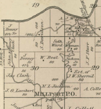
In 1883, it was announced that the White Pigeon Road would be building a subsidiary road to connect Anderson to Rushville. This line would carry train traffic through Knightstown and Carthage to Rushville. At this point, other than the Panhandle route going east to west, Knightstown had no other rail connections. Also, at Rushville, through other connections, the CW&M could actually carry traffic to Cincinnati.

But the owners of the CW&M saw another prospect. As was typical at the time, railroads weren’t built, usually, in such direct lines. The old phrase “money talks” was very much alive and well in the late 19th Century. The owners of the CW&M saw a chance to make even more money, contributing to the construction of a railroad, if they pitted two towns against one another. They chose Shelbyville.

The Hancock Democrat of 20 August 1883 dedicated over two full columns to the prospect. The plan was to incorporate a railroad to be called the Anderson, Greenfield and Shelbyville Railroad. It would be owned by the CW&M. There were even talks that Rushville was taken completely out of the running for the extension.

And the residents of Rush County were less than enthused.

The Hancock Democrat was reporting both sides of the issue. It was, however, beneficial to the Democrat, and its readers, should the railroad come through Greenfield.

The line wasn’t completed until 1891…and it ended at Rushville. Here, the line connected to the Vernon, Greensburg & Rushville, a line that had been leased by the Big Four in October 1891. At the same time, the Cincinnati, Wabash & Michigan would also be purchased by the Big Four.

But even that was not as tidy a proposition as one would assume. This was after the announcement in July 1890 that the Lake Shore & Michigan Southern (New York Central) had acquired the complete Cincinnati, Wabash & Michigan. This was strange in that the LS&MS owned one-quarter of the CW&M stock. Another one quarter was owned by the Big Four. Most of the last half of the stock was owned by a railroad President named D. J. Mackey. He was the President of the Big Four. Mackey had purchased the stock from J. H. Wade, President of the CW&M, in 1889.

While the CW&M belonged to the Big Four, and was planned to be completely merged at the close of the fiscal year on 30 June 1892, it wasn’t until 16 June 1915 that the line actually became officially part of the Big Four. It had been called the Michigan Division of the latter railway, but on paper, it was still separate.

There are still vestiges of the old CW&M that exist to this day. The original line from Goshen to Anderson is still shown on maps. It is owned by the Norfolk Southern. Past Anderson, however, while the track still exists in some places, it has long been out of service. Knightstown used to be home to the Carthage, Knightstown & Shirley Railroad, connecting those three towns. It was used as an excursion railroad for many years, until it was closed by its owner, Tom Allison, in 2013.

Addition of SR 331 and SR 17

1932. The Indiana State Highway Commission was getting its complete state road system, a little at a time since 1919, into a cohesive whole. Part of that was moving county roads to state control. One such road was SR 331.

The adding of SR 331 into the state highway system was announced on 14 January 1932. The plan was for the state to take over Dogwood Road south from the Dragoon Trail southeast of Mishawaka. It would follow Dogwood, or Bourbon, Road south to what is now SR 25 northeast of Rochester. This would place the road traveling east of Bremen, then through Bourbon and Tippecanoe.

The addition of this segment of road into the state highway system was started by the Bourbon Chamber of Commerce in 1930. The Chamber had asked that the Bourbon Road be included as a state highway. While becoming a state highway, it didn’t mean much for the road in the beginning. It would mean, eventually, that the state would start paving it. When was anyone’s guess. SR 331 was moved, later, to include Bremen as part of its travels. This would move the highway from the Dogwood (Bourbon) Road that it still follows north from SR 25 to the west to follow the Bremen Highway north to Mishawaka.

Another road added at the time was the Plymouth-Logansport Road. This road would carry traffic between those cities via Culver. This section of road was actually a continuation of a road across northern Indiana that connected Goshen, in Elkhart County, to Plymouth in Marshall County. That trail is to this day, in places, called the Plymouth-Goshen Trail. Following this route, travelers made their way from Goshen, through Bremen, to Plymouth. The continuation, as mentioned before, connected Culver and Logansport.

The Bremen Chamber of Commerce had lobbied for the inclusion of the entire trail complex, from Goshen to Logansport. This would have created two state roads to Bremen, added to the already extent SR/US 6 that traveled through the town.

In the end, the Plymouth-Goshen Trail was not included in the state highway system.

With the addition of these two roads, and almost 1,000 miles of other roads in the state, the Indiana State Highway Commission had control of around 10,000 miles of road facilities in the state. Ultimately, that total would never grow above 12,000.

Indianapolis’ West Washington Street

It goes without saying that Washington Street in Indianapolis has always been an important facility. Since 1821, when the town of Indianapolis was platted, Washington Street has had a prominent role in the expansion of the city. When the National Road came to Indiana, it followed that same town path through the fledging Hoosier Capital. But today, I am going to fast forward into the 20th century to discuss how it became a major concrete ribbon through town, at least on the westside of Indianapolis.

No matter how important Washington Street was to the city, it had, at least outside of downtown, been not much more than what we would call two lanes wide for the first half of its life. With the coming of the automobile, these old narrow cow paths were going to have to be put on a path to make them usable by more people at a time. Way back in the middle 19th century there were discussions, heated at times, about the width of sidewalks on the street, since only the center was covered with gravel for traveling.

The Indiana State Highway Commission decided that the National Road would be part of the state highway system. This, one would think, would automatically include West Washington Street. It didn’t. It just so happened that Washington Street made a direct connection between SR 3 (US 40) both east and west of the city. But Washington Street was still a city street.

In 1937, there was some talk about the Board of Works and Sanitation of the City of Indianapolis widening West Washington Street from White River west to the city limits…at that time near Tibbs Avenue. That plan was in the works, but there was one project approved for the area: widening of Washington Street between Traub and Tremont Avenues, in front of George Washington High School.

The Indianapolis News of 16 January 1937 ran a full page story about the history and pending expansion of West Washington Street. That article mentioned that the widening of the street in front of Washington High School would allow for the creation of safety islands for students trying to cross the busy thoroughfare. West of the city limits, the old National Road, by that time US 40, was already four lanes wide. Through the city itself was a bottle neck.

But the plan never got off the ground. That same year, the General Assembly passed legislation that would remove Washington Street from city control and give it to the State Highway Commission. This would make any widening of the road a state project, no longer a city problem. While the city could ask for something to be done, the state would be the ones to do it. And the wheels of progress sometime work very slowly at the state level.

Fast forward a decade, or so. “The State Highway Commission will receive a recommendation for the rebuilding of 2.1 miles of West Washington Street between White River and Eagle Creek.” So states the Indianapolis News of 20 May 1948. Three months, at that time, had been spent on surveys to figure out exactly how to widening the old National Road.

The end point to the west is important to note here. Around 1937, a new bridge was built by the State Highway Commission to carry US 40 and US 36 across Eagle Creek. This new bridge would be built north of the old structure, and would also entail moving the intersection of Washington Street and Rockville Road (US 40 and US 36 respectively).

MapIndy aerial photograph of the intersection of Washington Street and Rockville Road, 1937.

The 1948 project would include widening West Washington Street to 60 feet wide. That included four 11 foot wide travel lanes, two in each direction, and two eight foot parking strips (one on each side). The then current road surface, consisting of brick and blacktop, would be completely removed and replaced with concrete. New sidewalks were also part of the project.

There was to be a one block gap in the project, however, due to a planning and construction question. The plans included an underpass, allowing Washington Street to go under the Indianapolis Belt Railway at Neal Street. State Engineer of Road Design, William H. Behrens, recommended that such an underpass be postponed until construction costs could come down. “He said he favors a gap of 1 block in the new construction at this point.”

A spokesman for the Indianapolis Railways stated that when the construction was underway, the company would remove its unused streetcar tracks from Washington Street from the car barns near White River (where the Indianapolis Zoo is now) to a point 100 feet west of Tibbs Avenue.

The News pointed out that “the State Highway Commission has charge of the project because Washington Street is part of Roads 40 and 36. It is also part of the old National Road.”

Indianapolis Star, 19 August 1951.

The next reference I have found to the expansion of West Washington Street, I will let speak for itself. It is the news story from the Indianapolis Star of 19 August 1951 shown above. Apparently, this was the second annual party to celebrate the completion of the 1948 project.

Straightening of SR 135 in Northern Washington County

Sometimes, the state moves very slowly when it comes to improving routes that, well, from first glance, should have been higher on the priority list. When SR 35 was created with the Great Renumbering of 1 October 1926, a lot of the route was pretty straight forward. That was until you got to just south of the Muscatatuck River in Washington County. Here, the road was the definitive hilly road.

Monroe Township, Washington County
1878

And the road had been that way for a long time. The 1878 map snippet shown to the left shows the Millport Ferry, which was in the location, roughly, of the current SR 135 bridge over the Muscatatuck River. From there, the “direct” route to the next post office, that being at Millport, winds its way through the hilly territory south of the river.

And this routing hadn’t changed. Until the Indiana State Highway Commission started designing a new road to replace the old one in 1954. Yes, nearly three decades after it became a state road, SR 135 (formerly SR 35) was getting some work to make it safer for travelers.

The bridge just west of the old bridge at the location of the old Millport Ferry was opened for bidding in September 1954. The design of the bridge was to be of seven spans, 28 foot of right of way for drivers, and 26 inch pedestrian walkways on each side. The bidding, opened on 21 September of that year, only included the bridge itself. Approaches to the bridge were to be let in another contract. It also didn’t include the tie in to the then current road north of the river.

The bridge that was being replaced had been contracted in 1883. The superstructure of that bridge, to be built completely of iron, was contracted to cost $23.00 a linear foot.

Work on the design of the new SR 135 section was completed in March 1954. According to the Seymour Tribune of 18 March 1954, “It is understood plans for the new highway are normally straight, with the new location scheduled to eliminate the present many curves on the highway, which now has about 40 turns, many of them sharp, in less than two miles.”

Construction on the new section of the road began on 6 June 1955, and according to the Jackson County Banner of 3 August 1955, was expected to “be completed about the first of next year.” The contract connecting the new SR 135 to the new Millport Bridge would be let later, as the bridge had not been completed by that time. Until that bridge was complete, the old bridge would be in use, and the new SR 135 would connect to the old SR 135 just south of the new bridge. The following Google Map snippet shows the old road, the connection to the new road, and the location of the old bridge.

The new section of road would open in mid-December 1955. The entire route was concrete, with the exception of the south approach to the new Millport bridge, which was graveled to allow traffic access to the new bridge. The gravel would be replaced with concrete the following summer. The old iron Millport bridge would be removed soon after the opening of the road.

Indianapolis’ Downtown Interstates – Original Idea, Part 2

Today, I want to share part two of the original plans for the interstates connecting downtown. It is important to keep in mind that Interstate 70 east from downtown was still being designed. Today, we look at the downtown innerloop from Washington Street south to the south split, and Interstate 70 from the south split to the proposed interchange at Ray Street near the Indianapolis Union Belt Railway and Harding Street.

The downtown innerloop plan, which continues today from last Friday’s post, actually changed very little. Pine Street was planned to be continuous from Fletcher Avenue north to Washington Street, where a loop ramp allowed northbound 65/eastbound 70 traffic to exit at what was, at the time, US 40. There were very few places where these two major highways – Interstate 70 and U.S. 40 – meet with no way to interchange traffic. With the changes in the plans of this highway downtown, the center of Indianapolis was one of those places.

Continuation south of Fletcher Avenue shows plans for an onramp to northbound 65/eastbound 70 from Virginia and an offramp the opposite directions to the same. Both of these, in one form or another, made it to the final construction.

An off-ramp from northbound 65/eastbound 70 also connected to Virginia Avenue. Morris and Prospect Streets would cross over the highway in a straight line, and the onramp to southbound 65 from Morris Street is in place on these pictures to the left.

The mass collection of ramps along I-70 west was actually designed from the beginning, although the final product is way different. A full interchange at Capitol Avenue, an east-on/west-off setup at Meridian Street and a west-on/east-off at East Street were the plans of the day in 1960. There is also a lot of moving around for Ray Street, just north of the interstate. The plans, apparently, included making sure that Ray Street was usable from Madison Avenue to almost White River, as shown in the next two photos.

What would ultimately become the off-ramp from southbound 65/westbound 70 to East Street is also shown on this map. But according to the original plans released by the Indiana State Highway Commission, that ramp actually was supposed to connect Pine Street to Buchanan Street north of the west leg of I-70. The current entrance to the Eli Lilly facility at East and Buchanan Streets would have been an onramp to Interstate 70.

These two photos are from the Indianapolis News of 13 January 1960.

What was planned, and what happened, really shows in this Indianapolis News photo from 15 January 1960 sown below. West Street does have an exit eastbound. And it has an onramp westbound. But Missouri Street isn’t involved in the entire interchange, making it a one way proposition. The same setup of ramps also appear at Kentucky Avenue. This means that the next place one could get off of Interstate 70 westbound, or on I-70 eastbound, as originally proposed, would have been at Ray Street. Yes…Ray Street. That would be the next paragraph.

What about a ramp at Ray Street east of the Belt Railroad, instead of west of the Belt at Harding Street? Well, that was the plan. But there were some other things at play when the plan was changed from the one shown in the Indianapolis News of 16 January 1960. (And shown below!) Part of what changed the plan here was the potential of the SR 37 highway running through the west side of Indianapolis along the Harding Street corridor. That was planned after these rough drafts were created for Interstate 70.

Indianapolis’ Downtown Interstates – Original Idea

Today, I will be basically sharing three pictures…two of which are halves of one another. These pictures come from the Indianapolis News of 11 and 12 January 1960. They show the original ideas for the downtown connection between I-65 and I-70. The plans include those two highways – no more. As of January 1960, the only parts that had been designed to that point was I-65 west from the north split and the joint section from Washington Street north to the north split.

The original design had gone through many changes between 1960 and completion of construction in 1976. The original interchange between I-65 and I-70 would have been west of College Avenue, not east as it is now. On and off ramps at Massachusetts, Michigan, New York and Washington would have made for some interesting traffic patterns. The ramp patterns on the north I-65 leg would have been interesting, as well.

The design of Interstate 65, and its location, would start a cascade of legal and political moves that would delay completion of the highway until after the Federal money was supposed to stop being provided.

The picture of I-65’s north leg will be rotated to the right, with north to the top, due to the sheer size of the photo in the newspaper. This will allow for greater detail. I left the caption intact.

Indianapolis News, 12 January 1960

OSR 2/US 30 at Plymouth

When the Indiana state highway system was being expanded in 1920, one of the additions was what was, at the time, the Yellowstone Trail from Valparaiso to Fort Wayne. This Auto Trail snaked its way across the Hoosier landscape, nowhere near anything resembling a straight line. It was added to the system as SR 44, connecting at both ends with SR 2, or the Lincoln Highway. The original route had the road entering Plymouth from the west and the south. The Yellowstone Trail, and the state highway that came after, didn’t go straight through the Marshall County seat.

1923 Indiana Official State Highway Map showing SR 2 between Hamlet and Columbia City.

That was about to change. But first, a number change was in order. In 1923, the Indiana State Highway Commission started changing state road numbers. One of those that would change would be the Lincoln Highway…and SR 44. The SR 2 designation was moved from the Lincoln Highway to the Yellowstone Trail. This “straightened” the road between Valparaiso and Fort Wayne…SR 2 no longer ran through Goshen, Elkhart and South Bend. But the road still was a winding mess between Warsaw and Plymouth.

With the concept of federal aid funding sitting in the background, the state decided it wanted to fix the twists and turns of the original Yellowstone path. The first reference to this project that I found was in August 1925…but it wasn’t good news. The project was “abandoned” due to a $5 million shortfall in federal funding. Or, more to the point, a belief that the state was going to get $5 million from the federal government that hadn’t quite made it to Indianapolis. Two projects were actually put on hold with that shortfall…both of which were in northern Indiana. One was the SR 2 project. The other was the Dunes Highway along Lake Michigan.

The article that made it to most Indiana newspapers in mid-August 1925 lamented that the northern part of the state would be paying for the delays in funding. It also mentioned that most of the road was a hard surface (paved) road from Columbia City eastward to Fort Wayne. The section shown both in the map above and the one below show that the road is “gravel or stone (not treated)” between Warsaw and at least Hamlet…through Plymouth.

1926 Indiana Official State Highway Map showing the new US 30 (former SR 2) from Hamlet to Columbia City. This map also shows the pending reroute of the same road from Warsaw to Hamlet.

The new maps issued in late September and early October 1926, with the Great Renumbering, show the construction is at least still planned, as the circles on the map are listed as “proposed relocations.” The new US 30, which was SR 2, would be given a straighter route from Warsaw to Plymouth. And it would actually enter Plymouth from the east, not follow SR 1/US 31 south out of town like it did originally.

In relative terms, it wouldn’t take long for this new road to be completed. The South Bend Tribune of 20 November 1927 reported that construction was almost complete in a plan to avoid crossing the Pennsylvania Railroad for 75 miles, something the old Yellowstone Trail/SR 2/US 30 did quite a bit. As of the writing of the article, 16 miles to the west of Plymouth were completed. This connected US 30 to SR 29 (now US 35), a “recently improved asphaltic macadam” road.

As a side note, the section west from SR 29 to Hanna was also part of the project, but was in a serious holding pattern. The road was “a stretch of about 10 miles in which no concrete has been laid and cannot be laid this year because of two sink holes in the vicinity of the Kankakee river which have materially resisted grading and filling by the contractors.” That section of US 30 is still in use today…albeit a bit wider than it was at that time.

East from Plymouth, the road was open, according to the Tribune, to Bourbon, a span of 10 miles. Four bridges being constructed between Aetna Green and Warsaw were all that was standing in the way of opening the road on or about 1 December. The article mentions that the route actually enters Plymouth from the east along Pennsylvania Avenue. This is due to a bridge on what is now called Lincoln Highway over the Yellow River being built. Pennsylvania Avenue connects to Michigan Street (old US 31) just north of the old Pennsylvania Railroad Fort Wayne Line (and, for those that are landmark oriented…right at the Penguin Point restaurant).

And, in case you are wondering, the name Lincoln Highway would be officially applied to this road in 1928, one year after this construction. The places where the name “Yellowstone Trail” still exist as a road name were sections of the original path of that road…parts that weren’t improved as a part of the state highway system.

US 40: Bridgeport to Plainfield

When the National Road was surveyed in the 19th century, the people that laid out the road had very little to worry about when it came to man made obstructions to its path. The road was built in the most efficient way possible. Not necessarily the straightest, but the most efficient. An example of this is just west of downtown Indianapolis with the National Road bridge. The original route crossed the White River at a 90 degree angle…typical of bridge building at the time. And although that bridge would be later supplemented, then replaced, by a straighter Washington Street bridge, the old bridge would survive until 1904…a little over 70 years.

Another section of the old National Road that would survive into the 20th century before getting the straightening treatment would be the section starting just west of Bridgeport, heading toward Plainfield. Here, for two and half miles, the National Road would first curve its way across a creek, then find its way, in 1852, across a dangerous railroad crossing near the Marion-Hendricks County line.

Let’s start with the railroad crossing. In 1850, the Terre Haute & Richmond Railroad was chartered to create a route between its two title cities through Indianapolis. Typical railroad construction involves laying out the route to be as flat as possible. Through most of Indiana, being that most of the terrain is relatively flat, this is not a problem. The routing of the the TH&R west of Plainfield found itself winding through some very hilly territory. At Plainfield, the road started on a straight path to the Hoosier capital. When construction was completed in 1852 to Indianapolis, the railroad was a very straight line from west of Plainfield to Indianapolis.

Railroad construction at the time also didn’t take into consideration the roads that were in place when they were built. One half mile west of the Marion-Hendricks County line, at a spot that would later become known as Six Points, the TH&R was built to have a very flat crossing of the National Road. A crossing of about 15 degrees. On a clock, that is about the angle from 12:00 to 12:02:30, or half way between 2 and 3 minutes. Given the little amounts of traffic, the speed of trains, and what little there was normally involved horses, this was not seen as a problem.

Fast forward to the Auto Trail era when automobiles were taking over. Train traffic was booming, locomotive speeds were much higher, and the traffic was getting clogged with cars and trucks. The crossing at Six Points became one of the most dangerous in the state. With the state takeover of the old National Road as Original State Road 3 in 1917, the Indiana State Highway Commission became responsible for the conditions of both the road and the railroad crossing at this point. As traffic increased, this dangerous situation would remain into the mid-1930’s, when the ISHC started turning what had become US 40 into a divided highway across the entire state. The routing of US 40 curved to the north of the old road, crossing the Hendricks County Road (later to become 1050 East) a little over .1 mile north of the old crossing. The railroad, by this time the Pennsylvania Railroad, was then crossed at a 30 degree angle three tenths of a mile west of the Six Points Road.

This improved the situation at the crossing…but didn’t fix it completely. There were news stories of crashes, sometimes fatal, between cars and trains at that crossing, as well. But it did improve the situation.

The other quirk in the National Road would be the crossing of the creek at the west edge of Bridgeport. Bridgeport was an old village, mainly started as a watering hole along the old National Road. It is located less than 1/2 mile east of the Marion-Hendricks County line. At the west edge of town, the National Road curved slightly north of its straight path to cross over the White Lick Creek. The road then turned to become a straight line again aiming towards Plainfield.

This Google Map snippet shows the property lines of the old National Road from a point west of Raceway Road to west of Bridgeport. The road labelled “Old Washington Street” is the original path of the National Road/US 40.
This MapIndy aerial photograph, taken in 1941, shows the construction of the new US 40 west of Bridgeport.

When the state started working on connecting the two sections of already widened US 40, the section that remained was through Bridgeport and over the White Lick Creek Bridge. The work started on this section in 1941. The first task was to eliminate the curve at the White Lick Creek, making a straight line road between the 1936 bypass of Six Points and Bridgeport. It was mentioned in the Indianapolis News of 7 July 1941 that traffic through Bridgeport had dropped quite a bit with the old National Road/US 40 being closed for this construction. By 1942, the new section of US 40 would be completed, and the old road was left to flounder in the weeds.

Planning and Building I-65 in Southeast Jackson County

When the Federal Aid Highway Act of 1956 was made the law of the land, states throughout the United States started looking at how to cash in on the new superhighway plan. Rough routes had already been laid out. It was up to the states, more or less, to nail it down even more. While there were already sections of road that were going to be added to the new interstate system, I want to focus on one of the built from scratch sections that was planned. This section was so quick to be added to the highway system that it was announced in the Seymour Tribune on 14 February 1958. It would connect US 50 east of Seymour to Uniontown.

“Early Construction May Put New Road Near Here In Use Before Rest Of New Highway.” That was what the sub-headline read in the Tribune that day. Engineer for the Seymour District of the Indiana State Highway Commission, E. C. Willis, announced on that Valentines Day 1958 that the new superhighway, not mentioned by number in the article, was on the 1958 State construction plans.

According to the information put out by the ISHC, interchanges were to be built at US 50, just west of the then current US 31, and at SR 250, east of Uniontown. “This will permit the new stretch of the superhighway to be used between those two points before the remainder of the new limited access highway is completed.” The new highway would run roughly parallel to US 31, the major highway through the area.

“Survey parties of the state highway department still are working on staking the right of way for the proposed new road and one of them is now engaged between U. S. 50 and Kriete’s curve southeast of Seymour. Due to the deeply frozen condition of the ground from the recent continued near-zero temperatures, the survey party is encountering difficulties but is continuing its work with interruption for the extreme cold in order that the project can be rushed under this year’s schedule.”

The article goes on to state that right of way purchase at the Jeffersonville end of the new road had already begun.

Google Maps image of the area known as the Kriete Curve.

“The programming of the Uniontown-U.S. 50 stretch in the 1958 highway plans will permit the early construction of that section of the new road, which will include the utilization of the three sets of new dual-lane bridges south of the present Kriete curve, which have been under construction for some time and are about ready for use when a road is built to them.” I would assume from that statement that the state had already planned to move US 31 southeast of Seymour, and that bridges were already built pending completion of the road. With the creation of the interstate system, those bridges could be easily moved to the replacement highway, to be called Interstate 65. It is also safe to assume that the bridges in question crossed the Muscatatuck River, as shown in the Google Maps image.

The section of Interstate 65 in question was shown as under construction on the 1959 Indiana Official State Highway Map. It was shown as complete to a point north of SR 256 near Austin on the 1960 version of the same map. The same 1960 map shows completion of I-65 north from Jeffersonville to Underwood, with the section between Underwood and Austin under construction.

1917: Main Roads to Fort Benjamin Harrison Need Work

When Fort Benjamin Harrison was built in Lawrence Township, in northeastern Marion County, getting there was quite the chore. It has been built along the Big Four’s Bellefontaine, or Bee, line. This allowed steam locomotives to pass by the new Army post on a regular basis. The Big Four, with its affiliation with the New York Central, could get Army traffic to and from the fort to almost any place in the United States without much effort.

The workforce for the new fort would come on either the Bee line, or the new Indiana Union Traction line that connected Indianapolis to Anderson, Muncie and Fort Wayne. Although it didn’t last much more than three decades, this was an important way to access the fort. The station for that interurban line still exists…and is open to the public as a Mexican restaurant (as of this writing) called the Hacienda.

But automobile traffic was becoming more and more important. Even more important was the transit of Army vehicles to and from Fort Benjamin Harrison. To that end, in the spring of 1917, the commander of the station, General Edwin F. Glenn, sought to get improvements to the road system to the fort. With this in mind, he held a conference with Marion County government and business leaders to share what he had in mind.

The Indianapolis Star, 10 June 1917. Map of the north east side of Marion County, showing improvements needed to access Fort Benjamin Harrison.

First and foremost in the General’s mind was the main road to the fort – the Pendleton Pike. Technically, the Pendleton Pike started at the limits of the City of Indianapolis at Bee Line connection to the Indianapolis Belt Railway just east of Brightwood Avenue (Sherman Drive). West of that point, it was called Massachusetts Avenue. The county had taken over the Pendleton Toll Road in the late 1880s. But little was done for its improvement or maintenance. By the time the Army created the fort, the road was little more than a connection to other roads in rural Marion County and downtown Indianapolis. Many battles were fought about the improvement of the road, lasting past the end of World War I, when such improvements were vital.

The Pendleton Pike, in 1917, was being improved…slowly but surely. The plan was to concrete the road from the Indianapolis City Limits to 38th Street, just west of what is now Shadeland Avenue. From there, the first of the two sections to the fort’s main north-south entrance, would be improved with heavy stone. This would take the heavy stone from 38th Street to the old Noblesville-Franklin State Road, or Franklin Road. The next section would be graveled. This section ran from Franklin Road to the Yerger or Acre Free Gravel Road, now known as Post Road. The section of the Post Road, connecting Pendleton Pike to the interior of Fort Benjamin Harrison, was being hard surfaced with a “special preparation,” according to the Indianapolis Star of 10 June 1917.

The next road to get attention was the “54th Street Road,” connecting west from the fort to Millersville. Those of you from the area might be a little confused. The village of Millersville was along the Fall Creek, just inside the Washington Township border at what is now Emerson Way. The main drag from Fort Benjamin Harrison is now called 56th Street, not 54th. That road was built along the half-survey line starting where the Millersville and Fall Creek Free Gravel Roads come together near what is now Emerson Way at Millersville Road. The highlighted section of the following MapIndy photo, from 1952, shows the original route connecting the Millersville Road to the old Fall Creek & Mud Creek Road. (At the time, what is now Rucker Road continued south of what is now Fall Creek Road. It would be that way until sometime before 1962, when two lakes were built. The Rucker Road extension would finally be taken out sometime between 1979 and 1986.)

The Millersville Road, according to the Indianapolis Star “is by no means a direct route to the fort. It begins at Thirty-eighth street and Fall Creek and meanders northeast about eight miles to the famous Baker’s bridge and thence southeast a quarter of a mile to the fort grounds.” Baker’s Bridge is along the old Noblesville-Franklin State Road, now called Boy Scout Road, in the northwest corner of the Fort Benjamin Harrison grounds. General Glenn wanted the entirety of the Millersville Road covered with gravel…a job that, according to the General, with five wagons in two days. The first three miles of the Millersville Road had already been improved with asphalt. The next half mile being oiled gravel. The rest of the road was gravel…and work was being done at the time to repair damage done by large, heavy, loads transiting the road.

Other roads being worked on for access to the fort were the National Road from Irvington to Acre Road, Emerson Avenue, Arlington Avenue, 34th Street and the Acre Road itself.

At the time, National Road was the actual name of the Washington Street extension outside the limits of the City of Indianapolis at Sheridan Avenue in Irvington. West of Sheridan, it was Washington. East of that point, it was the National Road. The first mile of the National Road, from Sheridan Avenue, was being concreted. That would end near what is now Shortridge Road and Washington Street. The next two miles from Shortridge Road east were already concreted at that time. That would take it to a point east of Acre (Post) Road. The Acre Road, as of 10 June 1917, was closed for construction of a stone road stretching five miles north to the Pendleton Pike and into the fort.

Emerson and Arlington Avenues were also under construction at the time. Both were being concreted from Washington Street (both are west of Sheridan Avenue) to the Pendleton Pike. Emerson Avenue met Pendleton Pike at roughly 30th Street. Emerson Avenue, at least the southern section of said, ended at the Bee Line. Neither 30th Street nor Emerson Avenue crossed the railroad tracks, and passage past those tracks was done at an underpass on 32nd Street.

Arlington Avenue meets Pendleton Pike (now Massachusetts Avenue) at 34th Street. Improvements along 34th Street included asphalt paving from the Lake Erie & Western (Nickel Plate) Railroad crossing for three miles to the east to what was the northern section of Emerson Avenue. From there to Arlington Avenue, 34th Street was a stone road. Prior to being called 34th Street, the road was the Fall Creek & Warren Township Free Gravel Road.

It would take some time until the roads were improved for to the General’s liking. With the creation of the Indiana State Highway Commission in 1917, the National Road was taken over as Main Market Road #3. It wouldn’t be until 1923 that the Pendleton Pike would find itself part of the state highway system, entering that system as Original State Road 37. By then, the war was over, and traffic to Fort Benjamin Harrison had, while not stopping completely, had slowed considerably as it normally does after the completion of a war. The fort would, eventually, get its connections to the road system other than SR 67/US 36 (Pendleton Pike). In 1941, 56th Street west out of the fort would become part of SR 534, a designation it would only hold for a few years before that state road was routed straight down Shadeland Avenue. With the building of the Interstate system, which was technically built for the defense of the United States, Fort Benjamin Harrison would find itself with two exits from I-465 (Pendleton Pike and 56th Street) and one on I-70 (Post Road). I suppose the Post Road exit on I-74 could technically be listed as part of that…but it is quite a distance from the Fort.

The Building of I-465

The building of the Indianapolis bypass, Interstate 465, involved a lot of pieces to fall together. Property acquisition was a big part of that. Then came the money involved in building the interstate in the first place.

The Indianapolis News, on 14 December 1959, published the above photograph showing the first section of Interstate 465 to be built. It was already under construction when the article was published. Two contracts, on for the 46th Street overpass ($149,968.03) and the 56th Street overpass ($168,178.51) had already been signed. It is mentioned in the caption that “design work hasn’t been completed on the Interstate 64-465 cloverleaf interchange, although a $582,836.95 bid has been received for part of the work.” One wonders where that cloverleaf might have been.

Even before that, it was announced in the Indianapolis News of 30 April 1959 that the contract had been let for the grade separation (bridge) for 34th Street over the new interstate. What is of particular note is the line “over west leg of new Ind. 100, to be renumbered Interstate 465.”

Late 1962 would be the planned bidding date for a contract to build a new interchange in the already completed northwest leg of I-465. At the time, 38th Street was being extended and improved across northwestern Marion County. It was decided by the Highway Commission to create a diamond interchange where 38th Street crossed over I-465. At the time, there were no interchanges on the northwest side between I-74/US 136 and I-65.

Indianapolis News, 08 August 1962, showing progress on I-465 construction through Beech Grove.

The end of November, 1962, saw the announcement of a $3,197,216.11 contract to build the interstate from Meridian Street to Carson Avenue on the south side of Marion County. This contract was let on the same day they were opened. This was to allow for quicker construction of the bypass. Also, this was to give the contractor as much time as possible to complete construction before the deadline on December 1963. The 2.3 miles of new road and five bridges involved in this section of interstate would bring the highway to almost the pending interchange at I-65.

Another contract had to be let in this section when it was realized that the banks of Lick Creek, with the interstate built on both sides near Carson Avenue, had to be reinforced. To the tune of $298,014.40. The creek, as of 21 April 1964, had eroded its bank the previous winter requiring the building of additional slope walls and revetments to keep the creek where it belonged between the two directions of I-465.

In 1963, a contract bid to build the large interchange on the south side of Marion County between I-65 and I-465 was one of the bigger contracts. The project involved eight bridges and two miles of pavement to connect two of the sections that were already under construction or completed. The low bid on that particular contract was $3,507,672.18 by McMahan Construction Company of Rochester and R. L. Schutt Construction Company of Indianapolis. This bid was announced publicly on 20 April 1963.

Indianapolis News, 24 July 1967, showing the construction progress of the 56th Street bridge over (future) I-465.

The first contract to be opened up after the Fall 1964 completion of I-465 between I-74 and SR 100 (Shadeland Avenue) was the bidding, starting 25 May 1965, of a single bridge over US 52 (Brookville Road) and the Baltimore & Ohio railroad tracks on the southeast side of the county. This contract, and the rest of them connecting I-74 to US 40 on the east side had been on hold due to right-of-way difficulties. Norman F. Schafer, executive director of the State Highway Commission, commented that the summer of 1965 would be the first time in more than four years that no major construction was underway on the beltway.

Indianapolis News, 24 August 1967. Construction underway on the north leg…and a proposed SR 100 connecting the west leg at I-65 to the north leg west of Zionsville Road. This section would be built as SR 100, but like the rest of the route, would become part of I-465, causing confusion for over two decades with the “dog leg.”

The north and northeast legs of I-465 would be the hardest to complete. So much so that in July 1968, the Noblesville Ledger ran photos of the construction of the interstate through the small section of Hamilton County through which it passes. It is mentioned that the “State Highway Department schedules call for ‘phasing out’ I-465 construction from it western link with I-65 east to White River by the first winter freeze. However, I-164 from just north of Fall Creek northwest to White River will not start this year.” I would share the photos from that newspaper, but they are very dark and hard to see.

Indianapolis News, 17 March 1960. Proposed new route for the north leg of I-465 through Boone and Hamilton Counties.

I would be remiss if I didn’t mention one “might have been” on this entry. I found this map of another proposal for the north leg of the bypass. On 30 Janaury 2020, I wrote “Alternate Routes for I-465 on North Side of Indianapolis,” but didn’t find this map. I thought it appropriate to share it here.

The Status of Indiana Road Building, 1928

Within the first decade of the second creation of the Indiana State Highway Commission, the state found itself building, maintaining and upgrading roads at a furious pace. Up to that point, the ISHC was taking over roads slowly. This also meant that paving of those roads was slowly creeping forward. But 1928 saw the biggest improvement in state highways to that time. The Indianapolis Star of 16 January 1929 had an entire section called the “Good Roads Review” that covered the feat.

After the passing of the second ISHC act in 1919, the state started adding to the highway system as it could. A limiting factor, at the time, was money. The ISHC finances were slow in coming together. But it was also important to hold to the mandate of connecting the seats of government for each of the 92 Indiana counties to each other via state highways. A program of road and bridge building was pushed by Governor Harry Leslie in 1928. To that end, the ISHC was hoping for a large infusion of money to further the program, and to put Indiana on par with its neighbors when it came to good quality roads. Governor Leslie addressed the General Assembly to pass a bill to give the ISHC an additional 5 to 6 million dollars for the goal.

At the time, the state highway system consisted of 5,000 miles of roads, 2,800 of which were still in need of improvement. Most state highways at the time were gravel. But maintenance costs were skyrocketing due to major increases in traffic. This led the ISHC to believe that paving, instead of maintaining, these roads was both more cost effective and beneficial to the motorist of the Hoosier State.

At the close of the 1928 fiscal year, Indiana had improved 1,060.1 miles of its Federal aid highway system. Most of that was spent towards paving the roads, not just maintaining them. To put it into perspective, Indiana had 4,701.5 miles of Federal aid roads at the end of the same fiscal year. That meant that only 22.5 percent of those road had been improved. This put Indiana 31st in the Union when it came to the mileage of those roads. Most other states were gravelling roads as Indiana was pushing concrete road surfaces. Texas, for example, had completed as much as 50% of their Federal aid roads, much of that in gravel.

The government of the state had placed a higher priority on the “more bang for the buck” idea of infrastructure improvements. This stemmed from when the state would just throw money at projects, and almost had to file for bankruptcy. That in turn led to the Indiana Constitution of 1851, which forced financial responsibility on the government.

But that didn’t help Indiana in the sheer numbers of paved mileage. Illinois and Michigan both had 6,000 miles of paved road. Ohio had 11,000. Kentucky, at the end of 1928, had 4,000.

The plan for 1929 called for 220 miles of paved roads to be added to the state highway system. The Star listed those projects in the collection of articles. US 24 (called State Road 24 in the newspaper – there is no difference, really) would have 75 miles of paving done in 1929: 35 miles between Monticello and Huntington; and 40 miles at the eastern end of the road. US 50 between Vincennes and Aurora would add 50 miles of pavement. SR 29 between Greensburg and Shelbyville, 27 miles, would also get the same treatment. Another planned project was 27 miles of SR 37 between Bloomington and Bedford.

Two gaps in US 27 between Fort Wayne and Richmond would be completed during the summer of 1929. One, a 12 mile stretch north of Winchester. The other, 10 miles south of Berne. SR 16 was planned for 15 miles of paving between Rensselaer and Remington. The last project listed included US 150, with about two miles near West Baden on the list.

Michigan Road – Encroachment and Some History

One of the oldest state roads in Indiana is the old Michigan Road. I have covered that road several times in the annuls of Indiana Transportation History blogging. Today, I want to go back to the South Bend Tribune of 13 May 1928, and the pending improvements on the old road.

“Improvement by the Indiana highway department of what is known as the Michigan road south from Rochester will give South Bend and this part of the state a second good road to Indianapolis and more satisfactory connection with Logansport. The state highway commission is devoting much attention to this highway and finds that years of encroachment by farmers and others have decreased the original 100 foot width of the Michigan road so greatly that in some places in rural sections it is little better than a lane.”

The news article makes the case that the road should be returned to its original 100 foot right of way “so that the old glory of this celebrated highway may be restored and it may again take its place among the highways of history.” However, they recognize that some farmers, having had part of the ROW as part of their farms for years, might not make what the Tribune sees as the right choice and give it back freely and voluntarily.

“Perhaps no other road in Indiana, not excluding the old National road, has a more interesting history than the old Michigan road with extends from Michigan City, eastward to South Bend and then south through Plymouth, Rochester, Logansport, Indianapolis and Greensburg to Madison on the Ohio river. Due to the development of many local county and township roads in later years the need of a main through route like the old Michigan road was not so insistent as it is to-day and as a result was a tendency in many places to encroach upon the 100 foot right-of-way of this old historical road.”

The article continues with the “encroachment” theme throughout…making it quite clear that it shouldn’t have been allowed in the first place.

Then the article covers more history of the road. “During the administration of Gov. James B. Ray from 1825 to 1827 and due primarily to Gov. Ray’s influence, the United States congress authorized a treaty between the United States and the Potowatomie Indians for the purpose of obtaining land from the Indians to make a road through northern Indiana. The treaty was concluded on Oct. 6, 1827, between commissioners appointed by the United States and the chiefs and warriors of the Potowatomie Indians. This treaty provided that a large territory in southern Michigan and northern Indiana be ceded to the United States government. The real purpose of the treaty was to open new territory for settlement, although this reason, of course, was not implied in the treaty.”

“Indiana was authorized to lay out a road from Lake Michigan south. The right-of-way was to be 100 feet wide. The Indians were to receive $2,000 in silver for a term of 22 years. The government was to provide a blacksmith for the Indians and was to furnish $2,000 for education. The government also was to build a grain mill on the Tippecanoe river and keep the mill in operation. This mill was erected near what is now Rochester. The government also was to give the Indians 160 bushels of salt each year. The president of the United States, John Q. Adams, ratified the treaty in 1827 and congress passed legislation about 1827 authorizing Indiana to locate and make a road.”

The act in the Indiana General Assembly creating the Michigan Road was made into law on 24 January 1828. Survey work began in the autumn of 1828. “A course from Lake Michigan to the Wabash river, where the town of Logansport now is, was surveyed but on account of the marshes of the Kankakee river this route had to be abandoned. Finally, however, a survey for a road east of the marches 102 miles lone was made and the road was finally so located.”

The original survey of the road coming from Michigan City was not accepted by the commissioners creating the Michigan Road. So surveyors created another one…almost identical to the first. “The direction of the Michigan road as laid out began at Trail creek on Lake Michigan, thence eastward to the southern bend of the St. Joseph river, now the city of South Bend, then turned south, running to the Wabash river, crossing it at what is now Logansport, and thence south to Indianapolis. The road was later continued southeast through Greensburg and thence to Madison on the Ohio river.”

Acts for the building of the Michigan Road were passed on 29 January 1830 and 4 February 1831. The second of these covered the road “lying between Logansport and the southern bend of the St. Joseph river.” That second act was also never signed by the Governor. However, since it was also never vetoed, it became law according to the Indiana Constitution in force at the time.

Financial difficulties and other problems, however, led to the Michigan Road not being opened as desired. This required another act of legislation dated 2 February 1832 to provide for selling of tracts of land along the Michigan Road. “The road was authorized to be opened 100 feet in width. The opening was to be made clear of all timber as was the custom in those days.”

Thus is a brief history of the background of the Michigan Road. There are a lot of great sources of information for this great highway available online.

The Beginning, and End, of SR 534

As the Indiana State Highway Commission’s inventory of state roads was growing, the thought of putting a bypass around the city of Indianapolis hit the planning sheets. The original plan started appearing on official highway maps in 1932. But little would be done for almost a decade. In 1941, the start of a bypass road was contracted…and built. But there was more to it than just a section along the east side from Fort Harrison to Nora.

Yes, that’s right. From Fort Harrison to Nora. The original road that was started in 1941 followed 56th Street from Fort Harrison out to a new construction road along what was, and still is, the Shadeland corridor. At the time, it was Shadeland Road. But that corridor only ran from 10th Street to 56th Street, creating a dead end road north of 56th Street into the Woolen Gardens. A complete history of the road is available as “SR 100: How did it come to be?

The Indianapolis News, 24 July 1941
Legal notice for contract to build SR 534 from
56th Street to Castleton.

Things started happening on the bypass route in 1941, when the first contracts were let. As is typical of the ISHC at the time, the road was contracted separately from the bridges. The first contracts for the road were let in July 1941. The legal notices were published for the contract, as shown on the left. The bids were to be in the hands of the ISHC by 5 August 1941 at 10 AM Central Standard Time (the time zone Indianapolis was in at the time). The plan was for a reinforced concrete road surface north from 56th Street to the old state road that turned west along what is now 82nd Street.

The bridge over Fall Creek was let out for contract in September 1941, with the description “structure on State Road 534” details as a five span arch bridge “over Fall Creek, 2.7 Mi. North of Lawrence.” Those spans were to be, in order: one at 40 feet; three at 80 feet, and one at 40 feet. The bridge was to be of reinforced concrete arch design. Bids were to be at the ISHC by 10 AM CST on 7 October 1941.

The next leg of the road was published for contract in December 1941, with a due date of 16 December 1941. It was to include 4.578 miles of reinforced concrete from Nora to Castleton. (For the route prior to SR 534 construction, check out 82nd and 86th Street Before SR 534 (SR 100).) This would complete the first opened section of SR 534 in Indiana.

Then World War II started.

The Indianapolis News, of 21 December 1942, opined that the ISHC was in a holding pattern when it came to the building of the bypass road. The road was not mentioned by number, but the route was discussed. “One link, approaching Ft. Benjamin Harrison by way of Allisonville and Castleton, has been completed and is in use. The belt highway, discussed for years, will extend south, intersection Roads 40, 52 and 29, until it reaches the Thompson Road, where it will continue west, intersecting Roads 31, 37 and 67.” With the Shadeland Road corridor only extending as far as 10th Street, this would require the acquisition of right-of-way and building of four miles of new road from 10th Street to Troy Avenue/Southeastern Avenue/SR 29. South from here, the road was already in place as the Five Points Road.

“At Valley Mills it will turn north, crossing roads 40, 36 and 34, eventually intersecting Road 52, where it will join the northern east-and-west link that has been built.” This would put the road along the High School Road corridor on the west side. This would also include a state road that connected US 40 to the Indianapolis Municipal Airport. That state road was designated SR 100 when it was commissioned.

“The practical value of such a construction program has long been recognized, both for ordinary traffic and for commercial vehicles that will be enabled to by-pass Indianapolis without contributing to traffic congestion be traversing the downtown streets.”

The article concluded as follows: “A belt line around Indianapolis has been considered ever since the old days of the “Dandy Trail” when gravel roads were marked and motorists wore linen dusters. The successor to that trail is one of the numerous tasks that are being held in abeyance until the war is won.”

The designation of SR 534 would be applied to the east leg from Washington Street north to 82nd Street, then along the 82nd/86th Street corridor to SR 29, Michigan Road. In the summer of 1949, the following was published in the Indianapolis News: “Some of our highways are known by name as well as number. Thus the route called State Road 534 could be more easily found if you called it Shadeland Drive. This road, leading north from Road 40, east of Indianapolis, intersects with Roads 31, 431, 37, 52 and 29 and is part of what, some day, will be a belt line around the city. But what we started out to say is that on the new Indiana highway maps it is 534 no longer. The new number is 100.”

And with that, the ISHC removed one of the “daughters” of State Road 34, stretching the SR 100 designation from a short section of High School Road to the entire bypass. Or, at least, the sections that would be completed before it was entirely replaced by Interstate 465.

Interurban Freight Service

In the Golden Age of Electric Traction, the interurban lines covered quite a bit of the state of Indiana. This is a subject that I have covered several times in Indiana Transportation History. However, today, I want to cover more than just Indiana, in a way. In 1924, a freight service was created using the interconnected electric traction lines across several states. It was given the name of “the Minute Man of the Traffic World.”

The freight system set up, covering 4,728 miles of electric traction track, covering an area from Uniontown, Pennsylvania, and Buffalo, New York, in the east to Chicago and beyond in the west. It was entirely possible to ship something, via interurban, across Illinois, Indiana, Kentucky, Michigan, Ohio, and Pennsylvania.

A statement, issued on 18 July 1924, by Harry Reid of the Central Electric Railway Association, “described the position of the interurban railway as that of a minute man always ready to rush out on a hurry call.” The interurbans were in an ideal place to serve industries and their workers. (Source: Muncie Evening Press, 18 July 1924, pp 15)

“The development of the motor car has taken much local traffic off the hands of the electric and steam roads, but the demand for speedy service has more than repaid the electric lines, at least, for the loss of that business.”

One of the advantages the electric railroads had over the steam roads was less than carload deliveries. Steam railroads would spend a great deal of time and money on the creation of truck trailer service and less than carload service. Traction lines used free space to move parcels.

Fresh fruit, for instance, was shipped by rail into places like Indianapolis. Then the interurbans could deliver that produce to smaller towns along the line. Even livestock was transported by interurban. Indianapolis itself, in 1923, received 10,510 car loads of livestock…and sent out 1,086.

The Indianapolis traction freight yards, also in 1923, handled 229,150 tons of freight. “With the development of the new Indianapolis electric freight terminal, and the addition of new rolling stock by all lines, this total should be greatly exceeded this year.”

This freight service would find itself in trouble in less than a decade. With the Federal Government ordering the separation of electric utilities and electric traction companies, and the Great Depression, the traction lines would start failing. Private automobiles also helped in the demise. The Traction Freight Terminal, located on Kentucky Avenue near White River, didn’t last long. And the interurban was completely gone from Indianapolis in 1941.

Pigeon Roost Route

Today’s entry will be short. Just a little shorter than the road I am writing about. In the Auto Trail era, not all routes were long, cross country experiences. Today’s route, the Pigeon Roost Route, would clock in at 57.5 miles.

Labelled as “96” on this 1920 Rand McNally Auto Trail Map, you can see that the route only ran from Seymour south to New Albany. This is one of those roads that is going to take some time to look into. The southern part of the route, from Crothersville to New Albany looks to be along the route of US 31. It is not. While it connects some of the same places, it actually runs, for the most part, east of the current US 31.

According to newspaper accounts of the time, specifically from 1922, this route was the original State Road 1.

Towns that were included on the Pigeon Roost Route was Seymour, Dudleytown, Crothersville, Scottsburg, Vienna, Underwood, Henryville, Memphis, Sellersburg and New Albany.

It looks like I will be planning a road trip along this old route. Since I do have a dash cam, this will make documenting the Pigeon Roost that much easier.

The name of the road comes from the Pigeon Roost massacre, that occurred near Scottsburg. On 3 September 1812, a settlement named Pigeon Roost was attacked by native Americans. 15 children and nine adults, according the the State Historic Marker at the site, were killed. One family escaped to spread the alarm. I have read that the people of Scott County never found the ones that committed the killings.

Just a short blub today about the Pigeon Roost Route, a short Auto Trail that became part of the bigger state highway system…as its first inclusion.

The Ohio-Indiana-Michigan Way

In the Auto Trail era, I have mentioned many times that there where many roads that crept up all over the state. Many of these Auto Trails connected Indiana to far flung locations across the United States. Today, I want to discuss a road that connected Cincinnati, Ohio, to Kalamazoo, Michigan, through the eastern part of Indiana – the Ohio-Indiana-Michigan Way.

On old Rand McNally maps of the era, the OIM was listed as number nine in their list. I was never sure why Rand put the roads in the order they did. It certainly wasn’t in any kind of chronological order, since the Dixie Highway and the Lincoln Highway, two of the longest, most important and oldest Auto Trails around, were numbers 25 and 34 respectively.

Most of the original road is still followable today. From the south, it entered Indiana at College Corner, Ohio, southeast of Liberty. After passing through Cottage Grove, it made its way into Liberty. In Liberty, from what I can tell, it followed Liberty Avenue, Union Street, turning north on Main Street, then followed Market Street north out of town. Since it entered Indiana, it followed the route now covered by US 27. North of Liberty, an old bypassed section of the same US 27 is the original route of the OIM.

Just north of Potter Shop Road, or Old Indiana 122, the OIM turned northeast on Esteb Road, which it followed until it connects back into US 27. South of Richmond, the old road and US 27 split again, with the old road following Liberty Avenue on its way into the Wayne County seat.

Leaving north out of Richmond, it again follows what is now US 27 towards Chester. Before reaching that town, the old road turns north to follow Arba Pike, then turns northwest on Martin Road to again connect to the current highway.

After leaving Fountain City to the north, a small section of the road is now out of service. At Bockhofer Road, to follow the old OIM, turn left and then turn right on Hough Road. This trip will keet the traveler off of the modern highway for a little over 2 miles, when the old road and the current highway come together again to travel to Lynn.

At Lynn, a westerly turn onto Church Street will take the traveler out of Lynn. At the end of Church Street, at County Road 100 East, the OIM turned north. Here it followed that county road for five miles, where, at CR 300 South, it connects, once again, to US 27. Just north of CR 200 South, it followed what is now Old US 27 into, and through, Winchester.

The section through Geneva gets a little hard to follow. North of Geneva, however, the road veers to the northeast, following Covered Bridge Road to CR 0, which it follows to north of Monroe. Again, the old OIM connects to the current US 27 north of the town. At Decatur, the old road turns onto Winchester Street, the through town follows Second Street. Again, it connects to US 27 for its journey toward Fort Wayne.

At Fort Wayne, Decatur Road is the original path of the OIM…while US 27 was rerouted to the west. It’s best to follow US 27 through Fort Wayne. North of the city, the road changes to become SR 3. South of Huntertown, the old path veers off onto Lima Road and old State Road 3 until the two come back together north of Avilla. South of Kendallville, turn onto Main Street to enter that town. Here, it basically follows US 6 to SR 9, where it turns north bound for Michigan.

The next major detour from a state road occurs south of Valentine, where the OIM turned west on what is now County Road 500 South. At LaGrange, the OIM followed what is now Old State Road 9 north out of town to what is now SR 120. Here it turned west to connect back to the current SR 9 for the last of its journey to the Michigan State line and points north.

Fort Wayne Street Name Changes

The last entry, 1878: A Fort Wayne Street Guide, led me to looking up the subject of this entry. Indianapolis had gone through a major change of street names from 1894 to 1897. Fort Wayne, it appears, did the same. The following was reported in the Fort Wayne Daily News of 9 December 1897.

“The Names of Many of Our Thoroughfares to be Changed Next Month.”

“Last night the committee on streets and rules and regulations, a special committee appointed to change the names of all streets and avenues where the same name appears twice in the city streets, met and concluded it labors. Several new streets were names and some streets and avenues which were continuous or extensions of other streets, all experience changes of names.”

  • Fox Street, second east of Broadway, and Shawnee Avenue, extensions of the same street, changed to Fox Avenue.
  • Taber Street became Taber Avenue.
  • Pritchard Street changed to Lavina Avenue.
  • Nelson and Metz Streets changed to Nelson Street.
  • Trentman and Kinnaird Streets to Kinnaird Street.
  • Johns Avenue to Nutman Avenue.
  • Griffith Street, a continuation of Fairfield Avenue, to Fairfield Avenue.
  • Oneida Street, in South Wayne, to Wayne Avenue.
  • Locust Street to Chauncey Street.
  • Duryea Street to Poplar Street.
  • Dawson, Colerick and Charles Streets all to Masterson Street.
  • Allen Street and Park Place to Woodland Avenue.
  • Koch Street to Dawson Street.
  • Crescent Avenue (Bond’s Addition) to Meyer Avenue.
  • Hoffman Street to Hoffman Avenue.
  • Wells Street to Wells Avenue.
  • Ninth Street to McKee Street.
  • Tenth Street to Colerick Street.
  • North Street to Fairmont Avenue.
  • Ann Street to Ferguson Street.
  • Park Avenue (Nebraska) to Thieme Street.
  • Grace Street (Esmond’s Addition) to Esmond Street.
  • Grant Street to Findlay Street.
  • Shoals Street to Simons Street.
  • Lake Street (Aarcher’s Addition) to Maria Street.

This was after a first round of name changes that were recommended in April 1897. That list was much shorter. But it also looks like some of them never occurred. Especially the original recommendation of Ninth and Tenth Streets.

  • Hamilton Street, from Calhoun to Lafayette, Wallace Street.
  • Thomasetta Street, from Gay to Thomas, Hurd Street.
  • Julia Street from Thomas to Holton Avenue, Hurd Street.
  • Alliger from Pioneer Avenue to New Haven Road, Grant Avenue.
  • Winch from Pioneer to New Haven Road, Wabash Avenue.
  • Maumee Road to Maumee Avenue.
  • Penn from Alliger to Lumbard, Winch.
  • Hugh from Walton to Alliger, Alliger.
  • Eliza from Walton to Alliger, Penn.
  • Bowser Street, from Wells to Barthold’s Addition, Second Street.

A resolution was put forth at the time to change Ninth Street to Capital Street and Tenth Street to Manhattan Street. That resolution went nowhere, as the names of those two streets were changed, in January 1898, to McKee and Colerick Streets.

1878: A Fort Wayne Street Guide

In fairness to the rest of the state, I have decided that I will share the street guides from other places around Indiana from the same year as last week’s Indianapolis street guide. Today, it’s Fort Wayne. Now, it doesn’t have the same information available as the Indianapolis City Directory. There is no addressing in this list. But it does list every street in the city of Fort Wayne…at that time. I find such lists interesting…and helpful when you are doing genealogy.

For those that are interested, you can see a list of available Fort Wayne City Directories at this link: https://www.acgsi.org/genweb/fort-wayne/city-directories.html