Featured

Blog Changes…

With the passing of Richard, Myself and Jim Grey are taking over the Indiana Transportation History Blog.

In the last week or so I’ve been playing with WordPress to figure out how to make the blog easier to find things like old posts and such, because Richard previously had all of his blogs loading into a single page and you had to keep scrolling back to view older posts.

Categories

I updated the ‘home page’ header and added a “Transportation Categories” link to the top next to the “Home” that was already there. This Transportation Categories page is basically a bulleted list of the transportation categories that have been created.

Because of how WordPress works, adding and managing categories is tedious. I had started making a sub-category entry for every city, road or railroad company but the category list just got so big and because they don’t have the means to display it as a collapsed list that you can expand as you need, I was having to scroll through all the categories to find the one I needed, which was a pain in the butt!

So, I decided the categories would be basic categories under which to organize the posts. So, if you want to see the articles about bicycling in Indiana, I finished marking those posts last night and there are 18 posts about bicycling.

If you have any suggestions for categories, or find that some of the categories are too general or broad, I’m open for suggestions!

Tags

And then there are Tags… For the tags, these are much easier to dynamically add as needed. So, as I’m reading through a blog post, I’m tagging each year, city, road, river, bridge, canal etc that I come across.

Then, I added a Tag Cloud to the home page. This Tag Cloud shows a lot of the tags with higher usage counts and you can click on one to see a list of the blog posts which have been tagged with the tag. For example, right now I can click on the Lincoln Highway and there are 30 tagged posts about the Lincoln Highway!

It is going to take a while to get all of the blogs tagged, but I’ve got a good start. So far, any post that mentioned “Auto Trail”, “Bicycle” or “Canal” have been tagged.

Here is where I need help!!! I’m finding duplicate similar worded Roads and such that I don’t know if they are the same or not. I’d love to get them corrected in the blogs and then tagged correctly.

An example:

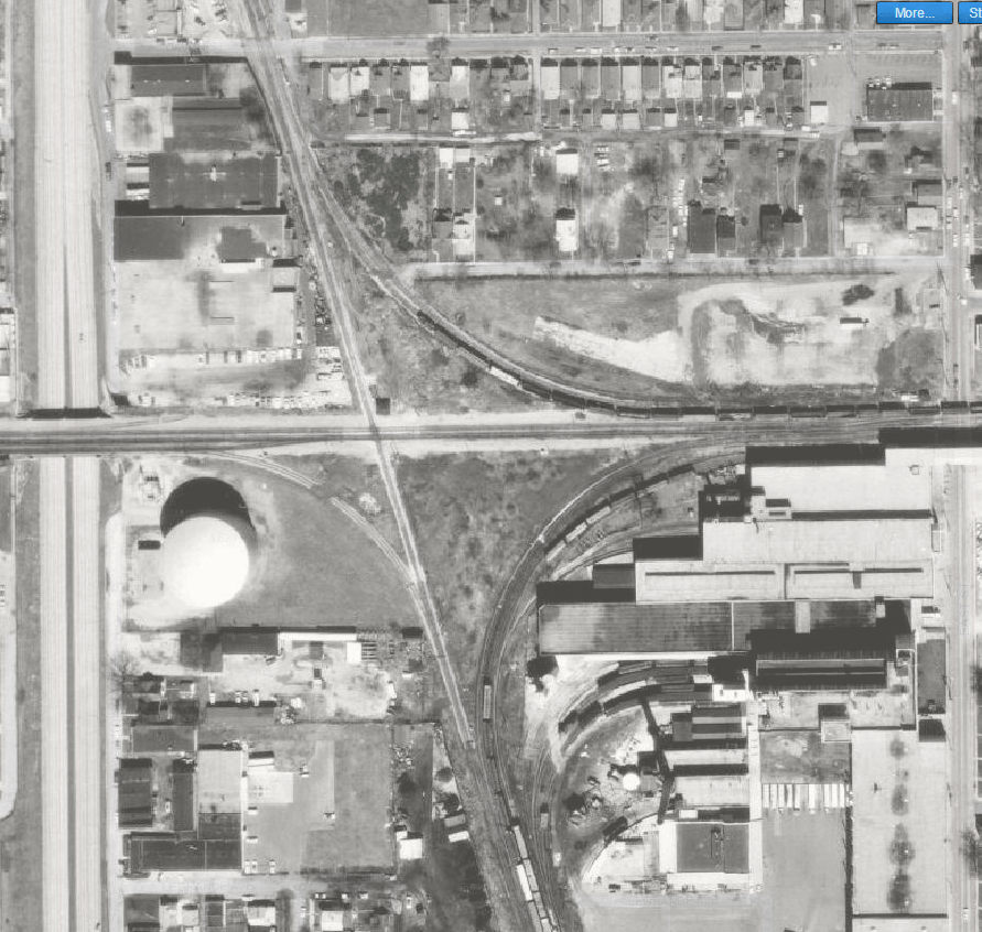
Belt Railroad – from a post “Bicycling the Shelbyville Road

Belt Railway – from a post “Bicycling the National Road West from Indianapolis

Which is correct? Or are they 2 different train companies?

So, as I continue to add tags and categories, the blog may keep changing… but hopefully in the long run it will make it more usable.

New Content – Contributors

This blog cannot die with Richard. It is such a great resource, and Jim and I would like to see it continue to be used and added to.

Jim and I have discussed it via email and we’d love to sign people up to be ‘contributors’. As a contributor you would write your blog post in a subject matter fitting for Indiana Transportation History blog, doing all of the necessary research and adding pictures and maps accordingly.

Then Jim and I would then approve and publish the blog entries as they are submitted.

If you would like to become a contributor, contact Jim or myself and we’ll get the ball rolling. It is all new to us so have patience with us as we figure out how to add the proper processes, procedures and blog infrastructure to handle the changes being made!

-Paula

Bankruptcy of the Southern Indiana Railway, Part 1

This post is going to include a LOT of legal jargon. But, I think it is important to show how the legal definitions of railroad right of ways are documented. It really isn’t “let’s build this this way, damn the consequences.” Well, not entirely.

In May, 2019, I wrote an article about the Milwaukee Road in Indiana. One of the roads that made up what would become part of that western railroad that wandered east was the Southern Indiana Railway. The creation of the railroad will be covered at some point. But while looking at a map of Clay County, there was a proposed Southern Indiana Railroad that went across Clay County that went through Saline City and north of Bowling Green. So I tried looking it up. But all I found was the one connected to what would become the Milwaukee Road.

But the topic of this post is the bankruptcy of the Southern Indiana Railway. It made the newspaper legal notices in September, 1910. And it took a complete page and a half in the Indianapolis Star. Yes, a page and a half. I have included the first page below. Do I expect people to be able to read. Oh, no. But to give you an idea of the complete railroad property bankruptcy, this picture sums it up.

Indianapolis Star, 28 September 1910. This is the first page of the “Notice of Sale of the Properies of The Southern Indiana Railway Company.”

The entire property of the railroad is so detailed in this legal notice that it will take a few blog entries to cover the entire thing.

The Southern Indiana Railway filed for bankruptcy in the Circuit Court of the United States for the District of Indiana on 27 May 1910. There were several plaintiffs in the complaint. First was the First Trust and Savings Bank, as trustee. The second was the Girard Trust Company under a deed dated 1 February 1901. Another plaintiff was Alfred M. Chapman. The offices of the railroad were located on Hulman Street, between 14th and 14 and 1/2 Streets, in Terre Haute.

The first parcel listed in the sale of the railroad was described as “all and sigular the main track of railway of the Southern Indiana Railway Company existing at the date of the mortgage or deed of trust made by the Southern Indiana Railway Company to the First Trust and Savings Bank of Chicago, dated May 1, 1906.” This trackage was listed as “commencing at the extreme northwesterly limit of said line as then constructed in Vermillion County, Indiana, at or near the line between the States of Illinois and Indiana, at or near Quaker Hill in the State of Illinois, thence in a southeasterly direction to and into and around the city of Terre Haute in Vigo County, Indiana, and thence in a southeasterly direction in and through the counties of Vigo, Sullivan, Clay, Green, Daviess, Martin, Lawrence, Jackson, Bartholomew and Decatur to the town of Westport in the last name county.”

This description would also include “all its branches diverging from said main lines at or near Black Hawk, Coalmont, and Latta in the State of Indiana and extending to or near Sullivan in said State, said branches being otherwise known as the Sullivan Branch (which includes the Hymera Branch), the Shelburn Branch, the Coalmont Branch and the Latta Branch, and also all other railroad tracks, extensions and branches which said The Southern Indiana Railway Company owned on May 1, 1906, or at any time thereafter constructed.”

Also included in this were “all buildings, lands and interests therein, rights of way and property of every kind on May 1, 1906, owned by The Southern Indiana Railway Company or at any time thereafter acquired.” There is one exception, which goes to show the original planned extent of the railroad. It is listed as “except the lands which it then owned in Wayne County, Indiana.” The original plan for the railroad was to reach to Richmond, in Wayne County. The Southern Indiana ended, at the time, at the Big Four Railway south of Greensburg. That is quite a distance from Wayne County.

1893 Map of Wayne County showing the proposed route of the Evansville & Richmond Railroad through Washington, Centre and Wayne Townships. This route would connect Centerville and Richmond south of the Panhandle Route (PRR).

The main line of the railroad was described in the following legal manner: “Beginning at a point of connection with the railroad of The Chicago Southern Railway on the state line between the states of Illinois and Indiana in the Southwest quarter (S. W. 1/4) of the Section Seven (7), Township Sixteen (16) North, Range Ten (10) West of the Second Principal Meridian.” Legally, most of the state of Indiana is surveyed from the Second Principal Meridian, also called the Paoli Meridian. (The First Principal Meridian forms the line between Ohio and Indiana.)

From there, “and extending thence in a general Southerly direction in and through said county of Vermillion, thence in a general Southerly direction through Vigo County, also from a point in the center line of the right of way of The Southern Indiana Railway Company 33 feet Northeasterly from where said center line crosses the south line of Section 3 (3), Township Eleven (11) North, Range Nine (9) West of the Second Principal Meridian and extending thence in a general Northerly direction to Wabash Avenue in the City of Terre Haute, Indiana, thence in a general Southerly direction through Sullivan County, Clay County, and Greene County; thence in a general Southeasterly direction through Daviess County; thence in a general Easterly direction through Martin County, Lawrence County, and Jackson County and into and through a part of Bartholomew County; thence in a general Northeasterly direction through part of Bartholomew County and a part of Decatur County to a point of connection with the Cleveland, Cincinnati, Chicago and St. Louis Railway.”

To give you an idea of how much information is in the above listed article, I have only covered the first half of the first column in this entry. I will be covering more in entries to come. I know these can be a bit boring, but it is also important to transportation history. Not many railroads in Indiana did not go through a bankruptcy. These types of legal announcements would have been made for each and every one of them, if they were required to publicly announce them. Just looking at one of them sheds a light on all of those things that most people don’t see when it comes to the railroads.

1913 Indianapolis Car Sales Ads in the Indianapolis Star

While doing the article that will appear tomorrow, the newspaper I was looking at had car and tire ads. What stood out to me were the locations of the sales. Also, the prices on those things at the time. This would be 28 June 1913.

Tire ad from the Indianapolis Star of 28 June 1913.
Indianapolis Star, 28 June 1913, used car sales ad.

The following one is what really caught my attention. It looked like a plea to return a car. But no. It was an ad for a car. The location also grabbed my eye: 20 West Wabash Street. For those unfamiliar, that is the alley just north of the Circle, and just south of Ohio Street.

The last things I want to share are personal sales ads that were included in that newspaper.

I know this isn’t normal fare for my blog. But this is transportation history, of a sort. I thought it was interesting. I hope you do, too!

Original State Roads 11-15

Today, I want to give a brief overview of the next five original state roads that were created with the law that created the Indiana State Highway Commission in 1919. I have covered the first ten, if you are interested, in these articles: “Dec 1917: Main Market Roads Officially Announced” and “Original State Roads 6-10.”

Original State Road #11: This road started in Greenfield, traveling north through Pendleton, Anderson, Alexandria, Marion, Mt. Etna, Huntington, and Roanoke ending at Fort Wayne. Most of the road in Grant, Huntington and Allen Counties was originally built as part of the Fort Wayne State Road, connecting the county seat of Allen County to Indianapolis. From Greenfield to Huntington, it would later be designated SR 9. The original US 24 used the rest of the original State Road 11.

Original State Road #12: This was the designation given to the original Indianapolis-Vincennes State road built in the 1830’s from Bruceville to (almost) Martinsville. It actually ended on the west bank of the White River opposite Martinsville. The southern end of the road was at original State Road 10 at Bruceville. In 1923, the state added the rest of the route from Martinsville to Indianapolis to the designated SR 12. That was discussed in the article “Original SR 22 – The “Fight” For the Way to Martinsville.” With the Great Renumbering, OSR 12 became part of State Road 67. (There is a reason for this road given the number 67…and I covered it in the article “SR 67 – Why?“)

Original State Road #13: Starting at Lewisville, on the National Road/OSR 3, heading north through New Castle, Muncie, Hartford City, Montpelier, Bluffton, and Ossian, to end with OSR 11 at Fort Wayne. The Great Renumbering changed this road to SR 3. Later, the northern section from east of Montpelier would be changed to SR 1 later.

Original State Road #14: This road started at Cannelton on the Ohio River, then north through Tell City and English, ending at Paoli. This road was marked on maps as going in a (as) straight (as possible in southern Indiana) line between English and Tell City. This road would become the new SR 37, sort of. The route would be changed along the way, especially from English to Tell City.

Original State Road #15: Starting at Logansport, the road travelled through Royal Center, Winamac, Knox, and Laporte to end at Michigan City. At the northern end, this road was part of the Michigan Road, but only a short section of it. (Basically the section from what is now the intersection of US 35 and US 20, following E. Michigan Boulevard into Michigan City.) As such, for all intents and purposes, it became a “Michigan Road” shortcut, connecting Logansport to Michigan City more directly. When the Great Renumbering happened, it was numbered as such…SR 29, the same number the ISHC gave to the Michigan Road from Logansport to Madison.

Acton and Wanamaker

In Franklin Township, Marion County, two towns were established to make use of the transportation facilities available. One was founded with the creation of the Michigan Road. One was created to make use of the Indianapolis & Cincinnati Railroad. Both would be so important in their function that they would be connected together by the interurban at the turn of the 20th Century. Those towns are Acton and Wanamaker.

1889 map of New Bethel, Indiana, along the Michigan Road.

Let’s start with the first created of the two: Wanamaker. The Michigan Road had been cut through Marion County in the 1830s. It was in 1834 when a man named John Messinger platted a town along the Michigan Road east of the Noblesville-Franklin State Road. The original plat called for 22 lots fronting the Michigan Road, with a perpendicular street near the middle. The town would be called New Bethel. When mail service was finally extended to the village, it did not have the post office. The post office was located on the Indianapolis & Cincinnati Railroad at the Franklin State Road crossing. That post office was called Gallaudet.

1889 map of Acton, Indiana.

The other town that came into being due to transportation facilities was platted in October 1852 along the Indianapolis & Cincinnati Railroad. The town would originally be called Farmersville. The name would later be changed to Acton, reportedly after a local resident. According to property records, the Marion County government still lists the some of the properties as in Farmersville. Some are listed as Farmersville (Acton).

The original plat of the town was located in two places. The first was on the west side of the county road that connected the town to the Michigan Road about a mile and a half north, along the railroad. The second centered on what was originally Oak Street, now Virgil Street.

North of town, a campground, opened in 1859, operated by the Southeast Indiana Conference of the Methodist Church was created at the junction of the road connecting the town to the Michigan Road (now Acton Road) and the dirt road connecting Acton to Southport (now Southport Road).

The I&C railroad would help bring people to the campground. This would help Acton grow quicker than Wanamaker. The campground would include a pavilion, a hotel, and other facilities. Several fires occurred at the location, but it was rebuilt each time.

In 1889, the town of New Bethel would change its name to Wanamaker, apparently named after the postmaster general under the administration of President Benjamin Harrison. It was not entirely unanimous when it came to the name change. For 50 years afterwards, road signs and residents used both names for the town.

1905 map of Franklin Township, showing the Indianapolis, Shelbyville & Southeastern Traction Company lines connecting Indianapolis to New Bethel (Wanamaker Post Office) and Acton.

In 1902, the Indianapolis, Shelbyville and Southeastern Traction line was built through Franklin Township. It would follow the Michigan Road from Prospect Street, near Sherman Drive, to what is now Hickory Road. From there, it would follow Hickory Road to the original Indianapolis & Cincinnati Railroad. As it would get close to Acton, it would depart the railroad right-of-way along what is now Swails Street (formerly known as Washington Street). Before Swails Street turns due east to become Lemont Street, the old traction line turned even more southeast to connect back to the railroad right-of-way for the traction lines connection to Shelbyville.

Three years after the interurban connected to Acton, the Methodist campgrounds would suffer complete destruction after another fire. The facility would not be rebuilt after this fire.

The Indianapolis, Shelbyville & Southeastern Traction Company would change its name to the Indianapolis & Southeastern Traction Company around the same time as the campground fire. Many mortgages were made for the traction company property. The first, to the IS&S, was made on 1 January 1902. The next would be to the I&S, dated 14 July 1905. Another name change would occur before 26 December 1910. This time, the company would become the Indianapolis & Cincinnati Traction Company. That date, a mortgage on the property to the Central Union Trust Company of New York.

The towns of Wanamaker and Acton started to more or less stagnate when it came to resident growth. They both would slowly grow over the years.

Wanamaker would get the next transportation improvement. In 1919, the Indiana State Highway Commission took over the old Michigan Road in Marion County. It would be given the number State Road 6. This caused the town of Wanamaker (New Bethel, whichever particular people preferred even at that time) to be located on the state highway system…again. The Michigan Road was built as a state road originally, but it was built to connect two places and given to the counties almost immediately after construction.

The interurban that connected to the two towns would run into major problems in 1928. The entire company, with the mortgages listed above, found itself sold at foreclosure due to orders from the Rush Circuit Court in Rushville. This foreclosure was entered on 31 March 1928. It also included the I&C Light and Power Company, which supplied power to the traction line. The foreclosure consisted of four busses, all property not covered by liens of the mortgages, all nine shares of the I&C Light and Power Company, and that section of the railway from Colescott Street in Shelbyville to the end of the line in Greensburg, among other things. The official beginning of the line was located 1.31 miles east of Keystone Avenue in Indianapolis. The line would become the Indianapolis & Southeastern again. But it wouldn’t last long. Abandonment would begin in 1931.

The two towns would continue on. Both would become part of the City of Indianapolis with the passing of UniGov.

West Newton and Camby

In keeping with the last entry in the Indiana Transportation History blog, and a question posted in one of the Facebook groups I post to, I want to cover two towns in Decatur Township which have a shared history: West Newton and Camby. Decatur Township has been, historically, the most “rural” of the townships in Marion County. The number of villages in Decatur Township in small compared to the rest of the county. But, the township is also the smallest in the county.

The story starts with the Mooresville State Road that, ultimately, connected Vincennes to Indianapolis. Christopher Furnas found a spot in the south central part of the township, along the then Mooresville Toll Road, in 1851 where he laid out the village of Newton. The town was laid out at a bend in the road. The new village would be 2.5 miles south of the then village of Northport.

The town name would be changed to West Newton by the Post Office, since there already was a Newton in Indiana. The new town’s major connection to the world was the Mooresville Road.

When the Indianapolis & Vincennes Railroad was built, it missed the village of West Newton. The railroad was built in a relatively straight line, due southwest, across Decatur Township. At least from what would later be Hanna Avenue southwest. But there would be a station built along the railroad that would be called “West Newton Station.” It would be located along the Indianapolis & Vincennes at what is now Camby Road.

1888 map of Decatur Township showing both West Newton, along the Mooresville Road, and West Newton Station, along the Indianapolis & Vincennes Railroad. West Newton Station would soon after this change its name to Camby.

The town of Camby was laid out after Don Carlos and Mary Alice Morgan purchased the land and moved to the area. When Mr. Morgan was asked about a name for his new “town,” he recommended the name Camby, after, apparently, a Brazilian town. The plan was to start a new station at the location, but since West Newton Station was already there, the railroad decided to rename it Camby.

This would make the two related towns separate. With the coming of the state highway system, the winner would be the town of West Newton. But not for long. By 1936, the state started to move what was then SR 67 to along the old interurban line from Indianapolis to Martinsville. It ran right along the edge of the old Indianapolis & Vincennes, at that time the Pennsylvania Railroad.

When the state was completed with the new SR 67, Camby was along the road, and West Newton found itself off the beaten path. These two towns, related from the beginning, found themselves both becoming part of the city of Indianapolis when UniGov was enacted. Today, West Newton is still a rural area, while Camby has become very commercialized.

When State Road Construction Required A Railroad Siding

1932 Indiana State Official Highway Map
of SR 3 from Greensburg to Rushville.

1933. The Indiana State Highway Commission started working on upgrading, and moving, State Road 3 between Greensburg and Rushville. As was typical of the time, the route of the state road wasn’t exactly straight, as shown in the 1932 map to the left. Before the state decided to move the road, it left Greensburg along the road that is still, to this day, State Road 3. At Decatur County Road 800 N, or Williamstown, the original route turned east to Rush County Road 100 W. At Milroy, or what is now SR 244, the road once again turned east for a mile, then north on Base Road for the rest of the trip to Rushville.

In another typical ISHC construction decision, the new SR 3 would run very close to the railroad track that is in place. In this case, the New York Central (Big Four until 1930) line that would ultimately connect Anderson to North Vernon through Knightstown, Rushville and Greensburg. And this is where the contractor that is building the new state road decided to use the resources at the location to his advantage.

The story was reported in the Daily Republican of Rushville on 20 June 1933. “Preliminary work on construction of a railroad switch which will handle shipments for the paving of State Road 3 has been started along the Big Four railroad two miles north of Milroy.”

1933 Indiana Official State Highway
Map of SR 3 between Williamstown
and Rushville.

The railroad company was putting in a 40 car siding for the arrival of construction supplies. The company name of the contractor for the road project, the Johnson Construction Company, would be the name of the siding, called “Johnson’s Switch.”

“Located near the point where the new state road will leave the present Rushville-Milroy pike to swerve across new ground to State Road 244 west of Milroy.”

Plans at the time were for 20 cars of material a day to arrive at Johnson’s Siding. The construction company would set up their office at the siding location. The materials that would need mixing would be done near the construction office. The Daily Republican reported that “several pieces of the company’s road machinery were unloaded at this site prior to opening the work on the spur track.”

1937 Indiana Official State Highway Map
showing the new SR 3 south of Rushville.

“Until the side track is ready to receive shipments of material and equipment, there will be likely be little labor done on the state road.

It was also reported that Rush County men were lining up to get jobs working on the road. 1933 was the low point of the Great Depression. Work projects were being started all over the United States. Unemployment in the summer of 1933 was around 25% nationwide.

Local men were gathering at the office of the Rushville Township Trustee, Harry Patton, hoping to get work on the new road. “But it was not known when the contractor will be ready to hire extra employees.”

Johnson’s Switch didn’t last long after the completion of the road project. There was no need for such a siding otherwise. The new State Road 3 would be listed as completed on the 1934 Indiana Official State Highway Map. But there was a small time in history when the railroad helped with the construction of the state highway system. This new route of State Road 3 would last past the end of the railroad that helped build it. The road is still in use today (2020). The section of railroad where Johnson’s Switch was located was removed from state highway maps in 1976, nearly 45 years ago. The railroad opened in 1881, and was closed a little over 90 years later. The replacement of SR 3 from Williamstown to Rushville has been around nearly that long now.

More about the railroad can be seen in the Indiana Transportation History blog entry of 9 March 2020: “Vernon, Greensburg and Rushville Railroad.”

19th Century Railroad Timetables

Today, I want to do a graphics intensive post. When railroads crossed Indiana in great numbers, the companies would advertise their routes in the newspapers of the day. I want to show some of those timetables available online in newspaper sources.

4 June 1864, Indiana State Sentinel
All Indianapolis Railroads

This image shows the need for standard time. Notice at the bottom where it states that Cincinnati is 12 minutes ahead of Indianapolis?

28 April 1865, Indiana State Sentinel
All Indianapolis Railroads

08 August 1881, Muncie Evening Press
Pittsburgh, Cincinnati & St. Louis

It should be noted that in the very same newspaper, right next to this ad, the Pittsburgh, Cincinnati & St. Louis Railway, in addition to the Indianapolis & Vincennes and the Jeffersonville, Madison & Indianapolis, both of the latter operated by the Pennsylvania Company, lowered passenger rates, except for short distances, three cents per mile. This meant a discount of at least 13%, and up to 25%.

4 December 1884, Steuben Republican (Angola)
Local Railroads

3 June 1891, Logansport Pharos-Tribune
Wabash

12 July 1894, Muncie Evening Press
Lake Erie & Western Railroad

12 July 1894, Muncie Evening Press
Big Four Route

30 November 1894, Hamilton County Democrat
Lake Erie & Western

6 June 1895, Princeton Clarion-Leader
Baltimore & Ohio Southwestern Railway

14 October 1898, Logansport Pharos-Tribune
Pennsylvania Lines

14 October 1898, Logansport Pharos-Tribune
Wabash

14 October 1898, Logansport Pharos-Tribune
Vandalia Line

Perry Township Additions, And the Greenwood Line Stops

Outside the city limits of Indianapolis, in Perry Township, several neighborhoods were being added to the Marion County landscape starting in the second decade of the twentieth century. I want to some time to discuss those. To give them an Indiana Transportation History connection, the most important thing mentioned in the advertisements for these new additions was how to get there – the Greenwood line of the interurban.

I have covered the Greenwood line several times over the past nearly two years. But here is the 30,000 foot view for those that have not read my other ramblings. The interurban, or electric traction, line to Greenwood began operation in 1900. Ultimately, it would take passengers from Indianapolis to Louisville, and all points in between. It travelled through Indianapolis along Virginia Avenue and Shelby Street, connecting to the old Madison Road (also known as the Indianapolis-Southport [Toll] [Free Gravel] Road). This would later become known as Madison Avenue. At the time, the traction line would go “cross country” from Stop 4, at Hanna Avenue, to the Madison Road. This “cross country” trip wouldn’t last long, as Shelby Street would be extended to Madison Avenue shortly after the line was built. Stop 5 was listed as 5.3 miles away from the Traction Terminal, placing it roughly at the south edge of what would become University Heights, or what is now Lawrence Avenue.

1917 map showing the first 10* stops on the Greenwood
Electric Traction (Interurban) Line
(* there are actually 11 – Southport had no number)

I have mentioned this elsewhere, but it does beg repeating: Stop 1 on the Greenwood Line, officially called the Interstate Public Service Company, was at Perry Street. This is just south of Troy Avenue, which separates Center and Perry Townships. The city streetcar line ended at Perry Street, and had a turnaround at that point for its return trip to downtown Indianapolis. Legally, the interurban companies did not enter the city. Or, did not enter as themselves. The electric traction companies would enter the city using the street car lines. The Greenwood interurban used the tracks of the Shelby Street line. This was the route that was approved by the city.

Stop 2 was 4.5 miles from the Indianapolis Traction Terminal, the world’s largest such facility. That would put it at roughly the corner of Sumner and Shelby. Stop 3 was 0.2 miles later, at what is now National and Shelby…the northern edge of the University of Indianapolis. Stop 4, when it was constructed, was 5 miles from the terminal (which would be built four years after the starting of operations on the Greenwood line), at what is now Hanna Avenue.

In my last entry of “More History Than Transportation,” I mentioned the Indianapolis suburb of University Heights. That town was designed by William Elder in 1902. It was located at Stop 4 on the Greenwood Line.

In the mid-1910’s, two subdivisions sprung up along the Greenwood line at Stop 6. Both of them straddled what is now Thompson Road as far as what is now State Street, basically one quarter mile east of the Madison Road. The addition north of Stop 6, designed by Edwin E. Thompson, would be called “Longacre.” The lots were not laid out like a normal subdivision. According to an advertisement in the Indianapolis News of 23 September 1916, Thompson was willing to sell lots of “5 acres in one tract.” However, “lots near stop, 80 x 400 feet, $700 to $900.”

South of the road that would mark Stop 6 was Ellerslee. This subdivision was located east of the Pennsylvania Railroad on what is now Mathews Avenue and State Street. In the same newspaper, Ellerslee was advertised as “half0acre lots sold on terms of $5.00 down and then $5.00 per month. Car fare 5c to city limits.” Lots in Ellerslee cost $300 and up.

Next down the line, and built four years earlier, was another development created by the same William Elder that created University Heights. This addition was advertised as being at Stop 7 of the Greenwood line, now Epler Avenue. The original scope of the development stretched from Shelby Street back to Madison Avenue east to west, and from Stop 7 to Stop 8 north to south. This addition would be called “Edgewood.” As mentioned before, Stop 7 is now Epler Avenue, explaining why the Perry Township School District’s elementary building on the north side of Epler Avenue was called the Edgewood School. The south end of Edgewood would be known by several names. It was called Center Church Road, Stop 8 Road, and (currently) Edgewood Avenue.

One half mile south of Edgewood, plans had begun for a new community to sprout up north of Southport at Stop 9 on the Greenwood line. This new addition was advertised as early as Spring of 1925. This new development, which would later become a town in its own right, was called Homecroft. Stop 9 would later become Banta Road.

At this point, I think it would be important to explain one thing that puzzled me for years…and probably just puzzled my readers that haven’t studied the interurban. Up to now, the traction stops have been basically half a mile apart. Stop 6 at Thompson Road, Stop 7 at Epler Avenue, Stop 8 at (now) Edgewood, and Stop 9 at Banta Road. But Stop 10 Road, named after the traction stop at that location, is one mile south of Stop 9. And what about Southport?

Well, in the day that the Greenwood line was built, towns like Southport would not have a number. It was simply called Southport. Numbers were assigned to stops outside towns. Since the line ended at Greenwood, originally, Greenwood as well would be given a name. The stops in Greenwood were Stop 14 (Frye Road), Stop 15 (around half-mile south) and Greenwood. As the line expanded south towards Franklin, the next stop added south of Greenwood, at what is now Smith Valley Road, would be numbered 17. Southport’s stop started as a purposely skipped number to show its importance. Five years later, it looked like a mistake. By the time the line expanded, it was too late to fix the counting.

The National (Toll) Road

In keeping with the way I normally write this blog, today’s will be filled with things that I found when researching yesterday’s. Except I decided to expand the coverage to the entire state. And I want to cover just one road – the National Road.

1889 map of Mount Jackson, Wayne Township,
Marion County.

Toll gates along the road had been moved from time to time. The Indianapolis News of 30 August 1875 had a single line concerning the topic: “The National road toll gate is to be set back to Mt. Jackson.” Mount Jackson, at that time, was actually a town located across the National Road from the Indiana State Insane Hospital, later to be Central State Hospital.

There was also news made when it came to the toll road. The Indianapolis News of 20 February 1877 reported that “an unknown man attempted to run the national road toll-gate near Cumberland Saturday night, and in the altercation which ensued was shot by the toll keeper, one ball taking effect in his body, the other in his leg.” 20 February 1877 was a Tuesday. The gatekeeper was fined $3, this being for assault and battery.

The whole mess, according to the Richmond Item of 25 June 1885, with the Cumberland Road was coming to a head. The Wayne Turnpike Company, having been in operation since 5 December 1848, was trying to claim that their road included 40 feet on each side of the centerline of the road. The National Road, through Maryland, Pennsylvania and (West) Virginia had been, by law, set at a width of four rods, or 66 feet. No such width was included for the additions across Ohio, Indiana and Illinois.

The Item also made sure to point out that the companies were to maintain the road, and that no toll could be collected by the owner if the road were in disrepair. And, if it should remain in disrepair, the charter would be forfeited. The original act creating the Wayne Turnpike Company stated that toll gates could not be within five miles of one another. This was amended to allow two in ten miles, to be placed at the convenience of the company. “From the first gate west of Centreville to the first gate east of Richmond, the Glen Miller gate, can’t be ten miles, yet there are four toll gates within that distance.”

The Hancock Democrat of Greenfield on 16 May 1889, made a plea for the Hancock County voters to approve the county commissioners to buy the toll roads in the county. Greenfield could, at the time, only be reached by two free routes. The National Road, according to the editorial staff, “is the principal road to be purchased to secure this happy end.”

On 19 September 1889, the Indianapolis News announced that the Cumberland Gravel Road was returned to Marion County, at least in those sections between Indianapolis and Irvington. The News pointed out that people have, for years, been avoiding the Cumberland Toll Road. Especially those going to college in Irvington. If people didn’t just blow through the toll gates without paying the fee, then just avoiding them by using English Avenue, which ends close to Irvington was possible.

Wayne County was working on returning the National Road to free status in 1893. It was announced in the Richmond Item of 10 February 1893 that the county commissioners had decided on a fair market value for some sections of the old road. The Wayne County Turnpike Company, owning the road “being known as and called the National Road,” was offered $12,000 for “all that portion of the National Road lying in the said Wayne township.” Wayne Township includes Richmond, and reaches from the state line in the east to the Greenville Treaty Line, at least along the National Road, in the west.

The 22 April 1896 issue of the Indianapolis Journal reported that a petition had been presented to the Marion County Commissioners to purchase, and make free, three miles of the Cumberland Gravel Road between Irvington and Cumberland. Admittedly, it doesn’t say WHICH three miles should be purchased. Irvington stretches from four miles east of the Circle (Emerson Avenue) to roughly 5.25 miles east of the Circle (Sheridan Avenue). Cumberland is at least ten miles east of the Circle, if you consider Cumberland starting at German Church Road. The main intersection in the town, at Muessing Street, is actually 10.75 miles east of the Circle. The difference between 5.25 and 10.75 is a little more than three miles.

I am sure there are more resources available to expand on this view of the National Road in Indiana and its toll road era. That is something that will be for a future article.

1860: Railroads to Indianapolis

One of the things that I enjoy doing is reading the City Directories of years past. Quite a few of them are available online. They can even be downloaded to your local computer if you want. They are available from the IUPUI University Library. Anyway, what started as an effort to find out when exactly Michigan Road became Michigan Avenue/Southeastern Avenue and Northwestern Avenue turned into “oh, look at these railroad listings.” Is there any doubt why I have a YouTube show called Short Attention Span Theatre?

This topic caught my interest because it actually lists not only the railroad company names, but also the destination cities of that railroad. It is important to keep in mind that, at that time, there weren’t monster railroad companies like the Pennsylvania or the New York Central. Those came later by buying consolidations of smaller companies that would, originally, have two, maybe three, major cities in mind.

The list from the City Directories also made me change a few assumptions that I had always made about railroads leaving the Hoosier capitol. For instance, the Bellefontaine Line, as listed in 1860, is described as “in full operation. Whole length, 202 miles. Indianapolis, Pittsburgh and Cleveland Railroad Co. From Indianapolis to Columbus.” It never occurred to me that the line would be listed as going to Columbus, Ohio, since every map I have ever seen shows it aiming toward Cleveland. The local offices of the Bellefontaine were listed as being on the northeast corner of Meridian and Louisiana Streets. That location, today, is the headhouse for the historic Union Station.

One line under construction at the time was listed with a complete length, when done, of 149 miles from Indianapolis to Decatur, Illinois. The directory reports that $500,000 had already been spent on the future Indiana & Illinois Central Railway.

The Indianapolis & Cincinnati Railroad was listed as connecting the two title cities, via Lawrenceburgh (spelled correctly for that time), without changing cars. One might say “so?” Except the journey used “the Ohio and Mississippi broad gauge track from Lawrenceburgh to Cincinnati.” The Indianapolis & Cincinnati had offices on “south Delaware street, one square north of South street.” That location isn’t as simple to locate as it sounds. Keep in mind that section of the original city design contained very few “squares.” That can be seen in the ITH entry “Indianapolis’ Mile Square.”

Another railroad that connected Indianapolis to Cincinnati was the Indiana Central Railway. For those of you that know more about railroad company history, you are probably scratching your head right now. The Indiana Central was listed as “in full operation. Running from Indianapolis to Cincinnati and Dayton, via Richmond.” The line that would later become the Pennsylvania mainline from Pittsburgh to St. Louis would be a second route to Cincinnati as far as most were concerned at the time. The offices were listed as “corner Delaware street, and Virginia ave. Freight office, one square on Delaware street.”

The next three railroads listed would be short descriptions…and two of them were interrelated, but originally not entirely by choice. The first listed was the Jeffersonville Railroad, “in full operation from Indianapolis to Jeffersonville. Length of Road, 108 miles.” The third listed was the Madison and Indianapolis Railroad “in full operation. Running from Indianapolis to Madison. Length of Road, 89 miles.” These two companies had their offices at the Madison Depot. The Jeffersonville at 43 South Street, the Madison at 45 South Street.

The second railroad, listed between the two above, was the Lafayette and Indianapolis Railroad. With a total length of 64 miles between the two title cities.

“From Terre Haute to Indianapolis, seventy-three miles. Passenger trains leave Terre Haute, three trains daily, (Sundays excepted,) making close connections with all trains at Indianapolis, also, at Terre Haute, with through trains for St. Louis.” Thus was the entry for the Terre Haute and Richmond Railroad in 1860.

The last connecting railroad listed was the Peru and Indianapolis Railroad. It was “in full operation from Indianapolis to Peru, a distance of seventy-three miles. Connects at Peru with Toledo, Wabash and Western Railroad.”

There was one railroad company listed in the 1860 City Directory that had offices in Indianapolis, but nothing else was listed. The offices for the Evansville, Indianapolis and Cleveland Straight Line Railroad Company were listed as “Office No. 3, Post Office Building.” The post office, at that time, was “on Meridian street, near corner of Washington.”

All of these railroad companies would change hands several times during consolidations. It wouldn’t be long before the Jeffersonville and the Madison & Indianapolis would become the Jeffersonville, Madison & Indianapolis. It would find itself joining what here is listed as the Indiana Central to become part of the Panhandle. Later, the Terre Haute & Richmond, as the Terre Haute & Indianapolis, would become part of the Vandalia, which in turn became part of the Panhandle.

The Peru & Indianapolis would become the Lake Erie & Western, at one time a direct New York Central property. But the NYC sold it, and it became the Nickel Plate. Most of that line has now been removed.

The Indianapolis & Cincinnati, the Indianapolis, Pittsburgh & Cleveland and the Lafayette & Indianapolis would form the backbone of what would become the Big Four Railway in 1889. The Indiana & Illinois Central would later become part of the Baltimore & Ohio.

Franklin Street, Greenfield, and Fortville Pike, Hancock County

A change in employment has me driving from Cumberland to Greenfield on a daily basis. Unlike my journey to West Carmel, where there is one fastest way to get to my place of work, there are many ways to get to my new work location. Many. Since I have been actively avoid the perpetual orange forest that is Interstate 70 in Hancock County, I have found several interesting drives to work. And although my time on it is short, I find myself interested in Franklin Street in Greenfield.

Franklin Street is closing in on 200 years of history. In its earliest days, it was the Lafayette State Road, at least at the Greenfield end. It was the most direct route connecting Greenfield to Lafayette. The old state road travelled from Greenfield to Noblesville through Fortville. At Noblesville, it would connect to the Noblesville-Lafayette State Road (covered in the State Road 38 West of Noblesville post).

Looking at a map, one will notice that Franklin Street is about 3/4 mile west of what is now SR 9, or the old Anderson State Road. Greenfield wasn’t that big in the beginning. But the old Lafayette State Road connected to the National Road west of the town that was located because of the National Road.

When the counties started selling off the county roads for maintenance, Franklin Street, outside the town, would become the Fortville Pike. As such, it would still serve its purpose to connect to Noblesville…albeit with a toll involved. The road outside the town still connected to the National Road at Franklin Street.

The road was so important that some maps included it as an official state road. This was shown in 1923 in this map.

The road would be officially added to the state highway system in summer of 1932. The State Highway Commission took over the route from Franklin and Main Streets in Greenfield north and northwest. But, the commission had made the comment that instead of Fortville, the state road would connect to SR 67 at McCordsville. No mention of the route it would follow was made. And as it turned out, it didn’t happen that way. The Fortville Pike was used, and it became SR 238. That number was assigned to the entire route from Greenfield to Noblesville.

Within a decade, the state had changed the routing of SR 13 to connect to Greenfield instead of Indianapolis (SR 13 to Indianapolis became SR 37 between Indianapolis and Noblesville). The numbering change would be announced in the Greenfield Daily Reporter of 9 April 1941. This change would bring a third major state road to Greenfield. It would also mean that the road, which has the purpose of connecting county seats, would make Wabash its first governmental center connection. As SR 238, it connected to Noblesville. Not like it made that much of a difference.

One of the things that is mentioned in the newspaper is that SR 13 would connect to SR 9 in Greenfield. But it would end at US 40. Also, “as present, Indiana 13 branches south of Elwood, one lane of traffic leading to Indianapolis through Noblesville, and another coming southeast on the aforementioned route.” That route was listed in the headline: “Highway 238 Gets New Name.”

And although it was still State Road 13 with the building of Interstate 70 (see I-70 At Greenfield), there were no plans to create an interstate interchange at the Fortville Pike. As mentioned in that other article, this created a complete disaster traffic wise in Greenfield in 1967. Unfortunately, within the decade (by 1976), the Fortville Pike was decommissioned as SR 13, and Franklin Street in Greenfield became just another city street.

Albeit one with a long, long, history.

1896: Indianapolis Street Name Changes, and Their Effects

In the past, I have covered street name changes in Indianapolis. The biggest example of street name changes in the city was in the 1895-1896 time frame. I covered it in an article called “Changes of Indianapolis Street Names in 1895,” the 250th post of my blog. But today, I want to go back to the 1896 changes, and share what the Indianapolis Journal had to say about the whole thing.

The street car conductors, as soon as the new numbers were applied to the streets, started calling out the new street names. Keep in mind that before the change of the names, Indianapolis DID have a First Street. Check out the article “Why Do Indianapolis Street Numbers Start at 9?” for more information. (And before you mention it, I know that there is a 7th Street in Indianapolis. But it was an afterthought and is, funnily enough, at 725 North, not 700.)

The Journal relates the story of the lady riding the Illinois Street trolley. “A lady riding on an Illinois-street car the other night amused other passengers by the consternation she expressed when the conductor poked his head into the car and called out: Tenth Street!”

The lady jumped to her feet immediately, saying she meant to get off the trolley at Fifth Street! Oh, no! The conductor explained to the lady that where she wanted was now 14th Street, not Fifth, as the names had been changed. “That’s the old name madam,” explained the conductor. And shortly thereafter, the trolley came to a stop at 14th Street for the lady.

What amused the passengers, and the conductor, was the look the lady gave to the conductor as she got off the streetcar. “Hateful thing to scare me half to death!” the conductor heard the lady say as the streetcar trundled on down the line. It is stated in the article that most passengers were concerned, as they didn’t know where they wanted to get off the streetcar with the new street numbering system.

Illinois Street, as listed in the Polk City Directory of
Indianapolis Street & Avenue Guide from the years
1895 and 1897. The address numbering is also included
in the guide to show where the houses were in relation
to the street names.

There were two different ordinances passed within a year concerning the changing of street names. The first, occurring in 1895 and mentioned in the article above, changed the numbers of the streets above St. Clair. The second, passed a few weeks before the publishing of the Journal article on 7 December 1896, ridding the city of duplicate street names. It is mentioned that under the first ordinance, Ninth Street was created out of Pratt, Gregg, Vine, John, Randolph, and Greencastle Streets. The second ordinance made the following change: “the name of Ninth street from its eastern terminus to its western terminus is hereby changed to Pratt street.” Hence the street guide not showing a Ninth Street.

The problem was that the house numbering system wasn’t immediately changed. I have mentioned before that houses were numbered from the beginning of the street, not a specific location in the city. As pointed out in the Journal, someone living at 53 Gregg Street simply couldn’t say they lived at 53 Pratt Street after the change. Gregg Street ran for two blocks – from New Jersey Street to Park Avenue. The corner of East and Gregg Streets was listed as 59 Gregg Street, making 53 Gregg Street just west of East Street. East Pratt Street ran from Meridian Street to Fort Wayne Avenue. 53 E. Pratt Street would be just east of Pennsylvania Street. West Pratt Street ran from Meridian Street to Paca Avenue. 53 W. Pratt Street was just west of Illinois Street.

“Until the streets are renumbered endless confusion will ensue in delivering mail matter. The advocates of the ordinances changing street names argued that it would be of great assistance to the Postoffice Department, but until the streets are renumbered letter carriers will have more serious problems to contend with than ever before.”

The article points out that “there is no arbitrary rule by which the numerical names of the east-wan-west streets north of Pratt street can be determined.” The old First Street, which ran east from White River to Pennsylvania Street, became Tenth Street. Add to that St. Mary Street from Delaware Street to Fort Wayne Avenue, Cherry Street from Fort Wayne to Massachusetts Avenue, and Clifford Street from Massachusetts to Rural Street (the end of the city at that time).

Even then, due to the way Indianapolis was expanded over the years, not all of the same street number was along the same line of the map. As I have mentioned before, Indianapolis was built of neighborhoods built to be separate entities…so very rarely did streets line up from one expansion to another. The street numbers north of what became 16th Street became a complete nightmare. Each broken end street was lumped with the street number closest to it.

The City Engineer, and his crew, were busy putting up new street signs for the new street names. They were doing this as quickly as possible to avoid as much confusion as possible. The city engineer was against the idea of changing the 50 numbers to a block rule to the soon to come 100 numbers to a block. The City Council was considering the changing of the addressing of houses, and the number of house numbers per block, in a meeting that evening. And, it seems, who would be in charge of changing house numbers in the city.

Remembering the Big Four from Trafalgar to Martinsville

On 25 February, 2019, I posted in this blog an article that I had originally written on 19 August 2014 in the Indiana Transportation History Facebook group about the Fairland, Franklin & Martinsville Railroad. Today, I want to look at the end of the railroad, at least west of Franklin, as reported by the Franklin Star of 24 October 1942. Merchants from Trafalgar, Morgantown and Martinsville were trying to save their 89-year old railroad. But the newspaper article brings up more memories and history than it does any real news.

“While merchants of Trafalgar, Morgantown and Martinsville fought hard today to preserve an 18-mile western section of the Big Four railroad from abandonment, residents of cities along the line turned their thoughts to fond memories of gayer days when ‘Old Jerkwater’ was the proud possessor of most of the passenger and freight business between Fairland and the Morgan county seat.” Thus starts the article that appeared on the front page of the Evening Star that day.

Abandonment hearings were held for the section of the railroad on 21 October 1942 in the Franklin City Hall. But the newspaper laments the fact that most of the old timers of the area “unfortunately, most everyone has referred to ‘Old Jerk’ with a touch of laughter, calling it ‘Old Pumpkinvine’ and other names certainly unbefitting to such a fine old institution.”

The first memory shared was that of Tom Sommerville. Sommerville had been a conductor, superintendent and paymaster of the railroad. He is described as “practically the ‘whole show.'” Sommerville had worked on the railroad so long that he was well known by “almost everyone in towns along the line.” One story is related that morning rides from Morgantown to Franklin, a group of men, with Sommerville, would walk to two or three saloons in downtown Franklin. This was after the train had stopped at the Jefferson Street crossing. The stop at Jefferson Street would end with the remark “Well, Ferd ought to be about ready now.”

Ferd Baldwin, the brakeman that would later become conductor, was known to have a vocabulary that would rival a sailor. His description in the newspaper included the words “had the reputation of being the wickedest man in his talk who ever lived, but a pretty good fellow otherwise.” Ferd was a very polite gentleman, unless something on his train went wrong…especially on a cold day.

Once Sommerville thought that Ferd should be ready, he would walk the men back to the station via Water Street. There, they would board the train bound for Fairland, and the trip to Indianapolis. The return to from Indianapolis to Fairland to Morgantown would be repeated that afternoon/evening. No date was described in the telling of this tale. I would have to think that either a) the men made it a ritual to use the Big Four for their journey, or b) it was before the Indianapolis Southern Railway (later Illinois Central, now the Indiana Railroad) made it to Morgantown.

Another story about Tom Sommerville was related by a Mr. Freeman. “Sommerville was one who always had the safety of others foremost in his mind at all times, and Mr. Freeman recalls coming from Martinsville once, ‘bumming’ a ride on a car loaded with pipe. When Uncle Tom finally noticed him at Morgantown, he made Mr. Freeman go back and take a seat in one of the coaches.” It was also stated that “if any of the youngsters wanted to get home, all they had to do was to walk to the railroad and, regardless of whether or not they had the fare, Uncle Tom would always stop the train to pick them up.”

There were times that special trains, especially for basketball fans, were added to the schedule. Several hundred Martinsville High School basketball fans chartered a special train to take them to Shelbyville for what was described as “an important contest.” The train would haul the spectators from Martinsville, through Fairland, to Shelbyville. The train ride home was, apparently, miserable. On a very cold (sub-zero) night, the slow plodding of the train as it carried the downtrodden fans and team back to Martinsville after a sound beating in Shelbyville. The defeat was still in the minds of those onboard the train as it “chugged slowly through Franklin in the wee small hours of the morning on its return journey, the feelings and spirits of the Martinsville supporters at a very low ebb as a result of hte setback and the slow speed of the train on such a cold and disagreeable night.”

The Franklin Evening Star then goes into more of a history of the line.

On 20 January 1846, the State of Indiana incorporated the Martinsville & Franklin Railroad Company. A special act was passed on 13 February 1851, and the railroad opened for traffic on 17 May 1853. At that point, it was operated, under five year lease, by the Madison & Indianapolis Railroad. It ended at the M&I in Franklin. After the lease, the railroad was in such bad shape that on 19 October 1858, it was abandoned due to poor physical condition.

On 19 May 1859, the line was sold at foreclosure. It was conveyed, by deed, by United States Marshall to Franklin Nichols on 28 November 1859. The new railroad, the Franklin & Martinsville Railroad Company, would not be operated during its entire life, stretching from 20 December 1859 to 26 September 1865.

The latter date was when the Indiana General Assembly reincorporated the railroad under the control of General Ambrose E. Burnside and associates, creating the Cincinnati & Martinsville Railroad. The new company would revamp the line between Martinsville and Franklin. On 14 June 1866, the line would be opened between Franklin and Fairland. General Burnside, also in 1865, would propose, and get chartered, the Indianapolis & Vincennes Railroad.

The entire line would eventually fall into the Big Four due to the fact that it was leased when completed to Fairland, to the Indianapolis, Cincinnati & Lafayette Railroad. Or, actually, that company and the people that would end up with the same through receivership.

The property would be sold once again under foreclosure on 9 May 1877 to become the Fairland, Franklin & Martinsville Railroad. It would be operated by the receiver of the Indianapolis, Cincinnati & Lafayette Railroad. The IC&L would become part of the Cincinnati, Indianapolis, St. Louis & Chicago Railway on 6 March 1880. Thus the FF&M would be operated by the predecessor company of what would become the Big Four until 7 June 1889. Then it would become operated by the Big Four (Cleveland, Cincinnati, Chicago & St. Louis) Railway.

The lease of the Fairland, Franklin & Martinsville would end on 16 June 1915, when, with delivery of the deed dated 17 December 1913, the ownership of the line would become property of the CCC&StL. One last change of “ownership” occurred on 2 January 1920, effective 1 February 1930, when the New York Central Railroad Company leased the Cleveland, Cincinnati, Chicago & St. Louis. The latter would eventually become absorbed into the former.

A 1941 Pictorial History: Indianapolis Area Railroad Yards

Today, I want to focus on rail yards in the Indianapolis area. I chose this area because I have access to aerial photographs of the area. I chose the year 1941 because it is the earliest I can find complete photos. There are some available from 1937…and you can check them out at the MapIndy site.

Yes, it is basically only pictures. It also includes links to articles that I have already written…and gives me some future topics to cover.

Beech Grove Shops and Yards

Brightwood Yards

Hawthorne Yards

Illinois Central Yards

Leota Street (Hill) Yards

Moorefield Yards

Yards along the Monon & Nickel Plate

State Street Yards

PRR Transfer Yards

West Bank of White River

The Madison Hill

One of the most interesting places when it comes to railroad history in Indiana is the hill leading out of Madison, Indiana. Madison was the starting point to both the Michigan Road and the first long distance railroad in the state, the Madison & Indianapolis. The problem with Madison is that its location, in the Ohio River bottoms, had always been a detriment to transportation connections to the rest of the state. The hillside behind Madison climbed as much as 400 feet above the town. When the railroad was built, there was no way to accomplish the feat without a serious gradient…a gradient that was very difficult for locomotives at the time to conquer.

1939 USGS Topographic map of the Madison Hill, showing the locations of SR 7, SR 29 (later US 421), and SR 62 (the future route of US 421), and the Pennsylvania Railroad (originally the Madison & Indianapolis) out of Madison. The darker lines are an elevation change of 50 feet.

As shown in the topographic map above, the city of Madison is at an elevation of 450 feet above sea level, and lower toward the Ohio River. Just north of the city limits, just east of SR 29, the top of the Madison Hill is at an elevation of 850 feet.

The route that is marked SR 29 on the map is the original Michigan Road. It was built to connect the Ohio River at Madison to Lake Michigan at Michigan City. The route of SR 7 was originally the Madison-Indianapolis State Road, which would connect Madison to Indianapolis via Vernon, Columbus and Franklin.

Below is another topographic map of the area, this time from North Madison and the year 1956. It shows in more detail the rise in elevation of the massive hill that was a hinderance to Madison’s growth over the years.

1956 USGS topographic map of the North Madison and northern Madison area.

On the 1939 map, it shows that State Road 7 is also called Hanging Rock Road. The map above shows where Hanging Rock actually is. It also shows that SR 29 has become US 421, with the SR 29 designation disappearing from southern and most of central Indiana.

The most “famous” part of the Madison hill is that of the route of the Madison & Indianapolis Railroad. The route of the railroad was cut through the hillside, creating the steepest railroad grade on any Class I railroad in the United States. Over a span of 7,012 feet (1.33 mile), the railroad gained 413 feet in elevation. This created a grade of 5.89 percent, or roughly one foot of elevation every 17 feet traveled.

To put this into perspective, many railroads would build long and winding sections of track to avoid grades higher than, say, two percent. One of the most famous examples of this is Horseshoe Curve outside Altoona, Pennsylvania. The Pennsylvania Railroad built, in 1854, a track that would cross the Kittanning Gap with an elevation change of 1.45 (now, according to Norfolk Southern 1.34) percent. The maximum grade between Altoona and Gallitzin is 1.85 percent.

The steep grade of the Madison Hill was quite the show stopper. In the beginning, train cars were lowered down the grade in an incline car fashion. This meant that the cars were normally disconnected from the locomotive, and pulled up or down the hill using horses, then a cog-wheel system. These methods would be used for the first 20+ years of the lines life. In 1868, the Jeffersonville, Madison & Indianapolis Railroad, successor to the Madison & Indianapolis, would introduce the most powerful locomotive built to that time. It was called the “Reuben Wells,” after the man that designed her. The Wells was a wood fired locomotive, built by the railroad at their shops in Jeffersonville. Her sheer weight, around 50 tons, and the fact that all that weight was on driver wheels, made the Wells able to handle the steep grade by adhesion to the track alone. The locomotive would be on the downhill side of every train it worked, slowing the descent, or pushing during the ascent. The Wells would perform this feat for 30 years before being retired in 1898.

Indianapolis News, 2 October 1926, showing the original
Madison cut on the Pennsylvania Railroad.

In 1926, the Pennsylvania Railroad discussed the likelihood that the Madison cut would be leveled on each side to avoid landslides onto the road bed. The cut would be widened for just that purpose. But the grade has always remained.

While the railroad had changed owners several times, it was not to be part of the 1975 Final System Plan creating Conrail from its constituent parts, including the bankrupt Penn Central. The City of Madison, through the City of Madison Port Authority, would purchase the route from North Vernon to Madison, operating it as the Madison Railroad.

The Reuben Wells, the most powerful locomotive built at the time, still exists and can be visited. In 1968, 100 years after it was built, the Penn Central gave the locomotive to the Indianapolis Children’s Museum, where it is on display to this day. After its life on the hill that gave it purpose, it floated around the Pennsylvania Railroad system for many years. It had remained in a Pennsylvania Railroad yard from 1949 to the time it was donated to the Children’s Museum.

Dedicated passenger service to Madison would be discontinued by the Pennsylvania Railroad on 15 August 1935. A passenger coach, attached to freight trains bound for the city, would do that function until they too were discontinued on 10 October 1938.

The Madison Hill that still remains today would have been bypassed completely had a plan started in 1853 not run into financial problems. That plan called for a 4.75 mile detour through the Clifty Creek valley to the top of the hill. $309,479 was spent on the plan, which would have included two tunnels, before the railroad ran out of money for the project.

Modern engineering, including the US 421 bypass, have made the rise out of Madison less noticeable and intimidating. The best ways to experience the hill today, at least by car, are using the State Road 7 entrance to Madison, or following the Historic Michigan Road Byway.

Google Maps Street View of the Madison Hill along the original Michigan Road. This snippet was taken on 18 October 2020.

It should be noted that the reason that Madison was picked for Indiana’s first railroad was that it was the closest point to Indianapolis on the Ohio River. It was, at the time of statehood, also the second largest town in the new state. The Michigan Road was designed to end at the town…but not by complete consent. The vote to end the road at Madison was 11 for and 10 against. The Madison-Indianapolis State Road was built to connect county seats to the new state capitol. Today, Madison is a historic town, with many things to see and do. It is always worth a visit.

Royalton, US 52 and the Northern End of SR 100

Today, I want to cover two things that have a close relationship. Recently, I covered the end of SR 100 and US 52 on the southeast side of Marion County, and why it was the way it was. (See: US 52 And the End Of SR 100.) But not much has ever been written about the other end of SR 100’s north and east bypass of Indianapolis. Part of that is because the road just ended. But where it ended was interesting. And right near the end of SR 100 is the community of Royalton, a location on the old Indianapolis-Lafayette State Road that received a post office in 1832, but is now the location of a subdivision and the junction of Interstates 465 and 865.

1942 MapIndy aerial image of the area of Lafayette Road and 86th Street. Or, more exactly, what would become that intersection as soon as 86th Street reached that far as SR 534/SR 100.

The first thing to realize is that the end of SR 100, at the old Lafayette State Road (now just Lafayette Road), was a relatively modern invention, much like its counterpart on the other side of the county. I have covered, in great detail, the creation of SR 534 and SR 100 (both are the same, by the way) with the article SR 100: How did it come to be? Suffice it to say that construction had begun on the non-existent road in 1948 when it was still SR 534.

1948 Indiana Official State Highway Map of SR 534 in northern Marion County, showing the under construction portion from SR 29 (Michigan Road) to US 52 (Lafayette Road).

The new construction would be completed in time for the 1950 Indiana Official State Highway map to have been published. Now, one could skirt Indianapolis from the northwest corner of the county to US 40 due east of the state capitol. At that time, US 52 also became a divided highway. At least for the intersection of the two state roads. (Yes, US 52 is a US highway…but it really is a state road.)

1956 MapIndy image of the intersection of US 52 (Lafayette Road) and SR 100 (86th Street).

The intersection of the two roads wouldn’t change much from 1956 until sometime before 1995, when the grassy area was removed from Lafayette Road. By that time, both the US 52 and the SR 100 designations had been removed, as they were both replaced by new roads. US 52, through this section, would be moved to duplex with Interstate 65. SR 100 was expanded, and replaced by a complete bypass loop called Interstate 465.

Now, I have seen some maps of SR 100, from the Indiana State Highway Commission (meaning those maps are official), showing that SR 100 did not end, for a few years, at US 52. The designation SR 100 would be continued along Lafayette Road to outside Whitestown, where it ended at SR 334. (I scanned those maps, but can’t find them at this point.) This made US 52 and SR 100 a duplex through the community of Royalton.

1942 MapIndy aerial photo of the original Lafayette
State Road and the new US 52 at what is now
Stones Ferry Road.

The community of Royalton is in Boone County, just north of the Hendricks County line. When the state built the road connecting Indianapolis to Lafayette, now called Indianapolis Road in Boone County and Lafayette Road in Marion, there were two different kinks in the road that the state would, when it reclaimed the facility, remove. The first would be north of 88th Street where Stones Ferry Road is today.

The other was an “S” curve that started just outside Marion County, in Hendricks County, but crossed over the Boon County line shortly after it began. it would swerve to the north, then almost due west to turn north again. When the state came through to straighten US 52, the new road went right through the middle of the “S” curve.

1953 USGS topographic map of Royalton.

That wasn’t the last of the destruction of the old “S” curve. In 1960, Interstate 65 was also built through the area…crossing over US 52, which it was replacing, in the exact spot where the then new US 52 crossed the “S” curve. This finally split the curve into two separate parts, divided by an interstate.

1964 USGS Topographic map of Royalton.

A Google Map satellite image, snipped on 15 October 2020, shows that not much has changed in the area, although there is a subdivision north of Royalton proper. The three maps that I have used (1953 topo, 1964 topo and the 2020 Google snip below, cover the same area…from the intersection of Indianapolis Road and Boone County Road 750 South to the intersection of Lafayette Road and 88th Street in Marion County.

Google satellite image of the Royalton, Indiana, area, snipped from Google on 15 October 2020.

Dale – A meeting of the PRR and Indianapolis Belt

Around the near center of Indianapolis is the Indianapolis Belt Railway. It never actually made it completely around the city, but it did make it enough to serve almost every major outlying industry in it. Today I want to focus on one part of the railroad…and one junction in particular: Dale.

Dale is located between Madison Avenue and East Streets, just south of Beecher. Visiting the junction is quite easy, as one could literally walk right up to it. It is still legally trespassing, so I recommend you do it at your own peril.

1875 Map of the junction of the Indianapolis Belt Railway and the Jeffersonville, Madison & Indianapolis Railroad.

Dale junction is where the Indianapolis Belt meets the old Madison & Indianapolis. When the Belt was originally being constructed, Dale was the end of the line. The Belt came from the west, dead ending at the Belt just east of the old Madison State Road. Construction past this point, and to be honest the majority of the Indianapolis Belt Railway, began in 1876 heading east from Dale. Connections to the Madison went both ways from the Belt.

With the completion of the Belt east of the Madison, the two tracks connecting to the Belt heading west fell more or less into disuse. Most maps I have seen show the connections running east, both north and south of the Belt most of the time. The western connections vary. Some have the northwestern connection, some have the southwestern connection. Very few have both at the same time. And, hence, very few maps I have seen show all four connections in place.

1889 Map of the junction of the Indianapolis Belt Railway and the Jeffersonville, Madison & Indianapolis Railroad.

By the time the first aerial photos are available, in 1937, the northwest corner of Dale no longer contained any connection tracks. It is hard to tell in the southwestern connection track was in place. It does, however, look like if it wasn’t in place, it hadn’t been gone for long. Also apparent in the 1937 aerial is the concentration of industrial tracks entering the Stokely plant that was at the Belt and East Street. This factory would go on to be the Gatorade Bottling plant, before it was moved in the late 1990’s – early 2000’s.

1937 aerial photograph from MapIndy showing the junction of the Indianapolis Belt and the Pennsylvania Railroad.

The northwestern connection track would never be put back in place. A factory was built in that section of the right of way, coming really close to both sets of tracks. The southwestern connection track kept coming and going. In 1941, it looks to be there, but the resolution isn’t the greatest. In 1956, it is mostly there…but again, with the resolution, it is hard to tell. That section of the map is unavailable in 1962. But it is in place in 1972, as shown below.

1972 aerial photograph from MapIndy showing the junction of the Indianapolis Belt (owned completely by the crossing railroad) and the Penn Central Railroad.

The southwestern connection track would finally be permanently removed sometime before 1978, probably under Conrail. The question that comes up when discussing this is: why not connect all the tracks in all directions? From what I can tell, there are two answers to that question. First, is, honestly, why connect them in all four directions. Train movements can be made, as long as the track isn’t overly busy, in all four directions using just two connecting tracks. Going west simply required some backing movements.

Second, tax purposes. For the longest time, railroads were getting hit really hard for property taxes across the United States. It was no different in Indiana. Some locations were jacking up the assessed value of the railroad rights of way, or, most often, charging much higher rates for those rights of way. Eliminating some of them cut taxes for the railroad quite a bit.

Sometime between 1979 and 1986, the Belt Railway was single tracked through the Dale crossing. It remains that way to this day. It does make for some interesting stories at times. One time, in 2000 or 2001, I was standing at the East Street crossing of the Belt watching trains. Two of them as a matter of fact. One was heading westbound on the Belt, just east of East Street. One was going eastbound, sitting in the middle of Dale crossing. I didn’t stay to see which of the long trains won that argument, as it was late at night, and I was tired.

Interstate Public Service From Edinburgh to Seymour

I have, over the past 18 months, done several articles about the Interstate Public Service electric traction line that would run south from Indianapolis, ultimately connecting to Louisville. From the Indianapolis end, it would follow what is now Shelby Street south to connect to the old Madison State Road (Madison Avenue) on its way to Greenwood. From there, it followed either the Madison Road right of way, or that of the old Jeffersonville, Madison & Indianapolis (later Panhandle and Pennsylvania Railroad) right of way. With slight detours in towns, it would hold true to those rights of way.

Historical Topographic Map Collection

While doing other research, I found a 1942 USGS topo map showing the route of the old IPS route from north of Edinburgh to north of Seymour. What I found was interesting. Yes, the Interstate Public Service line followed the Pennsylvania Railroad to a point south of Columbus. From there, it blazed its own trail across the Bartholomew County landscape on its way to Azalia, where it shared the right of way with the Chicago, Milwaukee, St. Paul & Pacific, familiarly known as the Milwaukee Road.

It would follow the Milwaukee into Seymour, where it would split again for its southbound journey to the Ohio River.

The only map of the route that I have found, so far, is the one to the left. This is a section of that 1942 USGS map with the interurban route highlighted in red.

It should be noted here that this map was released the year after the last train would run along the line, as mentioned in this article: Interstate Public Service.

Thanks to other available resources online, especially that of http://www.railwaystationlists.co.uk/pdfusaiu/indianainterurbanrlys.pdf, it is possible to not only follow the route more closely, but to get an idea of what stops there were between Edinburgh and Seymour.

Edinburgh itself was .3 miles south of Stop 42, known as Irwin Siding. Irwin Siding was 31.5 rail miles south of the Indianapolis Traction Terminal. The next numbered stop, Stop 43, also known as Elk Siding, was .7 miles south of that. This put Elk Siding at milepost 32.5, along the Bartholomew/Johnson County line. Stop 44 was located at the intersection of the traction line and what is now Bartholomew County Road 900 North.

Another stop, King Siding, was located halfway between County Roads 900N and 800N. The list of stops shows that there was possibly a passenger stop here. This siding would have been at what is now the south end of Edinburgh, near where there is a private drive coming from Walnut Street towards the railroad tracks. The above topo map shows no farmhouses in the area, so I lean toward it being just a passing siding.

From there, south to Columbus included:
Stop 45 (34.5) at CR 800 N
Stop 46 (35.6) at CR 700 N
Taylorsville, 36.1 miles from Indianapolis, at Tannehill Road
Stop 47 (37.1) at CR 550 N
Stop 48 (37.6), CR 500 N
Stop 49, CR 450N
Perry Siding (Stop 50) at CR 400N
Lowell (Stop 52) at Lowell Road
Washington and 10th Streets, also known as Corn Brook Siding
Columbus, located at Washington and Third Streets, 42.9 track miles from Indianapolis.

Google Maps image, taken 11 October 2020, of the crossings, at Columbus, of the Flat Rock River. The lower crossing is that of the old Pennsylvania, now Louisville & Indiana, Railroad. The upper crossing is that of the Duke Energy electrical lines.

It is not hard to find the location where the interurban tracks crossed the Flat Rock River to enter Columbus. Keep in mind that electric power service entered the city via the power lines that served the interurban. It was kind of a two for one deal. The lines that supplied power to both the city and the electric traction now belong to Duke Energy. Those lines were once part of the Public Service Indiana company before being purchased by Duke Energy. They started as part of the Interstate Public Service company, serving the electric traction lines that crossed at that location.

One of the things that makes interurban lines so generally easy to follow, especially in rural areas, is the remnants of the power feed lines. Many of those lines are still there because the electric company that put them there still has the right of way. When the interurbans were built, the electricity that was provided to run them was a bonus to the company. Or so it was thought. Turned out, the electric traction roads were always losing money by themselves, and staying afloat by selling electricity. When the Federal Government ordered the separation of the traction lines from the electric utilities, the choice for the companies was easy. Bye-bye traction lines.

In places southeast of Columbus, where the electric lines no longer exist, the remnants of the traction lines do still stand out. Some property lines along the way still exist, and can be easily seen in both Google Map’s satellite imaging, and in the closer up views of the regular maps.

From Columbus to Azalia, while the traction line went cross country, there were eight stops: Stop 53; Stop 54 (Troy Siding); Stop 56; Stop 57 (Newsom Siding); Mineral Spring; Stop 58; Stop 59 (Morris Siding) and Azalia. Azalia is unique (sort of) in that before the town was Stop 59 and after was Stop 61. Most of the time, towns were not counted in stop numbers.

The Interstate Public Service lines joined the Milwaukee Road at what is not County Road 800 South, which the IPS considered Stop 61, which was 52.3 miles south of the Indianapolis Traction Terminal. The next town along the way was Reddington. It was after Stop 62 (Gravel Pit), Stop 63, Stop 64 (Gibbons Siding), and Stop 65. The line crossed the Bartholomew-Jackson County line at Gibbons Siding. Reddington was not Stop 66, that was nearly a mile south of the town.

At some point, between Stop 66 and Stop 67 (57.4 and 58.5 miles south of Indianapolis respectively), a stop was added half way between the two. This was known as Stop 66 1/2. This was done occasionally, as sometimes roads and/or farms were added between the original locations. Most stops were at county roads in the rural sections. If a new road or farm was built along the line, then adding a stop at that location was often done.

After Stop 67, there were only four more before reaching Seymour. They were Stop 68, Stop 69, Tople and Seymour. The last two would also be considered numbered stops, strangely. Stop 71, called Seymour, was 62 miles from the Indianapolis Traction Terminal. This would put that station almost half way to the Louisville Terminal, which was 116.8 rail miles from Indianapolis. The last stop number used, Stop 106, was 14.4 miles north of Louisville. From that point, stops were named, and rather close together…being that there were 24 stops in that 14.4 miles.

This is a brief overview of the Interstate Public Service from Edinburgh to Seymour. As more maps become available, I plan to cover this further.