Madison Avenue Expressway

In the early 1950’s, much had been done to help with traffic issues throughout the city of Indianapolis. With the exception, as pointed out by the Indianapolis News Editorial Staff on 21 June 1954, of the south side. But things were going to be changing soon. The Indiana State Highway Commission decided that there will be another upgrade to US 31 in the state. This time, in the city of Indianapolis on the south side. But many things not only had to come together to do this project, many controversies were unleashed with the project, as well.

First mention of the project, at least in the newspapers, came in August 1953. The Indianapolis News of 6 August 1953 covered the project on page 23. The $3 million project would lower the roadway of Madison Avenue, at the time US 31, some 20 feet to allow for the road to pass under the Pennsylvania Railroad’s Louisville line and the Indianapolis Belt Railway. A large chunk of the money for the project was to be paid out for the acquisition of properties in the 15 block project area. However, most of the coverage in that day’s News was the fact that the State Highway Commission was creating a “District of Dead Ends.” Apparently, the original plan was to start at Morris/Prospect Streets, working south. It was later decided that the work would begin at Terrace Avenue, leaving that street connected to Madison Avenue at the north end of the project.

However, from Terrace to the Indianapolis Belt Railway, no less than six streets were going to be cut in two. Palmer, which actually connected to Madison Avenue at the Pennsylvania Railroad crossing was sure to be removed. Lincoln would be cut off at the Pennsylvania Railroad. Both Minnesota and Iowa would be truncated, as they both crossed Madison in a straight line. Caven did a stutter step type crossing of the state highway. Adler ended at Madison, just north of the Belt. South of the Belt, LeGrande Avenue stutter stepped its way across Madison Avenue, as well.

While the expressway was the major part of the project, that wasn’t the entire scope. From Southern Avenue, one half mile south of Raymond Street, to where Madison Avenue becomes Delaware Street near what was Wilkins Street (now the I-70 overpass), the road would be widened to a six lane facility. Right-of-way would be purchased on opposite sides of the road, with the section from Southern to Pleasant Run Parkway, and from the Pennsylvania Railroad north to Delaware Street being taken from the east side of the street. Between Pleasant Run Parkway and the PRR, the west side would be taken for the project.

A look at a satellite image of the area today shows exactly how much property was taken in each section. The new Madison Avenue is actually west of Old Madison Avenue. (Old Madison Avenue is one of the very few roads in Marion County that includes a hint that it used to be an important facility. And even then, this only occurred when the new street signs started showing up around the year 2000, because prior to that, the street was officially called “Madison Avenue.”) The old road, which sits along the top of the hill that was created with the new road, is in two sections, the the old Belt Railway crossing removed, connecting where Iowa Street was to Raymond Street. All of the property from the old road to the alley between Delaware Street and Madison Avenue was taken for the new canyon expressway.

As an Indianapolis history aside right here, one of the most famous restaurants on Indianapolis’ south side, the Key West Shrimp House, existed in this section of Madison Avenue. It was half way between LeGrande Avenue and Raymond Street (2138 Madison Avenue). By 1955, due to pending construction, it had moved to its more famous location, 2861 Madison Avenue. Almost anyone, of sufficient age, can tell you about the pink building on Madison Avenue that once housed the Key West. Now, they still have a location…at the other end of the road – in Madison, Indiana.

Not only was the road going to be part of the project, in October 1953, it was announced that the ISHC was going to take a “pedestrian census” to see whether a pedestrian bridge would have to be built somewhere in the project area. Plans were to have pedestrian crossings at both Terrace and LeGrande Avenues. However, the project removed the LeGrande Avenue crossing when the construction was completed. The only true pedestrian specific accommodation made in the project area would be a walking bridge crossing at Palmer Street.

Contracts for the first phases of construction of the new Madison Avenue were announced in May 1954. And while the south side of Indianapolis had always been hampered by narrow roads and railroad crossings, causing it to lag behind the rest of the city, it wasn’t long until newspaper editorial staffs began to realize what was about to become a real problem. The Indianapolis News Editorial of 21 June 1954 spelled it out quite succinctly: this is gonna get bad. “Of course, the Madison Avenue expressway is coming – but there will be a crisis for the south side motorists before the expressway is completed.” With the pending closure of Madison Avenue during construction, something that could last up to two years, an already strained city traffic system would be stretched to the limit. And most of that traffic, according to the thoughts of the Indianapolis News, through Fountain Square. “Cars pile up along Shelby, Virginia and Prospect trying to get through the area. This goes on morning, noon and night.” “One improvement has been made. Woodlawn has been straightened and widened between Virginia and Shelby. But the project primarily has provided more parking space and does not help move traffic.”

It would be in December 1954 that the state announced a change in the construction plans. The original idea was that Prospect and Morris Streets would connect to Madison Avenue as they always had, as shown in this snippet from a 1915 map of Indianapolis. Morris crossed straight over Madison Avenue, with Prospect being almost one block north. It is important to note that both these streets are important arteries in Indianapolis traffic. And, they are survey roads, meaning that their location is along a survey line. (That line is Morris Street west of Shelby Street, and Prospect west of it. Shelby Street is a survey correction line, so every street corrects to the north at or near Shelby Street on the south side.) It was announced that the state would create an underpass for Morris Street, with connecting facilities to allow traffic access to Morris and Prospect Streets. As it turned out, east bound Prospect Street became a very long ramp to allow northbound Madison Avenue traffic access to west bound Morris Street. In the same vein, a slightly moved westbound Morris Street became the eastbound Morris to northbound Madison ramp.

This change, along with the grade separation at Raymond Street that had been announced the previous August, were recommended by the United States Bureau of Public Roads, which provided half of the funding for the project. These two changes added over $1 million to the entire project. Construction on the Madison Avenue expressway was “probably” going to start in 1955. But plans for the new changes hadn’t even been worked out as of the announcement, so no one was quite sure of that.

June 1955 saw the start of getting rid of “the old Shrimp House, 18 homes, and an undisclosed number of garages near Raymond and Madison.” The state would be auctioning off the properties on 28 June 1955. Those properties would have have to be moved within 30 days of the auction. The same day that the auction was announced, it was also mentioned that construction was expect to begin that summer. As it turned out, November 1955 came news that the construction would begin in 1956, as contracts had just been awarded for the project.

That didn’t apply to other locations along the project area. It was announced that the new Madison Avenue bridge over Pleasant Run would be opened to traffic on 29 July 1955. The plan was to open four lanes of the six lane span that day. Since Madison Avenue had been closed, at this point, for almost a year, traffic had been slowed to a crawl anyway.

Indianapolis News, 25 September 1956, showing construction of the Madison Avenue expressway at the Indianapolis Belt Railway.

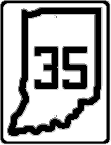
Another sticking point with the local news media, especially the Indianapolis News, was the lack of security when it came to all the old buildings that were being removed in the construction area. This was especially apparent when it came to the fact that there were three schools in or near the construction zone: School 31 on Lincoln Street east of Madison; School 35 at Madison and Raymond; and Manual High School at Pleasant Run and Madison. There were a bunch of buildings that looked like tornado damage, and more than fair share of basements that were just open to the public without any protection whatsoever.

The article to the left, which was published on 22 March 1956, shows the opinion of the Indianapolis News, and the parents of students in the area. Especially at School 35.

Indianapolis News, 25 September 1956, showing the construction area on Madison Avenue, and expressing the Indianapolis News’ concern about the safety of children in the area. An exact location of this photograph has not been determined, but not for lack of trying.

All wasn’t roses on the ISHC end, either. I will cover it in a later post, but irregularities were exposed in 1957 when it came to property acquirement for the Madison Avenue Expressway project. These irregularities were exposed in April 1957, and found itself in court the following October. It involved someone making a ton of money from real estate purchases and sales in 1954 and 1955. Part of the problem was that these types of shenanigans caused the delay of construction, and hence, an extension of the traffic nightmare on the south side of the city. It was, in June 1957, projected that construction would be completed by September 1958.

That construction projection would be close to true, as the 1959 Indiana Official Highway Map cover shows. The new Madison Avenue Expressway was shown in its brand new, completed, status. But even with the completion of the project, the controversy remained. Stanley T. Siegel, Indianapolis traffic engineer, stated, according to the Indianapolis Star, that the project is a “beautiful road that starts nowhere and leads to noplace.” Mr. Seigel took a lot of criticism for that opinion. The problem is, on the surface, he is absolutely right. What he didn’t take into his consideration is the removal of a narrow, overcrowded street (now Old Madison Avenue), and the constrictions placed on it by two busy railroad crossings (which, at the time, they were very busy), and made a better connection with a very busy United States highway running through south central Marion County.

The Expressway would be completely opened to traffic officially on 23 September 1958. It would still be technically closed for another week for curbing and other details, and the interchange at Morris/Prospect Streets would not be ready for several more weeks after that (for railroad elevation just west of the interchange). The project would cost almost $8 million, more than twice the original estimate. It was also announced that the State Highway Department had plans to extend the expressway another 10 miles. This extension would be along State Road 431, also known as Madison Avenue, in the non-bypassed sections of the old road.

Indianapolis’ Roosevelt Avenue

I want to start this post with the asking for thoughts for the crew of USS THEODORE ROOSEVELT (CVN-71). On its current Western Pacific deployment, it finds itself in port in Guam due to the discovery of crew members with Covid-19. I served three years about that noble vessel. The idea of being stuck on the ship due to an outbreak of disease was always present, but never thought about. I am not saying that they are going through anything any different than other people are at this time of troubles. But keep in mind that there are over 5,500 people on that ship. And, no matter what you think, an aircraft carrier really becomes just a big boat after spending sometime on it.

In 1902, an ordinance introduced by Councilman Negley asked “that the name of all the streets leading from the Massachusetts avenue depot northeast to Brightwood, along the line of Massachusetts avenue, be changed to Roosevelt avenue.” (Indianapolis Journal, 18 February 1902) The Big Four Massachusetts Avenue depot was near what is now 10th and Interstates 65 & 70. It would connect to the Big Four depot in Brightwood. What became Roosevelt Avenue wasn’t one street from end to end. It was a collection of streets and avenues that were combined to make the ultimate product.

1899 Atlas of Indianapolis and Marion County, with the route of what would become Roosevelt Avenue from 11th and Lewis to Rural Street highlighted.

The Polk 1904 Indianapolis City Directory street guide describes it as follows: (keep in mind this is a direct transcription, including capitalization) “ROOSEVELT AV – (Formerly Malott av, Hill av, parts of Hillside av, Valley av, Beech, Lawrence, Bloyd av and Glen Drive) From cor Eleventh and Lewis n e.” It was described in the above mentioned Journal article as: “The change will take in a section of Lewis street, all of Malott avenue, section of Columbia avenue, all of Hill avenue, south end of Hillside avenue, section of Valley avenue, all of Beech street, all of Lawrence street, east end of Bloyd avenue and east end of Glen drive.” Councilman Negley didn’t stop there. “The ordinance also provides that Nevada street, from Sheldon street to Hillside avenue, be changed to Eighteenth street; that Holloway street be changed to Ingram street, and that Parker avenue be changed to Winter avenue.”

Starting at 11th and Lewis, or the Monon and Nickel Plate, whichever you prefer, the city renamed Malott Avenue to Columbia (Street) Avenue. There is a break in the new avenue at this point, even though I highlighted part of Columbia Avenue. Continuing northeast, Hill Avenue, from Columbia to (what is mismarked as Hill) Hillside Avenue, then became part of the new boulevard. (For information, the 1885 Polk Indianapolis City Directory lists Hillside Avenue as extending from the corner of Sixth and Hill ave, northeasterly to city limits. That would be the curve turning from Hill to Hillside near Ludlow and/or Clarke.)

Only a few blocks of Hillside Avenue was taken for Roosevelt Avenue. A curve to the right, and now you are on what was once Beech Avenue. While the description in the city directory lists “part of Beech” as part of the avenue, I can’t see where, from the included map, there was any part of Beech that WASN’T made part of the road. Beech connected to Lawrence, which then would take the mantle of Roosevelt. It would carry it to Rural Street.

1899 Atlas of Indianapolis and Marion County, with the route of what would become Roosevelt Avenue from Rural Street to Sherman Drive (then called Brightwood Street) highlighted.

At Rural, Roosevelt Avenue replaced what was Bloyd Avenue. This corner is still shown, although not with Indianapolis’s standard oversized street signs at signaled intersections, as Bloyd to the west, Roosevelt to the east. Roosevelt was rerouted, removing a traffic intersection on both sides of the Bee Line tracks. I can tell you, from what I remember going to school at IPS #37, there was ALWAYS traffic snarls at those two intersections!

Roosevelt’s take over of Bloyd would last until it reached the old Shade Street, now known as Olney Avenue. There, the Glen Drive (now Glenn Drive) portion would start. That would take it to Brightwood Street. That portion of Roosevelt Avenue does still exist, creating a situation just like that at Rural Street at Sherman Drive. The major difference is the sheer difference in altitude of the rail crossings at both Rural and Sherman. Sherman Drive’s is relatively flat. This stems partially from the fact this was also where the Indianapolis Belt Railway’s north leg and east leg come to meet the Bee Line. Rural Street’s intersection with Massachusetts Avenue is quite a bit lower than the railroad track next to it.

Road Trip 1926: SR 63

Today’s road trip involves two sections of a short state road that would later become an alternate to US 41 in western Indiana.

The strangest thing about this road is that when the Indiana State Highway Commission issued the official news about the Great Renumbering, with descriptions of the new state roads, State Road 63 wasn’t included in the news release. Not mentioned anywhere. Although the 1926 Great Renumbering map shows SR 63 as an item, the state didn’t mention it as official news.

Flooded Indiana

Weather in Indiana. Anyone that has been in the state at this time of year knows that we are entering what best can be described as the rainy season. With it comes the almost annual flooding that will inevitably occur. Flooding is something, though, that can happen at any time of the year. January is notorious for it. Though, it is not as though the flooding is a new thing. It has happened in Indiana for as long as there has been a state of Indiana. And possibly long before. Some of the floods make massive changes to the landscape of the state. Some just get a shrug of shoulders and a shake of the head.

One of the most changing floods in the modern history of Indiana has to be that of 1913. One of the most famous (road) victims of that flood had to be the Washington Street bridge in downtown Indianapolis. But the entire state was punished that January 1913. New Albany, at the Falls of The Ohio (a natural low water point in the entire river channel) almost everything south of the Southern Railroad and Pennsylvania Railroad tracks was under water. The Pennsylvania Railroad ordered that its freight house in New Albany be abandoned. Said freight house had been under five feet of water in floods of 1907. In Evansville, the Ohio Street bridge (I would assume over Pigeon Creek) is “paritally submerged by water,” according to the Evansville Press of 15 January 1913. Especially hard hit were towns along the Ohio River. Several of these would be partly wiped out. Some would be moved to higher ground.

The flood that changed Indiana the most was that of 1937. The area had been devastated by floods in 1936…but the winter of 1937 was more damaging. January 1937 saw the massive closing of state roads due to ice and flooding. The list that was published in newspapers on 23 January 1937 included large numbers of roads. Just the US Highways listed included: US 31 north and south of Seymour, south of Memphis, at Speeds and north of New Albany; US 31E north of junction with SR 231 and junction SR 62; US 41 at Hazelton and Patoka; US 50 west of Brownstown, from Lawrenceburg to Aurora, west of Washington; US 52 from Brookville to West Harrison; US 150 west of Palmyra, at Fredricksburg, at Prospect, and east of Shoals. The list of closed highway is roughly 12 column inches long in the Richmond Item of 23 January 1937. The same newspaper mentions that the only road open from Richmond to Cincinnati is US 127 through Eaton, Ohio.

The aftermath of the 1937 floods would change the landscape across the state quite a bit. In addition to plans for 13 new reservoirs (many of which would not be built), levee and bridge construction would be commenced throughout the state. It was noted that many of the city street bridges at Indianapolis were too short to be safe in case of a flood rivaling or beating that of 1913. Improvements would be planned, and budgeted, for the Warfleigh section of Indianapolis, the Fall Creek area of Indianapolis, sections of the Wabash River in Peru and Logansport, and the White River at Anderson and Muncie.

There are additional reports of flooded state roads and such from many years between 1927 and 1950. January 1932 reported that three sections of SR 37 between Bloomington and Bedford have been damaged by rock slides caused by the same rain that had that part of SR 67 between Romona and Gosport, and at Edwardsport, under water. More flooding reports appear in March 1925, March 1927, November 1927, January 1930, March 1933, May 1935, August 1938, February 1942 and April 1948. This is just a quick look at the available newspaper data.

Updated: Indianapolis Union Depot

Indianapolis Union Station has been, for quite a while, a landmark in the city. Located on Jackson Street, originally the alley between Georgia and Louisiana Streets, the building erected in 1888 has seen many lives over the years. It was once the great entryway to the city, with hundreds of daily trains coming and going. From the station, there were direct connections to St. Louis, Chicago, Cleveland, Cincinnati and Pittsburgh, not to mention the countless other places along the lines.

But it wasn’t always that way. When railroads started connecting the Hoosier capital to the rest of the nation, they each had their own stations in different parts of the city. As it was in every other city with multiple railroad lines. I covered that later in the entry “Before Indianapolis Union Depot.”

It wasn’t long before some had to be done to make thing easier for the traveling public. By 1853, a new building was erected and a new concept had been created: the Union Depot.

Wait. What? Union DEPOT? Isn’t it Union STATION?

Yes, it is. But it wasn’t originally.

In August 1849, a company was created to create track connections between the three railroads then in Indianapolis: Madison & Indianapolis; Terre Haute & Richmond; and Indianapolis & Bellefontaine. The company took the name of the Union Track Railway Company. The company then took to not only connecting those railroads, but also creating a central ticketing and boarding location.

But before that could happen, the directors of the company decided to allow other connecting railroads to join the Union Track Railway. The Peru and Indianapolis had already given part of its line to the new venture. The Indiana Central (was originally the Indianapolis to Richmond section of the Terre Haute & Richmond) and the Lawrenceburgh and Upper Mississippi joined the group.

So, with the core group of railroads, the company changed its name to the Indianapolis Union Railway Company (IU). One month later, a brick station was built, being called the Indianapolis Union Depot. It was the first of its kind.

The location of the Depot, and the grand edifice that is Union Station that replaced it in 1888, is called the Wholesale District. One of the reasons that the Depot was built where it was is simply that the south side of the original mile square of Indianapolis was, quite honestly, not preferred real estate. Pogues Run meanders through the area. That section of the original town, and south of it, was known to be very swampy. To the point that malaria was a real concern to the young capital.

The Union Depot quickly became too small for its purpose. It took over 30 years, but the original building was replaced, on site, with the building standing today. It would be another 30 years until the track plan that exists today, being elevated over the grade of the city streets, would be completed.

Because of the ownership of the IU, through the many railroad consolidations, it became basically owned by two companies: New York Central and Pennsylvania Railroad. In 1968, it ended up with one owner: Penn Central, a merger of the NYC and PRR.

There are several “pictures” online of the Union Depot. I won’t be putting any of them in this blog because they just don’t appear right to me. None of them are true pictures, they are drawings. The Depot had five tracks. Some images show them going through the station, some show four going through and one skirting the outside. The Depot is drawn in different scales, and most of them, that I have seen, don’t show any buildings…in downtown Indianapolis. Granted, there weren’t the tall behemoths of today. But since the railroad had come to Indianapolis six years before the Depot was built, and Indianapolis was, by then, legally a city, there should have been SOMETHING in the background.

Indiana State Road Numbers

As someone that spends a LOT of time looking at maps, I notice that most states have no rhyme nor reason to the numbering of their state roads. Most states number them in the order they were created, or legislated. Indiana is, now, not one of those.

In the beginning, in 1917, Indiana started creating a State Market Highway system. At that time, there were only five state roads. OSR 1 ran, basically, down the center of Indiana north to south. OSR 2 was the Lincoln Highway. OSR 3 was the National Road (more or less). OSR 4 ran from JCT OSR 5 near Shoals to Lawrenceburg. OSR 5 connected Vincennes to New Albany.

Around 1924, talk was started about creating a “national” road system to take the confusion out of traveling in the age of Auto Trails and the myriad of names and directions. The system was ironed out over the next two years, coming to fruition on 01 October 1926.

And that is the day that Indiana did a wholesale slaughter of the state road numbering system.

Indiana decided to do the same thing with the numbering of state roads that the “national” system did: odd numbers travel north/south being numbered east to west, even numbers travel east/west being numbered north to south. For the most part, anyway.

There were exceptions. There always are exceptions. Yet, through some freak of numbering, the new United States highways, for the most part, just plugged right into the system. For example, US 31, US 36, US 40, and US 50 fit right into the Indiana system perfectly.

But the system was simplified, as well. In addition to the directions of the roads, and where the numbering started, Indiana also added the “mother/daughter” system. Main state roads were given one and two digit numbers, with three digit numbers being daughter routes to those. There were/are only two exceptions to the three digit daughter rule, but I will get to that later.

One of the purposes of the “daughter” system was to create a way to insert state roads into the system without totally destroying the order of the system.

The one major exception to the whole system was SR 67. There were discussions about US 67 connecting to Cleveland, OH, across Indiana. The plan was to number it SR 67, and change it if and when the time came. It never did. US 67 ended up traveling, more or less, due north through west central Illinois.

The Indiana numbering system works well. If you know the history. If you look at a map today, there are several things that stand out like a sore thumb. And those are really due to the United States highways that came to Indiana after 1926.

Let’s get back to the two three digit exceptions to the daughter rule. First, and most obvious to map readers, is SR 135. Yes, it is a major state road. No, it is not a daughter route to US 35. It used to be SR 35, until US 35 came to Indiana.

The other exception was SR 100. Ask anyone who knows, and SR 100 was to be a loop around Indianapolis. Unfortunately, the history of the road isn’t that simple. While SR 100 legally lasted (at least from I-465 to US 40) until 1 July 1999, it was replaced long before that by the same I-465. As a matter of fact, most of the contracts for the building of I-465 were actually issued as SR 100 contracts.

Now, to daughter routes. Marion County has a daughter route that connects to the Women’s Prison (used to be the Indiana Girl’s School) on, guess what, Girls School Road. It is SR 134. Yet, there is no SR 34 in Indiana. There was. There isn’t now. SR 34 became US 136 in 1951. There also used to be a LOT more daughters of SR 34: SR 234 (through Carmel – not the two that still exist), SR 334 (Zionsville – decommissioned just a few years ago), SR 434 and SR 534 (the original designation of the major part of SR 100 – the part that most locals know).

In southeastern Indiana, there are two daughters of SR 29: SR 129 and SR 229. These exist because before 1951, US 421 was SR 29 from Madison to just south of Boyleston.

I am sure that there are more examples of such numbering inconsistencies. SR 21 mostly became US 35. US 231 used to be part of SR 43 and part of SR 45, among others. Even in northwestern Indiana, there are a lot of x27s that are orphaned because US 27 was replaced by I-69 north of Fort Wayne.

But two roads that I am asked about quite often are SR 38 and SR 47. Strangely, SR 47 ends at SR 38 at Sheridan.

Although SR 47 spends most of the way traveling east and west, it is labeled north and south. As you travel east toward Sheridan, you are on North 47. I have never been able to find a reason for this. Nothing. INDOT has decommissioned part of this route from JCT SR 38 to JCT US 31.

SR 38 is a different story. It DID follow the pattern when it was created. The original SR 38 connected New Castle to Richmond. (Although US 36 didn’t exist east of Indianapolis, this location of SR 38 is between 36 and 40.) The State Highway Commission would eventually add to SR 38, displacing most of the route when it comes to numbering. It would follow the old “Crawfordsville State Road” from New Castle to Noblesville (with the rest of this Crawfordsville Road becoming part of SR 32), and, roughly, the Lafayette Road (Lafayette-Noblesville State Road) for the rest of its journey across Indiana.

So, although there are exceptions, there is some method to the madness of Indiana state road numbering. And, with a little thought and knowledge, it does make Indiana a little easier to navigate.

The Town Name is the Name of the Road, but How Do We Get There?

Indiana is nowhere near unique in the naming of roads. Throughout the state, there are roads that are named using three major principles: location, person or destination.

Most county roads, at least south of Marshall County, and not including Marion County, have coordinate naming: CR 500 S, meaning 5 miles south of an arbitrary center line. In Marshall County, the roads running east-west are named for their distance from the northern county line. St. Joseph County, they are more or less alphabetical by mile from the Michigan State line. These are just a few examples.

But, what I wanted to discuss is roads named after destinations. And why you can’t really follow that road name to its destination easily.

For instance: Shelbyville Road in Marion, Johnson and Shelby Counties. It’s easy to start…heck, Indianapolis didn’t change the original road’s name that much from where it started at Fountain Square to almost the township line at Troy. (Yes, it’s called Shelby St. because it was the old Shelbyville Pike.)

And, yes, Carson Avenue is a little puzzling. But we can deal with that. Leaving Marion County, it is called Shelbyville Road. And from there, poof. No idea where it goes. I would assume that it meets the Michigan Road at the intersection of SR 9 and Boggsville Road. But that is only a logical estimation. I really can’t find anything about it.

My wife went to Franklin College. Right off the campus, there is a road called Greensburg Road. Guess what? It used to be the Franklin-Greensburg State Road. But just as the road enters Shelby County, the name just disappears. Another logical assumption is that the old route would have included Vandalia Road, which is a straight line (more or less) from SR 9 west of Geneva to Greensburg. But how it gets from the Shelby County line at just south of CR 500S to the south center of Shelby County at SR 9 near CR 900S is beyond me.

There are a lot more examples of such things: Lafayette Road west from Noblesville, Mooresville Road south from Indianapolis, and Franklin Road connecting Franklin and Noblesville are just three. I am sure that wherever you are, if you are in Indiana, there is an example of such a destination road near you…that might wind its way to that destination.

I know that part of the reason for this is that early in Indiana history, very few roads were actually built to go directly to the destination. Most roads in this state follow survey lines. While some roads were started in the general direction of the destination, the builders would inevitably find a reason to use existing paths. Sometimes it was the easiest. Sometimes, it was land owners that wanted nothing to do with a road crossing their land.

All I know is that I would love to find out two things: 1) what were the paths of those old roads and 2) how on Earth did they mark them for travel.

SR 79

Two digit state road numbers in Indiana are generally used for major roads. In the history of the state highway system, this guideline has left the highest two digit state road number to be 75. (Yes, I have made the case, and will continue to make it, that there were two three digit “two digit” roads in Indiana – SR 135 and SR 100.) With the building of Camp Atterbury, the largest major state road number would be SR 79 for a while.

Camp Atterbury is located in southern Johnson County and northern Bartholomew County. Its construction would have a great effect on the state highway system was it was in the early 1940’s. Among other things, the routing of SR 252 from Morgantown to US 31 had been changed. And US 31 had been completely moved and rebuilt by the Indiana State Highway Commission through the same period. Especially near Edinburgh, the closest town to the new Army facility.

When US 31 was being rerouted to the west of Edinburgh, the old route through the town, which included SR 252 and Eisenhower Drive, would be given a new state road number – 79. Other bypasses of US 31 in the state created different state road numbers. The bypasses in both northern and southern Marion County, and adjacent areas of Hamilton and Johnson Counties, would be given the number SR 431. Bartholomew County’s replaced US 31 would become US 31A, then SR 11. Today, from South Bend north to the Michigan state line, the old US 31 is SR 933, and in southern St. Joseph County, and near Kokomo, it is called SR 931.

SR 79 came into existence with the bypass of Edinburgh. This bypass was completed in the time frame of 1942-1943, and was a direct result of the creation of Camp Atterbury. This designation would last from around 1943 to 1964, when it was completely removed from state records. The bypass around Edinburgh was also built as part of the plan to create a dual-lane highway along the US 1 corridor from Indianapolis south to Jeffersonville. Some that project was never finished to this day. That project would create bypasses, in Johnson County, or Greenwood, Franklin. Amity and Edinburgh.

Road Trip 1926: SR 62

Today’s journey back to 1 October 1926 focuses on a state road that would originally connect the Wabash to the Ohio. In the official press releases, the Indiana State Highway Commission described the new SR 62 as follows: “State Road 62. – What is now State Road 16 from New Albany to Mt. Vernon, with a new addition extending the road west from Mt. Vernon to the Wabash River. This road passes through Corydon, Leavenworth, St. Meinrad, Lincoln City, Gentryville, Booneville and Evansville.”

The section from Mt. Vernon west would be considered an authorized extension, which would finally be added to the state highway system in 1929.

ITH Tidbits, The Sequel

Today, I want to share some paragraphs of articles that I started to write, and ended up forgetting them as information about the subject became harder and harder to come by. Some of this stuff has been waiting in the “draft” bin for almost two months. And every day, I try to look for some more information to no avail.

Short Lived State Roads: My goal was to write an article about state roads that came and went, usually within a decade or so.

Over the past century, there have state roads that have come and gone in Indiana. Most of these roads were short connectors between other state roads. Some of them were created and removed within a decade.

SR 407: “Daughters” of SR 7 tend not to last long. So is the story of SR 407. North of North Vernon, on both SR 3 and SR 7 was a connector road that was created in 1933. On the SR 7 end, it connected at Queensville. Moving its way up Geneva Road out of Queensville, then turned east on County Road 500N. The road ended at SR 3. By 1938, SR 407 was removed from the state highway system.

SR 9W: At one time, SR 9 connected from US 50 to SR 7. The route of SR 9 south of SR 7 traveled through Elizabethtown, then turned south along what is now US 31 southeast of Columbus. West of Elizabethtown, a short connector road went due north to SR 7. This road was called SR 9W. It shows as under construction in 1938, and completed in 1939. By 1941, a US 31 bypass was being built around Columbus…but the route of US 31 had been changed to follow SR 7 to what had already been renamed from SR 9W to US 31. The rest of SR 9 south of Elizabethtown was also changed to US 31 at that time.

Bluff Road Bridge Over the Illinois Central/Indiana Railroad: I had planned to write this article about this overpass. I found information about when it was (repeatedly) closed and finally demolished. But nothing about when it was built.

Reconstruction work on the deteriorating span was scheduled in both 1971 and 1977. The Indianapolis Transportation Board posted a long list of bridge projects for that year in newspapers in mid May 1971 and early April 1977. By 1984, the city was looking at removing the bridge all together. Unfortunately, getting the right of way to do this proved troublesome. The bridge was built with very little clearance when it came to the actual right-of-way used. It was suggested by John Willen, DOT Chief Engineer, that land acquisition was a problem, and that the bridge would not be replaced due to decreased rail traffic at that location.

In September 1986, the city of Indianapolis introduced a resolution to implement a five ton weight limit on the overpass. The notification of the resolution in the newspapers of the time stated “whereas, the Indianapolis Department of Transportation Street Engineering Division was notified that certain portions of this structure had a stage of deterioration.” Prior to this, the bridge had had a ten ton weight limit. In May 1987, the bridge was closed completely as the city of Indianapolis decided it would be better off replacing the structure with an at-grade crossing. The city reported that the work would be completed by 15 July 1987.

National Road: Admittedly, this one died because I found this article, and wrote this paragraph…then nothing. I stopped there not knowing where I wanted to go with it.

The last contract for the complete widening of US 40 across Indiana was issued in August 1944. The Calumet Paving Company of Indianapolis submitted the low bid for the 10.75 miles of 22-foot concrete pavement between Dunreith and Dublin. The bid was $768,034. “Building of the new strip will complete multiple-laning of U.S. 40 between Richmond and Terre Haute.” (Source: Indianapolis Star, 24 August 1944)

I still have all three of these articles in draft status. And I continue to look for more information. So it may be that these articles will come back to life some day.

Bicycling Marion County, 1900, Part 2

Today is part two of two of covering a map I found on the Indiana State Library website about bicycling in Marion County, and the routes that were available.

Bluff Road: The direct route to Martinsville, Bloomington and points south. It was named after the Bluffs of the White River at Waverly. It was one of the first trails to connect to the Hoosier Capitol, as a lot of settlers would start their journey into Marion County from Waverly.

Clifford Avenue Pike: The extension of 10th Street past the city limits. The bicycle route ended at what is now Arlington Avenue, which connected Clifford Avenue to National Road and Brookville Pike.

Flackville Pike: The town of Flackville was created near what is now 30th Street and Lafayette Road. The Pike leading to the town is an extension of Indianapolis’ 30th Street.

Madison Road: The Madison-Indianapolis State Road, which the later Madison & Indianapolis Railroad would closely follow. Today, Madison Road is now Madison Avenue.

Millers Pike: Today known as Millersville Road, since that is where the road ended. A connecting route back to the White River & Fall Creek Pike used what is now 56th Street.

Myers Pike: This road would, in later life, become Cold Spring Road, connecting the Lafayette Road to the Michigan Road on the west (north) side of the White River.

Pendleton Pike: The old (1830’s) state road to the Falls of Fall Creek, where the town of Pendleton was formed. The old road went through Oakland (now Oaklandon), instead of basically around it like it does now.

Rockville Pike: The original Indianapolis-Rockville State Road. Still called Rockville Road for most of its length today. The old road is hard to navigate at its original beginning, since it was removed when Holt Road was built north of Washington Street. Rockville Avenue is the old road.

Shelbyville Road: The original state road to the seat of Shelby County. Its importance dropped off after the building of the Michigan Road. Near the current intersection of Shelbyville Road and Stop 11 Road/Frye Road, a branch took riders to Acton. At Acton, a branch from the Michigan Road came from the north.

Spring Mills Pike: The original path of Spring Mill Road started at the city limits on Illinois Street, crossing the White River near where Kessler Boulevard does today. It then continued up what is now Spring Mill Road into Hamilton County.

Sugar Flats Pike: The continuation of Central Avenue outside the city limits up to the Central Canal towpath, then following what is now Westfield Boulevard through Nora and into Hamilton County. The bike path led, after leaving Marion County, to the downtown area of Carmel.

Three Notch Pike: What is now Meridian Street was, for around a century, known as the Three Notch Road. The bicycle route followed Meridian Street from the Bluff Road intersection down to the county line.

White River and Fall Creek Pike: Labeled on the map as the White River and Eagle Creek Pike, this old road turned bicycle route followed the continuation of Keystone Avenue past the city limits to its end at River Road. Keep in mind, what is now Keystone Avenue north of White River was built by the state as a replacement for SR 431, which used to use Westfield Boulevard.

Indianapolis in the Auto Trail Era

Indiana has been known as the “Crossroads of America” for most of its history. No other place in the state exemplifies that more than the Hoosier Capitol. Although Indianapolis, as a town, started as a remote outpost in the forests and swamps of central Indiana, it would soon become a transportation center. The National and Michigan Roads started the journey toward Indianapolis’ connections to the rest of the country. The coming of the railroads from 1847 to the middle 1850’s accelerated it. The automobile would seal the deal.

A quick look at a Rand McNally Auto Trails map of 1920 shows that Indianapolis was well served when it came to the new routes. Some of these were old roads, using names that had been used for almost a century. Others were new names on old country roads. Today, I want to look at the Auto Trails of 1920 radiating from Indianapolis. For this, I will be using that mentioned Rand McNally map, and using Rand’s numbering system.

8 – Range Line Road: Leaving Indianapolis due north, earlier on Illinois Street, later on Meridian, this route connected Indianapolis to South Bend via Kokomo, Peru, Rochester and Peru. In Marion County, the Range Line followed the Central Canal into Broad Ripple, then northeast along the Westfield Pike, which once it crossed the Hamilton-Marion County Line followed a survey range line north to Kokomo and beyond. In 1926, this would be the route of US 31.

22 – National Old Trails Road: In Indiana, this old route followed what was the first United States road that had been built to connect Cumberland, Maryland, to Vandalia, Illinois. This was called the National Road. In Indianapolis, it followed that route as closely as it could. (Downtown, the original path of the National Road had been removed in 1904 with the demolition of the covered bridge over the White River.) In 1926, it became US 40.

24 – Hoosier Highway: This road crossed the city southwest to northeast. It would come into Marion County along the old Mooresville State Road, also known as the West Newton Pike/Maywood Road/Kentucky Avenue. It left the city along Massachusetts Avenue where it became the Pendleton Pike at the city limits. The Pendleton Pike was also called the Oakland (Oaklandon) Toll Road for a time. This routing, both ways, would become SR 67 in 1926.

25 – Dixie Highway: Indianapolis found itself in a very nice position when it came to this road. It was created by an Indianapolis resident, Carl G. Fisher. And it used four roads to enter and exit the Hoosier capitol. From the north, it entered Indianapolis along the path of the historic Michigan Road. From the west, the Dixie followed the old Crawfordsville Pike. Southward, the Dixie Highway left using the Bluff Road heading toward Waverly, Martinsville and Bloomington. The route also followed the National Road to the east toward Richmond and Dayton, Ohio. The former three routes are still known by those names today. With the Great Renumbering, Michigan Road became SR 29, Crawfordsville became SR 34, and Bluff Road became SR 37.

26 – Michigan Road: The historic old Indiana state road connecting the Ohio River to Lake Michigan. Through Indianapolis, that would be Southeastern Avenue and Dr. Martin Luther King Jr. Street/Michigan Road. The Michigan Road Auto Trail to the north ended at South Bend, even though the historic road left the west toward Michigan City. The entirety of the Michigan Road was made SR 29 in 1926.

42 – Hills And Lakes: This route was created to make a more or less direct route from Indianapolis to Lake Wawasee. It left Indianapolis along the Range Line Road, until it reached the Maple Road (now 38th Street), where the H&L turned east to follow the old Fort Wayne State Road, also known as the Allisonville Pike, out of the county. It did not get a state road number until 1932, when it became SR 13. It would later be renumbered SR 37.

47 – Pikes Peak Ocean-to-Ocean Highway: The original route of this road came through Indianapolis, using Rockville Road on the west and Washington Street/National Road to the east. It would later be moved to north of the city through Lebanon, Noblesville and Anderson. The original PPOO was made US 36 and US 40 in 1926.

69 – Jackson Highway: The Indianapolis section of this north-south long distance road used the old Lafayette State Road from the north (US 52 in 1926) and the old Madison State Road (US 31 in 1926) to cross the city.

92 – Terre Haute & Indianapolis Scenic Route: In Marion County, this duplicated the National Old Trails Road from downtown to the west, diverging in Belleville in Hendricks County.

Indiana License Plates, Revisited

On 1 June 2019, I posted about Indiana license plates and their history. It went over the different designs used, the evolution of them, and so on. Today, for the benefit of those that see antique license plates about and wonder where they might come from, I want to delve into the plate numbers that were issued.

Until the 1950 issue of Indiana license plates, all registrations had been issued sequentially. The numbers on the plates were just that, numbers. The United States standard size license plate had not been decided upon, as yet, but the width and height of Indiana’s had been basically the same for a decade starting in 1945 – with the exceptions of the “metal saving” years of 1952, 1953 and 1955. In 1956, Indiana’s plates became the same 12 inch by 6 inch they are today.

With the 1950 issue, the state started making the plates with county designations on them. Each of the 92 counties in the state had a specific two letter code as part of the registration number. I will list these later. 1963 saw the beginning of the system that most Hoosiers are familiar with…the two digit county code. For the most part, we still use this one today, although the numbers above 92 are no longer used.

The following is a list of Indiana counties and their licence plate codes used over the past 70 years. The current county code, used since 1963 is listed before the county name. The 1950 county code is listed after. If there were more two digits codes used, they will be listed after the 1950 code. Also, the maximum number of plates that could be issued for each county will be after the 1950 county code, the first number being using the 1950 scheme, the second using the 1963.

01 – Adams: JA-JC (29,997 / 239,976)
02 – Allen: DD-DH (49,995 / 239,976)
03 – Bartholomew: ZA-ZB (19,998 / 239,976)
04 – Benton: ND-NF (29,997 / 239,976)
05 – Blackford: ZD-ZE (19,998 / 239,976)
06 – Boone: HA (9,999 / 239,976)
07 – Brown: YE (9,999 / 239,976)
08 – Carroll: QC (9,999 / 239,976)
09 – Cass: SS-ST (19,998 / 239,976)
10 – Clark: WA (9,999 / 239,976)
11 – Clay: FA-FB (19,998 / 239,976)
12 – Clinton: XA (9,999 / 239,976)
13 – Crawford: ZG (9,999 / 239,976)
14 – Daviess: XG-XH (19,998 / 239,976)
15 – Dearborn: CA-CB (19,998 / 239,976)
16 – Decatur: LC (9,999 / 239,976)
17 – Dekalb: UA-UC (29,997 / 239,976)
18 – Delaware: JJ-JK (19,998 / 239,976)
19 – Dubois: PF (9,999 / 239,976)
20 – Elkhart: GG-GK (49,995 / 239,976)
21 – Fayette: ZC (9,999 / 239,976)
22 – Floyd: WW-WX (19,998 / 239,976)
23 – Fountain: XJ-XL (29,997 / 239,976)
24 – Franklin: TD (9,999 / 239,976)
25 – Fulton: TC (9,999 / 239,976)
26 – Gibson: NA (9,999 / 239,976)
27 – Grant: NN-NR (49,995 / 239,976)
28 – Greene: MA-MC (29,997 / 239,976)
29 – Hamilton: SA-SB (19,998 / 239,976)
30 – Hancock: UD (9,999 / 239,976)
31 – Harrison: XD (9,999 / 239,976)
32 – Hendricks: EA-EC (29,997 / 239,976)
33 – Henry: QQ-QS (29,997 / 239,976)
34 – Howard: PP-PW (79,992 / 239,976)
35 – Huntington: UT-UU (19,998 / 239,976)
36 – Jackson: SJ-SL (29,997 / 239,976)
37 – Jasper: GF (9,999 / 239,976)
38 – Jay: LA-LB (19,998 / 239,976)
39 – Jefferson: EJ (9,999 / 239,976)
40 – Jennings: LD (9,999 / 239,976)
41 – Johnson: KA-KC (29,997 / 239,976)
42 – Knox: TT-TU (19,998 / 239,976)
43 – Kosciusko: RR (9,999 / 239,976)
44 – Lagrange: YD (9,999 / 239,976)
45 – Lake: CC-CQ (149,985 / 719,928) – Extra codes 94, 96
46 – Laporte: LL-LN (29,997 / 239,976)
47 – Lawrence: QA-QB (19,998 / 239,976)
48 – Madison: FF-FK (59,994 / 239,976)
49 – Marion: AA-AU (209,979 / 1,199,880) Extra codes 93, 97, 98, 99
50 – Marshall: YA-YB (19,998 / 239,976)
51 – Martin: FM (9,999 / 239,976)
52 – Miami: ZY-ZZ (19,998 / 239,976)
53 – Monroe: VV-VW (19,998 / 239,976)
54 – Montgomery: TA (9,999 / 239,976)
55 – Morgan: WF-WG (19,998 / 239,976)
56 – Newton: ME-MF (19,998 / 239,976)
57 – Noble: PA-PC (29,997 / 239,976)
58 – Ohio: XE (9,999 / 239,976)
59 – Orange: SE (9,999 / 239,976)
60 – Owen: KN (9,999 / 239,976)
61 – Parke: UE (9,999 / 239,976)
62 – Perry: PY (9,999 / 239,976)
63 – Pike: QD (9,999 / 239,976)
64 – Porter: XX (9,999 / 239,976)
65 – Posey: HD (9,999 / 239,976)
66 – Pulaski: RD (9,999 / 239,976)
67 – Putnam: NC (9,999 / 239,976)
68 – Randolph: YX-YZ (19,998 / 239,976)
69 – Ripley: SC-SD (19,998 / 239,976)
70 – Rush: VE-VF (19,998 / 239,976)
71 – St. Joseph: BB-BH (69,993 / 239,976)
72 – Scott: JD (9,999 / 239,976)
73 – Shelby: RA-RB (19,998 / 239,976)
74 – Spencer: SP (9,999 / 239,976)
75 – Starke: VJ-VK (19,998 / 239,976)
76 – Steuben: SU (9,999 / 239,976)
77 – Sullivan: YF-YH (29,997 / 239,976)
78 – Switzerland: GD (9,999 / 239,976)
79 – Tippecanoe: MM-MN, MP (29,997 / 239,976)
80 – Tipton: SC (9,999 / 239,976)
81 – Union: ED (9,999 / 239,976)
82 – Vanderburgh: EE-EH (39,996 / 239,976)
83 – Vermillion: FC-FD (19,998 / 239,976)
84 – Vigo: HH-HK (39,996 / 239,976)
85 – Wabash: VA-VB (19,998 / 239,976)
86 – Warren: HE (9,999 / 239,976)
87 – Warrick: JF (9,999 / 239,976)
88 – Washington: WD (9,999 / 239,976)
89 – Wayne: KK-KM (29,997 / 239,976)
90 – Wells: GB-GC (19,998 / 239,976)
91 – White: MG (9,999 / 239,976)
92 – Whitley: DA-DB (19,998 / 239,976)

And Code 95 was used for “Special” plates. Not sure what that was.

Simply looking at the numbers, it is easy to tell which counties were less populated…at least with cars. Obviously, Marion and Lake Counties had outrageous numbers. Howard came third, then St. Joseph, Madison, Allen, Elkhart and Grant. That’s not exactly the order I would have thought.

The renumbering of license plates came, obviously, from the need to create more plate numbers. Pre-1950 numbers would end right around 2,000,000. The new numbering scheme in 1950 lent itself, as planned, to having 2,179,782 different combinations. There were a lot of letter combinations that could have been added to the mix, as well. In 1963, the new scheme allowed for 23,757,624 different combinations.

When the scheme was changed again in 2008, it was not because the state was running out of available registration numbers. Some counties were, however. There is a large market for old license plates…and some counties had way too many made for the sales. I had, at one time, 70 sequential 1981 license plates from Johnson County. When the state went to three year plates, that made it a bit better. Five year plates, even more so.

Indiana has joined other states in the “multiple issue” club. What I mean by this is very simple. Indiana’s Bureau of Motor Vehicles changes the plate background every five years (Except the Bicentennial, those were four years). Indiana state law states that license plates are good for SEVEN years. So depending on issue date, there were three valid passenger base plates legal in the state. In 2018, it was possible to still see legal plain blue, bicentennial and covered bridge plates. All the blue ones should be gone by now. The one thing that is different in the state today from years past is that when an actual new piece of aluminum shows up to be put on the back of your car, it (generally) will have the same number on it that your previous one did…as long as you get the same type of plate. This is the eighth year that I have had the same Navy Veteran registration number on my car…and that’s been over two cars.

Road Trip 1926: SR 61

Today’s “Road Trip 1926” entry is going to be one of the shortest in the series. When I did this series originally in 2018 in the Facebook Indiana Transportation History group, all the maps were at the same scale, with the exception of, I believe, US 50, since that is the one that I started with. Keeping that in mind, the map of this route is ONE image. And even then, it is rather large because the road is so short.

The official description issued by the Indiana State Highway Commission is as follows: “State Road 61 – Petersburg to Booneville, by way of Winslow, Spurgeon and Lynnville.” The map on the left below shows the route of SR 61 as printed on the 1926 Indiana Official Highway Map. It shows authorized additions from Vincennes to Petersburg, and from Winslow to Boonville. The section covered in this road trip is the section from SR 56 north to Petersburg. It is possible that SR 61 did multiplex with SR 56 to Winslow. I have not seen proof of that, nor do I have really any reason to show that since SR 56 has already been done.

Seymour

Indiana has always been proud of the fact that it is the Crossroads of America. Many cities in Indiana contribute to that nickname. And most people think of Indianapolis when the Crossroads moniker is brought up. But I want to focus on a city in south central Indiana that was not only a crossroads town, it was the crossing of the railroad that gave the city its name: Seymour.

The city itself came into being in 1852. That was the year that the Jeffersonville Railroad completed its track from its title city to Columbus through what soon would be Seymour. The Jeffersonville would be created in 1832 as the Ohio & Indianapolis Railway. In 1849, the railroad changed its name to the Jeffersonville Railroad Company.

In 1851, the State of Indiana chartered the Ohio & Mississippi Railroad Company. The goal of the company was to build a route that connected the Ohio River at Cincinnati to the Mississippi River at St. Louis. Its path through Indiana was far from settled when a mill owner in Rockford persuaded the railroad engineer to build the line two miles south of the then commercial center of Jackson County. That location south of Rockford where the O&M would cross would, in turn, be named by the mill owner after that railroad engineer: John Seymour.

The location had already been crossed by two state roads built in the decade or so prior to the creation of Seymour. The New Albany State Road entered the area from the north from Indianapolis. The original New Albany State Road turned east on the other state road, before turning south again bound for the Ohio River. That other state road connected Lawrenceburg (and Cincinnati) to Vincennes.

In the mid-1880’s, the city would have an addition to it crossroads status with the coming of the Evansville & Richmond Railroad. This would make Seymour a rail center, with direct connections (through the three railroads) to Indianapolis, Louisville, Cincinnati, St. Louis, and Chicago. The sixth route out of the city would connect to the Vernon, Greensburg & Rushville at Westport.

With the creation of the Auto Trails, Seymour found itself on three routes. The Jackson Highway, marked by the number 69 on Rand McNally maps of the era, entered Seymour along the old state road connecting the city to Indianapolis. It then followed the Cincinnati-Vincennes Road to the southeast towards Brownstown and Vallonia. That old state road would also be used, from west to east, through Seymour for the route of Rand McNally’s route 90, known as the French Lick Route. Rand McNally route 96 started in Seymour, and left the town going south, twisting and turning its way through Dudleytown and Crothersville to ultimately join the old New Albany State Road.

When the Indiana State Highway Commission was first formed in 1917, Seymour found itself on even footing with Indianapolis when it came to the state Main Market Road system. The state created five main market highways. Market Highway 1 followed the old New Albany State Road from Indianapolis to New Albany. Market Highway 4 would cross Indiana on the old Cincinnati to Vincennes state road from Bedford to Cincinnati.

This status quo would remain in place through the Great Renumbering on 1 October 1926. Although the official name of the Main Market Highway would change to State Road in 1919, Seymour would still be on both SR 1 and SR 4. With the renumbering, the city found itself on two cross-country highways, when SR 1 became US 31 and SR 4 became US 50.

By 1940, a US 31 bypass would be built from Columbus to Seymour, passing both cities to the east. At the south end of the bypass, the new US 31 connected to the original US 31 where it departed from the US 50. Up to this point, US 31 came in to downtown Seymour from the north, turned east along US 50, then turned south again east of Seymour. The old US 31 into Seymour would first become US 31A, then changed to SR 11.

Today, Seymour is still on US 50, but is bypassed by both US 31 and I-65, the interstate built to follow the venerable old US route. SR 11 still follows the old US 31 route into the city. After many name changes, the old Ohio & Mississippi would become part of the Baltimore & Ohio. The Jeffersonville would merge with one of its competitors, and then a bunch of other companies, to become part of the Pennsylvania Railroad. CSX and the Louisville & Indiana, respectively, are the successors to those railroads that helped form the town in the first place. Trains still rumble through on those roads. The Milwaukee Road, the ultimate successor to the Evansville & Richmond would rip out the tracks from Seymour to Westport in 1961, and from Bedford to Seymour in 1978.

Bicycling Marion County, 1900, Part 1

Today, we sort of return to a series that I worked on for quite a while – Bicycling Thursday. But the difference between those articles and this two part mini-series is that I will be covering Marion County in its entirety, not just each path. This won’t have the details as published in the Indianapolis News in the Spring of 1896. It will basically cover the routes shown on a map of 1900 – one that is available online from the Indiana State Library.

1900 Road Map of Marion County showing bicycle routes
available in a larger version at http://cdm16066.contentdm.oclc.org/cdm/singleitem/collection/p15078coll8/id/5247/rec/2

If I have happened to cover a specific route in the previous “Bicycling Thursday” series entries, I will make sure to link it here.

Allisonville Pike: Originally built as part of the Indianapolis-Fort Wayne State Road. The town of Allisonville was located at what is now the corner of 82nd Street and Allisonville Road, which is the current name of the Pike.

Brookville Pike: Covering the original Brookville State Road, it entered Marion County at Julietta, following what is now Brookville Road from Julietta to Sherman Drive. The original Brookville Road didn’t end there, however, as covered in the ITH entry “The Indianapolis end of the Brookville (State) Road.” This bicycle route started about one block west of Sherman Drive.

Crawfordsville Pike: As the name explains, this was the Indianapolis-Crawfordsville Road. The route is today Crawfordsville Road (mostly, there have been a couple of changes in the route), Cunningham Road, 16th Street, Waterway Boulevard, and Indiana Avenue.

Darnell Road (Reveal Road): What can be followed today is known as Dandy Trail. Most of the route, however, now sits under quite a bit of water – as in Eagle Creek Reservoir.

Michigan Road (north) and (south): One of the most important state roads in Indiana history, connecting the Ohio River at Madison to Lake Michigan at Michigan City. Inside the Indianapolis city limits, the two sections became known as Northwestern Avenue and Southeastern Avenue. The name Southeastern was extended all the way into Shelby County. Northwestern Avenue would be changed to Dr. Martin Luther King Jr. Street, but only to the old city limits. At the city limits (38th Street), the old road kept its original name. It was also given the name “Augusta Pike” by the toll road company that owned it for around half a century.

Spring Valley Pike: This road name was applied to what would become Mann Road from the old Mooresville Road, then known as the Mars Hill Pike, south to the county line.

Valley Mills Pike: This road started at the point where the original Mooresville Road changed from being the Mars Hill Pike to the West Newton Pike. Basically, it would follow what is now Thompson Road to Mendenhall Road (an intersection that no longer exists). From there, it would travel south along Mendenhall Road to what is now Camby Road. Here, a branch of the pike would continue south into West Newton, where it would end at the West Newton Pike. The main route followed what is not Camby and Floyd Roads to the county line.

Wall Street Pike: This is the old road name for what would become 21st Street west from the old Crawfordsville Pike, now Cunningham Road.

Webb Road: Crossing Marion County from the Spring Valley Pike to what is now Sherman Drive, this road had many names. Its most familiar name was “Southport Free Gravel Road,” shortened to Southport Road.

West Newton Pike: This road, that connected Mars Hill and Valley Mills to West Newton, and beyond that, Mooresville. It was built, originally, as part of the Indianapolis-Mooresville State Road. Today, the route is still called Mooresville Road.

White River & Big Eagle Creek Pike (Lafayette Road): The long name for this road was given to it when Marion County sold the road to a toll road company in the 1840’s. The original name for it, when it was built by the state, was the Indianapolis-Lafayette State Road. With very little exceptions, what is now Lafayette Road still follows the same route.

Zionsville Road: Starting at what is now 52nd Street just east of Lafayette Road, the old Zionsville State Road follows what is today Moller Road, 62nd Street, and Zionsville Road to it namesake town.

Indianapolis Street Running on Tennessee St. (Capitol Ave.)

In the late 19th Century, downtown Indianapolis, at least the south side of downtown, was absolutely covered in railroad facilities. With a centrally located Union Station, freight houses spread to either side of that, and several maintenance facilities to help out, it was very difficult to move around the area south of the Circle without tripping on a iron rail. Most of these railroads used areas between the laid out streets of the city. One railroad, however, ran their tracks right down Tennessee Street.

1889 map of Indianapolis, showing railroad facilities around Union Station.

In the 1970’s, the subject railroad track was removed from service. Up to that point, it had been on an elevated structure right down the middle of Capitol Avenue. The track that had used that bridge was a spur line to one industry that was located on what is now the south half of the Lucas Oil Stadium property. That track had been in place for 100 years when it was removed. But what was so important that the track was put there in the first place.

The earliest map that I have seen that shows this particular track is from 1870. At the time, the track was laid right down the middle of Tennessee Street to an iron works on the west side of Tennessee Street between Merrill and Catherine Streets. R. A. Douglas obtained the right to build the track in 1857. This was the Indianapolis Rolling Mill Company. Most of their work involved making and recycling rails for the railroads. The company reported 17,000 tons of rails sold in 1877, of those, 2,402 tons were new rails.

1889 map showing the Indianapolis Rolling Mill Company on South Tennessee Street

The Indianapolis Rolling Mill Company had quite a few rails inside their property. These connected to the line that ran in Tennessee Street, connecting to the outside world at Union Station. Here, the rolling mill had access to all railroads that entered the city. Around the same time that the map above was published, the company underwent a name change, to Premier Steel Works. But that company didn’t exist long. By 1893, a receiver was appointed for the works.

The railroad would run through Tennessee Street, later Capitol Avenue, until the elevation of the tracks at Union Station. With that elevation, it was necessary to elevate the Capitol Avenue tracks. At the time, the old Indianapolis Rolling Mill works was being used by the Central Indiana Railroad, as was the track running from Union Station. The city of Indianapolis decided to order the Central Indiana to elevate the Capitol Avenue track to conform with the new elevation of the Union Station tracks. The Central Indiana objected, partly by arguing that the company owned used the track without owning it. The city, not to be outdone, put forth the argument that the right to use the street for switch purposes was not granted to the assigns of the man that got the track built in the first place. Therefore, argued city lawyers, the Central Indiana had no right to protest.

The Central Indiana argued that the 2.5% grade of the track would put undue strain on the facility. A second argument was made that a change in the right of way for the track would be necessary, and that the statute creating the elevation project didn’t give the city the power to change the location of a railroad. The elevation would ultimately be completed, and the Capitol Avenue railroad viaduct would be built.

After 1979, the connection to Union Station, the grade and the tracks would be removed. Traces of some of the trackage on the property of the rolling mill remained until the turn of the 21st century, as shown in the following MapIndy image from 2000. The Rolling Mill is still referenced to this day, as the property to the east of the old company property is still legally referred to as “Rolling Mill Company Subdivision.”

State Road Numbers Changed With New US Routes

A quick look at a highway map of Indiana would lead one to believe that, with some minor moves and building of the interstates, the state road numbers in Indiana would be relatively static. And in most cases, that is accurate. But as I pointed out in one of the earliest posts on this blog (US Highways: They are actually State Roads), Indiana sees no technical difference between a road marked with a United States Highway shield and one marked with a state outline/square state road sign. For bookkeeping purposes, there are no differences.

Due to these bookkeeping methods of the Indiana State Highway Commission, it wouldn’t lend itself well to bringing new US highways to Indiana. Or, so one would think. There were several times when new US highways were extended to Indiana over the years. There were even times when they were also removed in places. Let’s look at some of the road numbers that were moved or outright changed to make room for those new national highways. All of these numbers come from the system after the Great Renumbering of 1 October 1926.

State Road 11 – This road actually ended up not having been part of the Great Renumbering…but it was. SR 11 has a very strange history. According to the original renumbering plan, SR 11 was to connect Columbus to Madison. Now, a discerning reader will ask, rightly so, “isn’t that SR 7?” Why, yes. Yes it is. But SR 7 wasn’t part of the original plan…at least that published by the Indiana State Highway Commission prior to the Great Renumbering. But SR 11 ended up being pasted on a short highway that entered Ohio as Ohio State Road 11. The National Old Trails Road, east from Richmond along the Eaton Pike, was just a continuation of Ohio State Road 11 into Indiana. By 1935, US 35 would be extended into Indiana along SR 11, and the number 11 would be removed from Indiana. For the time being, anyway.

State Road 35 – At the same time that SR 11 was being removed from Indiana, the ISHC found itself in a strange situation. There was already a SR 35 connecting Indianapolis to Mauckport through Nashville, Brownstown, Salem and Corydon. With the coming of US 35, SR 35 would have to be renumbered. This created a situation that Indiana has one three digit “major” highway, since the SR 35 was renumbered SR 135. Any “daughter” roads with a number of 35 are connected to SR 135, not US 35. For instance, the first daughter road of SR 135 was SR 235, which was actually the original US 50 from Vallonia to SR 135. The original US 50 route also used what is now SR 135 from SR 235 to Brownstown.

State Road 33 – In 1938, the American Association of State Highway Officials (AASHO), the keeper of the United States Highway system (they approved new routes, reroutes, and numbers assigned to such), approved the extension of US 33 into Indiana and Michigan. The route used for US 33 would take over SR 527 from Decatur to Ohio, multiplex with US 27 to Fort Wayne, then take over SR 2 from Fort Wayne to South Bend along the original route of the Lincoln Highway. Suddenly, the already existing SR 33 (two parts – 1] connecting Bennettsville to New Albany and 2] SR 62 west of Edwardsville to Mauckport through Elizabeth and Laconia) had to come up with a new designation. ISHC had just the number that would fit into the state highway numbering system: SR 11. Part one mentioned above became SR 111 originally. The Mauckport to Edwardsville section would be given the “major” number of SR 11.

State Road 133 – This road was renumbered at the same time as SR 33. The idea of having a “daughter” road that was nowhere near its “mother” was the prime reason for this. The old SR 133 became SR 111 in 1938. SR 133 (111) connected New Albany along the Ohio River to New Boston.

State Road 136 – 1951 saw another round of US routes extended to Indiana. The first of these would replace SR 34, which connected Indianapolis west to Crawfordsville, Veedersburg and Covington. It was also one of the old routes of the original Dixie Highway. SR 34 would be completely removed from the state system, replaced by US 136, although SR 34’s daughter roads continued to remain for years to come. This would lead to another renumbering. SR 136, at the time, ran northwest from Danville to North Salem, then west through Roachdale, Russellville and Marshall, ending at US 41 north of Rockville. From US 41 east to North Salem, SR 136 basically ran roughly parallel to its “mother” road, US 36. Due to the number 136 being assigned to the new US Highway, the old SR 136 was given the number SR 236. As an aside, US 136 was/is the only US highway that started/starts in Indianapolis. This replaced the former only US highway that started in Indianapolis – US 36 – which was extended into Ohio within a decade of its creation.

State Road 231 – This was a very short, and short lived, state road that connected US 31E north of Jeffersonville across to SR 62 in New Albany. In 1953, an extended US 231 would be added to the state of Indiana, connecting Owensboro, Kentucky, to US 41 south of St. John. This made the renumbering of SR 231 necessary. The number chosen? SR 131. Although the 1956 Indiana Official State Highway map would again list it as SR 231 – but I believe that that was a typo. Because the 1957 map again shows SR 131. SR 131 was removed in 1963, when Indiana finally decided that US 131 wouldn’t end at the Indiana-Michigan State Line. US 131 was Michigan’s extension of Indiana SR 15 for years. It was removed again in 1964, but part of that was that SR 13 would connect to Michigan’s US 131 in the years to come. (And, the fact that the ISHC marked the US highway on the Michigan side of the state line that was an extension of SR 15 as US 103, and the extension of SR 13 is labeled SR 131 in Michigan until it connected to US 131 as US 12.

Two US Highways that would be completely removed from Indiana maps over the years were US 460 and US 641. US 460 basically followed SR 62 from New Albany to Evansville and SR 66 from Evansville to New Harmony. It crossed into Illinois on the New Harmony bridge. US 460 became redundant with the completion of I-64 from Norfolk, Virginia (where US 460 still exists), to St. Louis, Missouri. US 641 was on maps from Evansville across the Ohio River into Kentucky, using the US 41 route and Evansville bridge. From Henderson, Kentucky, north, it was basically a multiplex, and was removed by Indiana. Two US highways were massively truncated over the years. Those are US 27 (truncated at Fort Wayne) and US 33, which now ends at Elkhart.

Vernon, Greensburg and Rushville Railroad

Greensburg, Indiana. The city that had already been connected to the rest of Indiana via the Michigan Road would become a busy spot on what would eventually become the Big Four Railway. It started with the main line connecting Indianapolis to Cincinnati. Then came the line that connected Greensburg to Columbus – called the Columbus, Hope & Greensburg. Then there was the last connection.

In July 1879, a charter was issued to build a railroad that connected Vernon, in Jennings County, through Greensburg to Rushville in Rush County. At the south end, the railroad would connect to several routes that converged in North Vernon, namely the Madison & Indianapolis and the Baltimore & Ohio Southwestern, connecting Vincennes and Cincinnati. At the north end, Rushville, connections were also plentiful – again with the B&O and the Pennsylvania, in the form of the Cincinnati, Indianapolis & Western (B&O) and the two separate sections connecting Rushville to both Shelbyville and Cambridge City (later Dublin) (PRR).

In October 1879, Colonel Horace Scott, with a group of investors, met with the Directors of the Vernon, Greensburg & Rushville to ask that the directors allow Colonel Scott to have part of the two percent tax to help build the Columbus, Hope & Greensburg. No decision was made at the time. However, it was passed on by Colonel Scott that his goal was to defeat another railroad, and that connections between the CH&G and the VH&R would have nothing but benefits for both companies. (Source: Columbus Republic, 25 October 1879)

The railroad itself was completed between Vernon and Rushville in July 1881. However, it found itself immediately leased to the Cincinnati, Indianapolis, St. Louis and Chicago Railway Company, one of the founding members of the Big Four (Cleveland, Cincinnati, Chicago and St. Louis Railway). The sole operation of the VG&R would be the care of the CIStL&C starting on 1 July 1881. Keep in mind, this was only a lease at the time.

In 1893, M. E. Ingalls, President of the Big Four Railway, went before the State Tax Commissioners to plead the case when it came to property taxes. The VG&R, according to Ingalls, cost $7,000 a mile to build, never earned any money, and could not be sold for over $100,000. The connection line, which connected Rushville to points north (Cincinnati, Wabash & Michigan) as far as Benton Harbor, Michigan, cost $15,000 a mile to build and had never earned a total of $100,000. It was also mention that it was possible that the Columbus, Hope & Greensburg would be dumped by the Big Four, and that another railroad, the Fairland, Franklin & Martinsville Railroad, should be abandoned by the company, since it “has never seen the day when it earned fifty-cents profit.” (Source: Rushville Republican, 22 August 1893) The assessed value of the VG&R, just in Rush County, was $83,285 as of February 1891.

On 29 Jul 1901, the Indianapolis Journal published the railroad property tax assessment reports for the year so far. The Vernon, Greensburg & Rushville was reported to have 44.67 miles of main line track and 8.97 miles of side track, with no second main. For the main track that summer, the VG&R was assessed $6,000 per mile of track by the State Tax Board. The side track was assessed $2,000 per mile. The railroad that year had spent $3,460 on improvements. The company was also assessed $500 a mile for using 52.14 miles of the Baltimore & Ohio Southwestern.

By 1941, passenger traffic was getting pretty slim. The New York Central had applied for the right to abandon trains 139 and 140, passenger runs between Anderson and Greensburg. They were scheduled to be taken out of service on 23 August 1941. That was extended until 30 August 1941. According to the Rushville Republican of 3 September 1941, the abandonment was pushed back indefinately. What made this abandonment even weirder was the fact that the trains to be removed only connected Anderson to Greensburg. The trains that made the run from Elkhart, through Anderson, to Greensburg weren’t on the abandonment list. The newspaper stated that “since the trains were not dropped as scheduled, there is speculation that the railroad may continue the local service.” Service that, at that point, had been running for over 60 years between Greensburg and Rushville.

The VG&R maintained separate stock ownership for many years after the lease started. There are references to stockholder meetings in the Rushville Republican into 1937. Those stockholder meetings were usually held at the Big Four train station in Greensburg. In January 1938, the Big Four asked permission of the Interstate Commerce Commission to consolidate its operations by merging eight railroads into the Big Four proper. Two of those connected at Greensburg: Columbus, Hope & Greensburg and the Vernon, Greensburg and Rushville. This would spell the end of those companies as separate entities, making them officially part of the New York Central Railroad. It wouldn’t affect the Big Four/New York Central much. For all eight companies, only 3,582 shares of common stock would have to be issued to cover the shares of stock the Big Four didn’t own. Those that owned the non-Big Four shares would have a choice: cash or shares.

With the merger of the Pennsylvania and the New York Central in 1968, the Penn Central found itself with multiple tracks running to the same locations. As mentioned above, the PRR met with the NYC at Rushville and North Vernon. The line from Rushville to Greensburg stopped appearing on Indiana Official Highway Maps in 1976. The section from Horace to North Vernon would be removed from the state maps for 1985. From Horace to Greensburg would disappear, at least according to state maps, in 1991.