Towns of Pike Township, Marion County

As I have covered much of Marion County when it comes to the little towns that have crept up due to the transportation facilities in Pike Township. For all intents and purposes, there really are only three places that could be mentioned here: Augusta; New Augusta; and Traders Point.

1889 map of Augusta, IN

Let’s start with Augusta. This town was created along the Michigan Road in 1832. It had been platted by David G. Boardman. Naming of the town has never been determined with any certainty. But it would lead to the creation of the Augusta Gravel Road Company, a toll road using the old Michigan Road right-of-way.

The original plan of the town included basically two blocks paralleling the Michigan Road centered on what was called Meridian Street (now 77th Street). The backing streets that were parallel to the Michigan Road were called Spring St. (now Spring Lane) and Parallel Street.

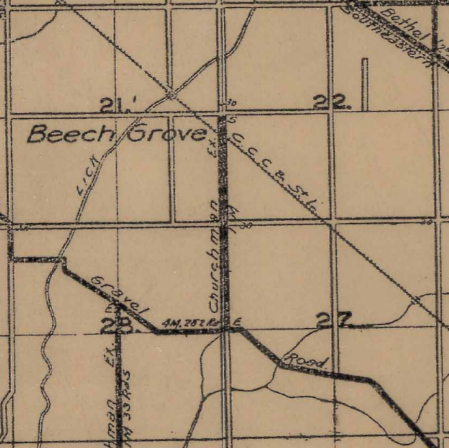
The southern most street of the original plat was Walnut Street. This, today, is called 76th Street. The cemetery shown in the map image to the left is still there. It is located on the curve of 76th Street as it leaves the town itself.

The town of Augusta grew slowly, providing services to local residents and travelers along the Michigan Road. Stagnation occurred when the Indianapolis & Lafayette Railroad was built through the area, located about a mile or so west of the town. This would create the second town I want to cover.

1889 map of New Augusta, IN

The Indianapolis & Lafayette Railroad built, in 1852, what would be called by the railroad “Augusta Station.” It would be the closest location to the town of Augusta above. The station was located just north of the survey line that would later become 71st Street.

The old town of Augusta found itself in a strange situation. Between the railroad and the fact that the Michigan Road became a toll road (The Augusta Gravel Road), within a few years, a town grew up around the station. There were two names for the village came to be used – Augusta Station and Hosbrook. In 1878, the United States Postal Service decided the issue of the town name. The post office was given the name New Augusta.

1889 map of Traders Point, IN.

West of both Augusta and New Augusta is Traders Point. Or, more to the point, more or less was, Traders Point. The original town sprang up around the mill built by John Jennings and Josiah Coughran in 1864. It was located along Eagle Creek where it was crossed by the old Indianapolis-Lafayette Road. The origin of the name is unclear. There are stories about it having been the location of a Native American trading post. It could also have been named simply because it was a convenient place to do business.

With the coming of the Auto Trail era, all three towns would be included. Traders Point and New Augusta would be included on the Hoosier Motor Club’s Dandy Trail, an 88 mile circle around Marion County. It would skirt Augusta to the south, having been run along the 71st Street/Westlane Road corridor through the area. Augusta would once again appear on the Michigan Road, this time the Auto Trail, that mostly covered the same roads as the original Michigan Road built in the 1830’s. Traders Point would also was on the Jackson Highway.

In 1919, with the creation of the Indiana State Highway Commission, the Jackson Highway north from Indianapolis became part of State Road 6. Later, the old Michigan Road, at least from Indianapolis to Logansport, would become part of State Road 15. SR 6, at least through Traders Point, would be changed to US 52, and SR 15 would changed to SR 29, when the Great Renumbering happened on 1 October 1926. New Augusta would find itself left off of the state highway system all together.

Traders Point would cease to exist as it was originally planned with the coming of Eagle Creek Reservoir in the 1960’s. The town was determined to be on the flood plain for the new man made lake. The location isn’t under water now, and visiting there has very little in the way of sights. The name Traders Point has been placed on quite a few things removed from the original town. Even on shopping centers miles away at 86th Street and I-465.

New Augusta would find itself removed from most of the commercial building craze of the 1950’s and 1960’s. Augusta would get those facilities as shopping centers and the like were built along Michigan Road. The railroad tracks that helped create New Augusta are still in place, but no longer connect to any towns north of New Augusta. They now connect to industrial park areas near 79th and 86th Streets, connecting to the Park 100 area.

All three areas of the county would be absorbed into the City of Indianapolis when UniGov went into effect. Neither Augusta nor Traders Point appear on the Indiana State Highway system, with Traders Point being the first to be removed since US 52 was the first state road in Marion County to be detoured around on Interstate 465.

Acton and Wanamaker

In Franklin Township, Marion County, two towns were established to make use of the transportation facilities available. One was founded with the creation of the Michigan Road. One was created to make use of the Indianapolis & Cincinnati Railroad. Both would be so important in their function that they would be connected together by the interurban at the turn of the 20th Century. Those towns are Acton and Wanamaker.

1889 map of New Bethel, Indiana, along the Michigan Road.

Let’s start with the first created of the two: Wanamaker. The Michigan Road had been cut through Marion County in the 1830s. It was in 1834 when a man named John Messinger platted a town along the Michigan Road east of the Noblesville-Franklin State Road. The original plat called for 22 lots fronting the Michigan Road, with a perpendicular street near the middle. The town would be called New Bethel. When mail service was finally extended to the village, it did not have the post office. The post office was located on the Indianapolis & Cincinnati Railroad at the Franklin State Road crossing. That post office was called Gallaudet.

1889 map of Acton, Indiana.

The other town that came into being due to transportation facilities was platted in October 1852 along the Indianapolis & Cincinnati Railroad. The town would originally be called Farmersville. The name would later be changed to Acton, reportedly after a local resident. According to property records, the Marion County government still lists the some of the properties as in Farmersville. Some are listed as Farmersville (Acton).

The original plat of the town was located in two places. The first was on the west side of the county road that connected the town to the Michigan Road about a mile and a half north, along the railroad. The second centered on what was originally Oak Street, now Virgil Street.

North of town, a campground, opened in 1859, operated by the Southeast Indiana Conference of the Methodist Church was created at the junction of the road connecting the town to the Michigan Road (now Acton Road) and the dirt road connecting Acton to Southport (now Southport Road).

The I&C railroad would help bring people to the campground. This would help Acton grow quicker than Wanamaker. The campground would include a pavilion, a hotel, and other facilities. Several fires occurred at the location, but it was rebuilt each time.

In 1889, the town of New Bethel would change its name to Wanamaker, apparently named after the postmaster general under the administration of President Benjamin Harrison. It was not entirely unanimous when it came to the name change. For 50 years afterwards, road signs and residents used both names for the town.

1905 map of Franklin Township, showing the Indianapolis, Shelbyville & Southeastern Traction Company lines connecting Indianapolis to New Bethel (Wanamaker Post Office) and Acton.

In 1902, the Indianapolis, Shelbyville and Southeastern Traction line was built through Franklin Township. It would follow the Michigan Road from Prospect Street, near Sherman Drive, to what is now Hickory Road. From there, it would follow Hickory Road to the original Indianapolis & Cincinnati Railroad. As it would get close to Acton, it would depart the railroad right-of-way along what is now Swails Street (formerly known as Washington Street). Before Swails Street turns due east to become Lemont Street, the old traction line turned even more southeast to connect back to the railroad right-of-way for the traction lines connection to Shelbyville.

Three years after the interurban connected to Acton, the Methodist campgrounds would suffer complete destruction after another fire. The facility would not be rebuilt after this fire.

The Indianapolis, Shelbyville & Southeastern Traction Company would change its name to the Indianapolis & Southeastern Traction Company around the same time as the campground fire. Many mortgages were made for the traction company property. The first, to the IS&S, was made on 1 January 1902. The next would be to the I&S, dated 14 July 1905. Another name change would occur before 26 December 1910. This time, the company would become the Indianapolis & Cincinnati Traction Company. That date, a mortgage on the property to the Central Union Trust Company of New York.

The towns of Wanamaker and Acton started to more or less stagnate when it came to resident growth. They both would slowly grow over the years.

Wanamaker would get the next transportation improvement. In 1919, the Indiana State Highway Commission took over the old Michigan Road in Marion County. It would be given the number State Road 6. This caused the town of Wanamaker (New Bethel, whichever particular people preferred even at that time) to be located on the state highway system…again. The Michigan Road was built as a state road originally, but it was built to connect two places and given to the counties almost immediately after construction.

The interurban that connected to the two towns would run into major problems in 1928. The entire company, with the mortgages listed above, found itself sold at foreclosure due to orders from the Rush Circuit Court in Rushville. This foreclosure was entered on 31 March 1928. It also included the I&C Light and Power Company, which supplied power to the traction line. The foreclosure consisted of four busses, all property not covered by liens of the mortgages, all nine shares of the I&C Light and Power Company, and that section of the railway from Colescott Street in Shelbyville to the end of the line in Greensburg, among other things. The official beginning of the line was located 1.31 miles east of Keystone Avenue in Indianapolis. The line would become the Indianapolis & Southeastern again. But it wouldn’t last long. Abandonment would begin in 1931.

The two towns would continue on. Both would become part of the City of Indianapolis with the passing of UniGov.

Some Sources for Maps

I want to make a quick entry to answer some questions that I have been getting through direct messages about where I find the maps that I use for my research. I want to share a few of my favorites.

One of my newest favorites is a Map of Indiana 1923. This map shows the railroads, interurban lines, Auto Trails, and the state road numbers – before the first renumbering in late 1923. As opposed to the Indiana State Official Highway Map of 1923. The second map shows the new numbers for the state roads. And of course the Indiana State Official Highway Map of 1926, which I have used quite a bit. It is dated 1 October 1926, which was the day of the Great Renumbering.

Of course, the almost entire collection of the state highway maps, at the Indiana State Library is available here.

The IUPUI digital library also has a nice map collection. The major difference between the State Library collection and the IUPUI collection is simple: the State Library will allow you to download the maps that you are looking at. This comes in really handy.

The best map, and photo, source for Marion County is MapIndy. This site will allow you to look at photos, maps, and property records.

I know this is a short entry. I won’t have one for Thursday, due to work commitments.

I want to wish all of you in the Indiana Transportation History community a Happy Thanksgiving. And please…stay happy, stay safe, stay yourself!

Original SR 31 and the Pike’s Peak Ocean-To-Ocean Highway

Just a short post to show how state roads have changed.

I have covered Auto Trails and the original state road numbers several times over the past nearly two years. I had done a post about the rerouting of the Pike’s Peak Ocean-To-Ocean Highway through Indiana. But the original route, as covered by fellow blogger (and ITH Facebook Group co-admin) Jim Grey, traveled across the western part of the state using the US 36 corridor. (The latest is “US 36 and the Pikes Peak Ocean-to-Ocean Highway in Danville, Indiana,” among others) I’d like to say it followed the current US 36, but it’s been moved several times over the years.

As I had mentioned in other posts along the way, many of the roads that were added originally to the state highway system were part of the Auto Trails systems that crossed the United States. When the Pike’s Peak road was taken into the state system, it was given the designation “State Road 31.” Well, sort of.

OSR 31 started in the west at OSR 10, across the Wabash River west of Montezuma. From there, it went through Montezuma, Rockville, and Bainbridge to Danville. From Danville, the PPOO rumbled across Hendricks and Marion Counties along what is now Rockville Road (and Rockville Avenue – because Rockville Road didn’t connect to Washington Street directly until later). The original SR 31, however, connected to the National Road (then Original State Road 3) at a completely different location.

Strangely, the route of the original SR 31 is now not part of the state highway system. Current SR 39 leaves Danville via Cross Street south towards Martinsville. Original State Road 31 turned south from Main Street on Jefferson Street. Jefferson Street turns into Blake Street, then Cartersburg Road. The state road connected to OSR 3 southeast of Cartersburg.

The drive from Danville to Cartersburg is quite a nice one.

With the Great Renumbering in October 1926, original state road 31 became US 36. Again, sort of. The section from Danville to Cartersburg was removed from the highway system at that time. US 36 continued on into Marion County, as shown in the article “Road Trip 1926: US 36.” Just like the original eastern end of OSR 31, the original eastern end of US 36 is now gone, ending at a parking lot.

I also covered a reroute that was put in place along US 36, after the Great Renumbering, at Bainbridge.

West Newton and Camby

In keeping with the last entry in the Indiana Transportation History blog, and a question posted in one of the Facebook groups I post to, I want to cover two towns in Decatur Township which have a shared history: West Newton and Camby. Decatur Township has been, historically, the most “rural” of the townships in Marion County. The number of villages in Decatur Township in small compared to the rest of the county. But, the township is also the smallest in the county.

The story starts with the Mooresville State Road that, ultimately, connected Vincennes to Indianapolis. Christopher Furnas found a spot in the south central part of the township, along the then Mooresville Toll Road, in 1851 where he laid out the village of Newton. The town was laid out at a bend in the road. The new village would be 2.5 miles south of the then village of Northport.

The town name would be changed to West Newton by the Post Office, since there already was a Newton in Indiana. The new town’s major connection to the world was the Mooresville Road.

When the Indianapolis & Vincennes Railroad was built, it missed the village of West Newton. The railroad was built in a relatively straight line, due southwest, across Decatur Township. At least from what would later be Hanna Avenue southwest. But there would be a station built along the railroad that would be called “West Newton Station.” It would be located along the Indianapolis & Vincennes at what is now Camby Road.

1888 map of Decatur Township showing both West Newton, along the Mooresville Road, and West Newton Station, along the Indianapolis & Vincennes Railroad. West Newton Station would soon after this change its name to Camby.

The town of Camby was laid out after Don Carlos and Mary Alice Morgan purchased the land and moved to the area. When Mr. Morgan was asked about a name for his new “town,” he recommended the name Camby, after, apparently, a Brazilian town. The plan was to start a new station at the location, but since West Newton Station was already there, the railroad decided to rename it Camby.

This would make the two related towns separate. With the coming of the state highway system, the winner would be the town of West Newton. But not for long. By 1936, the state started to move what was then SR 67 to along the old interurban line from Indianapolis to Martinsville. It ran right along the edge of the old Indianapolis & Vincennes, at that time the Pennsylvania Railroad.

When the state was completed with the new SR 67, Camby was along the road, and West Newton found itself off the beaten path. These two towns, related from the beginning, found themselves both becoming part of the city of Indianapolis when UniGov was enacted. Today, West Newton is still a rural area, while Camby has become very commercialized.

Valley Mills (and the Naming of Southport)

I have to start to tell the story of a Decatur Township village by telling the story of another village in Perry Township. Many people looking at a map of Marion County would recognize, almost immediately, a different colored area in the south central part of the county. That area is Southport, an excluded city in Marion County. An excluded city (or town) is one in which is not included in the city of Indianapolis after the creation of UniGov. Southport has its own city government, but they also vote for the chief executive of Marion County…which happens to be the Mayor of Indianapolis, as well.

Southport was platted in 1849. Many people from the area know the story about how the city got its name. Being a Southport High School graduate, I have heard it many times. But one fact that seems to fall through the cracks when it comes to Southport is the name. Yes, it does have to do with being south. But not only its southern location in the county. It also had to do with the subject of this article. Southport is actually south of another town, in Decatur Township, called Northport.

Northport was a small village that was platted in 1839. There was very little in the area of the county that would become Northport. The Mooresville State Road, connecting Indianapolis to the Morgan County town, passed very close by to the village. A branch of that road, running along the survey line located five miles south of Indianapolis (now mostly known as Thompson Road) went directly to the little village.

The road that led to Northport would become a toll road, as would the Mooresville State Road. The road would acquire the name of “Northport and Mars Hill Road.” Today, it would be Thompson Road from Kentucky Avenue to High School Road, then Mooresville Road to Mann Road. This was the only access the town would have to the city of Indianapolis, and anywhere else, for many years to come.

In 1859, the town was replatted as the town of Fremont. This name wouldn’t last long, as there was already a Fremont post office in Indiana, located in Steuben County. That Fremont acquired its current name in 1848, and the post office of that name the same year. When the post office was to be named, the chosen title was Valley Mills.

Valley Mills would acquire a second access to the city of Indianapolis when the Indianapolis & Vincennes Railroad was chartered in 1865, and completed between 1867 and 1869. This history of the Indianapolis & Vincennes was covered on 16 August 2019. This railroad connected the tiny village in rural Decatur Township to the rest of the nation.

The road that was called the Northport and Mars Hill became a free gravel road when the county purchased it back from the toll road company. The Indianapolis & Vincennes Railroad, which helped the town grow, didn’t actually find itself as profitable as it was led to believe. But it did help people in the rural part of the county reach county government offices, and shopping, in the city. It would connect Canby, Valley Mills, Mars Hill and Maywood to the capital. Mars Hill, the town, was founded in 1911…but the area where the town was built had been already called that. The high point in the area was called Marr’s Hill, after a settler in the area.

When the Army was looking for a place to put a post in the Indianapolis area, the front runner in that race was an area near Valley Mills. The Indianapolis Journal of 17 January 1903 stated that “the proposition to establish a military post at Indianapolis has resolved itself into the simple question of how to get enough money to buy the Valley Mills site.” The installation was, as announced in the Indianapolis Journal of 7 May 1902, already named: “The decision of President Roosevelt to call the new military post to be established near the city Fort Benjamin Harrison is a thoughtful, graceful and appropriate act. Incidentally it may be remarked that it practically assures the location of the post.” It was decided later that the Valley Mills site would not be used. Instead, a site in Lawrence Township would be used.

1905 Map of the Valley Mills area of Decatur Township, Marion County.

When the interurban system was created, Valley Mills would find itself in the path of the Indianapolis and Martinsville Rapid Transit Company traction line. This was mainly due to the fact that the traction line ran parallel to the Indianapolis and Vincennes/Vandalia Railroad, just to the south of the steam railway. At least in Marion County. The traction line would soon be owned by the Terre Haute, Indianapolis & Eastern, the owner of most traction lines in and out of Indianapolis, the Indianapolis Street Railway, and the Indianapolis Traction Terminal. Stop 7 along that line was at what is now High School Road and Kentucky Avenue. Valley Mills, the village, had a stop as well. And, like Southport on the Greenwood line, it did not have a number. Stop 8 was at a point halfway between High School Road and Mendenhall Road.

Valley Mills still found itself slightly off the beaten path when it came to the road system. When the state highway system was created in 1919, the new state road 22 would use the old Mooresville State Road, which was part of the Vincennes State Road. This put Valley Mills about one half mile from the state highway system.

Around 1936, the Indiana State Highway Commission decided to widen and straighten what was by then called SR 67. The new route of the state road would, as was typical of the time, run alongside the Pennsylvania Railroad, the owners of the original Indianapolis & Vincennes. The location of the new State Road 67 was along the Indianapolis & Martinsville Traction line, which had been closed for several years at that point. The official abandonment of the traction line occurred in February 1932. Valley Mills would find itself attached to the state highway system.

Today, the area called Valley Mills is part of the unified city of Indianapolis, included in the annexation of most of Marion County into the UniGov plan. It is still served by SR 67. But, it has also been basically obliterated by the growth of the Indianapolis International Airport. Due to its nearly central location in Decatur Township, the high school serving the entire township is located near the old village. The area has become very commercialized, and to a certain extent, industrialized. Many businesses serving the airport are located in or near the town that ended up being the reason that Southport has south in its name.

When State Road Construction Required A Railroad Siding

1932 Indiana State Official Highway Map
of SR 3 from Greensburg to Rushville.

1933. The Indiana State Highway Commission started working on upgrading, and moving, State Road 3 between Greensburg and Rushville. As was typical of the time, the route of the state road wasn’t exactly straight, as shown in the 1932 map to the left. Before the state decided to move the road, it left Greensburg along the road that is still, to this day, State Road 3. At Decatur County Road 800 N, or Williamstown, the original route turned east to Rush County Road 100 W. At Milroy, or what is now SR 244, the road once again turned east for a mile, then north on Base Road for the rest of the trip to Rushville.

In another typical ISHC construction decision, the new SR 3 would run very close to the railroad track that is in place. In this case, the New York Central (Big Four until 1930) line that would ultimately connect Anderson to North Vernon through Knightstown, Rushville and Greensburg. And this is where the contractor that is building the new state road decided to use the resources at the location to his advantage.

The story was reported in the Daily Republican of Rushville on 20 June 1933. “Preliminary work on construction of a railroad switch which will handle shipments for the paving of State Road 3 has been started along the Big Four railroad two miles north of Milroy.”

1933 Indiana Official State Highway
Map of SR 3 between Williamstown
and Rushville.

The railroad company was putting in a 40 car siding for the arrival of construction supplies. The company name of the contractor for the road project, the Johnson Construction Company, would be the name of the siding, called “Johnson’s Switch.”

“Located near the point where the new state road will leave the present Rushville-Milroy pike to swerve across new ground to State Road 244 west of Milroy.”

Plans at the time were for 20 cars of material a day to arrive at Johnson’s Siding. The construction company would set up their office at the siding location. The materials that would need mixing would be done near the construction office. The Daily Republican reported that “several pieces of the company’s road machinery were unloaded at this site prior to opening the work on the spur track.”

1937 Indiana Official State Highway Map
showing the new SR 3 south of Rushville.

“Until the side track is ready to receive shipments of material and equipment, there will be likely be little labor done on the state road.

It was also reported that Rush County men were lining up to get jobs working on the road. 1933 was the low point of the Great Depression. Work projects were being started all over the United States. Unemployment in the summer of 1933 was around 25% nationwide.

Local men were gathering at the office of the Rushville Township Trustee, Harry Patton, hoping to get work on the new road. “But it was not known when the contractor will be ready to hire extra employees.”

Johnson’s Switch didn’t last long after the completion of the road project. There was no need for such a siding otherwise. The new State Road 3 would be listed as completed on the 1934 Indiana Official State Highway Map. But there was a small time in history when the railroad helped with the construction of the state highway system. This new route of State Road 3 would last past the end of the railroad that helped build it. The road is still in use today (2020). The section of railroad where Johnson’s Switch was located was removed from state highway maps in 1976, nearly 45 years ago. The railroad opened in 1881, and was closed a little over 90 years later. The replacement of SR 3 from Williamstown to Rushville has been around nearly that long now.

More about the railroad can be seen in the Indiana Transportation History blog entry of 9 March 2020: “Vernon, Greensburg and Rushville Railroad.”

Original State Roads 6-10

1919. The second law creating the Indiana State Highway Commission was passed, and passed Constitutional muster. When the original law was passed in 1917, the fledgling ISHC created five state roads, called Main Market Roads. They were covered in my post “The First Five State Roads, and the Auto Trails They Replaced.” (Indiana Transportation History Blog, 18 October 2019) But legal issues were brought up in regards to the Indiana constitution of 1851. That Constitution was created after the debacle that was the Mammoth Internal Improvements Act. (Indiana Transportation History Blog, 23 August 2019)

The second law had answered a majority of the Constitutional questions when it came to funding roads. Some people saw the ISHC necessary, not for the creating of a state road system, but for a method to get the money the federal government was spending on creating the system. The federal government would only give money to states that had a state transportation agency in place. No money was to be given directly to any government entity smaller than the state.

The Indiana State Highway Commission wasted no time in adding roads to the state highway system. It should be noted here that the ISHC could not just take roads into the system. There were financing concerns, obviously, but also the fact that the roads in question were actually owned by the county. Most had been toll roads previously, which means the counties had to buy them back from the toll road companies in the decades prior to this.

A quick look at a map of the first state roads, when compared to Auto Trails at the time, shows that the ISHC started by using roads that were already supposed to be upgraded for car transportation. (Check out these maps at the Indiana State Library: ISHC Official Highway Map of 1920; and the Standard Series Map of Indiana, 1919.) I will be mentioning those as I cover the second five original state roads. I want to note here that when I use the term “original state road,” it is in reference to the current state roads and their numbering. All of the roads that are listed here, and the ones in the first five article, were renumbered on 1 October 1926, something I have been calling “The Great Renumbering” since I started the ITH Facebook Group on 31 May 2014. Also, the old state roads, those built by the state between 1820 and 1850, had names that showed their destinations, not numbers. Numbered state roads, at least in Indiana, are a 20th Century invention.

Original State Road 6: This road connected Madison to Monticello, via Versailles, Greensburg, Shelbyville, Indianapolis, Lebanon, Frankfort, and Delphi. For those of you keeping track at home, it may sound like the southern end looks miraculously like the Michigan Road, or at least the Auto Trail of the same name. And you would be right. From Madison to Indianapolis, it followed the Michigan Road Auto Trail. The difference between the historic Michigan Road and the Auto Trail is basically the section that runs from Bryantsburg to Napoleon. Versailles is on the Auto Trail, not the historic road.

North out of Indianapolis, OSR 6 followed the old Indianapolis-Lafayette State Road to Lebanon. From there, it used the old state road to Frankfort. This was the route used by the Jackson Highway from Indianapolis to Frankfort. From Frankfort, the ISHC just charged “cross country,” using county roads, to complete the route through Delphi to Monticello.

OSR 6 would become, in 1926, SR 29 from Madison to Indianapolis, US 52 from Indianapolis to Lebanon, and SR 39 from Lebanon to Monticello.

Original State Road 7: From the Illinois-Indiana State line west of Kentland, via Kentland, Monticello, Logansport, Peru, and Wabash, to Huntington. Map geeks will instantly recognize this by its post-1926 designation: US 24. From west of Kentland to Logansport, it was part of the Illinois Corn Belt Route (Indiana Transportation History Blog, 2 December 2019). Between Remington and Wolcott, the route was shared with the Jackson Highway, which led to Lafayette and Frankfort, where it connected to OSR 6. OSR 6 ended at OSR 7 at Monticello. From Logansport to Huntington, the ISHC used the route of the Wabash Way to create OSR 7.

Original State Road 8: From Remington, north through Rensselaer and Crown Point to Gary. The route was also the Jackson Highway from Remington to Demotte, and from due south of Crown Point east of Lowell to Crown Point. When the Great Renumbering occurred, OSR 8 became part of SR 53 from Remington to SR 2, then SR 2 to where SR 55 would come later. From Crown Point to Gary, the route became SR 55 in 1926.

Original State Road 9: From Rockville north to Hillsboro, then west to Veedersburg, then north through Attica and Williamsport to Boswell. The route then travelled through Fowler to end at OSR 7 west of Goodland. This one was interesting at the time of the Great Renumbering. The original route had been moved to the west from Rockville to Veedersburg, instead of Hillsboro. The road that headed toward Hillsboro had become SR 59, but only to Grange Corner. And even then, not for long. A lot of the route became US 41. At least from Veedersburg to Boswell. Otherwise, the original route of SR 9 was mostly forgotten. Some of this had to do with the renumbering of 1923. (Indiana Transportation History Blog, 18 May 2019) The only section of this entire route that had been part of the Auto Trail system was from Attica to the Benton-Lake County line, which was part of the Adeway. (Indiana Transportation History Blog, 26 October 2020).

Original State Road 10: Evansville, through Princeton, Vincennes, Sullivan, Terre Haute, Clinton, to OSR 33 west of Covington. This long route made use of several Auto Trails. Leaving Evansville, OSR 10 follows the route of both the Dixie Bee Line and the Hoosier Highway. (Indiana Transportation History, 23 October 2019). The two routes parted ways at Princeton, with the Hoosier Highway turning east. The Dixie Bee Line was used for OSR 10 to Perrysville Station, along the Chicago & Eastern Illinois Railroad. OSR 10 turned east to Perrysville, while the Dixie Bee Line turned west heading off to Danville, Illinois. The rest of the route of OSR 10 crossed the countryside along county roads until it ended west of Covington.

A quick glance at a map of Indiana, and the reader would think that OSR 10 became the original route of US 41 through the state. And from Evansville to east of Clinton, that would be correct. However, near Clinton, the route crossed the Wabash River. Here, in 1926, it would become SR 63 from Clinton to its end at OSR 33/SR 34.

By 1920, state road numbers would reach into the 40’s. Not many roads were added to the system by the time the first renumbering happened in October 1923. With the Great Renumbering, the state found itself dumping some roads, although it was to be temporary. These original numbered state roads would make a wonderful road trip. I plan on doing a series of that very thing soon.

Subway Street, Beech Grove

When the Big Four Railway started to build their new yards in what would become the city of Beech Grove, they realized very quickly that train traffic was going to be, at best, horrifying for those that were trying to get to the town from the north and east. The main road from the north was the line separating Center from Warren, and Perry from Franklin townships. This would be called First Avenue in the new town of Beech Grove, and Emerson Avenue in the rest of Marion County.

1905 Map of the Beech Grove area, before construction of the town. Center of the map is where the four townships (Center, Franklin, Perry and Warren) meet, now the intersection of Emerson and Albany Street (Troy Avenue).

This road, before Beech Grove was built, stretched from a point in Washington Township, near Millersville, to the Johnson-Marion County line east of Greenwood. Part of this was considered to be part of the Churchman Free Gravel Road extension when the Big Four started buying the property. What became Albany Street (Troy Avenue in the rest of Marion County) extended from the Bottoms Road (now Harding Street) to what is now Kitley Road near the Hancock-Marion County line.

With the construction of the new railroad shops, and the new town, at Beech Grove, the railroad knew that it wouldn’t be long before it came up that two major roads in the county were being clogged by rail traffic. The elevation movement had already been in full swing in Marion County, although there were no such facilities completed to that point. Arguments were still being had about who was supposed to pay for all the bridges necessary to accomplish the plan. It was here that the planners decided to make sure that both carriage (and later car) traffic was unimpeded by the mass amounts of train traffic.

Emerson Avenue would be cut off just north of the Big Four railroad tracks north of the new town. This would put the cutoff just shy of 1/2 mile north of Albany, or 1/2 mile south of what would become Raymond Street. A new street would be built just north of the northern right-of-way of the railroad tracks, where it would connect 1/2mile east of Emerson, becoming the continuation of Troy Avenue. About 2/10’s of a mile east of Emerson, a new road would be built at a 90 degree angle to the railroad tracks, going under said railroad tracks, connecting to the new Second Avenue and the street running along the southern railroad right-of-way (to become Bethel Avenue) in Beech Grove.

1956 MapIndy aerial photograph of the Subway Street/Connection Street/Emerson Avenue/Bethel Avenue area near Beech Grove. west of the spur tracks leading into the Beech Grove Shops is a stub end of Emerson Avenue starting at Subway Street. It would connect to essentially a long driveway and a house west of Emerson and south of the railroad tracks.

The first street mentioned would be given the name “Connection Street.” The road that would go under the railroad tracks would be called “Subway Street.” The name subway actually has a historical context in Marion County. When traffic at Indianapolis Union Station got beyond horrible, the city of Indianapolis decided to build an underpass along Illinois Street, under the railroad tracks at the station. This was, for years, called the Illinois Street Subway, although it was more a bridge, even a tunnel, than a subway.

This wasn’t to say that Emerson Avenue disappeared completely between the two sides of the railroad tracks. A small section of Emerson Avenue existed from Subway Street north to a road, and house, 1/4 mile north of Albany Street. It existed this way for years. Until the early 1970’s, as a matter of fact.

Indianapolis Star, 15 April 1971. The photograph shows a four lane bridge in the middle of nowhere, over the tracks of what was, at the time, the Penn Central Railroad at Beech Grove. That bridge would be connected to the surrounding area, and would carry Emerson Avenue into Beech Grove from the north.

The new Emerson Avenue bridge over the Penn Central tracks, as they were called then, was completed in Spring 1971, although the connections to the new bridge weren’t complete. The road that connected to the house in the 1956 photo above would become the new Subway Street, which was turned to intersect and cross Emerson Avenue north of the old connection point.

1956 MapIndy aerial photograph with a 2020 overlay of then current conditions. This shows the driveway and the house, that would be removed when Subway Street was relocated with the building of the Emerson Avenue bridge north of Beech Grove.

The new ending of Subway Street would be at Fifth Avenue, instead of Second. Sections of the old Subway Street, from the new turn to Second Avenue, still exist to this day, almost 50 years later. And looking at the Google Map, or even MapIndy, will show that the property lines of the old Subway Street are still valid.

The railroad that created the town of Beech Grove is long gone. The Big Four became part of the New York Central, officially in 1930. The New York Central gave way, in 1968, to the Penn Central, which found the NYC merging with its long time rival the Pennsylvania. Soon after the creation of the National Passenger Rail Corporation, called Amtrak, there was a move to have Amtrak purchase the Beech Grove shops from Penn Central. This would happen in 1975.

A quick glance at the MapIndy property records leads to some confusing things, however. The property that the Amtrak shops is on does actually belong to the National Passenger Rail Corp. But it has to cross property that is still legally owned by the Penn Central Transportation Company. Now, I realize that the tangled web of property ownership and changing railroads can cause such things. But the property right next to it is owned by New York Central Lines LLC c/o CSX Transportation. As does most of the property north of the Amtrak Shops and south of the railroad mainline. The property records lead to a lot of fun reading. There are four different railroad companies legally listed as owners in that area: National Passenger Rail Corp.; CSX Transportation; New York Central Lines LLC (CSX); and Penn Central Corp (c/o C E Parker General Tax Agent Penn Central Trans Co, Chicago, Illinois). What’s strange is that all the property owned by the Penn Central is exempt from property tax.

Ben Davis and Mickleyville, Wayne Township, Marion County

1852. The Terre Haute & Richmond Railroad was building its main line from Terre Haute to Indianapolis. Six miles west of the center of town, the railroad decided that they would build a station. But only if someone would take care of it. There were no takers, and the railroad skipped the place. There was, however, a signal put in place in case someone did want to board or leave the train in the empty field 3/10th of a mile south of the National Road.

It would be over two decades before a platform was built at the location. This was after the assignment of a ticket agent, John Pierson, that would go to the railroad location to sell tickets right before train time. Mr. Pierson would go on to acquire a lease from the railroad, by this time the Terre Haute & Indianapolis, so that he could build a small station and store room. In 1877, the Ben Davis Post Office would be opened, and two years later an express office was added to the station.

1895 map of Ben Davis Post Office

But the station never belonged to the railroad itself, so John Pierson sold it to another person, Wilson Morrow. Morrow went on to sell the station, and the goods in storage, to Humphrey Forshea, the then current station agent. Forshea was also the name of the road that stretched south from the National Road to a point 1 mile south of what is now Minnesota Street, as shown in the 1895 map to the left. The end of the road shown on the map is roughly where High School Road turns east to go around the Indianapolis International Airport.

The station and post office was named after Benjamin Davis, a first customer of the Terre Haute & Richmond Railroad. Mr. Davis would ship loads of wood and lumber from the future Ben Davis to Indianapolis. He was born in Lewis County, Kentucky, on 27 October 1821. He died at his home at 2406 Parker Avenue, in Brightwood, on 24 January 1899. He had been a railroad contractor and the owner of a livery stable in the city.

Another town in the area was located where what is now Morris Street crossed the National Road. J. A. Mickley, merchant, built a store at the location that would later be called Mickleyville. Mr. Mickley would become a cobbler at Ben Davis after coming to Indiana from Pennsylvania in 1868. In 1873, he moved to the National Road location. Mickley Avenue, which is a block west of Washington Street and Morris Street, was named after the unincorporated town.

When the National Road was a toll road, the tollgate was located at what became Mickleyville. This makes sense since what is now Morris Street was also a privately owned road…called the Emma Hansch (Free Gravel) Road, which ran from the county line (now Raceway Road) east to the National Road. East from the National Road, along the same line of Morris Street, was the Jesse Wright (Free Gravel) Road that extended eastward to what is now Warman Street.

There were other post offices started in Wayne Township, Marion County. Including one along the National Road, called Bridgeport. Others, which I will cover in a later post, included: Clermont (Crawfordsville Road and the Peoria & Eastern Railroad); Mitchell Station, at the Wall Street Pike and the Baltimore & Ohio; Brooklyn Heights, on the Lafayette & Indianapolis between what is now 34th and 38th Streets; Glendale, north of Crawfordsville Road (16th Street) on the Lafayette Road; Sabine on the Indianapolis & St. Louis Railway near what is now Girls School Road; Maywood on the Vincennes State Road and the same railroad; Haughville; and Mount Jackson, both of these last ones were along the National Road.

Richmond, 1907: Interurban Accident with City Street Car

I have mentioned several times that when interurban cars entered most of the bigger cities in Indiana, they would not run on tracks that were owned by the traction company, but owned by the city street railway. In cities like Indianapolis and Terre Haute, this really wasn’t a problem, since the street railways in both cities were owned by the Terre Haute, Indianapolis & Eastern Traction Company. (That also meant that the THI&E paid a ton of money in franchise fees, but that is a story for a different day.)

Now, we go to 4 November 1907. A collision, involving a Richmond street car, a THI&E passenger car, and a THI&E freight car created such a stink in and around Richmond that it was thought that the city street cars were going to undergo a massive change in operations. The accident, according to the Richmond Palladium, occurred in “the western limits of the city.” This was located near the country club. Due to the accident, officials of the Terre Haute, Indianapolis & Eastern were holding a “court martial” and an investigation of the circumstances in their eastern division offices at Greenfield.

The purpose of the meeting in Greenfield was bluntly stated, in the newspaper, that the company was “fully realizing that the street car wreck of Monday….was the direct result of carelessness on the part of some of the operators.” And that carelessness was considered to be on the part of the street car operators, not the interurban ones. The people involved in the accident were “Motorman Elmer Rhodes of the city car, Raydo Flower of No. 68, the interurban, and Riley Cook, of the freight car.” Additionally, Conductors J. C. Beldsoe (sic…listed as Bledsoe later) and Oliver Hill were asked to go to Greenfield to attend.

The property loss to the interurban company was considered to be “great than at first thought.” The braking system of THI&E car #68 was completely destroyed. Car #68 was crashed into by the Richmond city car. The car also happened to be relatively new, only being in service between Richmond and Indianapolis for “a short time.” The freight car was considered to be a total loss, to the tune of $3,500.

“When asked to roughly estimate the property loss, Superintendent A. Gordon of the city lines, said he had not the slightest idea, but it would be heavy. When asked if $6,000 would cover it, he said it might, but he would not say.” In addition, the THI&E “will undoubtedly be defendant in several damage suits which will call for large amounts. Claim Agent Kitchner was on the spot immediately on his arrival in the city and secured the names of the injured and set about making settlements.”

One person was commended for his actions during the situation. Conductor J. C. Bledsoe gave a warning to the 28 passengers of the danger, and his quick actions getting the passengers off of the wrecked car. “Many men would have stood on the rear platform with head in a whirl,” stated Superintendent Gordon. “Had the passengers remained in the passenger coach longer than they did, it is very probable the list of injured would have been larger, as a panic would have ensued had the passengers known of the great danger.”

The newspaper went on to point out that street car officials have been under a microscope for the past week. Street cars were known to follow the interurban cars to closely, thought to have been due to a change in the interurban schedule. The change was made to shorten the time waiting in Richmond for transfers from the THI&E and the Dayton & Western, the interurban line connecting Richmond to Dayton, Ohio.

The major cause of the accident was thought to be in the hands of city street car motormen following the interurban too closely, and the interurbans stopping to pick up city passengers, something that is not done in other cities along the line where street cars and interurbans use the same lines.

Google Map of the location of the street car/
interurban crash.

All of the cars involved in the incident were heading west, which, according to the sub-headline of the Richmond Palladium of 4 November 1907, made “the accident one of the most peculiar on record.” This issue of the newspaper also mentions that the accident was “the third and most serious street car wreck that has occurred on the Richmond city street car lines within the past ten days.”

The accident occurred when Rhodes, operating the Easthaven street car, heard the cars of a man wanting to catch the street car. He brought his car to a halt a few feet east of the Clear Creek bridge, awaiting the arrival of Wilson Langley, the man who called for the street car. As Langley was boarding, the crash occurred. There was no scheduled stop at that spot on the line. Langley would suffer a broken left leg, badly cut face, and internal injuries. His condition was considered serious.

The crash occurred at the bottom of a small hill going westbound along the National Road. Tests were done with traction and street cars when it came to stopping while coming down that hill. The interurban operators had, during the test, turned on reverse power so high that, according to sources, “the wheels were spinning backward.” Slippery conditions of the rails, the stopped street car in a place where it should not have stopped, and the hill were thought to all be contributing factors.

Information after the wreck was limited in the newspapers…other than the people that were hurt recovering from their injuries.

The Location of the Mauck’s Ferry Road, A Case of Revenge

The Mauck’s Ferry Road, now called Mauxferry Road, was a state road that connected Indianapolis to Mauckport on the Ohio River in Harrison County. It left the Madison State Road in downtown Franklin, heading more or less due south to the town on the river. But its location, while a relative straight line, was due to a surveyor that felt slighted by the state of Indiana, and the naming of a town in Bartholomew County.

The town in Bartholomew County is now Columbus. Originally it was called “Tiptona,” after General John Tipton. General John Tipton was born in Sevier County, Tennessee. He would serve in the War of 1812, becoming a Brigadier General with the United States Army. With the formation of Bartholomew County in February 1821, the county seat was to be located in the town of Tiptona, a town which he had founded. That name lasted around a month…when the county commissioners, at a meeting in March 1821, changed the name to Columbus.

To say the General did not take this well is an understatement. Tipton had originally planned to move his home from Harrison County to the new Bartholomew County. With the change of the county seat’s name, he changed his mind. In 1823, General Tipton was chosen to survey the new “state road” from the soon to be capital city of Indianapolis to Mauckport. Indianapolis had been chosen as the capital of the state in 1820, and the town was platted in 1821.

In those days, much like in later times, a town’s location on a state road was held in high regard. Every town wanted to be on one. And Columbus, being a county seat, would automatically have to be. That was the major purpose of the state roads at the time…much like they are today.

General Tipton had other ideas. The original Mauck’s Ferry Road, when surveyed, covered the same territory that State Road 135 does today south of, and leading into, Brownstown. From Brownstown, the surveyor could have taken the road to Seymour (now US 50), which, by extension, would have also included the road leading from Seymour to Columbus (now SR 11).

That route would have cut the cost and time of surveying the Mauck’s Ferry Road quite a bit. But General Tipton decided to go cross country, and surveyed his new road to be two miles west of the new Bartholomew County Seat town. It would part of the first road to Indianapolis, with the portion from downtown Franklin to Indianapolis later to be known as the Madison State Road (now, mostly, US 31 – and Madison Avenue in Indianapolis and Greenwood). The Madison Road left Franklin to the southeast, following what is now State Street and Old US 31. The Mauck’s Ferry Road leaving Franklin along South Main Street.

Tipton’s career after the survey of the Mauck’s Ferry Road has its good and bad points. He served as a United States Senator from Indiana when he was tasked with replacing James Noble after the latter died in 1831. In November 1832, he was elected in his own right to serve as a senator. His time in the Senate led him to be chairman of two committees: Roads and Canals, and Native American Affairs. The latter put him in charge of the forced removal of the Potawatomi from their lands in northern Indiana near Plymouth to reservation lands in Kansas. This led to the “Trail Of Death,” where more than 40 natives, mostly children, died on the journey.

After serving his term as Senator, Tipton moved to Logansport to live out the rest of his life. He didn’t run for re-election in 1838 due to poor health. He left the Senate in March 1839, and died in Logansport a month later.

Columbus, very quickly after its becoming the county seat, removed any reference to Tipton inside the town. Logansport and Huntington both have streets to honor General John Tipton. In 1844, the new town of Tipton, as well as the county of the same name, were created, also in his honor. In a bit of irony, the county and town were created out of land that, up to that point, still belonged to the Miami Nation of native Americans.

Today, the Mauxferry Road has been decimated by the creation of Camp Atterbury in Johnson and Bartholomew Counties. As mentioned above, it still exists, more or less, from Brownstown to Mauckport. From Brownstown north, there are still some sections of the original road that exist. One part also is now part of SR 58. Columbus went on to have its share of the early state roads – being on the roads that led to Indianapolis, Madison, Jeffersonville, Bloomington, and Greensburg.

19th Century Railroad Timetables

Today, I want to do a graphics intensive post. When railroads crossed Indiana in great numbers, the companies would advertise their routes in the newspapers of the day. I want to show some of those timetables available online in newspaper sources.

4 June 1864, Indiana State Sentinel
All Indianapolis Railroads

This image shows the need for standard time. Notice at the bottom where it states that Cincinnati is 12 minutes ahead of Indianapolis?

28 April 1865, Indiana State Sentinel
All Indianapolis Railroads

08 August 1881, Muncie Evening Press
Pittsburgh, Cincinnati & St. Louis

It should be noted that in the very same newspaper, right next to this ad, the Pittsburgh, Cincinnati & St. Louis Railway, in addition to the Indianapolis & Vincennes and the Jeffersonville, Madison & Indianapolis, both of the latter operated by the Pennsylvania Company, lowered passenger rates, except for short distances, three cents per mile. This meant a discount of at least 13%, and up to 25%.

4 December 1884, Steuben Republican (Angola)
Local Railroads

3 June 1891, Logansport Pharos-Tribune
Wabash

12 July 1894, Muncie Evening Press
Lake Erie & Western Railroad

12 July 1894, Muncie Evening Press
Big Four Route

30 November 1894, Hamilton County Democrat
Lake Erie & Western

6 June 1895, Princeton Clarion-Leader
Baltimore & Ohio Southwestern Railway

14 October 1898, Logansport Pharos-Tribune
Pennsylvania Lines

14 October 1898, Logansport Pharos-Tribune
Wabash

14 October 1898, Logansport Pharos-Tribune
Vandalia Line

Perry Township Additions, And the Greenwood Line Stops

Outside the city limits of Indianapolis, in Perry Township, several neighborhoods were being added to the Marion County landscape starting in the second decade of the twentieth century. I want to some time to discuss those. To give them an Indiana Transportation History connection, the most important thing mentioned in the advertisements for these new additions was how to get there – the Greenwood line of the interurban.

I have covered the Greenwood line several times over the past nearly two years. But here is the 30,000 foot view for those that have not read my other ramblings. The interurban, or electric traction, line to Greenwood began operation in 1900. Ultimately, it would take passengers from Indianapolis to Louisville, and all points in between. It travelled through Indianapolis along Virginia Avenue and Shelby Street, connecting to the old Madison Road (also known as the Indianapolis-Southport [Toll] [Free Gravel] Road). This would later become known as Madison Avenue. At the time, the traction line would go “cross country” from Stop 4, at Hanna Avenue, to the Madison Road. This “cross country” trip wouldn’t last long, as Shelby Street would be extended to Madison Avenue shortly after the line was built. Stop 5 was listed as 5.3 miles away from the Traction Terminal, placing it roughly at the south edge of what would become University Heights, or what is now Lawrence Avenue.

1917 map showing the first 10* stops on the Greenwood
Electric Traction (Interurban) Line
(* there are actually 11 – Southport had no number)

I have mentioned this elsewhere, but it does beg repeating: Stop 1 on the Greenwood Line, officially called the Interstate Public Service Company, was at Perry Street. This is just south of Troy Avenue, which separates Center and Perry Townships. The city streetcar line ended at Perry Street, and had a turnaround at that point for its return trip to downtown Indianapolis. Legally, the interurban companies did not enter the city. Or, did not enter as themselves. The electric traction companies would enter the city using the street car lines. The Greenwood interurban used the tracks of the Shelby Street line. This was the route that was approved by the city.

Stop 2 was 4.5 miles from the Indianapolis Traction Terminal, the world’s largest such facility. That would put it at roughly the corner of Sumner and Shelby. Stop 3 was 0.2 miles later, at what is now National and Shelby…the northern edge of the University of Indianapolis. Stop 4, when it was constructed, was 5 miles from the terminal (which would be built four years after the starting of operations on the Greenwood line), at what is now Hanna Avenue.

In my last entry of “More History Than Transportation,” I mentioned the Indianapolis suburb of University Heights. That town was designed by William Elder in 1902. It was located at Stop 4 on the Greenwood Line.

In the mid-1910’s, two subdivisions sprung up along the Greenwood line at Stop 6. Both of them straddled what is now Thompson Road as far as what is now State Street, basically one quarter mile east of the Madison Road. The addition north of Stop 6, designed by Edwin E. Thompson, would be called “Longacre.” The lots were not laid out like a normal subdivision. According to an advertisement in the Indianapolis News of 23 September 1916, Thompson was willing to sell lots of “5 acres in one tract.” However, “lots near stop, 80 x 400 feet, $700 to $900.”

South of the road that would mark Stop 6 was Ellerslee. This subdivision was located east of the Pennsylvania Railroad on what is now Mathews Avenue and State Street. In the same newspaper, Ellerslee was advertised as “half0acre lots sold on terms of $5.00 down and then $5.00 per month. Car fare 5c to city limits.” Lots in Ellerslee cost $300 and up.

Next down the line, and built four years earlier, was another development created by the same William Elder that created University Heights. This addition was advertised as being at Stop 7 of the Greenwood line, now Epler Avenue. The original scope of the development stretched from Shelby Street back to Madison Avenue east to west, and from Stop 7 to Stop 8 north to south. This addition would be called “Edgewood.” As mentioned before, Stop 7 is now Epler Avenue, explaining why the Perry Township School District’s elementary building on the north side of Epler Avenue was called the Edgewood School. The south end of Edgewood would be known by several names. It was called Center Church Road, Stop 8 Road, and (currently) Edgewood Avenue.

One half mile south of Edgewood, plans had begun for a new community to sprout up north of Southport at Stop 9 on the Greenwood line. This new addition was advertised as early as Spring of 1925. This new development, which would later become a town in its own right, was called Homecroft. Stop 9 would later become Banta Road.

At this point, I think it would be important to explain one thing that puzzled me for years…and probably just puzzled my readers that haven’t studied the interurban. Up to now, the traction stops have been basically half a mile apart. Stop 6 at Thompson Road, Stop 7 at Epler Avenue, Stop 8 at (now) Edgewood, and Stop 9 at Banta Road. But Stop 10 Road, named after the traction stop at that location, is one mile south of Stop 9. And what about Southport?

Well, in the day that the Greenwood line was built, towns like Southport would not have a number. It was simply called Southport. Numbers were assigned to stops outside towns. Since the line ended at Greenwood, originally, Greenwood as well would be given a name. The stops in Greenwood were Stop 14 (Frye Road), Stop 15 (around half-mile south) and Greenwood. As the line expanded south towards Franklin, the next stop added south of Greenwood, at what is now Smith Valley Road, would be numbered 17. Southport’s stop started as a purposely skipped number to show its importance. Five years later, it looked like a mistake. By the time the line expanded, it was too late to fix the counting.

More History Than Transportation – South Indianapolis

1889 map of the section of Perry Township, Marion County, containing the “town” of South Indianapolis.

I decided to write a blog entry that skirts on the transportation history, but really ventures into the history of really two spots in Perry Township, Marion County. This is why it will not be part of the normal rotation of blog entries. It also is a bit of history that I encountered in person, although much after the fact.

In the summer of 1979, my family (my mother, my brother and I) moved to the southside of Indianapolis. The area that we moved to was tucked north of Hanna Avenue and east of State Street. The thing that always puzzled me at the time, being that my mind works at 1000 MPH on things like this, is why the children in the neighborhood, myself included, went to Perry Township schools, and not Indianapolis Public Schools. Now, the area is in Perry Township. But right around one half mile south of my house was (and still is) IPS School #65. It was literally within walking distance. Yet we rode the bus to Clinton Young Elementary, Keystone (now Southport) Middle School, and Southport High School.

I would later come to know that my neighborhood had never been taken into the City of Indianapolis. It was never annexed. But the area south of Hanna, and east of Shelby Street, had been. That area started life as the town of University Heights, being the community that served the Indiana Central College (later University, then University of Indianapolis).

For many years, the children of my area did have a school close by. It was originally Perry Township School Number 4, later to be called University Heights School. This would cause problems for other children later…but we will get to that.

Back to my neighborhood. Sometime after 1870, a new “town” was platted that would be accessed via the Shelbyville Pike (a toll road leading to, you guessed it, Shelbyville). It would be located one quarter mile north of the survey line that was located four miles south of downtown Indianapolis. It would stretch one quarter mile to the west, and one quarter mile south, being square in shape. There would be three streets north to south, and five streets east to west. And, it would be given the name of “South Indianapolis.” Earliest mention I can find for the “town” is when two lots, numbers 115 and 116, were sold by Elias C. Atkins to Henry H. Mason in May 1874. The “town” itself was originally recorded in Plat Record Number 6, page 186, in the Marion County Recorder’s Office.

The street along the north edge, which did connect to the Shelbyville Pike, would connect to a county road that was located 3.25 miles east of the Leavenworth Road (or Three Notch Pike). That road also connected to the Shelbyville Pike on the south to the Center-Perry Township line on the north.

South Indianapolis was never actually incorporated, either. I would assume it was the goal to build a community separate from the city, yet still connected to it by a good road…the toll road that was the Shelbyville Pike.

I have yet to find any actual plats of South Indianapolis available online. What I can tell you is that when I was growing up, my house was listed as being in, according to the official description from the Recorder’s Office, South Indianapolis lots 163 and 164. That property is no longer listed separately, as it was consolidated along the way into the property to the north. But, since the house burned down in my junior year of high school (1984-1985), I can see why that would happen to a lot with a garage and no house on it.

Now, I want to turn back to University Heights. The Church of the United Brethren in Christ wanted to start a college in Indianapolis, but were unable to find a location for it. Developer William Elder, who created several Perry Township neighborhoods, offered to change the name of his pending neighborhood Marion Heights to University Heights, with the hopes that the church would build the college just north of his new development. This was in 1902.

The new University Heights would have a north edge along the survey line that was four miles south of downtown. This would connect that road to the road that created the southern limits of South Indianapolis. With the creation of University Heights, the Perry Township School #4 would move from just south of what would eventually be built as Hanna Avenue on Madison Avenue to a location north of the new town. That would put the school on the grounds, or at least close to it, of the new Indiana Central College. And thus created a location for elementary education for the children of the new development, which would become a town in its own right.

And that would last until 1925. The people of University Heights decided that they wanted to be part of the City of Indianapolis. So annexation was in order. This created a small problem. The children of Indianapolis went to Indianapolis Public Schools. This put the University Heights school, still belonging to Perry Township, out of the district for the children of University Heights. This caused those children to have to be taken to the McClainsville School. McClainsville was at the northern edge of Perry Township at the Shelbyville Road. The school itself was in Center Township, across the street from the town itself…much like the school at University Heights.

The parents of University Heights were in a complete uproar. Because the annexation only included the town, and not the college campus, School #4 was still legally in Perry Township, and thus would remain part of that school district. And even then, the annexation was a very strange thing in itself. At the time, the City of Indianapolis ended at Southern Avenue. The city annexed straight down Shelby Street from Southern Avenue to the street that, by that time, had been named Hanna Avenue. It was originally called Kephart Avenue when it was created by Elder.

This annexation meant that the properties along Shelby Street were still in Perry Township, while the street itself, and the interurban line that ran along it, were in Indianapolis.

The University Heights School was part of a court case in 1933. The city tried to annex the property that contained the school. There were 179 students living in the University Heights neighborhood. So the parents of the area tried to get their very close school to be part of the Indianapolis schools. The court ruled that the city couldn’t annex that property, and the school would remain in Perry Township. Some of the students would have to use the interurban to get to school…either School 72 (formerly McClainsville) or School 35, located at Madison Avenue and Raymond Street.

The township finally sold the school to the Indianapolis Public Schools in 1961. This would cause the students living in the area known as South Indianapolis to be transported to other Perry Township schools. Ultimately, this would mean Clinton Young Elementary. But IPS found themselves unhappy with the University Heights School. Its size was too small to be of use. So work started on creating a new IPS school on South Asbury Street, later to be numbered 65. Both schools survived together for a short time. Finally, the old Perry Township School #4 was closed and sold to the Indiana Central University.

The names of the streets in the “town” of South Indianapolis today are (east-west) National Avenue, Atlantic Street, Pacific Street and Hanna Avenue. (Hanna was the name of a prominent land owner in the area, as shown on the map at the top of this page.) The north-south streets would be (from the east) Aurora, Randolph, Walcott, Asbury and State. Randolph, Walcott and State are most likely not original street names, as they are now named after streets in the old city of Indianapolis in the same general area.

The National (Toll) Road

In keeping with the way I normally write this blog, today’s will be filled with things that I found when researching yesterday’s. Except I decided to expand the coverage to the entire state. And I want to cover just one road – the National Road.

1889 map of Mount Jackson, Wayne Township,
Marion County.

Toll gates along the road had been moved from time to time. The Indianapolis News of 30 August 1875 had a single line concerning the topic: “The National road toll gate is to be set back to Mt. Jackson.” Mount Jackson, at that time, was actually a town located across the National Road from the Indiana State Insane Hospital, later to be Central State Hospital.

There was also news made when it came to the toll road. The Indianapolis News of 20 February 1877 reported that “an unknown man attempted to run the national road toll-gate near Cumberland Saturday night, and in the altercation which ensued was shot by the toll keeper, one ball taking effect in his body, the other in his leg.” 20 February 1877 was a Tuesday. The gatekeeper was fined $3, this being for assault and battery.

The whole mess, according to the Richmond Item of 25 June 1885, with the Cumberland Road was coming to a head. The Wayne Turnpike Company, having been in operation since 5 December 1848, was trying to claim that their road included 40 feet on each side of the centerline of the road. The National Road, through Maryland, Pennsylvania and (West) Virginia had been, by law, set at a width of four rods, or 66 feet. No such width was included for the additions across Ohio, Indiana and Illinois.

The Item also made sure to point out that the companies were to maintain the road, and that no toll could be collected by the owner if the road were in disrepair. And, if it should remain in disrepair, the charter would be forfeited. The original act creating the Wayne Turnpike Company stated that toll gates could not be within five miles of one another. This was amended to allow two in ten miles, to be placed at the convenience of the company. “From the first gate west of Centreville to the first gate east of Richmond, the Glen Miller gate, can’t be ten miles, yet there are four toll gates within that distance.”

The Hancock Democrat of Greenfield on 16 May 1889, made a plea for the Hancock County voters to approve the county commissioners to buy the toll roads in the county. Greenfield could, at the time, only be reached by two free routes. The National Road, according to the editorial staff, “is the principal road to be purchased to secure this happy end.”

On 19 September 1889, the Indianapolis News announced that the Cumberland Gravel Road was returned to Marion County, at least in those sections between Indianapolis and Irvington. The News pointed out that people have, for years, been avoiding the Cumberland Toll Road. Especially those going to college in Irvington. If people didn’t just blow through the toll gates without paying the fee, then just avoiding them by using English Avenue, which ends close to Irvington was possible.

Wayne County was working on returning the National Road to free status in 1893. It was announced in the Richmond Item of 10 February 1893 that the county commissioners had decided on a fair market value for some sections of the old road. The Wayne County Turnpike Company, owning the road “being known as and called the National Road,” was offered $12,000 for “all that portion of the National Road lying in the said Wayne township.” Wayne Township includes Richmond, and reaches from the state line in the east to the Greenville Treaty Line, at least along the National Road, in the west.

The 22 April 1896 issue of the Indianapolis Journal reported that a petition had been presented to the Marion County Commissioners to purchase, and make free, three miles of the Cumberland Gravel Road between Irvington and Cumberland. Admittedly, it doesn’t say WHICH three miles should be purchased. Irvington stretches from four miles east of the Circle (Emerson Avenue) to roughly 5.25 miles east of the Circle (Sheridan Avenue). Cumberland is at least ten miles east of the Circle, if you consider Cumberland starting at German Church Road. The main intersection in the town, at Muessing Street, is actually 10.75 miles east of the Circle. The difference between 5.25 and 10.75 is a little more than three miles.

I am sure there are more resources available to expand on this view of the National Road in Indiana and its toll road era. That is something that will be for a future article.

Toll Roads of Center Township, Marion County

A picture in a Facebook group to which I belong got me to revisit this topic, in a different light. The picture was that of the toll schedule, and rules of the road, for the Southport & Indianapolis Gravel Road, also known as the Madison State Road. One of the things that I had mentioned in the previous article (“Toll Roads In Marion County“) is that the counties were to purchase the toll roads from the companies. While this is accurate, it isn’t completely.

Before the county could purchase the road, the voters of each township had to vote whether they wanted the toll roads to become county property. The Indianapolis Journal of 2 April 1890 points out that in Center Township there are eight such roads that could be purchased by the Marion County Commissioners: Indianapolis and Bean Creek; Southport and Indianapolis; Indianapolis and Leavenworth; Indianapolis and Lick Creek; Bluff; Fall Creek; Allisonville and Fall Creek; and the Mars Hill.

The law passed by the Indiana General Assembly stated that the toll roads, if purchased, must be done so at a fair market value. This averaged about $500 a mile in 1890. The companies were to be paid using five year bonds paying 6 percent interest. It is mentioned that Center Township had more toll roads than any other in the county. This makes sense, since Indianapolis is right in the middle of Center Township. Then again, some of it was just barely.

For instance, the Indianapolis & Lick Creek Gravel Road only spent a little over half a mile of its existence in Center Township. Up to then, it had been a city street from what became Fountain Square south. It then crossed Perry and Franklin Townships before leaving Marion County along the south county line east of the Noblesville & Franklin State Road (Franklin Road). The Indianapolis & Lick Creek was originally built as the Shelbyville State Road, and the section in Center Township was Shelby Street from Southern Avenue to Cameron Street, then Carson Avenue to Troy Avenue. In Franklin Township, for its entirety, it is still called Shelbyville Road.

Another short township section would be the Indianapolis & Bean Creek Gravel Road. East of Indianapolis, it left the city limits near English Avenue and Rural Street. It traveled southeast to the township line at Emerson Avenue. For those of you that haven’t guessed it, the Indianapolis & Bean Creek Gravel Road is the original Michigan Road. Inside Indianapolis at that time, it was called Michigan Avenue. It would be changed to Southeastern Avenue shortly thereafter.

The Allisonville and Fall Creek Gravel Road didn’t stay in Center Township alone for long either. The city limits at the time were at what is now 34th and Central. From that point, the Allisonville Road continued along Central Avenue to 38th Street, then turned east to the Indiana State Fairgrounds. Here, the road turned out of Center Township, since the township line is 38th Street. Although it is difficult to follow at the southern end, the road is still called Allisonville Road.

The Fall Creek Gravel Road was on the other side of Fall Creek from the Allisonville and Fall Creek. Both of these roads (with Fall Creek in the name) were remnants of the old Indianapolis to Fort Wayne State Road. The Allisonville & Fall Creek would become the preferred route to get to Fort Wayne from Hoosier capitol. But the original route, at least in Center Township, skirted Fall Creek to the south and east. Until it got to the Center-Washington Township Line. Today, the old toll road is called Sutherland Avenue from 30th Street to 38th Street. As an added fact, the old Fort Wayne State Road crossed Fall Creek at what is now the 39th Street (closed to traffic) Bridge.

As mentioned before, the Southport & Indianapolis Gravel Road was the Madison State Road, now Madison Avenue. But only a little over half a mile of it was in Center Township, the rest was in the city of Indianapolis. That section was from Southern Avenue to Troy Avenue along Madison Avenue.

I should point out that although downtown Indianapolis is in Center Township, the roads inside the city limits belonged to the city. The township government was responsible for those sections of Center Township that weren’t part of Indianapolis. And there were parts of Center Township that legally didn’t become part of the city until UniGov went into effect. The city itself had expanded into other townships long before it completely took over its home township.

The Indianapolis & Leavenworth Gravel Road was also called the Three Notch Road. It left the city as Meridian Street south towards Brown County and Leavenworth along the Ohio River. The Bluff Road, still called that, started life as the Paoli State Road. Both of these roads, like the Madison and Shelbyville Roads listed about, left the city limits at Southern Avenue, and each spent one half mile in Center Township before entering Perry Township for the rest of their journeys out of the county.

If you have seen the pattern yet, the south city limits for a long time of Indianapolis’ history was Southern Avenue. And, yes, that’s why it is called that. There is an Eastern Avenue called that for the same reason. The first street after Eastern Avenue is Rural Street. You can’t make this stuff up.

The only quirk in the Journal article that I can see is the claiming that the Mars Hill Gravel Road existed in Center Township. It did, I guess. The city limits at the time ended on the west side at Belmont Avenue. That also happens to be the township line separating Center and Wayne Townships. The Mars Hill Gravel Road started at Morris and Belmont, travelling south to where Belmont crosses Eagle Creek, then the Mars Hill road turned southwest, and out of Center Township, along Kentucky Avenue and Maywood Avenue…or what was created as the Mooresville State Road.

There are several roads that aren’t listed by the Journal article that some of you might have noticed are missing. First, and absolutely the most well known, is the National Road. None of the toll road sections of the National Road were in Center Township. The city limits were Belmont Avenue on the west (the township line), and the eastern end of Irvington, well past the Emerson Avenue township line on the east.

The Indianapolis & Lanesville Gravel Road, also known as the Pendleton Pike, also no longer crossed Emerson Avenue, ending at 30th Street. Even though the Indianapolis City limits didn’t cross the Pendleton Road until about where 25th Street would cross…aka right through the middle of the Brightwood railroad yards.

The Michigan Road northwest out of Marion County also didn’t enter Center Township. The city limits by that time were at 38th Street, the Center Township line. That is why, to this day, Michigan Road, the name, ends at 38th Street, and inside the old city limits it is Dr. Martin Luther King Jr. Street.

And last, but not least, the Lafayette Road. The line separating Center and Wayne Townships actually cut through the eastern landing of the Emrichsville Bridge, which carried the Crawfordsville and Lafayette Roads across White River right about where 16th Street is now. So the 16th Street bridge, and all of Lafayette Road, are outside Center Township.

1860: Railroads to Indianapolis

One of the things that I enjoy doing is reading the City Directories of years past. Quite a few of them are available online. They can even be downloaded to your local computer if you want. They are available from the IUPUI University Library. Anyway, what started as an effort to find out when exactly Michigan Road became Michigan Avenue/Southeastern Avenue and Northwestern Avenue turned into “oh, look at these railroad listings.” Is there any doubt why I have a YouTube show called Short Attention Span Theatre?

This topic caught my interest because it actually lists not only the railroad company names, but also the destination cities of that railroad. It is important to keep in mind that, at that time, there weren’t monster railroad companies like the Pennsylvania or the New York Central. Those came later by buying consolidations of smaller companies that would, originally, have two, maybe three, major cities in mind.

The list from the City Directories also made me change a few assumptions that I had always made about railroads leaving the Hoosier capitol. For instance, the Bellefontaine Line, as listed in 1860, is described as “in full operation. Whole length, 202 miles. Indianapolis, Pittsburgh and Cleveland Railroad Co. From Indianapolis to Columbus.” It never occurred to me that the line would be listed as going to Columbus, Ohio, since every map I have ever seen shows it aiming toward Cleveland. The local offices of the Bellefontaine were listed as being on the northeast corner of Meridian and Louisiana Streets. That location, today, is the headhouse for the historic Union Station.

One line under construction at the time was listed with a complete length, when done, of 149 miles from Indianapolis to Decatur, Illinois. The directory reports that $500,000 had already been spent on the future Indiana & Illinois Central Railway.

The Indianapolis & Cincinnati Railroad was listed as connecting the two title cities, via Lawrenceburgh (spelled correctly for that time), without changing cars. One might say “so?” Except the journey used “the Ohio and Mississippi broad gauge track from Lawrenceburgh to Cincinnati.” The Indianapolis & Cincinnati had offices on “south Delaware street, one square north of South street.” That location isn’t as simple to locate as it sounds. Keep in mind that section of the original city design contained very few “squares.” That can be seen in the ITH entry “Indianapolis’ Mile Square.”

Another railroad that connected Indianapolis to Cincinnati was the Indiana Central Railway. For those of you that know more about railroad company history, you are probably scratching your head right now. The Indiana Central was listed as “in full operation. Running from Indianapolis to Cincinnati and Dayton, via Richmond.” The line that would later become the Pennsylvania mainline from Pittsburgh to St. Louis would be a second route to Cincinnati as far as most were concerned at the time. The offices were listed as “corner Delaware street, and Virginia ave. Freight office, one square on Delaware street.”

The next three railroads listed would be short descriptions…and two of them were interrelated, but originally not entirely by choice. The first listed was the Jeffersonville Railroad, “in full operation from Indianapolis to Jeffersonville. Length of Road, 108 miles.” The third listed was the Madison and Indianapolis Railroad “in full operation. Running from Indianapolis to Madison. Length of Road, 89 miles.” These two companies had their offices at the Madison Depot. The Jeffersonville at 43 South Street, the Madison at 45 South Street.

The second railroad, listed between the two above, was the Lafayette and Indianapolis Railroad. With a total length of 64 miles between the two title cities.

“From Terre Haute to Indianapolis, seventy-three miles. Passenger trains leave Terre Haute, three trains daily, (Sundays excepted,) making close connections with all trains at Indianapolis, also, at Terre Haute, with through trains for St. Louis.” Thus was the entry for the Terre Haute and Richmond Railroad in 1860.

The last connecting railroad listed was the Peru and Indianapolis Railroad. It was “in full operation from Indianapolis to Peru, a distance of seventy-three miles. Connects at Peru with Toledo, Wabash and Western Railroad.”

There was one railroad company listed in the 1860 City Directory that had offices in Indianapolis, but nothing else was listed. The offices for the Evansville, Indianapolis and Cleveland Straight Line Railroad Company were listed as “Office No. 3, Post Office Building.” The post office, at that time, was “on Meridian street, near corner of Washington.”

All of these railroad companies would change hands several times during consolidations. It wouldn’t be long before the Jeffersonville and the Madison & Indianapolis would become the Jeffersonville, Madison & Indianapolis. It would find itself joining what here is listed as the Indiana Central to become part of the Panhandle. Later, the Terre Haute & Richmond, as the Terre Haute & Indianapolis, would become part of the Vandalia, which in turn became part of the Panhandle.

The Peru & Indianapolis would become the Lake Erie & Western, at one time a direct New York Central property. But the NYC sold it, and it became the Nickel Plate. Most of that line has now been removed.

The Indianapolis & Cincinnati, the Indianapolis, Pittsburgh & Cleveland and the Lafayette & Indianapolis would form the backbone of what would become the Big Four Railway in 1889. The Indiana & Illinois Central would later become part of the Baltimore & Ohio.

1952: Another New US Highway

Between 1951 and 1952, there were a lot of highways that were added to the US Highway system by the AASHO, or American Association of State Highway Officials. The main reason for this was, quite honestly, “tourist roads.” That was the purpose of expanding US 421, mentioned in my last post, from Tennessee to Michigan City. Another addition was US 231, which crosses the state from Owensboro, Kentucky, to Lake County, Indiana.

At the time, the two major US Highways that crossed Indiana, US 31 and US 41, were very busy doing what they do best – moving travelers north and south. Both highways start in northern Michigan, with US 41 beginning in the Upper Peninsula, US 31 starting at Mackinaw City. At the other end, US 31 ends in southern Alabama, US 41 end at Miami. Both highways were essentially “tourist roads.”

Since US 41 connected Chicago and Miami, it was the US highway replacement for the Dixie Highway. And as such, was very busy. AASHO decided that it would be a good idea to create another south bound highway to funnel off traffic from the two major roads crossing Indiana. That road would be US 231.

The Lizton Daily Citizen of 17 September 1952 mentions that the new route markers for the newest US highway in Indiana were in stock and to be replaced over the next month or so. It was also mentioned that the state road numbers that were assigned to route that would become US 231 would still be there after the marking of the US route. “The newly-designated U. S. 231 will travel from Chicago, Ill. to Panama City, Fla. It is to be called a ‘tourist’ highway and is designed to relieve overloaded U. S. 41 of some of its traffic.”

US 231 started life in 1926 with the creation of the US Highway system. At the start, it began at US 90 near Marianna, Florida. Its northern end was at Montgomery, Alabama. The first expansion of the road had it ending in Panama City, Florida.

US 231 crossed into Indiana from Owensboro, Kentucky, on what was then SR 75 (now it is SR 161), then east on SR 66 to Rockport. From there, it would follow SR 45 to near Scotland, SR 157 to Bloomfield, west on SR 54 to SR 57, then north on SR 57 to its junction at SR 67.

From the junction of SR 57 and 67, the new highway would follow SR 67 into Spencer, where it would be joined with SR 43. From here, it would follow (replace) SR 43 north from Spencer to Lafayette.

Now, here is where the description of the highway in the newspaper and the actual route differ. According to the route published in the newspaper, the route would follow SR 43 all the way to Michigan City, ending there. Well, it was already mentioned that it would end in Chicago (which, by the way, it never did), not Michigan City. Also, again, as mentioned in my last blog entry, US 421 took SR 43 into Michigan City.

At Lafayette, US 231 would multiplex with US 52 to Montmorenci, where it would turn north on SR 53. Now, for those of you keeping score with the US highways in the Hoosier state, this is where, from 1934 to 1938, there was another US highway that had been removed for being too much of a duplicate. That highway, US 152, used the US 52 route from Indianapolis to Montmorenci, where it replaced SR 53 (which it was in 1933) all the way to Crown Point. In 1938, with the decommissioning of US 152, the road reverted to SR 53 again.

And in 1952, that designation was once again removed for the placement of US highway markers. This time, US 231. But, the state road number wasn’t removed immediately this time. And US 231 rolled its way along SR 53 until it entered Crown Point. From there, it connected to US 41, the road it was supposed to help relieve traffic, near St. John using what was then SR 8.

For the most part, with the major exception of two places, the US 231 route is the same as it was back then. There may have been some slight moving of the road, especially near Scotland for Interstate 69, but the minor revisions are few and far between. The major relocations are definitely major. A complete reroute in the Lafayette area, which has US 231 bypassing both Lafayette and West Lafayette. It has, in recent years, taken to carrying US 52 around the west side of the area, replacing the much celebrated US 52 bypass along Sagamore Parkway. I will be covering that bypass at a later date. Let’s just say that there was a lot of newspaper coverage of that at the time.

The other major change in the route is near the Ohio River. A new bridge spanning the river was opened in 2002. The new bridge, called the William H. Natcher, is located north of Rockport. The original US 231 route, which followed SR 66 to due north of Owensboro, Kentucky, is now SR 161 between SR 66 and the Ohio River. It should also be noted here that at Patronville, SR 75 (US 231 now SR 161) had a junction with SR 45…the route that the new US highway would follow from northeast of Rockport to Scotland. Now that junction is just with Old State Road 45.

Due to its route across the state, at 297 miles long, US 231 is the longest continuous road in the entire Hoosier State. That may seem wrong, but consider that Rockport is actually south of Evansville…and the route through the state is nowhere near straight.

1951: US 421 – A Third “Michigan Road” Route

In 1950, a series of new United States highways were voted upon by the organization that controlled such things at the time, the American Association of State Highway Officials, or AASHO. That organization is not one of the Federal government, but one that is actually the states (and Washington DC and Puerto Rico) getting together to set standards and keep track of interstate and US highway numbers. (There is a lot more to it, but I want to get to the point!)

Whenever a highway is added or removed to the interstate or US highway system, it has to have approval of AASHTO (the successor to AASHO, with the words “and Transportation” added in 1973). When US 33 was removed from Indiana and Michigan, while the two states agreed, it had to be approved by AASHTO. The same for US 460 when it was truncated at Frankfort, Kentucky, leaving the rest of Kentucky, Indiana, Illinois, and Missouri without that highway that was basically replaced by Interstate 64.

So, in 1950, some new US highway was added to the system. These highways were “daughters” to other routes. For instance, US 136 would be the first branch off of US 36, with 136 starting in Indianapolis, and US 36 originally starting there. But today, I want to look at another road that came through Indianapolis for a time…US 421.

When the Indiana State Highway Commission was created (the second time) in 1919, the first state road added to the highway system after the first five Main Market roads was the Michigan Road Auto Trail, slightly different from the Historic Michigan Road, from Madison, through Versailles, Greensburg, and Shelbyville to Indianapolis. The original State Road 6 continued north from Indianapolis via the Lafayette Road, but that is not part of this profile.

On the northern end, original SR 15 connected Michigan City to Logansport via Laporte, Knox and Winamac. In 1923, with the first Renumbering, the Historic Michigan Road from Logansport to Indianapolis was added as an extension of OSR 15. This created a route that connected the same destinations without going the same direction. The Historic Michigan Road connected Logansport to Michigan City via Rochester, Plymouth and South Bend. The new original State Road 15 used a direct course between the two.

Meanwhile, the original State Road 6 from 1920 would come into this story by connecting Frankfort to Monticello through Rossville and Delphi. With the renumbering of 1923, that route would be given the number 44, the original number of what would become the rerouted Lincoln Highway (and US 30).

With the Great Renumbering of 1 October 1926, entire route of the old Michigan Road Auto Trail from Logansport to Madison was given the number 29, as was the original State Road 15 from Logansport to Michigan City. The old state road 6/44 that connected Frankfort and Monticello was given the number 39.

To other roads that would become part of this story were shown as authorized additions to the state highway system. First was the road that connected the Michigan Road near Boylestown to Frankfort was to be added as State Road 28, which at the time connected US 31 west of Tipton to SR 9 north of Alexandria. The other was to be added as SR 43 north from Reynolds along the new US 24 due north to Michigan City.

Meanwhile, the original Michigan Road route from Logansport to Rochester was an authorized addition to the state highway system as SR 25. The rest of the route, from Rochester to Michigan City had been part of the system since 1923, most having been part of the system since 1917. Original State Road 1 (later US 31) from Rochester to South Bend was an original Main Market Road, as was Original State Road 2 from South Bend to Rolling Prairie. The section from Rolling Prairie to Michigan City would be added as OSR 25, and the section from Rolling Prairie to South Bend would be given the number 25 as well, since the number 2 was moved to what would later become US 30.

So now that we have the history of the route nailed down, let’s get to the topic of this post.

On 25 January 1951, it was announced that road markers had arrived from the renumbering of several state highways to a new number: US 421. At the time, US 421, a daughter of US 21 that connected Cleveland, Ohio, to Hunting Island, South Carolina, ended at Bristol, Tennessee. The road itself had been truncated to Bristol, as it had previously connected to the Cumberland Gap in Virginia. And once again, it would cross Virginia, on its way to Lexington and Milton, Kentucky, to cross the Ohio River into Madison, Indiana.

Once in Indiana, it would follow the Michigan Road Auto Trail route (again, not entirely the Historic Michigan Road) to just south of Boylestown. This would take the new US highway through Versailles, Greensburg, Shelbyville and Indianapolis. This was the route of SR 29.

At the point south of Boylestown, US 421 turned west for seven miles to enter Frankfort along SR 28. At Frankfort, the new highway would turn north along SR 39 to US 24. West along US 24 to SR 43, then north along SR 43 to Michigan Road.

On 13 March 1951, the new US 421 was officially marked along the route mentioned above. All official press releases for the marking of the route made sure to point out that the old route numbers would be used along the new route until 1 July 1951 to avoid confusion. Thus from Boylestown to Madison, the road would have two numbers: US 421 and SR 29. At least for a while. It would seem that the only two road numbers that would removed would be SR 29, located as above, and SR 43 from US 24 to Michigan City. SR 28 is still, to this day, labelled as such along the US 421 route. And SR 39 is multiplexed with US 421 from Frankfort to Monticello.

From Indianapolis, this new US highway would create the third route with a Michigan City end. And all three followed the Historic Michigan Road out of the city. At Boylestown, US 421 separated from the historic road to follow the route above. At Logansport, SR 29 left the historic route by travelling northwest across the old swamp land that caused the road to turn toward Rochester in the first place. Meanwhile, the original road continued along its old path, connecting to Rochester as SR 25, then to South Bend as US 31, and on to Michigan City as US 20.

The SR 29 route would be changed, as well, to a US Highway from Logansport to Michigan City…when it would become part of the US 35 route. By 1935, the number US 35 was multiplexed with SR 29 from Burlington (west of Kokomo) to Michigan City. In 1942, the section from Burlington to Logansport would go back to being just SR 29, as US 35 was rerouted along the new SR 17 connecting Kokomo to Logansport directly. The SR 29 designation would be truncated to Logansport, thus removed from the US 35 route, sometime in either late 1957 to 1958. The Indiana Official State Highway Map of 1959 shows no multiplex of US 35 and SR 29.

Over the 170 years of its existence, the Michigan Road has been an important route. The city of Michigan City was created to be a point of destination for the road. As technology improved, this important route would be replaced and shortened. Today, the US Routes of 20, 35 and 421 are the ends of the different routes connecting Indianapolis (more or less) directly to Lake Michigan at Michigan City.