The City of Indianapolis has, for a very long time, known as “The Circle City.” It’s not hard to figure out why just looking at a map. The town of Indianapolis was planned that way by Alexander Ralston back in 1821. But the Circle (originally called Circle Street) was not designed to be the major focal point, street wise, in the new plat. That honor went to the street one block south of the Circle: Washington Street.
The original plat of the town of Indianapolis, called the “Mile Square” due to its size, included 26 streets. All but four of these would be named after states. Four more were added when the town began to expand past the mile square. The added streets would be called North, South, East and West. Almost all of the streets were 90 feet wide, with the exceptions of Circle, North Carolina, South Carolina and Washington. Circle was 80 feet wide, the Carolinas were 60. I will get back to Washington Street shortly.
It is not a stretch to think that Washington Street is the widest street downtown because of the National Road. It is a logical assumption. Unfortunately, it is not the correct assumption. Mr. Ralston decided that Washington Street would be platted at 120 feet wide. He also decided that both the state house, and the county court house, would front onto this major thoroughfare. That made the focal point of the new town this major street.
Plat of the Town of Indianapolis, designed by Alexander Ralston. Image courtesy of Wikipedia.
Due to a quirk in the laying out of the town, the entire mile square, although not intentional, is actually out of kilter with the cardinal directions. The center of the city is actually tilted to the east about 2 1/2 degrees. When the city first expanded to the east, Washington Street would be corrected so that, at least right outside of the mile square, it was a due east-west street. When the survey for the National Road came through Indiana in 1837, it was logical to use Alexander Ralston’s centerpiece of the capitol city. Since the street was already planned to be the widest one in the town, it made the National Road a more grand thoroughfare.
Washington Street has maintained that “grand thoroughfare” feel throughout its almost 200 year history. Until the coming of the interstates in the 1960s and 1970s, it remained one of the widest roads in Indianapolis. When it became US 40 in 1926, it allowed the state to make it the jewel of the highway system through Central Indiana. I live one mile from the Hancock-Marion County line, 10 miles from downtown Indianapolis, just south of Washington Street. Even out here, it varies from seven to nine lanes wide.
This is a continuation of yesterday’s entry: State Roads, 1831 (Part 1). Remember: The concept of “state road” was completely different that it is today. Today, a state road is a road that has become the responsibility of the state transportation authority (for instance, now INDOT). Then a state road was a road that was authorized by the state, paid for by the state, but built and maintained by the county through which the road passed. So, basically, the state using Federal land proceeds to pay for, what will be, county roads. Some of these routes DID cross the line between the two different types of state roads.
Section 7: The section first listed in this act, from Frankford (Frankfort) to Delphi roughly follows US 421. The route to connect to the road that was mentioned in Section 6 of the same chapter, this road could have basically used a (more or less) straight line that follows SR 18 from downtown Delphi to SR 43. Or, followed what is now US 421 from Delphi to Michigan City. I am leaning toward the former.
Sections 8, 9 and 10: These sections talk about the Commissioners: their oaths, duties, paperwork to be done, and payment for service. Other things discussed was the fact that although the state is paying to make the road, it is the county’s responsibility to open and maintain them. The minimum requirement for the road to be open is that it be no more than 40 feet wide.
The three percent fund is the money that the Federal Government gave the state after the sales of Federal land. The state was given three percent of the sale price.
Section 11: Of the several places mentioned in this section, one (Baltimore) disappeared when the Wabash & Erie Canal was built on the opposite bank of the Wabash River, and another (Legrange) is very hard to find out any information. There is one old brick house left of Baltimore. It is located on SR 263 at Warren CR 1025S. (Strangely, Google Maps has SR 263 labeled “Old State Highway 63” as the street name.) The road starts at the Warren County line as Warren CR 600W. The original road has disappeared between US 136 and the old location of Baltimore.
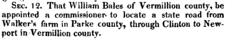
Section 12: This is one of those “special acts” that I mentioned in my Indiana Toll Road(s) post on 24 May 2019. The state road starts at one person’s farm? Really? Exactly where IS Walker’s Farm in Parke County? At least from Clinton to Newport, the road roughly resembles SR 63 (or, at least, old SR 63).
The Acts of 1830, available here, shows more state road laws put into place that year. I will be covering those at a later date.
On my many journeys through the internet researching anything transportation related that I can find, I found a collection of books that contain laws passed by the Indiana General Assembly. Today, I wanted to use one of those books to have a look at what was then, and see how it compares to now. The following excerpts come from Chapter LXXX of the Acts of 1830, effective 10 February 1831. I will be putting the excerpts directly from the book in this post. Some of these roads will show the “special acts” that I mentioned in the Indiana Toll Road(s) post of 25 May 2019. These are roads that were set out for the special interests of a person or small group, with specific locations for that purpose.
One thing that is important to mention at this point. The concept of “state road” was completely different that it is today. Today, a state road is a road that has become the responsibility of the state transportation authority (for instance, now INDOT). Then a state road was a road that was authorized by the state, paid for by the state, but built and maintained by the county through which the road passed. So, basically, the state using Federal land proceeds to pay for, what will be, county roads. Some of these routes DID cross the line between the two different types of state roads.
Section 1: From what I can tell, this road started at what is now Armiesburg, which is on Big Raccoon Creek southeast of Montezuma. (Not sure of this, but given that the start of the road is the Army Ford of the Big Raccoon Creek, it makes sense to me.) Armiesburg is on Parke CR 600W, south of US 36. A quick glance at a satellite image of the area shows where there used to be roads connecting Armiesburg to Montezuma more in a straight line than now. This route connected to Newport and Covington via, I would guess, what became SR 63 and SR 34/US 136. Portland, the next mentioned location on the road, is described in the 1833 Indiana Gazetteer as a “post town in Fountain county. It is situated on the Wabash river about seven miles north of Covington.” From there, the road aimed towards Lafayette. One would assume that it would enter Lafayette along what is now SR 25 and Old US 231. Hard telling, really.
Section 2: This road almost would seem to be straight forward, given that it connects Frankfort (or, Frankford as it is called) to Lafayette. But, nothing could be that easy. There are several routes this route could have taken between the two towns. Some of them might also have been part of the Noblesville-Lafayette State Road that I have also mentioned in another post (SR 38 West of Noblesville, 8 May 2019). My best bet is that it leaves Lafayette along the SR 38 route, then an almost straight line to Frankfort. This is clearly visible on any detailed map.
Section 3: Covington to the Illinois State Line in the direction of Danville. Some of you road geeks out there will notice that this describes one of the routes of the Dixie Highway…and SR 34/US 136.
Section 4: This road may be a little confusing at first. It was when I looked up. It was to connect Greencastle to Chambersburg via Russellville. A quick search on Google Maps will tell most people that this is impossible since Chambersburg and Russellville are in opposite directions; the former being south of Greencastle, the latter being north. This begins to make more sense when it is mentioned that Chambersburg is the old name for a town now called Veedersburg.
Section 5: This is one of the most specifically detailed description I have seen in a road law. The section/range/township mentioned is now where SR 26 crosses the Tippecanoe-Warren County Line. Cranberry Lake (now Cranberry Marsh) is northwest of there. It drains through Holder Ditch. Williamsport, the county seat of Warren County, is southwest of there on the Wabash River. I really need to do some research on this. Going by the maps that I have on hand, this law makes no sense whatsoever. It runs in all directions.
(Note – town charters are this detailed. Most road laws are “go that way, more or less” usually. To give an idea how detailed town & county creation laws can be, the county seat of Marion County, which most know as Indianapolis, really isn’t. The “official” county seat of Marion County is “square 58 in the plat of the town of Indianapolis.” Square 58 is bounded by Delaware, Market, Alabama and Washington Streets. Yes, the location of the City-County building.)
Section 6: Oh, the irony in this one. The location of the northern terminus of this road also happens to be the northern terminus of the Michigan Road: Michigan City. It roughly follows a straight line (very rare) from Lafayette to Michigan City on what is now SR 43 and US 421 (the irony – US 421 is [mostly] the historic Michigan Road from south of Boyleston to Madison).
Ivanhoe, Indiana – 22 JUNE 1918, 0400. Early reports are that 61 are dead and 129 injured after a troop/equipment train rear ended a circus train on the Michigan Central Railroad. Three circus train cars were destroyed, and a fourth heavily damaged. After the crash, the kerosene lighting system on the circus train caught fire, making the situation much worse.
The circus train was taking the Wallace-Hagenbeck Circus of Peru, Indiana, to a show in Hammond. The train’s consist was as follows: four sleepers, five stock cars, fifteen flat cars and a caboose. At the time, all steel construction for railroad cars was not the norm. As such, the circus train consisted of mainly wooden cars with steel frames. According to witnesses, the circus train had pulled into a switch where it stalled due to a hot box*. The flagman, as was standard operating procedure, went back to the main track to set fuses warning of the circus train’s predicament.
*A “hot box” is a railroad term for an overheating axle bearing. These bearings used to be packed in a box of oil soaked rag or cotton. When the oil ran dry, the bearings would become so hot from friction that it could catch the entire train on fire.
The other train, consisting of 21 empty troop cars, missed the fuses and plowed through the four sleeper cars that were at the rear end of the train. After the wreck, two stories began to be circulated about exactly what happened. But, there was also the actions of the engineer and the fireman after the crash that began to create more questions.
Fireman Gus Klaus, of Michigan City, Indiana, states that the engineer “positively ignored” five sets of signals that were set to get the dead-head troop train to stop. As reported in the Munster Times of 24 June 1918, “he passed the caution sign post, the block system, the flagman who threw his fusee into the cab window, the flares stuck in the ties and the two red lights on the way car of the standing circus train.”
Engineer Alonzo K. Sargent, of Jackson, Michigan, stated that “he was prevented from seeing the signal on account of smoke from an engine on the E. J. & E. track, parallel to the Michigan Central track there.” He went on to state that “he remained in the cab while the big engine was ploughing through four circus cars before it stopped.” It should be noted, at this point, that newspaper articles of 23 June 1918 mention that the engineer was arrested the night of the wreck in Kalamazoo, Michigan, and brought back to the Hammond/Gary area at the request of the Lake County Coroner.
Investigators believe one of two things had to have occurred at the time of the wreck. One, the engineer was asleep at the throttle. Or two, he wasn’t in the cab. Attorneys for the Michigan Central railroad promise “he will tell his story to the coroner at Hammond” tomorrow (25 June 1918). “Today he is in a state of physical and mental collapse at Jackson, Mich., he home.”
The official testimony of the fireman was reported as follows. “I was busy shoveling coal, watching steam and water and didn’t know where I was. I saw the fuzee about eight car lengths ahead and the red lights of the way car. Then the crash came. I went out and laid down beside the track. Then I got into one of cars of the troop train. I went back on the special. I thought the engineer was on his side of the cab. I couldn’t see, it was dark.”
Munster Times, 24 June 1918, pp 1
Munster Times, 24 June 1918, pp 3, part 1
Munster Times, 24 June 1918, pp 3, part 2
The above snippets from the Munster Times of 24 June 1918 show the testimony before the Lake County Coroner. Most confusing is the claim at the bottom of the article on the right about how the Michigan Central lawyers are saying that “the methods of the officials of Lake county are not to the liking of the railway company in that they did not proceed legally.” The lawyers claim that the Gary Police Department did not have the authority to wire the Kalamazoo Police Department to have the engineer arrested. And yet, in the next paragraph, the same lawyer states “we know that the engineer was asleep on the job, and had been asleep for a mile and a half before the collision.”
The wreck of the Wallace-Hagenbeck (W-H) Circus train also led to the best of its competitors. At the time, the W-H was second only to the Ringling Brothers Barnum and Bailey (Ringling) in terms of size and popularity. Other circuses, including the Ringling, donated performers and equipment to the W-H so that the show could go on. The W-H missed only two performances due to this crash. The first was to be in Hammond, the scene of the wreck.
The Lake County trial of locomotive engineer Alonzo Sargent began at Crown Point on 14 April 1919. The engineer admitted at trail that he fell asleep at the throttle. As reported in the Lake County Times (Hammond, Indiana) of 15 April 1919, “he admitted it on the witness stand.” Sargent stated “I closed the cab window after we passed Tolleston. It was chilly and then I dozed.” The trial ended up with a hung jury. It would be reported on 5 May 1919 that the state was dropping the manslaughter case against the engineer.
The ultimate death toll in this crash was estimated at 85. The injured were reported as 142. Of those killed, only 12 were positively identified. The rest were burned beyond recognition having been caught in the kerosene fire. The lawsuits against the railroad started almost immediately. The problem was that the Michigan Central, technically, wasn’t responsible for the train. During World War I, an entity called the United States Railroad Administration had taken over all of the railroads in the country for the federal government. Reports of the lawsuits, mentioned in the Indianapolis Star or 29 November 1919, list damage suits of nearly $1 million against the USRA. (The death toll in this article is listed as 100, with 80 injured.) It is the above mentioned testimony of engineer Alonzo Sargent that was to be used in court during the lawsuit.
Of all the newspaper articles that I had searched through, there are no pictures of the actual wreck that I have seen. I can imagine several reasons for that. Just now that I had planned on including them…if I could find them.
Most of the time, the railroads of the United States were divided by those west of Chicago and the Mississippi River, and those east of Chicago and the Mississippi River. And Indiana contained mostly railroads east of those locations. With one exception: the Chicago, Milwaukee, St. Paul and Pacific (CMSP&P), otherwise known as the Milwaukee Road, was one of the great western railroads, at one point linking Chicago with the Pacific Northwest. Ultimately, the Milwaukee had more trackage in Indiana than the Pennsylvania had in Illinois.
Indiana has so many railroad routes that were built by people wanting to make their fortune with the iron horse, without really spending any time figuring out if would be even worth it. The origins of the route that would become part of the CMSP&P in Indiana started as one of these railroads. First given a charter by the Indiana General Assembly on 10 September 1886 as the Evansville & Richmond (E&R) Railroad. It was created as an extension of the Evansville & Terre Haute (E&TH) Railroad with the purpose of connecting Elnora on the E&TH to Westport, in Decatur County. The E&R owned no rolling stock. It, instead, depended on the E&TH to provide all of the locomotives and cars to operate.
Given the name of the project, Westport was about 70 miles short of the ultimate destination of the railroad, Richmond. However, with trackage rights, it could come close.
The E&R was operated as a separate company until it went into receivership on 27 February 1894. This receivership would end on 4 June 1897, when the railroad was reorganized as the Evansville & Richmond Railway Company. This would be after a series of washouts between Bedford and Westport in March, 1897, rendered that portion of the track useless. Two more events in the year of 1897 would occur: 1) in October, the securities of the E&R would be sold, completely, to John R. Walsh of Chicago; 2) the name of the company would be changed, on 01 December, to Southern Indiana Railway Company.
The Walsh years were those of expansion of the Southern Indiana. The entire route would be put back into service in January 1898, and the complete rebuild would be finished by October 1904. But it also included the extension of the road (from Elnora) to Linton (12 miles – 22 January 1900), to Terre Haute (85 miles – 17 September 1900), and to the Illinois-Indiana State Line near Quaker in Vermillion County (34 miles – 1905). The Southern Indiana, through trackage rights of the affiliated Chicago Southern Railway (incorporated on 26 September 1904), would reach Chicago in 1907.
But, like many railroads in Indiana, both the Southern Indiana and the Chicago Southern fell into receivership on 26 August 1908. When it emerged from this receivership on 1 December 1910, it was acquired by a company named the Chicago, Terre Haute & Southeastern (CTH&SE) Railway Company. This company, however, did not last very long. Three weeks later, on 22 December 1910, the company was reorganized with the same name. The CTH&SE lumbered on until it was leased by the Chicago, Milwaukee & St. Paul (CM&STP) Railway for 999 years on 12 May 1921, but effective 1 July 1921.
The CTH&SE would be operated as a separate company, even after the CM&STP became a property of the newly organized CMSP&P on 31 March 1927. The merging of the CTH&SE into the Milwaukee Road finally happened on 31 December 1948. This was later than most of the major mergers in Indiana.
Given the railroad connections at both Seymour and Westport, the section between the two was treated like a stub branch since it never did reach its goal city of Richmond. At the Westport end, at one point, there were track connections to the Big Four (CCC&STL) tracks connecting North Vernon and Greensburg, allowing passenger traffic between Greensburg and Seymour/Bedford/Linton/Terre Haute. But traffic was sparse, at best. Multiple daily trains were replaced by a once daily (except Sunday). That was ultimately, before getting permission to abandon the Westport Branch, replaced with a mixed train, with passengers riding in the caboose. Freight traffic had fallen to less than 40 cars a month. The permission to abandon this branch was given in 28 November 1960, effective 30 days later. Traffic was stopped on 3 January 1961 and the section from Seymour to Westport was completely ripped out within six weeks.
The next abandonment would occur in 1978, according to INDOT documents (available here), although it would still appear on the Indiana Official Highway Map until 1984. This section was the Bedford Branch, from milepost 262.5 at Bedford to milepost 300 at Seymour. 1980 saw the filing of the abandonment of the rails from Chicago Heights (milepost 31.8) to northwestern Vigo County (milepost 171.2). Five years later, a branch from Bedford to Oolitic was removed, as well.
The Milwaukee was purchased by the Soo Line. Most of the Milwaukee Road legacy was removed from the State of Indiana by that time. Any parts that are left are owned by the Indiana Railroad (INRD).
Indiana, due to its location, has always been a vital cog in the transportation facilities of the United States. This is obvious when it comes to the Auto Trails age and the highways age. Indiana has been connected to the east coast, Florida, the Mississippi Delta, the Great Plains, and beyond, due to its location on the Auto Trail/US Highway system. But one road in the state shows a connection dependence like no other in Indiana: The Indiana Toll Road.
Any discussion of the “Indiana East-West Toll Road,” its official title, must start with a highway hundreds of miles to the east that opened on 01 October 1940: The Pennsylvania Turnpike. If there ever was a more telling transportation facility of the triumph of cars and trucks over railroads, the “Pike” (what locals call the Pennsylvania Turnpike) is it. Heck, the original section was built on an old railroad right-of-way! The Pennsylvania Turnpike would connect to the Ohio Turnpike in December 1954. The following October, the Ohio Turnpike was completed from the Indiana state line to the Pennsylvania state line. Next came Indiana.
The law creating the Toll Road Commission was passed in 1951, as “Chapter 281, Acts of 1951, page 848.” There was some question about the constitutionality of the law creating the commission. The Indiana Supreme Court settled the question with an unanimous decision handed down on 17 November 1952. The stated reason for the act was to allow Indiana to create a new type of high speed, safer highway: “emboying safety devices, including center division, ample shoulder widths, long-sight distances, multiple lanes in each direction, and grade separations at intersections with other highways and railroads.” (Source: Angola Herald [Angola, Indiana], 03 December 1952, pp 15) Also included in the law was the fact that the Governor must approve the location, with the Indiana State Highway Commission approving alignment and design. The act specifically stated that the Toll Road Commission (ITRC) was “authorized and empowered to construct, maintain, repair and operate toll road projects at such locations as shall be approved by the Governor.” This sounds like the ITRC was allowed to build more than one such road. Since this would happen before the creation of the interstate system in 1956, with basically the same design standards, this makes sense.
It was reported in the Munster, Indiana, Times of 23 October 1953 that the route for the toll road had been set, encompassing 156 miles across northern Indiana. The total cost of the project was expected to be $218 million. The details of the road were reported as “it will be dual lane, separated by grass strips, 156.06 miles long connecting the state lines (Ohio and Illinois) north of Angola and in northwest Hammond. It will be between the Michigan border and U.S. 20.” This route was not without controversies. Some of these included the closing of county roads along the route.
Groundbreaking at South Bend was celebrated 21 September 1954. The Ohio Turnpike had already turned into a successful venture. With the completion of the road, at least to South Bend, it was hoped it would be more so. And, yes. Yes it was. When the Indiana Toll Road opened in 1956, traffic in Ohio skyrocketed.
As mentioned above, the law creating the ITRC allowed for more than just the northern Indiana extension to the Ohio & Pennsylvania Turnpikes. The first such project was a “north-south toll road proposed to begin in the Calumet and end within five miles of Lizton in Hendricks County.” This project was, ultimately, surveyed by the ITRC. But the law creating this project had even more constitutional battles. Mainly, the requirement that the ITRC also improver both SR 100 and US 136 as freeway feeders to the new route. It was that specific requirement with which some legislators had problems. Before the 1851 Constitution, the General Assembly passed hundreds of these “special acts.” Those led to the constitutional rewrite.
The second proposed toll road would have connected Vincennes to Lawrenceburg across southern Indiana. Basically, a limited access replacement for US 50. There was a third proposal for a toll road, connecting Fort Wayne to the East-Wet Toll Road with a 45 mile highway. In the end, these roads were eliminated by the pending interstate system. The US 50 route would never be built as it was not considered for part of the interstates. The closest that came to being is I-64, but that actually was more an upgrade for US 60 for most of the route.
The Terre Haute Star of 28 October 1960 reports that, at the time, there were 85.8 miles of interstate highways in Indiana, with the 157 mile East-West Toll Road to “become a part of the interstate system, but it was built with bonds before the federal interstate program was started.” It should be noted that the toll road from Chicago to Philadelphia was originally designated some form of I-80. In Indiana, and most of Ohio, it was I-80. West of Youngstown, Ohio, it became I-80S. That designation would be replaced with the number I-76.
I have decided to end the discussion of the Toll Road with the building of the facility. Many changes have happened over the 60+ years since it was opened. It still seems fairly busy, at least that what it looks like when I visit South Bend. South Bend also has one of the longest interchange ramps I have ever seen on a limited access highway. The connector from the toll road to (now old) US 31 comes in at about one mile. I have no idea why…one would assume it has to do with the University of Notre Dame, which is right across SR 933 (Business 31) from the end of the ramp. I don’t know. If any of you are privy to such information, I would LOVE to know. You know…that whole curiosity thing.
As an aside, I find it ironic that the Indiana East-West Toll Road, with its counterparts in Ohio and Pennsylvania, would almost directly rival, and help end, the state named railroad based in Philadelphia. With the three state toll road, it was possible to compete directly with the Pennsylvania Railroad “Broadway Limited” that ran from Philadelphia (actually, New York City…but that’s not on the turnpikes) to Chicago. And I would bet do it both faster and cheaper. Just another nail in the coffin of the railroads in the United States, or at least the passenger railroads.
When the interstate system started its “invasion” of Indiana, one of the first highways built was the “minor” interstate numbered 74. Construction started within three years of the passing of the law creating the interstate system. The section in southeastern Marion County was one of the first specifically built interstates in Indiana.
Indianapolis Star, 21 June 1959. Franklin Road bridge over I-74Google Maps, 23 May 2019. Franklin Road bridge over I-74
Most of the routing of I-74 through southeastern Marion County was along a new path north of Southeastern Avenue, then US 421, which the new limited access highway would replace. According to the Indianapolis Star of 21 June 1959, “huge overpasses arise out of cornfield, barns disappear in a day’s time and hills are chewed into flatlands by the monster machines that build roads to modern standards.” The article mentions that the section in question is six miles long, starting just east of Arlington Avenue.
The sheer size of the construction is also mentioned. “The finished road will have four 12-foot lanes of concrete divided by a 60-foot strip, with 10-foot asphalt outside shoulders, 4-foot inside paved shoulders and no crossings at grade. The engineers expect it to be fast, safe and enduring.”
Paving of the new six mile highway section was planned to be complete in the fall of 1959. The problem was that an opening date still hadn’t been set, as there were two bridge contracts that hadn’t been let. The ISHC at the time, and I believe that INDOT follows the same pattern, let the road construction and bridge construction separately. Looking at aerial photos of highway construction, one will notice that bridges were sometimes completed long before there was a road to use it. One such bridge is the I-74 bridge over I-465. I-74 was open several years before I-465 was built that far.
As was standard with ISHC interstate construction at the time, the bridges across I-74 in this section would be (mostly) concrete arch bridge. (See both the above and below pictures.) A few of these original bridges still exist along this original section of the interstate.
Indianapolis Star, 21 June 1959. Hunter Road bridge over the I-74 connector road between I-465 and Southeastern Avenue east of Arlington Avenue.
Newspapers reported that 19.856 miles of Interstate 74 between Southeastern Avenue and SR 9 at Shelbyville were open by 28 October 1960, with the next 2.46 miles to SR 44 (again, at Shelbyville) to be open soon after. One newspaper mentions that I-74 would be completed in several years to Cincinnati, shortening the time by at least one-third. The strange thing was that I-74 left Indianapolis via US 421, while the direct route before the coming of the interstate system between Indianapolis and Cincinnati was US 52 (which I-74 replaced near the Indiana-Ohio state line).
The state road system in Indiana came about in two different phases. The second phase, which I have well documented in the (short) history of this Indiana Transportation History blog. The first phase, starting in the 1820s, led to many of the roads that would become part of the second phase starting in 1917. That first phase consisted mainly of paths through the wilderness. There have been previous entries about one old road in particular, the early state road that would be replaced by the coming of the National Road. But I wanted to discuss another of these original state sponsored paths: the Shelbyville State Road.
Shelbyville has a distinction of being one of the few towns in the state that had two state sponsored roads connecting it to the capitol of Indiana. The main difference is the routings of those two roads. Strangely, the second of these roads would be a more direct route to the Shelby County seat of government. But only because it really wasn’t built to connect to Shelbyville, per se. It was the Michigan Road, which was designed to cross the entire state.
The first road, authorized half a decade before the Michigan Road, takes a very indirect path to Shelbyville. But it leaves its mark on Indianapolis just the same. It was simply called the Shelbyville Road, a name which some parts still maintain. Some more obviously than others.
A little history is in order. Indianapolis’ location was chosen in 1820, with the town platted in 1821. Shelbyville came into being with Shelby County a year later.
When the state authorized a road to connect the two towns, the routing chosen was nowhere near a straight route. It started by using Virginia Avenue southeast from Indianapolis. That avenue was extended to reach the range line one mile east of the center of the new capitol city. That range line is currently known by a shortened version of the state road name: Shelby Street. There, it would follow that range line south a little over a mile and a half, turning southeast again. The southeast turn is now called Carson Avenue. The road then travels southeast, then due south, a little over two miles to another range line now called Thompson Road. Turning east for one mile, the original route then turned roughly southeast again. Here, the city calls the street Shelbyville Road.
The road continues more or less southeast until shortly after crossing into Johnson County. It then turns due south again. But not for long. At Johnson CR 1100 N, or Shelbyville Road, it turns east again for 1.75 miles to Johnson CR 700E, also known as Acton Road. The old road travels due south along Acton Road to Rocklane Road (side note, Rocklane Road is Main Street in Greenwood).
The Shelbyville Road turned east along Rocklane Road to the end of that road just inside Shelby County at Shelby CR 825W. It then turned south along that road to Shelby CR 400N. East along 400N, the old road travels less than a mile to London Road. Note – here the road has been moved to allow better traffic flow. But London Road takes the road trip into Boggstown. There, the road changes name to what it will keep all the way to Shelbyville: Boggstown. Although there are some other names between the two. First is CR 450W, which goes south from Boggstown Road. Then it turned east on CR 100N to turn south again on CR 350W which becomes Boggstown Road again to Shelbyville.
The end of the old Shelbyville Road is at the original path of the road that would replace it, the Michigan Road. Eventually, the old Shelbyville Road would become a toll road, known as the Shelbyville Pike. This would last until the 1890s, when the toll company was bought out by Marion, Johnson and Shelby Counties to become county roads. Because of the duplication by the Michigan Road, it would not become part of the state highway system.
Zionsville. A quaint village on the Lafayette & Indianapolis Railroad. The nearest connection to the state highway system, in 1926, was SR 29, the Michigan Road. But it wouldn’t stay that way for long.
Most people that know the area know that Zionsville is (was) on SR 334. That state highway, connecting (originally) US 52 at Whitestown to SR 29 east of Zionsville. But SR 334 was an afterthought in the grand scheme of things. The town of Zionsville was originally connected to SR 29 by a new highway, SR 329, along what is now Sycamore Street, in 1934. The first mention of this road was the pending oiling of the road. This was announced in the Indianapolis News of 03 November 1934.
Indianapolis News, 3 November 1934
The strange thing about the creation of SR 329 is the fact that the same 1935 Indiana Official Highway Map that shows SR 329 shows a pending SR 334 from Zionville west to Whitestown and from SR 29 east through Carmel and Fishers to SR 238. The eastern section of SR 334 connects to SR 29 at a location (what is now 116th Street) that is opposite SR 329.
1935 Indiana Official State Highway Map showing SR 329 and (pending) SR 334 across Boone and Hamilton Counties.
The fates of SR 329 and SR 334 get strange from that point. The 1936 map shows that SR 334 is under construction from Zionsville west to US 52 and SR 329 connecting it to SR 29. The pending section of SR 334 is shown to be authorized to US 31, not SR 238 as was shown the year before. 1937 shows SR 334 a completed, yet gravel, road between SR 329 and US 52, with the authorized addition connecting SR 29/329 to SR 238. By 1938, SR 329, and the authorized addition to SR 334, are gone.
1936 Road Map of Boone County, showing SR 334 and SR 329 at Zionsville.
I have not found any definitive reason why the state decided that Zionsville was deemed worthy of addition to the state highway system. The state highway laws required that all county seats (Zionsville is not) and that all towns of a population of 5,000 or more (Zionsville didn’t reach that level until the late 1980s) be connected to the state highway system. Looking at the maps, it is entirely possible that it would have been part of a pseudo-bypass of Indianapolis (look at SR 238, SR 334, SR 267, and SR 144). Not that I have ever seen any information about anything like this. It just looks that way from staring at maps.
SR 334 is now just a memory on maps. It was 2011 when INDOT decided that it didn’t want SR 334 anymore. (As an aside, in 2013 the last section of SR 267 added to the state highway system [from US 40 to US 136/I-74] was removed from state responsibility.) The road was returned to the maintenance responsibility of Whitestown and Zionsville, with the bridges given to Boone County.
01 January 1968. A collision of two Pennsylvania Railroad trains causes an entire town to be evacuated, an environmental catastrophe, and a fire that required several days to extinguish. The wreck would happen a month before the formal end of the Pennsylvania Railroad as an entity. It would also be an example of what happens when choices are made as to where to spend money.
The wreck had occurred when two trains, each heading different directions on the Pennsylvania St. Louis mainline, collided at Dunreith, a town east of Indianapolis in Henry County. One of the trains was carrying 12,000 gallons of ammonia, and another with the chemical acetone cyanhydrin. The crash ended up catching fire, burning half the town and forcing the evacuation of all 236 residents of the town. Since the tracks were right next to US 40, the road was closed as well. A brakeman on the westbound train believed, at the time, the rail had broken beneath the 75th car of the 98 car train, forcing a derailment. The cargo of gasoline, crude oil and ammonia caught fire almost immediately. When the west bound train derailed, it sideswiped the east bound freight train.
Indianapolis News, 02 January 1968.
The explosions caused by the fire knocked a fire truck driver out of the cab of his truck two blocks away. It also knocked out street lights in Knightstown five miles away. Flames shot into the air some 300 feet.
News reports the next day reported that the damage had been less than expected. As of the reports on 2 January 1968, two homes and the town’s only industry, the Butterfield Canning Company, were destroyed. Also, the acetone cyanhydrin, when it was burning, created a large quantity of cyanide gas and spilled that chemical into the Buck Creek, a tributary of the Big Blue River.
In the aftermath of the wreck, the State Board of Health planned to dump some five tons of chlorine into the Big Blue River from the SR 44 bridge west of Shelbyville. The initial concentration of the cyanide was 20 parts per million at Knightstown. On 19 April 1968, it was announced that the State Department of Natural Resources was to begin an effort to kill, over five days, the last remaining species of fish in the Big Blue River from the mouth of Buck Creek at Knightstown to the dam at Edinburgh. The fish kill was designed to kill off the carp, since all of the bass in the river were killed by the cyanide in the river. The 56 mile stretch of the Big Blue River would be restocked with smallmouth bass, rock bass, suckers and some perch. All traces of the cyanide in the river were negligible within two weeks. The rivers were checked all the way downstream to Seymour.
What ultimately caused the crash was decades in the making. The Pennsylvania Railroad, the most extensive railroad network in Indiana at the time, had been stumbling like a teetering giant for years. The PRR was, at the time, the largest industrial employer in the United States. Railroad rates were not controlled by the railroads themselves at the time, but by the federal Interstate Commerce Commission. The company had made the choice to maintain employee wages over maintenance. The mainline between Indianapolis and Columbus, Ohio, had been on slow orders for years with a speed limit of ten miles per hour. The company had also been investigating a merger with a stronger railroad since the mid 1950s. All merger talks had failed until the ICC approved the merger between the PRR and the New York Central, which was to take place on 01 February 1968.
In the end, the location of the wreck would be abandoned in the early 1980s by a successor company of the Pennsylvania Railroad, the Consolidated Rail Corporation (Conrail), as was the entire line from Richmond to Terre Haute, with the exception of a small section on the westside of Indianapolis that connects the city to the former Indianapolis & Frankfort. Ultimately, most of the old PRR properties in the state were dropped, mainly due to the cost of getting the long neglected rails into usable shape.
Almost everyone in Indiana (at least with the slightest amount of interest) can tell you where the National Road is across the state. What is not as well known is the differences between what was laid out and what was planned in the first place. And it all starts in Wheeling, Virginia. (I know, it’s West Virginia. But at the time of the creation of the National Road, it was still Virginia.)
This story starts far to the east of the state of Indiana. The Cumberland Road was created to connect the Potomac River, at Cumberland, Maryland, to the Ohio River at a point between what would become Steubenville, OH, and Wheeling, VA (WV). The act to build this road was approved by President Thomas Jefferson on 29 March 1806. By 1818, the road would reach Wheeling. This would turn Wheeling into the jumping off point for access to Ohio and Indiana. The Ohio River, from Wheeling, was navigable at least as far as Louisville, Kentucky. Except in the winter.
This would lead Congress, on 15 May, 1820, to appropriate $10,000 to lay out a road between Wheeling and a point on the Mississippi River between St. Louis and the mouth of the Illinois River. The stipulation is that the road be 80 feet wide and on a straight line.
This act would be put in place right about the same time that Indiana decided to locate its capitol city in the central part of the state. Keep in mind that, when Indiana became a state, most of the territory of Indiana didn’t actually “belong” to the state of Indiana. A treaty in 1818 finally allowed non-Native settlement up to the line of the Wabash River, with the exception of the area south 34.54 between where the Eel (Logansport) and Salamonie Rivers (Lagro) meet the Wabash. (This was known as the Great Miami Reserve.) This treaty would allow the state of Indiana create a central location for the seat of government.
The decision was made to locate the new capitol, eventually named (after what seemed like hundreds of suggestions) Indianapolis, one mile east of the mouth of Fall Creek at White River. This would put the “straight line” of the National Road in the act mentioned above some fifteen miles south of the new town. It was at this point the Indiana General Assembly, meeting at Corydon, would send a memorial to the federal Congress asking that the planned “Western National Road” be moved north to enter the future capitol. It was also mentioned that “at no other place along the White River for a distance of thirty miles was there so good a location for a bridge.*”
In 1825, an amendment to the 1820 National Road act, offered by Jonathan Jennings (Congressman and first Governor of Indiana), stating that the road should be changed to connect the capitols of Ohio, Indiana and Illinois. The new survey of the National Road was completed in 1827. This survey was under the direction of Jonathan Knight (namesake of Knightstown, Indiana) and Joseph Schower. The original field notes of the survey are available in both Washington, DC, and at the State Library in Indianapolis. The field notes are in four volumes, all in Knight’s handwriting. The survey showed that “the road was to run due west from the Ohio line to Indianapolis, passing through the towns of Richmond and Centerville in Wayne County.” There were two roads in Wayne County that were near the road, Salisbury and Vandalia, that were left off the survey, and have since disappeared from any maps.
Along the original surveyed path of the National Road in Indiana, there were only four towns: Richmond, Centerville, Indianapolis and Terre Haute. Between the last two, the road was surveyed in as close a straight line as possible. This meant missing the county seats of Hendricks, Putnam and Clay Counties (Danville, Greencastle and Bowling Green). Before you ask, Greenfield, the county seat of Hancock County, and on the National Road, was declared the county seat on 11 Apr 1828, exactly 41 days after the effective creation of the county. This puts Greenfield in the path of the National Road survey. But since it wasn’t there when Knight and Schower went through, it wasn’t part of the survey.
One of the things that Indiana did early in its history is create a system of state roads. This was done between 1821 and 1823. These roads were originally paid for from the “three percent fund,” the amount the state would receive from the Federal Government upon sales of government land. Most of these roads were planned to have a 48′ right-of-way. There was, on a map of 1827, one of these state roads on the map between Richmond and Terre Haute, through Indianapolis. This road was to have a 100′ right-of-way. The surveys were complete for this state road, but very little construction was done before the National Road surveys were done.
The big difference between the state road and the National Road is the construction standards. Essentially, the state roads were little more than open paths. No real finishing, just trees cut down to make a path. The National Road had very specific standards. The right-of-way was to be 80 feet, trees removed, ground graded and bridges and culvert built of stone.
On 5 July 1827, the surveyors reached central Marion County and Indianapolis, which had about 700 inhabitants at the time. At that point in history, the principal market town for the up-and-coming Hoosier capitol was Cincinnati. The direct route to that Ohio city was the Brookville State Road. The Brookville Road ended at the old Centerville State Road (and hence, in Marion County, the National Road later), taking the latter road from what is now Ewing Street (first street on the south side of Washington Street west of Sherman Drive) into Indianapolis. The surveyors noted that the road would connect to Washington Street on the east side of Indianapolis (which, at the time was East Street), and follow that thoroughfare across to the west boundary of town (then, you guessed it, West Street).
The surveyors continued west of Indianapolis on 10 September 1827. It was to be a continuation of Washington Street west of the town, with the slight jog to allow for a 356′ bridge over White River, to be built at a right angle to said river. This would cause the National Road to turn 15 degrees north of west just one block west of the town limits. The National Road bridge would cross to a point on the west bank that would be a straight line from that bank to Washington Street in town. The old Washington Street bridge, in White River State Park, starts on the west bank of the river in the same location. There were only two signs of settlement in Marion County west of Indianapolis along the surveyors path, both of which were near Eagle Creek: the house of a Mr. Harris east of the creek, and the house of Mr. William Holmes west of it.
From that point, a total of ten to 13 clearings, each being on the bank of a creek or river, between the Marion-Hendricks county line and Terre Haute were noted. Finally, in the middle of October, the surveyors hacked and slashed their way through heavy forests and swampy lowlands to a point five miles east of Terre Haute. This was the location of Jenck’s Distillery. The road was to be placed a few feet to the south of this location. Two days later, the survey connected to the east end of Wabash Street. The road would use that street to the Wabash River. Within three days, the survey would be complete to the Illinois-Indiana State Line.
Construction would begin in 1829 in Indiana. In 1831, $18,000 was finally allocated for a bridge at Indianapolis. That bridge would finally be removed, still in good condition, in the early twentieth century. (As a side note, the bridge that replaced it would last less than a decade before it was destroyed by the Flood of 1913. After which, the current “old” Washington Street bridge was built.)
Around two decades later, the federal government would give the road back to the states. By 1851, the entire National Road would be paralleled from Terre Haute to Richmond by steam railroads (Terre Haute & Indianapolis and the Indiana Central, both to become Pennsylvania Railroad lines.) 150+ years later the railroad is gone and most of the traffic has been siphoned off to Interstate 70. But the old road still serves the local communities which came into being due to its construction.
Information for this post came from the book “National Road in Indiana,” written by Lee Burns, published in 1919.
I have mentioned quite a few times about the Great Renumbering, the renumbering of all of Indiana’s state roads on 1 October 1926. This was a major overhaul of the state highway system put in place in 1919. But it was the second time state road numbers had been changed in Indiana. The first, while not a complete overhaul, was in 1923.
Between 1919 and 1923, the Indiana State Highway Commission grew from maintaining five roads to 55. The problem, according to the commission, was that as roads were entered into the system, they were given the next number in line. This led to a large number of roads that would start and end in places where the number would change, even if the two roads were in a straight line with one another.
The new road numbering scheme was announced in October, 1923. The news article to the left from the Indianapolis Star of 28 October shows the information that was released. The example used as to why the state needed new signage, and new route numbers, points out what was apparently a common problem with the state highway system at the time: people interrupting other people’s lives to get directions.
SR 1 – SR 20
The most obvious change to the system came with SR 2. Until the 1923 renumbering, the route of SR 2 followed the original Lincoln Highway from Dyer to east of Fort Wayne through Valparaiso, LaPorte, South Bend, Elkhart, Goshen, Ligonier, and Fort Wayne. The new SR 2 would, according to the description to the right, follow the Lincoln Highway in and out of the state, but the Yellowstone Trail between the two points. This route would be the later route of the Lincoln Highway, as well.
Looking at the descriptions of the state roads at the time, it is easy to see what the state road number was before they all changed in 1926. For instance, it is easy to see that SR 4 became US 50, and SR 5 became US 150. (Yes, others are obvious, as well. But, I have covered some of those ad nauseum.)
The rest of this post will basically be the list of the state roads at the time of the first renumbering. One note is the very last line of the article: “Highway officials believe that the new numbering of the state system will be permanent.”
Oops.
Another thing that should be noticed is that while the article lists 55 state roads, the 1923 system does not have a State Road 49 or State Road 52. Also, some of the old road numbers were moved to an entirely new area of Indiana. For instance, the new SR 5 replaced, from Paoli to New Albany, SR 42. The number 42 would become the designation for the Lincoln Highway from Valparaiso to New Carlisle. SR 44, the original designation for the Yellowstone Trail would replace SR 6 from Lebanon to Monticello.
When the original State Highway law passed in 1917, the search was on for the first five Main Market Highways. Some of the highways chosen were not controversial at all. SR 2 was the original Lincoln Highway route across northern Indiana. SR 3 was the National Road, or at least most of the 1830s route was included. SR 4 and SR 5 would connect across southern Indiana. However, the one that raised questions was SR 1.
The idea was that SR 1 was to connect Louisville to South Bend through Indianapolis. South of Indianapolis, this was pretty straight forward. The route was mostly in place as the Madison State Road and the Jeffersonville State Road. Just like the railroads that went between these cities, they shared the same right-of-way (in this case road or trail) to Columbus, splitting there to go to the respective destinations.
But north was a different story.
Survey map of Marshall County, south of Plymouth. The circled survey section numbers are those that were part of the original Michigan Road survey, prior to the area being surveyed to match the system in the rest of the state.
This is where a little bit of Indiana history comes into play. When the state was young, there were state roads created to connect towns across Indiana. One of the first was the Michigan Road. This road would connect Madison (on the Ohio River) to Lake Michigan at a new town to be called Michigan City. The route north of Indianapolis would not be directly north because a large section of the land due north of Indianapolis was still part of the “Great Miami Reserve,” a large area that had belonged to Native Americans. So the original Michigan Road would leave Indianapolis to the northwest, skirting the Great Miami Reserve to the west to Logansport. At Logansport, the state would buy land from Native American tribes in one mile sections to build the road through what would become Rochester, Plymouth and South Bend. If you look at any map of the area which includes survey lines, it becomes obvious where the road was placed. The attached map shows the survey sections south of Plymouth in Marshall County.
Map of north central Indiana showing the 760,000 acres of the Great Miami Reserve (dotted line) set up in 1818. Thin black lines show the current Indiana county lines.
The other road north was the Range Line Road. This road started at what is now Broad Ripple as the Westfield State Road. Just south of the Hamilton-Marion County line, it would follow the dividing line between to survey townships, otherwise known as a range line. At the time of the creation of both the Michigan Road and the Westfield Road, the Great Miami Reserve, set aside in 1818, contained lands that were north of a line that was from a point 34.54 miles due south of Logansport east northeast to a point 34.54 miles due south of Lagro.
It would not be until 1838 when the land of the Great Miami Reserve would become government land, pending the end of all Native American titles to said land. In 1844, two of the last three counties in Indiana were created from the Miami Reserve: Richardville and Tipton. (The third of those counties was Ohio.) It turned out that a trading post on the Wildcat Creek in Richardville County would be on the range line as it was extended and surveyed north through the new lands. That trading post would be setup as the town of Kokomo.
The Range Line Road would be extended to the new town, which would become the county seat of Richardville County. In 1846, the name of the county would be changed to Howard. The road would then travel due north from Kokomo to just south of the Wabash River, where it would turn to go into the town of Peru. From there, it would connect to the Michigan Road at Rochester via Mexico. Most of this route is marked today as Old US 31.
Indianapolis News, 23 August 1917
Now that the general history is done, let’s get back to the 1917 decision of the route north of Indianapolis. I can’t say for sure why the decision was made, but the Indiana State Highway Commission decided that the Range Line would be used instead of the Michigan. Before the decision was officially made, there were many people on both sides of the argument. One of the people on the Michigan Road side of the article was none other than Carl G. Fisher, creator of the Lincoln and Dixie Highways. His arguments are shown in the attached article from the Indianapolis News of 23 August 1917.
As pointed out in the article, the number of towns, especially county seats, along the Range Line is higher than those on the Michigan before they join at Rochester. The travel distance between Indianapolis and South Bend doesn’t vary much between the two routes. Granted, in the time of horses, a two mile difference in distance was almost monumental. But in the time of the automobile, not so much.
I guess it should be mentioned that, at the time, the only direct railroad route between Indianapolis and South Bend would be the Indianapolis & Frankfort and the Vandalia South Bend line (both Pennsylvania Railroad properties). This would take train travelers through Lebanon, Frankfort and Logansport before heading north to Plymouth and South Bend.
As it turned out, the ISHC would decide the Range Line Road would be the official winner of the SR 1 sweepstakes. This would lead to what ended up being bypass after bypass being built to fix little problems that had plagued the Range Line Road. One that comes screaming to mind, and was corrected about a decade after the decision, was the area at Broad Ripple. Narrow and winding, that section of OSR 1 would be a thorn in the side of the ISHC until it was removed from the state system around 1968 (removed from US 31 in 1930, it would become SR 431 until the completion of Keystone Avenue to the new I-465).
This is far from the last controversial road decision made by the state of Indiana. But it was one of the first. After, of course, the constitutionality of even having to make the decision in the first place. In the end, the historic Michigan Road, one of the first state roads in Indiana, would be one of the last added to the inventory of state maintained highways.
In the early 1960s, the interstate system in Indiana was beginning to be put into place. By 1962, there was quite a bit of construction completed. One of the first highways that was working to completion was I-465 around Indianapolis. At the time, there already was a bypass highway of Indianapolis known as SR 100. Some of the contracts for the construction of I-465 was listed as being for SR 100. But the original plan for I-465 didn’t go all the way around the city. It actually was planned to complete the SR 100 loop.
MapIndy 1962 aerial view of I-65/I-465 area in Northwest Marion County.
The original plan for the interstate was for a 54 mile loop starting south from near 62nd and Lafayette Road. It would then be built (usually) within one half mile of the planned SR 100 route around Indianapolis. SR 100 had been planned to circle Indianapolis using, roughly: Shadeland Avenue, 82nd/86th Streets, High School Road, and Thompson Road. The final I-465 would be close to this. The only difference is that 465 would not be a complete loop. The end of the highway would be at I-65 near SR 334 and Whitestown.
The above MapIndy image shows the beginning of I-465 and the rerouting of High School Road, Lafayette Road and 62nd Street to make room for both I-465 and I-65. It also shows the temporary end of I-65 at Lafayette Road.
The original plan for I-465 would be completed before the section connecting the pictured area to the north leg near Zionsville Road and 96th Street.
MapIndy 1962 Aerial image of the Airport (now Sam Jones) Expressway interchange with I-465.
Further research of the MapIndy 1962 aerial photo shows that there were no interchanges at 56th or 38th Streets. Most of the rest of the exits were in place down to I-70, which didn’t exist in any form at the time. A glance at the Airport (now Sam Jones) Expressway interchange shows that going east from Weir Cook Indianapolis Airport (before it became Indianapolis International) there was nothing built yet. The Airport Expressway wasn’t. The area around I-70 would be put in place, although it would be several years until this section of that interstate went anywhere.
1962 MapIndy aerial image of I-70/I-465 area.
The end of construction of the starting section, according to the 1962 aerials, was just east of White River north of Thompson Road. A second section of construction occurred from just west of Ninth Avenue in Beech Grove around to Payne Road.
The cloverleaf interchange at I-74, which was already completed to Shelbyville, was in place, although there were no north/south connections.
1962 MapIndy aerial image of the end of I-465’s first section.
1962 MapIndy aerial image of the interchange between the future I-465 and I-74 on the east side of Marion County.
The original I-465, as planned, was completed in 1968. The north/south final section, originally called SR 100 (hence Park 100 Industrial Park in that area) was completed by 1972. It would be 1976 when the interstate system in Indianapolis would be “completed” with the final construction of I-65/I-70 downtown. (Some would argue that it isn’t complete, since I-169 from downtown to Fishers was never built. After almost 45 years, I believe was can honestly say that ship has sailed.)
When the Great Renumbering occurred in 1926, one of the few exceptions to the numbering pattern connected Indianapolis to Vincennnes. This exception was SR 67. The reason for this exception was that someone in Indianapolis believed that US 67 would be routed across Indiana to Cleveland. (I still can’t figure that out…given where US 67 is. But, hey.)
The road that would become OSR 22/SR 67 started life as one of the original state roads established by law in 1822. The road description read as follows: “from Highlands on White River to Washington, Burlington, Spencer, thence to Indianapolis – 100 miles.” In Marion County, that would become what was known as the Mooresville State Road. As with other roads established in 1822, one could get to Mooresville following the state road, it wasn’t a direct trip.
Path of the Mooresville State Road (1822)/OSR 22 (1920)/SR 67 (1926) through southwest Marion County. The dark red line shows sections that still exist. Two orange sections show parts that have been removed (one for I-465, one for safety as it crossed the Indianapolis & Vincennes Railroad).
As shown in the above map, the Mooresville State Road was not a direct route by any stretch of the imagination. Most of the route in Marion County, to this day, is still called Mooresville Road.
With the coming of the state highway system, it would take a couple of years for the addition of this very old state road. Eventually, this section would become SR 22. (Past Mooresville, it would become SR 12.) Then came the Great Renumbering. This section was made part of SR 67.
This would last right around a decade, as the state worked to make a more direct route for SR 67. This more direct route mentality was put into place along the entirety of the road from Vincennes to Indianapolis. In rural Marion County, that meant that the SR 67 would be placed along side the Indianapolis & Vincennes Railroad. The first section was shown on a 1935 map of the county showing the new road given the number SR 67W. The SR 67W section, at that time, started at Camby Road and went northeast to connect to SR 67 at Tibbs Avenue/Mooresville Road/Maywood Road. The following year, the old road would go away completely. The town of Glenns Valley would be the loser in this bypass.
As with other old roads, I recommend driving this if you get the chance. Of the two removed sections, one still connects (via bypass) two sections of the road. Over I-465, the bridge for the route is called Mooresville Road by INDOT, but the Indianapolis street signs list it as Mooresville Bypass.
The Michigan Road. The history of the Michigan Road is covered in lots of wonderful sites. Briefly, the state of Indiana built a state road connecting Madison on the Ohio River to Michigan City on Lake Michigan via Greensburg, Shelbyville, Indianapolis, Logansport, Rochester, Plymouth and South Bend. The section will be discussing today is the first part of US 421 that was replaced by I-74 in 1960-1. And I won’t be exactly covering what you think I will. Let me explain.
The idea for this post all started with a street sign. Yes. A street sign. But I will get to the particular sign later.
A family get together in Shelbyville, the location of my house, and hunger led to my traveling the old Michigan Road. Let’s start by saying that in this trip, I would normally take Carroll Road (along the Marion-Hancock County Line) to Southeastern Avenue (the old Michigan Road). In Marion County, and Pleasant View, the name is Southeastern Avenue. The rest of the old road in northwestern Shelby County is called Michigan Road (or, as the street sign at Carroll Road states: “Michican Road”).
Shelby County street signs at CR 900 W (Carroll Road) and Michigan Road (Southeastern Avenue). Both Hancock and Shelby Counties still mark the road as a county road, even though the name was changed from County Line Road to Carroll Road, at least in Marion County, in the id-1980’s.
This section of the old road is very short, as both ends were replaced in 1960 by I-74. Northwest from this point, a section called Southeastern Avenue (it’s in Marion County), the road doesn’t go very far. Only about 0.2 mile. The concrete ends, and I-74 was built to barge right across the old right-of-way. Going southeast, the old road enters Pleasant View, a small residential community. The Pleasant View/I-74 interchange is on Walnut Street, which is 0.7 mile from the county line. Well, kinda. The street signs at the corner, and there are two sets, make things a bit confusing. On the southwest corner, the street signs read “Southeastern Ave” and “Pleasant View Rd.” On the southeast corner, they read “Walnut St.” and “Michigan Rd.” (It should be noted that the exit signs on I-74/US 421 read “Pleasant View Road.”)
Old Michigan Road at Pleasant View, showing the interchange with I-74/US 421.
The old US 421 only extends another 0.4 mile to the southeast from this point. According to the book “Development and lands of Michigan Road” (the title is a link to the available page at the Indiana State Library website), the original Michigan Road
Current Google Map showing the original Michigan Road (highlighted).
actually turned south on what was Shelby CR 850W, then east on (what is now) Frontage Road (old Shelby CR 940N) to connect to where the old US 421 is under the interstate.
Pleasant View area shown in the book “Development and Lands of Michigan Road.”
A quick look at a map shows that the westbound lanes of I-74 is the original old US 421 location. This is especially shown when driving westbound on I-74. The interstate turns slightly west, and the old road is visible in a straight line. The next picture shows the end of the old road as seen from westbound I-74.
East end of Pleasant View section of the original Michigan Road.
The red lines show the path of the old road and the red square sign marking the end of pavement on the original Michigan Road.
Aerial view of the east end of Pleasant View section of the old US 421.
This next snippet shows the aerial view of the same location.
The old road is under the lanes of I-74 to just shy of the next exit: London Road. The connection to London Road was built in 1960-1961 to allow access to the old road that wasn’t replaced by the interstate. From this point to just northwest of Shelbyville, the interstate runs along side the old road, with a few changes for geometry at both the exits and a bridge over the interstate. The state historic byway follows this route. It is marked on maps as “Michigan Road.”
Street sign at 600W and Michigan Road in Shelby County.
The street sign that gave me the idea for this post is located at Shelby CR 600W. On the trip to Shelbyville, I decided that I needed to find something to eat. I went along US 52 to go to the McDonalds in New Palestine. With the line going around the entire building, I decided to pass on that one. So I turned south on Gem Road to go down to Michigan Road. When I got to the old road, I saw the pictured street sign on the left. Remember when I said that I-74 replaced the old Michigan Road/US 421 in the early 1960’s? Well, this street sign shows either a) someone didn’t get the memo, or b) they haven’t changed the sign in almost 60 years. You be the judge.
If one looks at the Google Maps of this section of the old road, it will show the thing that made the Michigan Road different than most early state roads. State roads like the one I discussed last Saturday, the Paoli State Road, had a 48 foot right-of-way. The Michigan Road was built with a right-of-way of 100 feet. While the state would have problems with that right-of-way in other parts of the state, here it is clearly shown on the Google Map.
Google Map showing the expanded right-of-way of the Michigan Road in Shelby County. This map also shows, near the center, the age of Green Meadows Estates area. The property lines show that the main road of the subdivision connected to Michigan Road, although it can not reach it due to Interstate 74/US 421.Current Google Map of the Fairland Road exit of I-74/US 421 area.
The next change in the old road happened twice, actually. It occurred at the Fairland interchange. The original change connected the old road to Shelby CR 200W closer to the intersection with Shelby CR 400N. With the building of the casino at this location, Michigan Road was moved north to make traffic a little better and allow for the building of a parking lot. The original road would have connected the diagonal Michigan Road in a straight line across what is now the interchange.
The second to last change would be where the old road would cross over the interstate. The red lines on the map to the left show the original route of the Michigan Road. The overpass was built with a change in geometry to allow easier construction of the bridge. In that reroute, the Frontage Road was built on the southside of the interstate, partially using the old road to connect it to the road to Shelbyville.
I would like to think that the entire concept of the Frontage Road was to allow access to property that would be cut off with the building of I-74. There are very few places in Indiana where such a road was built. Then again, there are very few places in the state where the interstate was built as a direct replacement for the old state road that was in place at the time.
The last change the state made to the old Michigan Road had nothing to do with Interstate 74. The map to the right shows the current routing of Michigan Road and SR 9. The old road is, again, marked in red.
SR 9 didn’t come to Shelbyville until 1932. To that point, SR 9 ended at US 40 in Greenfield. The bridge over the Big Blue River that is currently in place is the original crossing of the Michgan Road. The map below shows the 1935 routing of the two state roads that meet at this point.
The change of the road at this point allowed for both improved geometry and two less dangerous crossings of the Big Four Railroad at this point. (As an aside, the paved road that meets the two state roads just north of the river is Boggstown Road, which was part of the Indianapolis-Shelbyville state road. That would later become Shelbyville Road. The Marion County section is still named that from Thompson Road to the southeast.)
Of the entire route of the original Michigan Road, this section through Shelby County was the one that was butchered the most. This is an old bridge that was bypassed in southeastern Shelby County. The route described in this post is all part of the Michigan Road State Historic Byway. The byway uses Interstate 74 from the Acton Road exit in Marion County/Indianapolis to the London Road exit in Shelby County. I always recommend, if given the chance, people drive the old road. It, quite honestly, is more scenic and allows access to local businesses that would be forgotten if all travel was done on the interstate.
Images for this post come from Google Maps ((C) 2019 Google), and assorted older maps and books of Shelby County, Indiana. The non-Google Maps images are available at the Indiana State Library website. (Click on the “Indiana State Library” to the left for a link to all Shelby County maps available.)
Admittedly, I have been what most people would call a road geek for a long time. And a historian. So putting the two together made sense. One of the things that I have learned to do along the way is to study the routes and old routes of roads by looking at the clues available.
For instance, along SR 9 in Southern Shelby County, the road had been moved twice. Once years ago and once in the past couple of years. The most recent move did little. It basically changed the geometry a bit to allow the building of a new bridge. The previous move was a little more massive. The attached aerial image shows the current road
situation, with the former road geometry highlighted in orange and red. The red lines are parts of the old road that can be followed. The orange sections have been removed, or in some cases, applied to different situations. There are several tools that I used to ascertain the old layout of SR 9. First was simple looking at old maps and comparing them to the current situation. One must remember that the gentle curve of the current SR 9 is a relatively recent invention. Roads, until taken completely over by government entities (read early to mid 20th century), would be built in straighter lines along property lines. The only entities, for the longest time, that had the right to take and/or purchase land for transportation were the railroad companies. Also, looking at the location of the old bridge, it shows that it crosses at a right angle, much like the currently one. It is VERY common for roads to be bent to cross streams at a right angle. This would allow the least expensive, and possibly most stable, bridges to be built. I recommend that you look up any web page about the National Road S-Bridges (hint, hint, Jim Grey has one*) to show what I am talking about.
Another example of this would be the old National Road bridge in Indianapolis. The National Road crossed White River at a right angle, then turned about 15 degrees south of east to connect to Washington Street one block west of West Street. The old road became Washington Avenue when the original bridge was removed in 1904.
The other give-away in this were, quite simply, the location of the utility poles. One of the things that usually doesn’t happen when a road is moved is the removal of the utility poles. Part of the reason for that is simply that those poles belong to one of the utility companies that have wires on them. There are a lot of hoops to jump through to move private property like that.
But the “new” tool that I have been using lately to follow the old routes of roads is, believe it or not, Google Maps. What started this entry is looking at Google maps for the last entry (Paoli State Road). Let’s look at the northern end of Martinsville, with SR 37, to show what I am talking about.
The attached is the Google Map of the area. Notice I am not using the satellite image for this. The regular map has a lot of great information in places. In this case, the highlighted section is the old SR 37 entering Martinsville. What helps give this away is fact that Google Maps will use property lines. Check out the northern end of E. Morgan Street before it turns east to connect to SR 37. Notice the property lines that connect the new road in a straight line to the old road. Following the old SR 37 from that point shows more examples of this. Following East Morgan Street into Martinsville, I see several. I could be wrong, but it looks like they could be part of old SR 37 (look at Kristi Road and Reuben Drive).
Another example is south of Martinsville. It also shows the location of the old SR 37 bridge over Indian Creek (highlighted). This bridge has long been disconnected from the road system. But according to Google Maps satellite imagery, it is still there. Looks like a road trip is coming!
One must consider that all of these tools must be used together, as no one tool is complete and/or fool proof. For instance, in these two images, I can tell where the old SR 37 is because one shows a bridge and one shows property lines. But on the first example (of SR 9), that required on the spot research as utility lines are hard to see on Google satellite images, and there are no property lines showing the old route.
Using these kinds of tools, doing some research before hitting the road gives you something to look for. On the ground research becomes a little easier with some information ahead of the game. There are times when very little or no information is available before the road trip. But it is better to find out there is no information available than to not have looked at all for any help you can get.
In the interurban era, almost all of the traction companies (the name given to electric light railroads, both interurban and street) radiating from Indianapolis ended up being part of one company, the Indiana Railroad (IR).
This Indiana Railroad is not to be confused with the current one that acquired the old Illinois Central tracks out of Indianapolis. The IR of the 1930s was almost entirely an interurban concern, with the exception of three street railroad companies (Terre Haute, Indianapolis and Richmond) owned by the Terre Haute, Indianapolis and Eastern Railroad.
The Indiana Railroad came into being in 1930 under a plan of the Midland Utilities, the electrical concern that gained control of the five major traction companies in Central Indiana. Samuel Insull, owner of Midland, decided he could take the profitable lines, pare the money losers, and make the IR a success.
Midland would purchase the Union Traction Company (UTC) on 2 July 1930. This company had, at the time, 410 miles of trackage in rural areas, and owned the street car companies in Anderson, Elwood, Marion and Muncie. The UTC entered bankruptcy in 1925. But it became part of the Indiana Railroad in tact in 1930.
The strongest of the Central Indiana traction companies was Interstate Public Service. It also happened to be the largest owned by Midland before the creation of the Indiana Railroad. Its lone route ended up being the last interurban line to the Indianapolis area after a train crash south of Columbus.
Another Midland owned route prior to creation of the IR was a northern Indiana traction company called the Indiana Service Corporation. By the time it was made part of the IR, the ISC consisted of the Fort Wayne and Wabash Valley Traction Company, the Fort Wayne and Northwestern, and the Marion and Bluffton Traction Company.
The last company that became part of the IR at the same time as the IPS and the ISC was the Northern Indiana Power Company, the successor to the Kokomo, Marion and Western Traction Company. This would be the weakest, and smallest, addition to the IR.
The last company to be added was the THI&E. This occurred on 23 June 1931. But the THI&E was very dependent on the Dayton & Western to connect the THE&I at Richmond to the Cincinnati & Lake Erie (C&LE) at Dayton.
There were two things working against Insull from the very beginning. First, the most profits of his new Indiana Railroad were coming from one subsidiary: Indianapolis Street Railways (ISR). ISR also owned the Indianapolis Traction Terminal, the building that was essentially an interurban version of Union Station. The problem was that the THE&I was hemorrhaging money other than the ISR.
The second problem was timing. 1930 was the beginning of the Great Depression. Any intercity travel was severely curtailed by lack of potential passenger and/or cargo money available from customers. THI&E lines to Danville, Martinsville, Lafayette and Crawfordsville were losing money hand over fist. These were among the first lines on the chopping block.
From there, it didn’t go well.
By 1933, the IR found itself in bankruptcy proceedings. The receiver of the company was left with an infrastructure that was crumbling in on itself. Also, the rise of cars and trucks didn’t help. The IR made a go of it, with about 600 miles of track, until about 1937. At that point, the IR was holding the lease for the Dayton & Western, a money losing concern for years. In May, the IR had to drop the lease, causing the D&W to fold under financial pressure. This had a domino effect on both sides of the Indiana-Ohio State Line. The IR was very dependent on the D&W financially. From there, the company started dropping lines one by one. The last line made it until 1941, when a train wreck on 8 September ended the interurban era in Central Indiana.
1822. The state of Indiana is, officially, around half a decade old. Travel around the state at the time was difficult at best. The state government, still based at Corydon, decided to pass laws creating a series of state roads to and from Indianapolis. One of these state roads was set up to go “from Horseshoe Bend, to Paoli, Palestine, Bloomington, thence to Indianapolis – 100 miles.” This was to be known by many names in many locations. Here, I’ll refer to it as the Paoli State Road.
A quick glance at a map will show that there is, still today, a state road that connects Indianapolis to Paoli. That would be SR 37. And, yes, this 1822 state road would form the basis of the current route. But, throughout the years, the old road had been moved, rerouted, and flat out destroyed along the way.
The description of the route, listed in a short list of state laws of 1822, mentions the road starts at “Horseshoe Bend.” I can find no reference to that location name. I would have assumed it was on the Ohio River, but the mileage doesn’t add up. As a matter of fact, using today’s SR 37, Paoli is 95.6 miles from the Indianapolis terminus of the Paoli State Road. That terminus was the corner of South and Meridian Streets, just south of Union Station. (This would also be the terminus of the Madison State Road, established in 1822, as well.)
1849 Indiana Gazetteer entry for Paoli
The 1849 Indiana Gazetteer listing for Paoli shows that the town is on the turnpike from New Albany to Vincennes. That turnpike, now the basis for US 150 through the area, had been used for many years before the Europeans arrived. It forms the easiest path between crossing points of the Ohio and Wabash Rivers. The entry also mentions that there are 400 inhabitants in the town…the same number listed in the 1833 Gazetteer.
The next mentioned location in the route was “Palestine.” A quick Google map search of Palestine, IN, takes the user to New Palestine, a town along the Brookville State Road (US 52) not far from my current location. The 1833 Gazetteer does not list Palestine, either. The one line entry in 1849 states “PALESTINE, a small town in the south-west of Monroe, on Indian creek.” (This entry makes more sense, given the location, than the other Palestine listed: “a small town on Sugar Creek, in Hancock county.” Oh, wait. I’ve already mentioned that “Palestine” in this paragraph.) I can not find this location on any map that I have seen so far. It also seems a bit out of the way, given that Paoli is almost due south of Bloomington. Between Paoli and Palestine would be Orleans, Mitchell, and Bedford.
(Edit 1-Jan-2024 by Jim Grey. Palestine is southeast of Bedford. It appears on this 1899 map. That map clearly shows the route from Bedford to Palestine, but does not make clear the exact route of the Paoli State Road from there.)
The 1822 road continues north through Bloomington, Martinsville, and Waverly, eventually ending at the above mentioned point in Indianapolis.
The Paoli State Road would become an important part of the auto era when it came at the end of the 19th century. The entire route, from Paoli to Indianapolis, would become part of the second cross country auto route: the Dixie Highway. The Dixie Highway, well covered by the internet, will be the subject of a later post. Due to the location, since 1820, of the state university at Bloomington, the route has pretty much always been a busy road. The road has been the scene of almost constant widening and rerouting. Little sections have been moved slightly, like north of Paoli, at Mitchell, two sections between Mitchell and Bedford (still called Dixie Highway), through Bedford to north of Bloomington, and assorted places north of that. It’s being rerouted even more now north of Bloomington as the old road is being replaced by I-69. Heck, even some of the previously bypassed sections are being replaced, but not as a state road, with the building of the new interstate.
(Edit 1-Jan-2024 by Jim Grey. It appears that from Bedford to about Mitchell, the Dixie Highway was not routed along the Paoli State Road, but rather the Bedford and Mitchell Pike. This road is more or less the original routing of State Road 37 between these two towns.)
As of the writing of this entry, most of the road is still able to be accessed and traveled. One major section is north of Bedford at Oolitic. The old road is not only not accessible, it is completely gone as there is a quarry in that location. At the Indianapolis end, the section of Meridian Street between Henry and South Streets (one block – which requires use of the original Madison State Road) is gone, as well.
I will say that if you ever get the chance, I recommend spending some time driving the old road. The section north of and through Bloomington is a very pretty drive. With the new section of I-69 open, starting this journey is even easier. Instead of trying to cross a busy multilane SR 37, there is an exit and frontage road giving access to the old road. Get off of I-69 at Exit 134/Liberty Church Road, turn east to Hacker Creek Road. Turning south on Hacker Creek Road, the road turns into Old State Road 37. This old road eventually ends at College Avenue after crossing the road that was built to bypass this section (called Walnut Street/SR 37 Business). Most of the old road south of that crossing is winding and has only one junction between Walnut Street and College Avenue (the southbound SR 37 Business and south of this point, the southbound replacement for the old road that was actually on Walnut Street through town).
On 23 February 2019, I posted an entry about roads that are named for their destination. There are numerous examples of this across Indiana. Just out of Indianapolis, the state has turned many of these into state roads: Rockville (US 36); Crawfordsville (US 136); Pendleton (US 36/SR 67); Lafayette (US 52). A quick look at a map of Indiana makes you wonder why SR 38 west of Noblesville exists. A big reason is called the Lafayette Road.
2011-2012 Indiana Official Road Map, showing SR 38 from Noblesville to Lafayette
Without looking at a map, one would think that connecting Noblesville to Lafayette, via Frankfort, makes sense. That had been the whole purpose of the early state roads: connect the seats of government of the counties. This one road connected three (Hamilton, Clinton, Tippecanoe)! But as I mentioned in the blog entry “The Town Name Is the Name of the Road, But How Do We Get There?,” there were very few of these roads that would be anywhere near a straight line. And Noblesville’s Lafayette Road is a prime example.
To be honest, until I started really looking more into the history of the roads of Indiana, I would often question why SR 38 existed west of Noblesville. Anyone that has driven that road, especially between Kirklin and Sheridan, knows what I am talking about. One of the functions of the state road system is to allow trucks to traverse the state. The section of SR 38 near Terhune gets a little fun, and a lot of slow down and turn sharp, when it comes to trucks. Kirklin is literally a one stop light town…and it is a block SOUTH of the state road.
But this section of road shows how strange the original paths between these cities really was. Unless it was clearly marked, or you were very familiar with the area, I can see where one could get lost trying to get between these two points.
But this part of what became part of SR 38 wasn’t on the minds of the Indiana State Highway Commission originally. It was announced in the Noblesville Daily Ledger of 12 February 1932 that the ISHC finally decided to take over the Lafayette Road. The decision was made after the people of Hamilton County asked repeatedly for the state to take it over. The article, shared below, mentions that the “Lafayette road connecting Noblesville with Sheridan” would be placed “on the dotted line for the present and improving it at a later date.”
Noblesville Daily Ledger, 12 February 1932
It is also mentioned that the County Highway Superintendent is of the opinion that this new state road would be numbered “37.”
The Lafayette Road is not the only old state road that the designation “SR 38” would be attached. The SR 38 east of Noblesville was part of the old Richmond-Crawfordsville State Road, another of the 1820s trails called state roads at the time. The Richmond-Crawfordsville Road continued out of Noblesville to the west (roughly) along what is now SR 32. Ultimately, it would connect five county seats: Richmond (Wayne); New Castle (Henry); Noblesville (Hamilton); Lebanon (Boone); Crawfordsville (Montgomery).
1933 Indiana Official Highway Map, Terhune
1934 Indiana Official Highway Map, Terhune
1935 Indiana Official Highway Map, Terhune
Strangely, the Lafayette Road section of SR 38 would be added slowly. The first section would appear on the 1933 official map, as shown above. At this point, the section from Lafayette to SR 39 north of Frankfort was added, as well. The three map snippets show the changes in this section of the road. The section from Noblesville to Sheridan was pretty much a straight line, and was easily completed. SR 38 ended at the Michigan Road (SR 29 at Kirklin) until 1940, when it was added west of Kirklin to Antioch on SR 39.
So searching newspapers for an answer to why SR 38 exists here has answered the question. It is a very old road to a far away destination. I have to believe that traffic on this section of road is low: low enough to not justify straightening is, but high enough to keep it in the state road system. That, I am afraid, requires more research.