In honor of the 200th post to Indiana Transportation History, today’s post covers the capital city of Indiana 200 years ago.
1816. In December of that year, Indiana was officially admitted to the United States as an equal member. In the middle of the state (at that time) was a town founded in 1808 that would become the seat of government for the Indiana territory in 1813. When statehood became a possibility, that town would be the site of the convention to create the original Constitution for the future state. Upon statehood, the territorial capital became that of the new state. That town was Corydon.
Normally, I would cover the history of the county, in this case Harrison, at this point. Due to its location, Harrison County went through eight different border changes between its creation in 1808 and the last change on 29 January 1818. Harrison County was created on 11 October 1808, effective 1 December 1808. It took territory from Knox and Clark Counties. (An astute map geek will probably ponder the fact that Knox County is on the Wabash River. But, in the early history of Indiana, there were fewer counties. Knox County covered most of the area that was part of what would become the Indiana, Michigan and Illinois territories. Another county created in the territory was Wayne County. Its seat of government was at Detroit. It is the same Wayne County in Michigan, as Indiana’s Wayne County came much later.) At the time of statehood, Harrison County covered territory that is now parts of Crawford, Floyd and Clark Counties, in addition to its own area. When the county was created in 1808, Corydon was chosen as the location of the county government.
Now…back to transportation history.
In the early days of Indiana, the transportation situation was, at best, rough. Most “roads” were basically slashed trails through the wilderness. State roads, even the early versions, wouldn’t come into being for a couple of decades. Corydon’s location half way between the Ohio River and the Buffalo Trace put it in a position of being out of the way. But having been made the seat of government in 1813, it was important to gain access to this outpost in the wilderness. Early trails connected to the aforementioned Buffalo Trace, the Ohio River in a couple of places, and to New Albany.
When the state roads started being constructed throughout the state in the 1830s, Corydon would find itself connected to New Albany and Indianapolis directly. The connection to New Albany would be made along (roughly) what is now called Corydon Ridge Road east out of town. Near the current junction of state roads 62 and 64 with Interstate 64, the old road would essentially split into two. One road, now called the Old Corydon Road, is now a dead end path. The other, which for a time had been a toll road, is still called Corydon Pike.
The Indianapolis connection would be made via the Mauck’s Ferry (now Mauxferry) Road. This road branched from the Indianapolis-Madison State Road in the center of Franklin. Main Street (Franklin) would carry the Mauck’s Ferry road soutn southeast then south across Johnson County, into Bartholomew. That section of the road had been removed with the creation of Camp Atterbury in the 1940s. From Brownstown south, the old road followed, again roughly, what is now SR 135 through Salem and Palmyra to Corydon. Just south of where I-64 is now, the old road turned into Corydon itself on what is now SR 337.
There is one railroad into Corydon. It was created as the Louisville, New Albany & Corydon Railway originally on 30 April 1881. Its sole function would be to connect what is now the Norfolk Southern line across Indiana at Corydon Junction to Corydon. The railroad was sold at foreclosure (10 December 1887), being reincorporated as the Louisville, New Albany & Corydon Railroad on 28 April 1888, although it didn’t receive title to the railway property until 10 July of that year. The extent of this railroad was a little over eight miles.
With the creation of the Indiana State Highway Commission, Corydon found itself on only one state highway, SR 16. This road connected New Albany to Evansville via Corydon and Boonville. With the Great Renumbering, this road became SR 62. SR 62 has been rerouted several times over the last century, but it still enters Corydon proper. Leaving to the east, however, it has been moved to a more southerly route.
The Mauck’s Ferry Road would make its way back into the state road system, albeit a small section of it. As mentioned above, SR 135 (in 1926, SR 35) followed the old road out of Corydon. In this case, only to the north. SR 35 ended at Corydon. The section from Palmyra south to Corydon was listed in newspapers at the time of the Great Renumbering as “a new road.” This would be an addition to what had been State Road 24 at Palmyra. SR 35 would wind its way west of the old road, connecting to Nashville, Morgantown and Indianapolis via the Three Notch Road (Meridian Street).
In time, SR 337 was added to the town, coming from the north from Depauw on SR 64 to connect to SR 11 southeast of Corydon. Through Corydon itself, it would replace SR 135 through town. This path took over a large section of the old Mauck’s Ferry Road through the town, until it reaches Laconia Road. Here, SR 337 turns east while the Mauck’s Ferry Road curves to the west then south.
While Corydon has generally “off the beaten path” as far as major transportation facilities go, it still has a place in the grand scheme of Indiana road history.
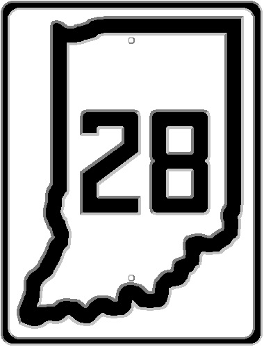
Today’s road trip covers a road that was planned from the very beginning to stretch from Illinois to Ohio. SR 28 though, at the time of the renumbering, was only in the state highway system in two sections: SR 1 (US 31) to Alexandria was SR 19; and from Muncie to Union City was SR 33. Today’s entry includes the maps of the authorized additions.
Nashville. The seat of government on Brown County. In 1926, with the revamping of the state highway system, it was served by one state road: SR 46. This road connected Bloomington to Columbus through the hilly south central Indiana county. In the early days, it was thought that all county seats should be served by at least two state roads, leaving Nashville a little short.
In the 1830s, a state road was created to connect Indianapolis to the Ohio River at Mauckport. This road would be called the Mauck’s Ferry, now Mauxferry, Road. It would leave the Madison State Road at Franklin, heading roughly due south. When SR 35 was created out of Corydon, the designation was given to a portion of the old Mauxferry Road.
When the state decided to extend SR 35 toward Indianapolis, they also decided to move that road to the west, not using the Mauxferry. This would take the road through Nashville, creating a second state highway to the town.
Most of the road south of Nashville was built roughly in the place where it is currently. From Nashville north, the current SR 135 (originally SR 35) was specifically built for the purpose, replacing the road that had been used to this point.
The original SR 35 would leave Nashville to the west, along Main Street and the Helmsburg Road. This would wind its way through the hills of Brown County to Helmsburg, on what is now SR 45. The state would then turn SR 35 along what is now SR 45 to connect to Bean Blossom and the SR 35 already built connecting to Morgantown. A few years later, the current SR 135 was built connecting Bean Blossom to Nashville, replacing the Helmsburg Road route.
Route map from the Indianapolis News, 11 April 1896, showing bicycling routes.
Today’s Bicycling Thursday I want to go back to the Indianapolis News of 11 April 1896, which covered routes west of Indianapolis, starting with the National Road. While the article mentions shorter routes that use other roads back to the city, I want to stick to what is now Washington Street.
The first part of the journey was pretty much straight forward: “starting from Meridian and Washington streets, the run is out Washington street, which is paved some distance west of White River.” Before this point, the crossing of the White River could be done using one of two bridges, with more information available at “Indianapolis: Washington Street & National Road Bridges.” “Beyond the pavement, to the point where the National Road proper begins, the street is badly cut up.” This would be the section from roughly the Belt Railway to Mount Jackson, mentioned later. It was also mentioned that, while the road was in bad shape, the “going is good in the center of the car track.” Keep in mind that the “car track” mentioned here is that of the street cars.
1889 map of Mount Jackson and Haughville along Washington St.
“The National road starts from Mount Jackson, three miles out, and runs off a little southwest.” The town of Mount Jackson stretched from what is now Belmont to Tibbs Avenues, south of Washington Street. (Haughville proper was along the same stretch, north of Washington Street.) At what is now Warman, the “Indiana Insane Hospital” property was located. This property would be later named Central State Hospital.
At the edge of the hospital property, “a dirt road running northwest, skirting Haughville and crossing the Osterman (10 Street from White River to the Danville State Road), Crawfordsville and Lafayette roads.” This is now Tibbs Avenue.
1889 map of the National Road from the Eagle Creek crossing west, also showing the original connection of the National and Rockville Roads.
After passing the hospital, the old road passes over Eagle Creek “on a good iron bridge, the approaches to which are easy.” It then crosses the Big Four railway, which at the time was an at-grade crossing. The road then turns more to the southwest. Here “there has been a liberal supply of fresh gravel distributed over the road for about one mile, but there is a hard path at the side.” Also, there are two dirt roads branching from the main road in this section. One goes to Maywood, which is now Tibbs Avenue south of Washington Street. The other is between Tibbs and the place where the original Rockville Road turned northwest from the National Road (that intersection is now where Holt Road meets Washington Street).
About a mile from Rockville Road, the old road crosses a toll road that is a continuation of Morris Street from Indianapolis (and has that name today), the Emma Hanck turnpike. “Six miles from the city is a grocery and blacksmith shop, which may be used to good advantage by unfortunates.” This is between Morris Street and High School Road, which was called the Forsha Turnpike, which connected the National Road to Ben Davis Post Office. At seven miles from the city, a “pleasant resting place for the first riders” at a big saw mill. A dirt road near this point, running north and south, could allow a rider wanting a short ride to connect back to the city via “half a dozen turnpikes running east and west.”
At a point 9.5 miles from the city, where the road passes through a small, well shaded village called Bridgeport. The road then continues over White Lick Creek and rumbles toward Plainfield over what was a recent installment of fresh gravel. Finally, before leaving Marion County, the rider will come across a “large nursery, with green and white buildings and storehouses, situated on the side of a hill” just at the edge of the county line.
In the early 20th Century, the state of Indiana, as with the rest of the United States, was undergoing a large number of consolidations of railroad companies, forming larger companies with, supposedly, economies of scale. In Indiana, this created a larger problem: competition. Due to its location, Indiana was always considered the “Crossroad of America.” Often, there were two railroads between two points. For instance, getting from Indianapolis to Chicago could be done using four direct railroads. And two of those routes, at the turn of the century, were controlled by the same company. Today, we discuss one of those routes that spread across the state and the eastern United States: Lake Erie & Western.
The Lake Erie & Western (LE&W) would be formed, as reported by the Interstate Commerce Commission, from multiple consolidations of 37 different companies. At the time of the ICC report, put together due to the need for the valuation of the many railroad companies taken over by the government in World War I. At the time of this report, the Lake Erie & Western was controlled, but not owned, by the New York Central. Getting back to the competition mentioned above, this created two routes from Indianapolis to Chicago controlled by that company. The other being the Cleveland, Cincinnati, Chicago & St. Louis, known as the Big Four.
The building of the separate parts of what became the LE&W occurred with just a few of the 37 separate parts. Today, I will covering each Indiana section in chronological order.
The first trackage that was completed would start in Indianapolis, heading to Peru. This was called the Peru & Indianapolis. For a short time in 1851, the company name would be the Madison, Peru & Indianapolis, as it was merged with the Madison & Indianapolis. That lasted nine months before a court reversed the merger at the behest of the shareholders of the P&I. The tracks were completed from Noblesville north to Peru in 1851, then south to Indianapolis in 1854. The company became the Indianapolis, Peru & Chicago on 11 March 1864. Foreclosure in 1887 led the company to become part of the Lake Erie & Western.
The Cincinnati, Peru & Chicago, created on 23 June 1853, built a line from Plymouth to LaPorte in 1855. This company would be sold at foreclosure to become the Chicago, Cincinnati & Louisville on 12 October 1866. This new company would continue the trackage from Plymouth to Peru in 1869. On 30 March 1887, it was sold at foreclosure to the Lake Erie & Western.
With a confusing genealogy, the Connersville & New Castle Junction, created 23 October 1863, finished the railroad line between the title cities in 1865. This company merged with the New Castle & Muncie to become the Cincinnati, Connersville & Muncie on 2 January 1868. That year, the rails were completed from New Castle to Muncie. The Fort Wayne, Muncie & Cincinnati Railway, created 3 October 1868 from the foreclosure of the Fort Wayne & Southern, built from Muncie to Fort Wayne a line that was complete in 1870. The Cincinnati, Connersville & Muncie and Fort Wayne, Muncie & Cincinnati Railway merged to become the Fort Wayne, Muncie & Cincinnati Railroad on 9 June 1869.
The New Castle & Rushville Rail Road was created on 4 December 1879. The line connected the title cities in 1881. This company merged with the successor of the Fort Wayne, Muncie & Cincinnati (the Fort Wayne, Cincinnati & Louisville) to become the second Fort Wayne, Cincinnati & Louisville on 11 November 1886. This company would be sold to the Lake Erie & Western, although it would maintain a separate existence until it was finally merged into the successor of the Lake Erie & Western, the Nickle Plate, in 1923.
On 4 June 1870, the state chartered the Michigan City and Indianapolis Railroad. This line connected Michigan City to LaPorte starting in 1871. This company was made into a cornerstone of the Lake Erie & Western on 8 April 1887.
The last line to become part of the Lake Erie & Western was the Lafayette, Muncie & Bloomington. This line built from Lafayette, with the line toward Bloomington, Illinois, completed in 1872, and the line to Muncie completed in 1876. This company would change its name to Lake Erie & Western Railway, the first of three companies with the exact same name. It was this company that completed the line from Muncie to Celina, Ohio, in 1879.
The LE&W Railway would become the LE&W Railroad on 8 April 1887. The LE&W would be controlled by the New York Central until 1920, when it was sold off to become the Nickle Plate.
Before there was an interstate 465, before SR 100, or even SR 534, there was a drivable loop road around the city of Indianapolis. Unlike I-465, and its 53 mile loop, this loop entailed 88 mile connection of already present roads, venturing closer to the county line than SR 100 or I-465. This loop was created by the Hoosier Motor Club (HMC), a part of the American Automobile Association (AAA). It was named after a prize Pomeranian belonging to M. E. Noblet, the then secretary-manager of the HMC. This would be the Dandy Trail.
The Dandy Trail was mapped and marked in the spring of 1920. The first tour of part of the route would be a drive of the northern section on 9 May 1920. The southern part would be traversed on 16 May 1920. (Source: Indianapolis News, 1 May 1920, pp 17) It should be noted here that the Dandy Trail was an Auto Trail, a named path put together by an organization, as opposed to a state road of any kind. As such, all signs and markings would be the responsibility of the Hoosier Motor Club, not any government agency. In the source article, there is a picture of the junction of the Dandy Trail and the Jackson Highway, which at the time used the Lafayette Road from Indianapolis to Lebanon. Another note here is that the Dandy Trail was marked along Lafayette Road from Traders Point (located at the crossing of Big Eagle Creek and Lafayette Road, at roughly what would be the equivalent of 75th Street) and 71st Street, the road to New Augusta.
Indianapolis News, 1 May 1920.
Starting in the northwestern part of Marion County, working clockwise around, the marked Dandy Trail would, at the time, connect Traders Point, New Augusta, Meridian Hills, Broad Ripple, Allisonville, Castleton, Fort Benjamin Harrison, Lawrence, Lanesville, Five Points, Southport, Glenn’s Valley, Antrim, Drexel Gardens, and Speedway. But, it has to be said that there was not a real straight connection between these points.
The routing is listed following. It should be noted that while the roads that are still in place can be followed, not all of the roads are in the same place. I will be posting some maps from MapIndy to show these changes.
Starting at Traders Point, the marked road would travel south along Lafayette Road, turning east on what is now 71st Street. It would stay on 71st Street and Westlane Road to Spring Mill Road. South on Spring Mill, crossing Kessler to become Illinois Street (before Kessler Boulevard was built, Illinois Street going north crossed the river and became immediately what is now Spring Mill Road). South on Illinois, the road turned east (more northeast, actually) onto Westfield Boulevard. It followed Westfield through Broad Ripple (where Westfield Blvd. became SR 1). The route then turned east on 80th Street, which turned into Union Chapel Road. Union Chapel, at the time, connected to 86th Street next to White River, on which Dandy Trail turned east. 86th turns into 82nd near that point, which is followed to Hague Road.
MayIndy 1941 image of the Dandy Trail along 80th Streets and Union Chapel Road with a dim current transportation overlay showing the location of current Keystone Avenue and other disruptions in the original route.
Turning north on Hague Road, the Dandy Trail then uses 86th Street again, heading east to Sargent Road. The route then followed this curvy road south to the Fall Creek Road. This is one place where Dandy Trail connected to Fort Benjamin Harrison. It skirted the northern edge of the fort while connecting to 56th Street. The trail then turned east on 56th Street, which it followed to the gated community of Brendonwood. While this area is not accessible today, Dandy Trail actually followed the arch that is Lawrence Avenue through Brendonwood. Upon returning to 56th Street, it followed that road onto Fort Benjamin Harrison before turning south on Shadeland Avenue.
MapIndy 1941 image showing the original path of Franklin Road from south of 16th Street to north of 21st Street.
South on Shadeland Avenue, the route turns east on 46th Street, which is followed to Franklin Road. South on Franklin Road (some of which no longer exists since the building of I-70) to Washington Street, east on Washington, then south on Post Road. Post Road south to Troy Avenue, west to Five Points Road, south to Hanna Avenue, west to Arlington Avenue, then south to Shelbyville Road. Shelbyville Road, after going northwest and west, turns into Thompson Road (historically, it was Shelbyville Road to what is now Carson Avenue). Just past Carson, the Dandy Trail turns south on McFarland Road, west on Southport, south on Meridian, west on Stop 11 (note – NOT what is now Meridian School). The historic Stop 11 Road (originally Frye Road) followed, as did the Dandy Trail, what is now Rahke Road between the two sections of Stop 11. This routing of Stop 11/Frye Road had been in place since at least 1855, according to maps. Again, the Dandy Trail followed Stop 11 west, Bluff Road southwest, Wicker Road west, Lake Road north, and Southport Road west to Mann Road. Southport Road had been, and still is, the southern most bridge over the White River in Marion County.
The Dandy Trail then turned north on Mann Road, west on Mooresville, north on Lynhurst, turning east on Vermont. Vermont Street used to have a bridge across Eagle Creek, which has since been removed. Grande Avenue was part of the old trail, but can be reached by turning north on Gasoline Alley. The Dandy Trail then followed Cossell Road and Winton Avenue to 16th Street, which at the time was both the Dixie Highway and the Crawfordsville Road. The Dandy Trail shared the road with the Dixie Highway from 16th and Winton, across 16th Street, Cunningham Road, and the old Crawfordsville Road (which ran south of the current Crawfordsville Road and the old Peoria & Eastern railroad tracks).
MapIndy 1941 image with the original path of the Dandy Trail marked, from Crawfordsville Road north to 38th Street. The current Dandy Trail curves around the original route from north of current 34th Street south to Crawfordsville Road, where it connects to Country Club Road.
From the next turn of the old road, to the chosen beginning point at Traders Point, the old route is very much missing in parts. Salt Lake Road, which is east of the road now called Dandy Trail, was followed north, where it crossed Eagle Creek, then turned east on 34th Street. It should be noted that this connection is long gone, so it is best to follow the route NOW called Dandy Trail, although it really has nothing to due with the old route in this section. The original Dandy Trail was moved, from 34th Street north, to the new route in many places, while some of the old road is used between 34th Street and Sailors Lane north of 46th Street. At what is now Sailors Lane, the road turned west and skirted Eagle Creek on the east bank until it reached 56th Street. At 56th Street, the route crossed Eagle Creek, then continued north to Lafayette Road.
Route of the Dandy Trail around 56th Street through what is now Eagle Creek Reservoir. The base photo is from 1941, courtesy of MapIndy.
Now, a shrewd map reader will notice that the described crossing of Eagle Creek is a bit on the wet side, now being in the middle of the Eagle Creek Reservoir. This is true from basically Sailors Lane north to near Hill Creek on the west side of the reservoir in Eagle Creek Park, where the old road becomes a walking trail before ending at a west running branch of the reservoir south of Wilson Road. The street name, Dandy Trail, still exists east of the intersection of Traders Lane and Wilson Road. It is now inside park property. But the road connected directly to the Lafayette Road across Eagle Creek from the intersection of Dandy Trail and Wilson Road. The travelers would then find themselves back in Traders Point…or at least the old town of Traders Point.
Route of the Dandy Trail from Lafayette Road/Wilson Road south through what is now Eagle Creek Park. The blue section is now Eagle Creek Reservoir. The base photo is from 1941, courtesy of MapIndy.
Other than the west leg from 46th north to Lafayette Road which probably still exists under the waters or the reservoir, the other sections that can’t be exactly driven are as follows (again clockwise from Traders Point): from Spring Mill Road to Illinois Street, which requires using Kessler Boulevard to cross White River; the Westfield Boulevard section from College Avenue to Winthrop Avenue in Broad Ripple gets a little dicey, although it may still be intact; Union Chapel Road from 80th Street to 86th Street (cut at Keystone Avenue and before reaching 86th Street); the section along 86th and 82nd Streets to Allisonville (covered as part of “82nd and 86th Street Before SR 534 (SR 100)” on 20 September 2019); Fall Creek Road from Shadeland Avenue to west of I-465 (here the old road is Fall Creek Road North from Shadeland to Boy Scout Road); the section mentioned above in Brendonwood; the original area of Shadeland Avenue at 56th Street (current under I-465); Franklin Road from north of 21st Street to south of 16th Street (shown in a map above); Troy Avenue at Franklin Road (detoured since I-74 was built to go right through that intersection); Hanna Avenue between Churchman Bypass and Arlington Avenue (again moved for I-465); the above mentioned Vermont Avenue bridge over Eagle Creek; old Crawfordsville Road from Cunningham Road to near Girls School Road; the section from Crawfordsville Road north to north of 34th Street; sections at 38th and 46th Streets (changed for traffic efficiency, since both these roads ended at the original Dandy Trail); and everything north of Sailors Lane.
In north central Indiana, where the Yellow River is crossed by the Michigan Road, is a town that, ultimately, would be connected directly to Indianapolis if three ways, connected directly to New York City and Chicago the other way, and would become a home on two major Auto Trails of the early 20th Century, although one would be a reroute. That town is the county seat of Marshall County, Plymouth.
A little history: Marshall County was organized by an act of the Indiana General Assembly on 4 February 1836, which became effective 1 April 1836. The territory that became part of Marshall County would take parts of St. Joseph County directly, with some of the county having been under the jurisdiction, legally, of St. Joseph and Elkhart Counties. Because the original law creating the county was actually put together on 7 February 1835, the actual law creating Marshall County, passed the following year, moved the Marshall-St. Joseph County line three miles north. As originally enacted, the county line was the dividing line between townships 34 and 35 north. The law a year later moved that line north to the center point of township 35 north. Commissioners appointed on 1 April 1836 decided on 20 July 1836 that Plymouth would be the center of government for Marshall County.
By this time, the area around Plymouth was already connected to the rest of the state when it came to transportation resources. Okay, well, sort of. The Michigan Road had been created and built through the central part of Marshall County, north to south. Both Fulton (Rochester) and Marshall Counties were created at the same time. The Michigan Road, as such, was a route connecting Logansport and South Bend, with nothing in between. Also, the center of the county would be surveyed different than the rest of the county and state. For more information about that, check out my post “Survey Lines and the Michigan Road,” published 6 August 2019.
Railroads would come to the area in three forms, two of which would ultimately fall under the Pennsylvania Railroad umbrella. The first would connect Plymouth to both Chicago and Pittsburgh, via Fort Wayne. This railroad would start life on 11 May 1852 as the Fort Wayne & Chicago Railroad. By 6 May 1856, when the railroad was consolidated with two other struggling railroads to create the Pittsburgh, Fort Wayne & Chicago (PFtW&C), only part of the route between Plymouth and Columbia City (45 miles) was partially completed. The PFtW&C would complete the route between Fort Wayne and Chicago in February 1858.
The second railroad that came to Plymouth would be what would become the Lake Erie & Western, and, in 1922, the Nickle Plate. The Cincinnati, Peru & Chicago Rail Way built a line south from LaPorte to end at Plymouth in 1855. Between 1863 and 1867, the Indianapolis, Rochester & Chicago Railroad began construction of the line connecting Peru and Plymouth. It was to be completed by the Chicago, Cincinnati & Louisville Railroad company in 1869. This company was sold at foreclosure and, along with the original Peru & Indianapolis (and its successors), formed the foundation of the Lake Erie & Western Railroad in 1887.
The last railroad to be completed to Plymouth was built by the Terre Haute & Logansport Railroad in 1883 and 1884. This was a line from Logansport to South Bend. In time, this line would become part of the St. Louis, Vandalia & Terre Haute Railroad company, also known as the Vandalia. Ultimately, it would become part of the Pennsylvania Railroad system, connecting the PRRs two major subsidiaries, the PFtW&C and the Pittsburgh, Cincinnati, Chicago & St. Louis Railway (aka the Panhandle), together at Plymouth.
Into the 20th Century, with the coming of the Auto Trails era, Plymouth found itself on multiples of these routes. First and foremost was the Michigan Road, which had been the catalyst for its location in the first place. The Dixie Highway, connecting Michigan to Florida, was also using the Michigan Road for its route from South Bend to Indianapolis. Also connecting those two cities was the Range Line Road, which separated from the Michigan Road at Rochester, with the Michigan Road heading towards Logansport, and the Range Line heading toward Peru.
East and west through the area gets to be a bit fun. Originally, the city was located on a road that connected Plymouth, Massachusetts, to Seattle, Washington, with a spot on the road in Wyoming that gave the route its name: the Yellowstone Trail. From the west, the Yellowstone would come into town along the Valparaiso-Plymouth State Road, then would share the Michigan Road/Dixie Highway/Range Line Road south out of town to what is now 12B Road, then headed east toward Bourbon. (Side note: there is a small jog in 12B road east of the current US 31, which is also an original part of Michigan Road. That jog is a remnant of the survey of the Michigan Road mentioned in the link above in the third paragraph.)
Now, because of the chronological order of things, the story of transportation in Plymouth moves to the Indiana State Highway era of 1917. Yes, 1917. Plymouth was one of the cities connected to the original original ISHC system when it was created in 1917. It is located on what was Main Market Road (MMR) 1. Because the law of 1917 was questioned under Constitutionality issues, it wouldn’t be until 1919 that the dust settled creating the ISHC that survives today as INDOT. MMR 1 would become Original SR 1. By 1920, another state road would connect to Plymouth, this time given the number 44. OSR 44 would follow the path of the Yellowstone Trail through the area. This would be changed to OSR 2 in 1923. OSR 2 was the original designation of the Lincoln Highway through Indiana. This will be important later. (Unless you have already looked at modern maps of the area and know the answer.)
When the Great Renumbering occurred on 1 October 1926, OSR 1 became US 31 and OSR 2 became US 30. It should also be noted that US 30 still didn’t leave Plymouth to the east. US 30 followed US 31 south to, again, what is now 12B Road. But the plans were in place to change this. The road that was being constructed to change the route of US 30, at least the first time, is currently called “Lincoln Highway.” Now, it wasn’t entirely officially the Lincoln Highway…not yet anyway. The Lincoln Highway Association set up two routes in Indiana. The first route, established in 1913, went through South Bend. The second route would more or less follow US 30 across the state (and into Ohio and Pennsylvania). This would be made official in 1928 (after the Great Renumbering).
The reroute of US 30 had been completed by 1929 (maybe earlier, still looking at sources that are hard to find). This reroute would straighten US 30 quite a bit between close to Wanatah to Warsaw.
Changes after that, as far as roads go, are these: the coming of SR 17 to the city in 1935; the US 31 bypass (and the naming of US 31A through town) in 1963; the building of the US 30 bypass north of town (while still maintaining US 30 through town) in 1965; and the removal of US 31A and US 30 through Plymouth in 1968. At the time of the removal of US 31A, SR 17 was continued along the route of the old US 31 (and its numerous names I won’t repeat) to the junction with the US 30 bypass.
The Vandalia line connecting Terre Haute and South Bend would also go away in time. Most of the Plymouth section would be officially abandoned by Conrail in 1984. The Nickle Plate line, or at least the tracks, are still in place connecting to Rochester, and for a short distance northwest out of town. Even the PFtW&C, which had been one of the most profitable lines, and home of one of its crack passenger trains (Broadway Limited between Chicago and New York), under the Pennsylvania Railroad umbrella, has been sold by the Norfolk Southern to another company.
Today’s Road Trip, US 27. Indiana, in the beginning, only had three north-south US routes: US 27, US 31 and US 41. Part of this is simply the fact that Indiana is a lot taller than it is wide. The first one, US 27, skirted the eastern edge of the state. Today, US 27 has been decommissioned above Fort Wayne. That was a long time coming, since INDOT and MDOT (the Michigan counterpart) had agreed to move US 27 to multiplex with I-69.
Around the time of World War II, the state of Indiana decided that it was time to finally start building a belt highway around Indianapolis. The decision was made that the new state highway, named SR 534, would use an old county road that would later become known as 82nd Street and 86th Street. (For information about SR 100, check out “SR 100: How did it come to be?,” published 9 March 2019.) But a question that comes up on a regular basis is why 86th and 82nd Streets are connected they way they are? Was it the state that changed this? That answer is, no.
1875 map of northern Marion County, showing what is now the 86th and 82nd Street corridor.
By 1855 (and still into 1875, as shown above), there was a road built connecting Nora, at the Westfield State Road (later the Range Line Road) and Castleton at the Lake Erie & Western railroad, through Allisonville. This road would start, on the west, on a survey line (one that is one mile south of the Hamilton-Marion County line) at Nora. The road at the east end of this section would be placed on the half section line (1/2 mile south of the section line that would run through Nora). A quick look at the map above will show that the survey line east out of Nora would cross the White River in three places, if the road was put in that place.
1889 map of Nora.
The bridge that was put into place would skirt the White River, which was standard operating procedure at the time. Early state roads, those built by the state originally but turned over to the counties as they were completed, would, as a general rule, be built in as simple and inexpensive way as possible. A road didn’t have to be straight if geography didn’t allow it to be easily done. Such is the case with this section of the 86th/82nd Street corridor. Also, bridges at the time were built to cross rivers at a right angle, making them easier and cheaper to build. This route also had the additional consequence of making Castleton the bigger of two towns along the Lake Erie & Western. The other town, which pretty much floundered, and disappeared, was Vertland. Vertland was located on the survey line that would become 86th Street at the LE&W tracks.
At Nora, as shown in the 1889 map above, the town consisted of two roads, one of which is now 86th Street and the other was the state road connecting Indianapolis to Westfield and Kokomo (Westfield Boulevard/Range Line Road). This latter road would be the original State Road 1/original US 31.
1889 map of Allisonville.
At Allisonville, the road would rumble through town along what is now the 82nd Street corridor. The other major road through the town, at the time of this 1889 map of the town, was a toll road called the Allisonville Pike. This road started life as the state road that connected Indianapolis to Fort Wayne through Noblesville, Marion and Huntington. There was a toll gate south of what is now 82nd Street on Allisonville Road, clearly shown in the map snippet. Allisonville contained three small streets. Due to commercial development in the area, what was the town of Allisonville was basically just removed from maps.
The Allisonville Pike was one of the few old state roads that wasn’t immediately accepted into the state highway system between 1919 and 1926. As a matter of fact, it wouldn’t be until around 1930 when this road became part of the highway system as SR 13. Later, it would become SR 37.
1889 map of Castleton.
At Castleton, the 82nd Street corridor was, in 1889, called “State Road.” This is typical of Indiana street naming conventions. In most places, if the name of the street includes the word “State,” for instance State Road, State Street or State Avenue, it generally means that it was, at one point, an original state road from the 19th Century. (Indianapolis’ State Avenue does not fit this rule, one of the few exceptions in Indiana.) The 1889 map of Castleton shows this.
By the time the state decided to add this corridor to the state highway system, the curvy road was still in place. The following MapIndy images show the corridor in 1941. The Indiana State Highway Commission decided that, if they were to turn this into SR 534, it would need to straighten out the corridor. Work started on this project, and one that would continue Shadeland Avenue from south of Fall Creek (at 56th Street and Fort Benjamin Harrison) to connect to this corridor. When completed, this would be a two lane “highway,” first connecting Nora to Fort Harrison. Along the way, due to traffic volumes, it would be expanded to four (or more) lanes. This would be before I-465 was built to replace this state highway.
MapIndy 1941 aerial photo showing the original 86th Street corridor as it approached White River near what is now Keystone At The Crossing. The faint red line running through the center of the snippet is the current 86th Street, showing that it was straightened and the bridge moved.MapIndy 1941 aerial photo showing the original 82nd Street corridor as it approached White River near what is now Keystone At The Crossing. The faint red line running through the center of the snippet is the current 82nd Street, showing that it was straightened and the bridge moved. This snippet ends just west of Allisonville, since the road was straight from the right edge of the snippet to Castleton.
Indianapolis News, 09 May 1896, map showing “the Crawfordsville Route.” It should be noted that the “PCC&StL” notations on this map along the railroad tracks from Indianapolis to Danville and Indianapolis to Crawfordsville should read “CCC&StL,” as these are Big Four (NYC) tracks, not Panhandle (PRR) tracks.
Keeping with the Indianapolis News articles about bicycling routes from the city, today we focus on the Crawfordsville Pike, from the News of 09 May 1896. For starters, the Crawfordsville Road was built in the 1820s as the Indianapolis-Crawfordsville Road. It wasn’t the straight route that exists today. Marion County’s section was covered here. Outside Marion County, what became the Peoria & Eastern/Big Four/New York Central was built to dart back and forth across the original road. This was typical of railroad companies at the time, since road travel was sketchy most of the time.
Editor’s note: For those unfamiliar with the work “pike” in this context, here goes. “Pike” is a shortened version of the word “turnpike,” which was a term used to describe a toll road. At points where a toll was to be paid, a large stick, or pike, was put across the road. Once the toll was paid, the toll collector would turn the pike, or move it out of the way for passage.
The bicycle route recommends following, from the Circle, Illinois north to Indiana, Indiana out to Michigan, and Michigan Street out to Haughville. “At the second street beyond the river bridge” the rider should turn north. This is now Belmont Avenue. Belmont took the rider to, and along side, the White River. At the time, the White River Parkway did not exist. Continuing north meant meeting the junction of the Crawfordsville and Lafayette Roads at what is now 16th and Lafayette, although the connection was moved south to allow replacement of the intersection in the 1950s. (Being the parts of US 52 and US 136 at the time, the state made the decision to revamp the area.) The area is shown on the map below. Best described in the News, the bicyclist should “turn and go to a point where the road forks, one branch running north and one west. The west fork is the Crawfordsville pike.”
1889 Map of the area of what is now 16th Street and Lafayette Road. Grandview Street at the bottom of the snippet is 10th Street today. Crawfordsville Gravel Road is 16th Street. The city limits line on the right runs through Belmont Avenue. The bridge over White River, called the Emricksville Bridge, connected the old Crawfordsville/Lafayette Road to downtown to the same roads west of the river. That bridge was named after owners of the land in the area. Image courtesy of the Indiana State Library Digital Collection.
From here, the original road followed what is now 16th Street out to Cunningham Road northwest to (just shy) of what is now Crawfordsville Road. From this point, the old road “runs close to the Peoria & Eastern tracks most of the distance to Brownsburg, passing through Clermont and crossing the tracks twice. This stretch of road is almost level. There are only two small hills.” After Brownsburg, the road is level to Pittsboro. “Any lover of beautiful scenery who is the happy possessor of a camera would do well to take the extra trouble” to bring that camera along.
This changed once past Pittsboro. “From Pittsboro the road is devoid of unusual features, with the exception of a rather long hill about a mile and a half before reaching Lizton.” The writer of this article actually had some advice about this particular hill. “A little caution should be observed in taking this hill, and none but those having accident policies, with all premiums paid, should attempt coasting.” I guess that’s subtle.
1909 map of northern Hendricks County showing the route of the Crawfordsville Pike from Brownsburg to the county line northwest of Lizton. Snippet courtesy of the Indiana State Library Digital Collection.
Here’s where a little historic research is needed. The News states that “the railroad is again crossed before reaching Lizton. From this town the road leads north about three-quarters of a mile, then forks. The west fork should be taken.” According to maps of the era, like the 1909 shown above, the railroad crossover is west of Lizton by one mile. And that crossover is just about 1/2 mile north of the turn in the road. The road then follows closely the railroad on the north side of the tracks. This continues to just before the Boone-Hendricks County Line southeast of Jamestown.
The road crosses back over to the south side of the P&E tracks before leaving Hendricks County. After Jamestown, the road gets “more hilly.” It is also stated that if you have your camera, “at Raccoon creek the camera ‘fiend’ may again find scenery worthy of his instrument.” Before entering Montgomery County, southeast of New Ross, the road once again crosses the railroad tracks. The road here is still in place, with the exception of the bridge over the Big Raccoon Creek. The described trip uses what is now State Street entering New Ross, and follows that street, and the county road continuing from there, to the current US 136. All this time, the road is north of the P&E tracks.
From New Ross to Crawfordsville the route curved quite a bit, before entering the Montgomery County seat. “Crawfordsville is quite a bicycle town, and contains many riders. The wheelmen make it a point to be very courteous to visiting riders.”
A big goal in the early days of bicycling is called “the Century,” a 100 mile trip in one day. The article goes on to mention that following the Crawfordsville Pike from Indianapolis to Crawfordsville and back “will give the rider almost a century.” The article also mentions a more hilly route back to Indianapolis via the Rockville road, which “will make a ride of 110 miles.”
When the final interurban was abandoned in 1941, one would have thought that, with the removal of all the rails and other facilities, any real traces of the old traction lines would have disappeared from the face of Marion County. But there are traces of these old routes. They exist in property lines that, for some reason, didn’t completely disappear. Today, I want to focus on some of these. In addition, there is at least one place in Marion County where, while it may not be directly related to the interurban, it does give a clue of what might have been.
1937 MapIndy aerial image of Acton, Indiana, in southeastern Marion County. Running from upper left corner to lower right corner is the New York Central (Big Four) Railroad through the town. Branching off to the east in the upper left, and then curving to the southeast in the lower right, is the line of the interurban through the town, which ran along Swails Street.
Acton. The interurban that ran from Indianapolis toward Shelbyville and Greensburg connected to this small village in the southeast corner of the county. The above 1937 photo shows the right-of-way still in place. It is clearly visible running through Acton after it left the right-of-way of the New York Central trackage that ran through the town. Once in town, it ran through the middle of Swails Street, which is typical of interurban lines at the time. The companies would get permission to actually run through town, instead of the possibility of bypassing it by following the steam railroad right-of-way. The two below Google Maps images show the property lines that are still in tact of that route.
Google Maps image of Acton, Indiana, at the west end of the old interurban cutoff into town. Image snipped 16 September 2019.Google Maps image of Acton, Indiana, at the east end of the old interurban cutoff into town. Image snipped 16 September 2019.
While the property had been sold to private parties after abandonment, for some reason, those property lines continued. Some of the adjacent properties were too small to do anything with. But once the right-of-way was disposed of, it didn’t take long for people to use two, or more, lots to build homes and other buildings that a few years earlier would have had interurban railroad tracks running through them.
Another old interurban right-of-way, not marked with property lines today, that was on the way to Acton was at Hickory Road. The interurban ran down the west side of Hickory Road. Before reaching the Big Four line, it crossed over Hickory Road in an arc to connect to the Big Four right-of-way. One thing that makes this site interesting is the fact that the property along the old traction line is now owned by the Indianapolis Power and Light Company, the local electric utility, as a substation. It makes one wonder if there was a power substation at that location providing power for the interurban line. Given the resolution of the 1937 image, it is hard to tell if there is a power generation station or just a house in that area at the time.
1937 MapIndy aerial image showing the interurban turn to the southeast at Hickory Road and the Big Four Railway. The red area shows the current property lines of the parcel, as well as the Indianapolis-Marion County property information available for that property.
On the west side of Indianapolis, around the area that the current Rockville Road separates from Washington Street, was the Danville line of the Terre Haute, Indianapolis & Eastern Traction Company. As shown in the below images, one from 1937, and two current Google Maps, the line is clearly visible in both the right-of-way, and the property lines. 1937 would have been right around the time of abandonment of this money losing line for the Indiana Railroad, the purchaser of the THI&E in 1930.
1937 MapIndy image of the Danville line of the Indiana Railroad, branching from (new) Rockville Road on the west and Washington Street on the east. This image also shows the new Washington Street bridge over Little Eagle Creek arcing away from the original structure, creating, as well, a new junction with (new) Rockville Road.Google Map image of the west end of the Indiana Railroad property lines from (new) Rockville Road east. Image snipped 16 September 2019.Google Map image of the west end of the Indiana Railroad property lines from Washington Street west. Image snipped 16 September 2019.
1937 MayIndy aerial photo of the Indiana Railroad traction line through what is now the grounds of both the Indianapolis Museum of Art and the International School near White River and Michigan Road.
The last area of the city that shows current property lines of old interurban routes, that I want to cover today, is the area of the Indianapolis Museum of Art and the International School on both sides of White River near Michigan Road. This line connected Indianapolis to Lebanon, and from there to Crawfordsville, Frankfort and Lafayette. A glance of Google Maps, in close up view, anywhere along Michigan Road from this point north shows multiple property lines that show the route of this traction line. (Here are four links to Google Maps that show what I am writing about: Here. Here. Here. Here.) The property lines across the IMA and International School are not available on Google Maps. But they are available on the MapIndy site, as shown in the images below.
MapIndy property line map of the area occupied by the current Indianapolis Museum of Art.
MapIndy image showing property lines in the area occupied by the current International School.
These are a few of the places that still hold a place in Indianapolis interurban history that, even though the infrastructure has been removed for many decades, still show where they were located. Other areas that still kind of exist are places where the old right-of-ways were paved over to expand roads (for instance, when old SR 431 [Madison Avenue] on the southside was expanded in the mid-1950s, the southbound lanes would use the old Greenwood line ROW from Shelby Street to Southport. There, the traction line crossed over the Madison Road to the east side of the road, to be replaced with the northbound lanes.) If you are interested in seeing more of these locations, in a 1937 context, I recommend checking out MapIndy, turning on the aerial photos of 1937 and turning down the current overlay. The 1937 photo is not complete, but it is a very good resource. MapIndy also has 1941 and 1956 aerials, just to name a few.
Before 1968, the second largest railroad company in Indiana was the New York Central. To most people that know railroads, especially in the Indianapolis area, know the New York Central from its 1930 acquisition of the Cleveland, Cincinnati, Chicago & St. Louis (Big Four), and the Peoria & Eastern (leased by the Big Four, but separate…at least heading west out of Indianapolis). The Big Four, covered here, covered a very large territory in Indiana. For all intents and purposes, Indianapolis was the center of that railway company. Six rail lines radiated from the Hoosier capital. But the New York Central itself had very extensive holdings in Indiana prior to 1930.
It is important to realize that the New York Central (NYC) itself was a consolidation of many railroads that officially came into being on 23 December 1914. That is the creation date of the corporation that, on 1 February 1968, became the “junior partner” in the merger with the Pennsylvania Railroad that became known as Penn Central. This is not to say that the NYC didn’t exist prior to that. The base part of the NYC, also called the New York Central, came into existence in 1853. But from 1 November 1869 to 23 December 1914, it was officially the “New York Central and Hudson River Railroad.” The NYC of 1914, and its constituent Indiana parts, are the primary focus of this post. The information included here comes from the ICC Valuation Reports Wiki of the NYC. To put it into perspective, this report shows 190 corporate entities that created the New York Central in 1914. This does not include railroads later added to the NYC along the way (that includes the Big Four).
Across northern Indiana, connecting Chicago to Detroit (among other places), was the Lake Shore and Michigan Southern (LS&MS) Railway. Entering Indiana along Lake Michigan from Chicago, the line crossed Lake, Porter and La Porte Counties before rumbling into St. Joseph County and South Bend itself. From there, line headed toward Elkhart, where the LS&MS split into two, one heading toward Michigan via Vistula, the other crossing Elkhart, Kosciusko, Noble and De Kalb counties before entering Ohio east of Butler, running along side what is now US 6.
The LS&MS that was part of the consolidation that created the NYC became a corporate entity of its own on 16 August 1869, with some of the constituent rail lines having articles of consolidation in Indiana as far back as 6 February 1835. This is the date of the creation of the Buffalo & Mississippi Rail Road company. The name was changed on 6 February 1837 to the Northern Indiana Rail Road company. Two companies of the same name (one in Indiana, one in Ohio) consolidated on 30 June 1853 to form a new company, of the same name. By this time, lines had been constructed between the Indiana-Michigan state line to South Bend (nearly 30 miles, 1851), between South Bend and the Illinois-Indiana state line (71.5 miles, 1852) and from Elkhart to Goshen (10.2 miles, 1852). The new company of 1853, its successor of, again, the same name, then its successor, the Michigan Southern and Northern Indiana Rail Road (created 19 May 1855) completed the line from Toledo to Goshen (122 miles) in 1857. This last company would consolidate with the Lake Shore & Michigan Southern Railway to create the LS&MS that would form part of the NYC.
Although there were predecessor companies, the Indiana, Illinois & Iowa (III) Railway of the State of Indiana came into being through consolidations on 9 January 1893. This company would build, in 1894, two lines: Knox to South Bend (33.4 miles) and a Michigan Central connecting branch at South Bend (2 miles). On 15 September 1898, the III of Indiana was consolidated with another company, just called the Indiana, Illinois and Iowa Railroad to form, again, the Indiana, Illinois and Iowa Railroad.
The Indiana Harbor Railroad Company was formed under the general laws of Indiana on 23 November 1901. This company built 100.8 miles of track in two sections: Indiana Harbor to Osborn, and Osborn to the Illinois-Indiana state line. The III and the Indiana Harbor were consolidated on 9 April 1906 to form the Chicago, Indiana and Southern Railroad Company. This would be another company that would be consolidated on 23 December 1914 to form the New York Central.
Two other companies became part of the New York Central during the period covered by the ICC Valuation reports (these were done for valuating the railroads that were taken over by the US Government during World War I). One started life as the Elkhart & Western Railroad Company on 5 June 1888. Although the date of the construction was not known, that company built a 12.1 mile line from Elkhart to Mishawaka. The other was the Canada & St. Louis Railway (formed through consolidation of the Indiana & Southwestern Railway and the Sturgis & State Line Railway on 17 November 1887). The Canada & St. Louis was sold at foreclosure, and reorganized as the Sturgis, Goshen & St. Louis Railway. Both of these companies were sold to the New York Central on 11 June 1915.
It should be noted that at the time of the ICC report, the New York Central consisted of a total of 3,718.73 miles of railroad lines (not including sidings and more than single track areas). The Big Four at that point consisted of 1687 miles. In addition to the Big Four, another Indiana property that would become, eventually, part of the NYC was the Michigan Central, which connected extreme southwestern Michigan to Chicago through LaPorte, Porter and Lake Counties, and a line that ran due north from South Bend to Three Rivers, Michigan.
Situated near the head of navigable waters on the Wabash River, the town of Lafayette was founded in 1825. At that location, it became an important transportation hub in north central Indiana. As the county seat of Tippecanoe County, it became the confluence of several early state roads and railroads, and a place on the Wabash and Erie Canal. Today, it still maintains that position, albeit with a bit of moving things around for efficiency.
A little history. Tippecanoe County was created from parts of the unorganized Wabash County (which at the time encompassed almost all territory in the state west of the second principal meridian) on 20 January 1826, effective 1 March 1826. Part of this territory had already been, jurisdictionally, part of Parke County. Part of the county’s territory wasn’t ceded to the state until October 1826. Lafayette, platted in May 1825, was made the county seat at the same time. Tippecanoe County is among the very few counties that have not had any territorial changes since its time of creation, with the exception of some unorganized territory jurisdiction until those areas were incorporated into counties of their own.
Other than river travel along the Wabash, the first transportation facilities built into the town were state roads from assorted places in Indiana. These included the Crawfordsville Road (now roughly US 231), the Noblesville Road (roughly SR 38) and the Indianapolis Road (roughly US 52). The original junction of the last two was on the SR 38 side of what is now Tippecanoe Mall. This can be seen in the Google Map image below by the property lines that remain.
Google Map image of the area of the original area of the junction of the Noblesville-Lafayette and Indianapolis-Lafayette state roads. The property lines diagonally from left of center bottom to the northwest show the location of the original Indianapolis road. Image snipped 14 September 2019.
The next facility built that connected to Lafayette would be the Wabash and Erie Canal, finished to the town in the 1840s, although the canal would actually be across the river from the town (through what is now West Lafayette). This canal would allow traffic from Lake Erie, at Toledo, to connect to the Ohio River, via the Wabash and White Rivers, at Evansville. The Wabash and Erie would end up being the longest canal built in the United States, a total of 497 miles. The canal itself competed with another canal from Toledo, connecting to Cincinnati. It connected to Lafayette in 1843. It would be the premium transportation facility to the town for less than a decade. It would be superseded by the railroad, even though canal traffic would continue for decades.
Three years after the coming of the canal, on 19 January 1846, the state of Indiana incorporated the Lafayette & Indianapolis (L&I) Railroad company. This was the most successful attempt at creating a railroad to connect the two cities. The first was an addition to the Madison & Indianapolis to connect to the town. Later laws allowed for this addition to be either a railroad, or if more financially efficient, a road to connect Lafayette to the Hoosier capitol town. (Indianapolis was legally a town until October 1847.) The original plan was to connect Indianapolis, via Crawfordsville, to Lafayette.
The L&I finished construction, on a more direct route, in 1852. On 14 February 1867, the L&I merged with the Indianapolis & Cincinnati Railroad to form the Indianapolis, Cincinnati & Lafayette Railway. That, in turn, was reorganized on 10 July 1873 to become the Indianapolis, Cincinnati & Lafayette (IC&L) Railroad. This version of the IC&L would be sold at foreclosure on 2 February 1880, becoming part of the Cincinnati, Indianapolis, St. Louis & Chicago (CISTL&C) Railway on 6 March 1880. This, in turn, would be consolidated into the new Cleveland, Cincinnati, Chicago & St. Louis Railway, better known as the “Big Four,” on 1 Jul 1889. The Big Four would have strong connections with the New York Central system, although it was technically its own company, starting in 1906. By 1930, the Big Four was merged into the NYC, ending its separate existence.
Between 1846 and 1852, a new railroad would be built from the south, starting in Crawfordsville, to connect to Lafayette. While this sounds like the original plan for the Madison, Indianapolis & Lafayette mentioned above, it wasn’t that company that had anything to do with it. Incorporated on 19 January 1846, the Crawfordsville & Wabash Railroad was created to build north from the title town. The 28 miles to Lafayette were finished in 1852, just in time for the C&W to be sold to the New Albany & Salem Rail Road company. This would become part of the ultimate line idea to connect New Albany to Chicago and Michigan City. Seven years later, the company would change its name to better show off its size: Louisville, New Albany & Chicago. This company went from being a (legally) railroad (24 October 1859), to a railway (7 January 1873), to a consolidated railway (10 August 1881), all while keeping the same base name. The last consolidation would include the Chicago & Indianapolis Airline Railway (“airline” in this context means the fastest and most direct route allowed for a railroad). Another name change in the company formed the Chicago, Indianapolis & Louisville Railway. It wouldn’t be until 1956 when the name changed to the nickname the line had for many years during the CI&L period: Monon. The line is now part of CSX, like the old New York Central line mentioned above.
The next railroad to reach Lafayette would become the Wabash Railroad. Like the Wabash and Erie Canal, the railroad would connect Lafayette to Toledo. To the west, the line continued toward Danville, Illinois, through Attica. The original company to build the line was the Wabash & Western Railway, incorporated in Indiana on 27 September 1858. After several consolidations, and bankruptcies, the line would come under the umbrella of the nearly 2000 mile Wabash system.
On 13 July 1869, the Lafayette, Muncie & Bloomington (LM&B) Railroad was incorporated in Indiana to connect the title cities (Bloomington being in Illinois). Construction on the line started shortly after the incorporation was passed into law. It would start at Bloomington, Illinois, headed toward Lafayette. From there, it would traverse the Indiana countryside through Frankfort to its terminus at Muncie. The line was completed, for a total of just shy of 36 miles, to Lafayette from the Illinois-Indiana state line in 1872. The other 85 miles, to Muncie, was completed in 1876. The LM&B would not last long as a separate entity after its completion, being purchased by the Lake Erie & Western (LE&W) on 28 April 1879. 1879 was the year that several lines were purchased to create the overall LE&W. The railroad itself would find itself controlled by the New York Central from 1900 to 1922, when it was sold to the New York, Chicago & St. Louis Railroad, better known as the Nickel Plate.
These two railroads would become part of the Norfolk & Western (N&W) Railway on 16 October 1964, but in different ways. The Nickel Plate became part of the N&W flat out, via merger. Technically, the Nickel Plate ceased to exist that day. The Wabash, however, was leased by the N&W. As such, the Wabash maintained a more separate existence even through the N&W/Southern merger creating the Norfolk Southern (NS). The Wabash still existed, on paper at least, until the NS finally absorbed, in merger form, the Wabash in November 1991. Stock in the company would be traded until that time.
In 1902, a new form of transportation was aiming to come to the city. The Fort Wayne, Logansport & Lafayette Traction Company was trying to get the tow path from the (at that time) old Wabash and Erie Canal “from the west line of High street in Logansport westward to the county line” condemned for use as the right-of-way for the new interurban line. This was, as reported in the Indianapolis Journal of 27 August 1902, because the company claimed that the right-of-way was “necessary to construct its line in, through and between the cities of Fort Wayne, Huntington, Wabash, Peru, Logansport, Delphi and Lafayette.” The defendants in this action were the owners of property along that tow path. Another suit, involving the same company, sought the same action for the entire tow path, 39 miles, from Lafayette to Logansport. This would culminate in the Fort Wayne Journal-Gazette (14 December 1902) headline “The Fort Wayne, and Lafayette Traction Company Can Have Tow Path if it Pays the Price.” The value of the land between Logansport and Lafayette was determined to be $38,750.80.
Another line entering Lafayette was built from Indianapolis. By 27 June 1903 (Indianapolis Journal), the Indianapolis & Northern Traction Company, building a line from Indianapolis along the Michigan Road, through Zionsville, Whitestown and Lebanon (roughly following the Big Four Lafayette Line), then through Frankfort to Lafayette was two miles away from the city. This line would become part of the Terre Haute, Indianapolis & Eastern Traction Company, owners of a large number of the routes leaving Indianapolis. In 1930, this line was purchased by Midland Utilities, and consolidated into the Indiana Railroad (1930). After this purchase, the line wouldn’t last long before it was abandoned due to profitability issues.
With the (second) creation of the Indiana State Highway Commission in 1919, Lafayette would be connected to the state highway system using state roads 29 and 32. State road 29 started in Boswell, connecting Oxford, Otterbein, West Lafayette, Lafayette, and Russiaville, ending at the Range Line Road, then SR 1 (now US 31) south of Kokomo. State road 32 started in Lafayette, connecting to Bloomington via Crawfordsville, Greencastle, Cloverdale and Spencer. State road 29 west of Lafayette would become US 52 and SR 22 in 1926. East of Lafayette, the number would be changed from 29 to 26. State road 32 would become part of SR 43. This would change with the addition of US 231 to Indiana, removing the SR 43 designation in favor of the new US route number, in 1951.
With the Great Renumbering, more state roads were added to, or authorized to be added to, the city of Lafayette. US 52 would follow the old Indianapolis state road to that city. Northwest out of Lafayette, there were already plans in place to move the newly designated US 52. Northeast out of town, a new state road was authorized to be built to Delphi. This was to be designated SR 25. Also authorized was an extension to SR 43 north from the city, ultimately connecting to Michigan City. In the years to follow, Lafayette would also be connected to SR 25 to the southwest and SR 26 to the west. The number 43 would remain north of town, as the new US 231 would follow US 52 and then replace SR 53 north from Montmorenci. The last state road to head toward the city would be SR 38, which roughly followed the original state road from Noblesville.
Many changes in transportation facilities have occurred in Lafayette since the creation of all those mentioned above. US 52 and US 231 have been rerouted around the city. The railroads have consolidated routes for efficiency through downtown. Lafayette is served by both of the major railroad companies in the eastern United States: CSX and NS. Prior to 1999, it was actually served by all three. The third being Conrail. Lafayette still serves as the transportation hub in the area.
Today’s trip back to 1926 covers SR 26, a route that connected US 31 south of Kokomo to Lafayette. Much of the original SR 26 still maintains that designation. This makes it one of the few highways in Indiana (mostly) unchanged from its commissioning to present day.
In the early days of the Auto Trails, one of the earliest organizations created was the “National Old Trails” road (NOTR). Through Indiana, this route mainly used the National Road, built by the federal government, at least in Indiana, in the 1830s. That route crossed the state from west of Terre Haute to east of Richmond. At Richmond, the original road crossed into Ohio on a straight line heading for Springfield and Columbus.
Google Maps image showing the current US 40 and surrounding area east of Richmond. Snippet taken 10 September 2019.
By the time the NOTR, the organization decided that the new Auto Trail would head toward Dayton, as opposed to directly to Springfield. Part of this was the fact that the Eaton Pike, the trail that connected Richmond to Dayton, was in much better shape than the old National Road. There have been some reports that the National Road, coming from the west, actually ended at the Indiana-Ohio State line, with the Indiana section having pretty much reverted to being a private farm field.
1910 USPS map of rural delivery mail routes east of Richmond. This map shows, or more to the point doesn’t show, the missing section of the original National Road that was replaced by the road connecting to Eaton and Dayton.
But the Indiana State Highway Commission decided early on that old road be restored. With the Great Renumbering, the US 40 designation was applied to the original route of the National Road, not the NOTR route. That route, over what is still called “Old National Road,” became SR 11. This number was assigned since it was the number that the Ohio transportation officials gave to it as it rumbled its way toward Eaton and Dayton.
It is important to note that the old National Road wasn’t entirely a straight route from Richmond to Springfield. A large hill at a point 1.5 miles west of the state line caused the old road to curve in a large arc around said hill. More on that later.
Another change was to occur in 1931. When the original roads were added to the state highway system, there were two crossings of the Pennsylvania Railroad that turns south in eastern Wayne County. These crossings were at both US 40 and SR 11. As paving of US 40 started across the state, a project was to pave the last 2.5 miles of the National Road at the east end of the state. This project included a new bridge to be built by the ISHC under the Pennsylvania Railroad. This would also require a reroute of SR 11, as well. This removed the “Old National Road” crossing of the tracks. This reroute of SR 11 would have the Eaton Pike connect to US 40 one half mile west of the state line instead of 1.5 miles, cutting one mile from state maintenance.
This old route, including the arc around the hill, would still be in place in 1935, as shown on the map below. 1935 would be the year that the American Association of State Highway Officials (AASHO) would extend US 35 across Ohio and Indiana, replacing SR 11 in both Indiana and Ohio. In both states, the number 11 would be reused. In Indiana, it replaced SR 33 in southern Indiana in the 1930s. In Ohio, it would be 30 years later.
1935 map of Wayne County, Indiana, showing the routes of US 40 and US 35 east of Richmond.
1947 saw the last big change in US 40 east of Richmond with the expansion of the road to a four lane highway. This would also require a rebuild of the PRR bridge that was put in place 35 years earlier. This would also see the removal of the great arc that is now Woodside Drive from the state highway system. One can look at the right-of-way space on Woodside Drive to tell that it was once part of the old road. It is shown on this Google Map link. And the old right-of-way connecting to US 40 on the west end is shown here.
In April 1896, as part of the Indianapolis News series of articles concerning bicycle routes from Indianapolis, it is pointed out that “the trip to Noblesville seems to be a favorite ride for Indianapolis wheelmen this season.” The route is listed as being in fine condition, as long as you don’t completely follow the Allisonville Pike.
At the time, the Allisonville Pike was a rerouted version of the original Indianapolis-Fort Wayne state road, at least through most of the city itself. The original road used Central Avenue to Sutherland Avenue, winding its way to the old 39th Street bridge across Fall Creek to follow Fall Creek and Allisonville Road north through the county. The reroute went straight up Central Avenue to Maple Road (now 38th Street), then follows Fall Creek to connect at the 39th Street bridge with the original route.
The conditions of the road to Noblesville were kept in very good shape over the years. It was a very popular route. “There are some fairly stiff hills on the route, but they are all fit for coasting, an the riders can afford to do a little turn on foot after the exhilarating effect of a mile a minute a clip down a steep grade.”
The newspaper article mentions three methods of reaching what is, now, Allisonville Road. First, the paper points out that while the road is in excellent shape, the section of Central Avenue above Fall Creek is not. Which leads to the second point, which is the recommendation to use Meridian Street north to Maple Road, then east to the State Fairgrounds. The third point is that another popular way to get to the Allisonville Road is to follow College Avenue north then skirting Fall Creek using the Millersville Road to the bridge opposite the fairgrounds. That bridge, at this time, is at 39th Street. This last route is “probably the most satisfactory way to reach the road.”
“The Allisonville pike turns northeast in passing the Fair grounds, and for a mile follows Fall creek. Just at the upper edge of the Fair grounds it crosses the L. E. & W. (Lake Erie & Western) tracks.” Those railroad tracks would later become the Nickle Plate formerly used by the Fair Train. Near where Keystone Avenue is now was the location of “one of the most picturesque spots along Fall creek,” or Schofield’s Mill. There was also an old dam just upstream from the mill. The old dam is still there, of sorts. There is also a newer dam basically under Keystone Avenue.
Where Keystone Avenue is now, the road is described as “White river and Fall creek gravel road.” It is opposite of Hammond’s Park, described as “one of the prettiest spots of natural scenery about Indianapolis.” The White River and Fall Creek Road ran through Malott Park and within a quarter mile of Broad Ripple Park, at least according to the News.
Back to the Allisonville Road, 1.75 miles north of Hammond’s Park is a dirt road connecting Malott Park to Millersville. That road, described as both a popular route for bicycle riders and one of the best dirt roads in the county, is now 56th Street. Shortly north of that road, the Pike crossed the L. E. & W. tracks again before a good condition dirt road leading to Broad Ripple Park and Broad Ripple. That road is now 62nd Street.
For the next two miles above the Broad Ripple road, the route is described as “very undulating” road. The Pike then drops into a valley and crosses a small stream before, at the 2.5 mile mark, it enters the village of Allisonville. From Allisonville, a road leads to the west to Dawson’s Bridge and Nora, and to the east leads to Castleton. That road, at the time called the Andy Smith Pike, now is called 82nd Street. Half a mile north of there was a dirt road (now 86th Street) that lead east to the village of Vertland on the LE&W tracks.
Before leaving Marion County, and entering Hamilton County, the old road climbed one of the biggest hills on the entire route. After crossing the county line, the next major crossroad (now 116th Street) connected the Allisonville Pike to Fisher’s Station on the LE&W railroad. From there, it was five miles to the destination of Noblesville.
The article, like the one I posted about the Michigan Road, mentions a route to get back to Indianapolis. In this case, it would be the Westfield Road. I will cover that in a later entry.
On 8 August 1933, the South Bend Tribune published a story about how many roads in the area were “excellent and pleasing concrete roads.” St. Joseph County was chuck full of them at the time. The paper had, in the article, posted five tours to make use of these great condition roads. Some of them would venture north of the border into Michigan. Those will be detailed here, as well, as they were a very important part of the transportation facilities of the area.
Each tour is directly quoted from the newspaper article.
Tour 1: “Drive on state road No. 31 (US 31) south to Lakeville, turn left on Quinn road, following it and Patterson road to the Bremen highway in Wyatt. Turn left on the Bremen highway, following this road into Mishawaka where pick up state road 2, turning left into South Bend.”
Today, the US 31 is now SR 931, or old US 31. Quinn Road in Lakeville is called Patterson Street. Quinn Road has also been cut off at the new US 31 when it was built. On the east side of new US 31, Quinn Road ends at Gumwood Road. Here, turning north, the next road to the east is Patterson Road. The Bremen Highway, at Wyatt, is now SR 331. This travels north until the US 20 bypass, where SR 331 turns east along the highway. The old SR 331 continues north to become Union and Church Streets to SR 933, also known as Lincolnway East. The return to South Bend from this point is very close to still extent, until the modern road travels across Monroe Street, since the original Lincoln Highway had been removed decades ago.
Tour 2: “Take state road No. 23, following it through North Liberty and Walkerton, continuing through Walkerton into Starke county where pick up state road No. 30 (US 30). Turn left and follow this road into Plymouth, the county seat of Marshall county. Turn left on state road No. (US) 31 and drive 24 miles into South Bend.”
SR 23 in Starke County connects directly to the old US 30, although it has been expanded over the years. Shortly east of the Starke-Marshall County Line, the new US 30 turns more directly east. This tour continues along the railroad on “Lincoln Highway,” the 1928 version of that venerable old road. Following this old road into Plymouth, the old US 31 is along Michigan Street in that city. Michigan Street north of the city has two names of historic importance: Michigan Road and Dixie Highway. Due to the construction of new US 31 near South Bend, the old road (at least the continually passable version) had been replaced and cut off north of Kern Road. But there is an interchange with the new US 31 at this point, allowing the traveler to, after entering the new US 31 north, to continue on into South Bend along the old road, now SR 933.
Tour 3: “Take state road No. 20, driving west to near New Carlisle, a distance of about 13 miles. Instead of passing through the underpass follow the concrete road a few rods straight ahead to Timothy road, turn right, following this highway to near Galien, Mich., where it intersects with Michigan road No. 60. Turn right on No. 60, which follow to Niles, Mich., picking up No. 31, turning right and following 31 to South Bend.”
The major change in this tour is at Galien, Michigan. Michigan SR 60 in this description had become US 12 (previously US 112). Just east of the St. Joseph Valley Parkway (now US 31), the old road turns onto Michigan SR 139 into Niles. After crossing the St. Joseph River in Niles, the old road follows Main Street to become Michigan SR 51. That road turns south toward South Bend. Here, while numbered 51, it was US 31 before it was moved to the current location. Michigan SR 51 turns into Indiana SR 933 at the state line. This continues past Roseland (as Dixie Highway) and Notre Dame (town named after the university of the same name located there) into South Bend proper.
Tour 4: “Take state road No. 31 to Niles where pick up Michigan road No. 60, turning right and following to Cassopolis, Mich. No. 60 enters the Cassopolis business district and makes a right hand turn. A short distance beyond this turn pick up Michigan road No. 62, turn right and follow No. 62 to the Indiana line, where pick up No. 23, which follow to South Bend.”
For this trip, return the way followed in trip 3 above along SR 933 and Michigan SR 51 into Niles. At Niles, the old road is called “Business Michigan 60.” Here, I will need some help from my Michigan roadie friends. Business 60 connects to what is now Michigan SR 60 east of Niles, also known as Detroit Road. I will have to have help in determining the original route of this SR 60 into Cassopolis. Current SR 60 connects to current SR 62 south of Cassopolis proper. It looks, to me anyway, that following the current 60 to O’Keefe Street, then south until that becomes Michigan SR 62. SR 62 travels through Edwardsburg before reaching the Indiana-Michigan State Line, where Michigan SR 62 becomes Indiana SR 23. The name of the road becomes Edwardsburg Highway and South Bend Avenue when it starts its southwesterly journey towards South Bend proper. The current road turns south on Eddy Street before crossing the St. Joseph River and the Lincoln Highway (SR 933) to become Sample Street to Business US 31/SR 931 at Michigan Street.
Tour 5: “Take state road No. 31 south to Ewing avenue. Turn left, following Ewing avenue to the city limits where the thoroughfare becomes the Dragoon trail, winding around the base of the hills, the highest point in St. Joseph county. Following Dragoon trail to Beech road, turn left, proceeding on Beech road to Lincoln trail or state road No. 2. Turn left, following No. 2 through Mishawaka to South Bend.”
The first several parts of this tour can still be followed today. Ewing Avenue turns into Dragoon Trail, which ends at Beech Road. Beech Road connects to Lincolnway East, which today is labeled SR 933. From there, the same description used in tour one above is followed.
And with that ends the article about touring the Michiana area on the concrete highways in place in 1933. Below is a copy of the article, edited into three columns to make it easier to post and to read.
On 7 January 1932, the Indiana State Highway Commission announced the plans to make the biggest expansion of the state highway system since its creation to date. The plan was announced in newspapers the next day. This particular post will be coming from the Richmond Palladium-Item of 08 January 1932. This particular expansion adds more than 1000 miles to the state highway system. According to Ralph E. Simpson, assistant director of the ISHC, this additional mileage will bring the state highway system to 10,000 miles.
Marion County, 1932, from the Indiana Official State Highway Map of the same year.
The new roads were called part of the “dotted line system,” due to the way they were depicted on the 1932 Indiana Official State Highway map (available here from the Indiana State Library). Most of the list below (which comes from the article in the Palladium-Item) is included on that map. Some roads, however, are not. The one that stands out the most is shown in the map to the left: a loop road around Indianapolis. This would be a forerunner, if it were built, of SR 100 built closer to both the route of the Dandy Trail (see Jim Grey’s posts here, here, and here) and the county lines than the ultimate plan of SR 100 (and as such, I-465, which replaced SR 100 officially) would be. I covered the beginnings of SR 100 here. Another standout is not because it is planned, but because it is under construction: the new US 31 (bypass) along North Meridian Street.
Without further ado, let’s cover the list as announced by ISHC:
Columbus to Bedford, via Norman Station. The number given to this project is definitely out of place. It was given the number SR 58 when it was completed. The road never did connect directly to Columbus, actually ending at US 31 (later SR 11) south of the city. When Interstate 65 was completed through the area, SR 58 would be moved even farther south.
Bloomfield to Worthington to Clay City to the Lewis Road west to Middletown. This project became two different state roads. First, SR 157 covered the section from Bloomfield to Worthington to Clay City. At Clay City, SR 246 completed the project from the Lewis Road west to Middletown. The section of SR 246 from Clay City (Martz) to Lewis is in place in 1932. The Middletown listed is now called Prairie Creek.
Willshire (Ohio) through Monroe and Bluffton to Peru. From SR 5 east to SR 527 and Ohio SR 54, this road was given the number SR 124. Ohio SR 54 and Indiana SR 527 would change its number with the arrival of US 33 to the two states. SR 124 is still in the same place, although it now ends at the state line suddenly.
Logansport north through Culver to US 30. SR 17 north out of Logansport is this project. It relates to another project mentioned later connecting Logansport to Kokomo, which started as SR 17, but ended up US 35.
Union City to Ridgeville to Albany. Built as an extension to SR 28 from SR 67 (at Albany) to SR 32 (at Union City). It is still SR 28 to this day.
Kendallville north to state road 20. An extension of SR 3, which at the time ended at US 6. SR 3 would ultimately be extended to SR 120.
From SR 200 and SR 227, west through Lynn, Modoc and Springport to Pendleton. SR 200 is actually a continuation Ohio SR 200 on the Indiana side. The road in question would become the extension of US 36 from east of Indianapolis. More information about US 36 is covered here.
West of New Castle to McCordsville. This route became a daughter of SR 34, known as SR 234. More about SR 34 and “Daughters” here.
Warren on SR 5 west through Pleasant View to LaFontaine. The section from SR 105 and SR 9 was the only part of this plan built. It was, and still is, designated SR 218. Pleasant View is actually Pleasant Plain.
From SR 9 just south of Banquo, north through Andrews and Bippus to South Whitley. This project that relates to one above. This road became SR 105, which is where SR 218 ended.
Wheeling to Converse. Added as SR 21, this route is now parts of SR 18 and SR 19. SR 21 was completely decommissioned in Indiana, replaced by numerous state roads.
Markle to SR 3 south of Fort Wayne. This gets a bit complicated. In 1932, SR 1 existed in several places at once. One place it didn’t exist is from Fiat to Fort Wayne. SR 3 did, however, exist in that area…because in 1934, that road was changed from SR 3 to SR 1 when the subject road was added to the state highway system as SR 3. There was a four way intersection at Fiat involving three state roads: north, SR 3; west, SR 3 & 18; south, SR 1; and east, SR 18. What gets better is that at Roll, there was another four way intersection involving three state roads: north, SR 5; west, SR 18; south, SR 3; and east, SR 3 & 18. By 1934, Markle would be connected to Roll via the new SR 3, the SR 3 & 18 multiplex would be no more, SR 1 would take over SR 3 from Fiat north and SR 5 would end at SR 118.
Tipton to Noblesville. Added as SR 19, but not for more than a decade (at least in Tipton County). It wasn’t built in Hamilton County until 1953, and even then only to Cicero, with the portion from Noblesville to Cicero being under construction at that time. Since I have no maps available for 1954 and 1955, it is safe to assume that the road was completed in either of those years since it appears on the 1956 map.
Turkey Run to Danville through Russellville, Roachdale and North Salem. This road became the first “daughter” of US 36, being given the number SR 136. When US 136 was added to Indiana, this changed numbers to SR 236.
SR 15 east of Roann to SR 5. Built as an extension of SR 16. It still is to date.
SR 9 north of Columbia City past Tri-Lakes to SR 2 at Churubusco. Added as SR 205, this plan did not come into fruition until 1937.
Auburn east to Ohio SR 193 to Hicksville, Ohio. Added as an extension to SR 8. Ohio SR 193 would later become SR 18 in 1940.
From SR 1 north of Fort Wayne through Leo, St. Joe, Butler and Hamilton north to Michigan state line. This one is weird. It starts out as a road that connects to SR 1. By construction completion, it BECAME SR 1. Old SR 1 at that point became SR 427, a daughter of the now, non-existent, US 27 north of Fort Wayne.
Princeton to Union to SR 56. This project was an extension of SR 65. It still has that designation today.
Dillsboro, Cross Plains to Madison. This plan was to be the extension of SR 62 from Madison east to US 50 at Dillsboro.
Mitchell to Medora to US 50. This plan never came to fruition.
Linton to Sandborn. Extension to SR 59 south from Linton. Sandborn is located on SR 67.
Sunman to Harrison. This road would become a extension of SR 46 It wouldn’t last long, as it would be replaced with a more straight route between Penntown and New Trenton. The strange thing is that on the 1932 map, the dotted lines show both routes as additions…what is now SR 46 and what originally became SR 46. This road is no longer part of the state highway system.
Mooresville to Plainfield. The beginnings of the road that would become SR 267, which is covered more in depth here.
Bloomington to Helmsburg. A continuation of SR 45 that now ends at Bean Blossom. At the time, it ended at SR 35 (which actually used the SR 45 route from Bean Blossom to Helmsburg, then south on the Helmsburg Road to Nashville). SR 35 was rerouted, and renumbered as SR 135.
Washington to Haysville. A direct route was never built.
Brownstown, Uniontown, Dupont, East Enterprise. This road was never completely built, but its sections were all numbered SR 250. The two sections of SR 250 were shown to be connected by the dotted line on the 1932 map.
Bellmore to Waveland. This route became SR 59 when it was finally built in 1947.
Blocher to Austin. SR 256 would be the designation given this route.
Lexington to SR 62. According to the “dotted line map” of 1932, this road was to run due east (more or less) from Lexington to SR 62 near Chelsea. The road that was ultimately built connected more northeast as SR 356.
Bennettsville, New Albany, Elizabeth, Mauckport. This road, when construction started, would be designated SR 33. When US 33 expanded to Indiana, this road was renumbered SR 11.
From SR 62 south of Tennyson, through Selvin and Holland, to Huntingburg. This would be added as an extension of SR 161.
Rising Sun to Dillsboro. Became SR 262, which mostly still exists today.
Dana to Clinton. This road was never directly built. Dana is a town just north of what is now US 36 on the old B&O railroad. At US 36, going south, the ISHC added SR 71, connecting to SR 163, already in place, near Klondyke (Blanford). SR 71 was added north of US 36, connecting Dana to SR 63 near Newport.
Newburg to Boonville. The designation of this plan became SR 261. It connected SR 66 to SR 62 between those two towns. It still does, even though SR 66 now bypasses Newburgh.
Mishawaka, through Bourbon, to SR 25. When completed, this became SR 331. More recent information about SR 331 is covered here.
Kokomo to Logansport. This road, while ultimately built, wasn’t added until 1940. When US 35 was brought to Indiana, it followed (much like it still does for a while) SR 22. It would follow SR 22 across to SR 29, then north on SR 29 into Logansport. This route would be built as an extension of SR 17. Well, sort of. When construction was complete, it would be US 35.
Burlington to Lafayette. Planned as an extension to SR 22 that would connect Kokomo directly to Lafayette. It was never added to the state highway system.
Merrillville, through Shelby and Goodland, to Fowler. This road would become SR 55 north from Fowler to Crown Point, then SR 53 from Crown Point to US 30. SR 55 was built to the EAST of this section of SR 53 from Crown Point north. This lasted until 1941, when SRs 53 and 55 were swapped.
Shelbyville to Andersonville. This road became SR 244, connecting Michigan Road (SR 29/US 421/Old US 421) to US 52 at Andersonville. The 1932 plan, according to the Indiana Official State Highway Map of that year, involved the road that follows, as well.
1932 Indiana Official State Highway Map showing the future SR 244 and SR 121 from Michigan Road (SR 29) through Andersonville to Laurel and Connersville.
Connersville to US 52 via Laurel. This road would become, and still is, SR 121. According to the 1932 official map, this road actually was to connect to US 52 at Andersonville (see road above). The plan was to use what is now Old US 52 (which was never US 52, discussed here) to connect US 52 to Laurel. That never happened. SR 121 connected straight to US 52 along the Whitewater River.
Brookville to Penntown. This road was never built. A direct route would be replaced with a trip down SR 56 (now SR 1) from Cedar Grove to St. Leon then across what would become, when built, SR 46.
Leavenworth via Marengo to state road 150. Although this road is north-south, it was added as an extension of SR 66. It still is today.
Edinburgh to SR 35, via Trafalgar. This road, while originally not ever making it to Trafalgar, would become SR 252. The history of this road was covered here.
Morgantown to Martinsville. Another part of the route that became SR 252 mentioned above. Ultimately, SR 252 and SR 135 would multiplex between Trafalgar and Morgantown.
New Haven east to Ohio state line. This state road would begin, actually, near the point where US 24 and US 30 go there separate ways on their way to Ohio. When it was added to the ISHC system, it started as SR 230. This connected to Ohio SR 113. Between 1939 and 1941, the number was changed to SR 14. In 1986, Ohio changed SR 113 to SR 613. This portion of SR 14 would be removed in 1993 or 1994.
Crawfordsville via Wingate to Attica. This road would become part of SR 55. In 1934, SR 55 was added to the state highway system connecting Crawfordsville to Wingate at SR 25. This would survive until 1976.
Perrysville to Illinois state line near Danville. Using the Danville-Perrysville Road, this section would become, and is still part of, SR 32. In the beginning, this was an orphaned part of that state road. Eventually, it would be extended across the Wabash River to Crawfordsville, connecting to the rest of SR 32. The extension of SR 55 from Wingate to US 41 south of Attica, which still exists today, was completed in 1935.
Matthews north to SR 18. At the time, Matthews was on SR 21, a road that would later be completely replaced (eventually) by US 35. This road would become a daughter of SR 21, called SR 221. This road would also be part of SR 22, and later SR 26, where the 22 and 26 came together heading for Hartford City. SR 26 headed south from this intersection, SR 22 north. SR 221 would eventually be extended all the way to Huntington. The section of the road mentioned in this description, from Matthews to SR 18, was removed from the state highway system in 1972 as SR 221. From SR 22 north to SR 18 was added back into the system as SR 5 in 1986. Both the SR 22 and SR 26 portions still exist. At the junction of the two is where SR 22 now ends, where it has since 1977.
SR 5 extension: US 30, through Cromwell, to SR 2. Strangely, this road, which still exists with minor changes to improve traffic flow, connected the original Lincoln Highway (US 33, then SR 2) south of Ligonier to the replacement Lincoln Highway (US 30) north of Larwill. The one change in the road that is quite obvious is at the north end of the described section. At US 33, the road was curved to the northeast to make an intersection with a gentler curve on the original Lincoln Highway.
Maxville to Santa Claus to state road 162. This one would be hard to place if someone is looking through Google Maps for Maxville. The Maxville mentioned in this description is an unincorporated community in Spencer County. It is located along SR 66 near the place where the Anderson River enters the Ohio River. The town is shown on maps from the ISHC and its successors. The direct route mentioned in this article would become SR 245 when it was built. 1951 would see an addition/extension to SR 245 from SR 70 west of Newtonville south to Grandview. Between 1953 and 1956, SR 245 was rerouted due south from Lamar, removing the section directly to Maxville from the state highway system.
Azalia to Elizabethtown. This addition would end up with several designations in its history. Today it’s part of US 31. More information can be found on my US 31 at Columbus post of 26 April 2019.
When both US 50 and US 150 came into being in October 1926 in Indiana, both roads connected at Shoals. There, US 150 ended its journey from New Albany at its mother road. From there, US 50 would connect to Loogootee on its way to Vincennes. But the current road that connects Loogootee to Shoals didn’t come into being until the early 1930s. And as such, this became one of many reroutes on one of the most bypassed state roads in the entirety of Indiana.
Google Maps image of the area between Loogootee and Shoals, Indiana. Scale of image is to take into view both current US 50/150 and the original route of US 50. Image was snipped on 07 September 2019.
Looking at a map of the area, there are two routes, more or less, between the two towns. First is the current route of US 50 (and US 150…which would come later). The other is the original route of US 50, using SR 550 and Spout Springs Road (marked on the map above with the 63 inside a square). The current route of US 50 was a large construction project that was mostly completed in 1930.
An article in the Jasper Herald of 24 April 1931 explains that “highway bids will be open on May 5th.” The part of the article that applies here is the “6.7 miles of 18-foot pavement” on US 50. It is noted that the new pavement “will be laid on a heavy fill completed last year.” The fill was created from a “70-feer deep (cut) through solid rock, said to be the deepest cut ever made on an Indiana highway.” The cut and fill lead to a hilly, be it somewhat more gradual, travel across this section of the highway.
The newspaper also points out that the paving of this section of the road will complete US 50 paving between the Illinois-Indiana State Line (on the bridge over the Wabash at Vincennes that connected to Main Street in that town – not the current Vigo Street bridge) and Shoals. But there were three things that had to be completed before this contract came up for building. First, the fill had to settle. Second, a bridge over the Baltimore & Ohio Railroad was built. And third, a bridge over Boggs Creek needed to be built.
This project helped make US 50 “probably the most expensive road work ever undertaken in Indiana.” This was mostly due to the fact that US 50 traverses some hilly country. The hills and valleys of that area of the state created flooding problems in the low lying areas. It is reported that “the new pavement will be above the maximum flood limit.”
1932 saw the completion of the new US 50 between Loogootee and Shoals. The old route of US 50 through the area was completely removed from the state highway system. It would stay that way until the designation of SR 550 in 1949. The multiplex of US 50 and US 150 between Shoals and Vincennes would be created in 1935, when it was decided that US 150 would continue to Vincennes and Terre Haute. From Terre Haute, it would replace SR 46 out of town and into Illinois.
Today, we look at the third (numerically) United States road in Indiana: 24. The road crossed Indiana on its journey from Michigan to Colorado.
Entering Indiana from Illinois west of Kentland, the road made its way via Logansport, Huntington, and Fort Wayne temporarily ending at New Haven. This was because the route hadn’t been decided upon when it came to connecting to the continuation of the road in Ohio heading towards Toledo.