The Great Renumbering

What is involved in taking an entire state road system, and changing all of the road numbers on one day? Well, the Indiana State Highway Commission found out on 1 October 1926. Planning for months, the ISHC was as ready as they could be for the day that could turn into the “day from hell.”

Route decisions 1: it took quite a bit of time to decide to make this project happen. Let’s start with the AASHO, the American Association of State Highway Officials. The work started in 1924 to design a replacement for the confusing number of cross-country highways, then known as Auto Routes. As mentioned before in this blog, the US Highway system was basically an agreement between the states to keep the same number across state lines. But 1924 and 1925 were the beginning of trying to nail down a plan of roads to put the newly created US shields.

Route decisions 2: What to do with the duplicate numbers? Does Indiana keep them, knowing that they are only state roads with a more important sign, or do they replace the ones that were in place? Original State Road (OSR) 20 connected Mount Vernon, New Harmony and Owensville in southern Indiana. OSR 24 ran along what became SR 35 in 1926 from Palmyra to south of Vallonia. OSR 50 became SR 10. OSR 27 became SR 15. OSR 40 became parts of many state roads connecting (western part) Jasper, Patoke, French Lick and West Baden, with the eastern part starting at Scottsburg, via Madison, Vevay, Rising Sun and Aurora to Lawrenceburg. Needless to say, SOME road numbers were going to have to change. Should the ISHC change them all? The decision was yes.

Route decisions 3: Since the numbers are changing, what do we (the ISHC) change them to? The decision was to follow AASHO’s lead when it came to numbering the US highways. With very few exceptions, the new numbers would follow that same system very well.

Public notice: Now that decisions have been made, time to tell the public that things are going to be moving around. Every newspaper in the state published the very same article between 25 and 30 September 1926. The article listed all of the pending changes. Pieces of that article were shown in this entry: https://intransporthistory.home.blog/2019/04/04/us-and-interstate-numbers-and-the-crossroads-of-america/

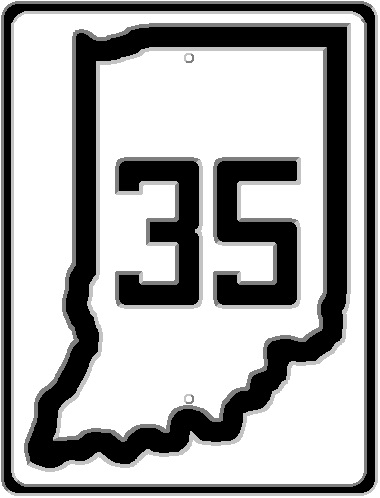
Signage 1: Oh, yeah. The whole signage thing. The whole reason that state highway systems were created in the first place. To take the place of all the confusing array of painted route markers. The picture to the left shows the state road markers in place before the Great Renumbering. This is taken from a 1923 Indiana Official Highway map. It goes so far as to say that these were painted on

telephone poles. The new signs were to be just the state outline on a flat sign, as shown in the picture to the right. (Personal laughing moment – the SR 2 sign shown above left was placed along what became US 30 in 1926. The original OSR 2 was the original 1913 route of the Lincoln Highway. This original OSR 2 would, on 1 October 1926, became, get this, NEW SR 2. Oh, yes. That did happen.

Signage 2: Oh. My. Goodness. Signs along the sides of the roads at that time couldn’t be printed on a laser printer like Indiana’s current license plates. (I know, laser printers didn’t exist at the time!) Signs at that point in history were stamped and hand painted. Just like the license plates at the time. (See what I did there?) This is part of the reason

Indianapolis News, 16 August 1926


that the fonts on most signs at the time is so square looking. But let’s get to the meat of the issue. There MIGHT have been a total of two months notice to make signs for the massive change about to come. That is not enough time to make that many signs. An article, shared to the left, mentions the state needed 39,300 route markers and signs.

So what happened the day of the Great Renumbering when it came to route markers? Since all the renumberings had to be done in one day, the resignage was done with paper board signs until the metal signs could replace them.

I am having visions of local state transportation officials running to the local printer and having them run a print job of THOUSANDS of cardboard state shapes with different numbers on them. This may or may not have been how this happened. It just seems funny to me.

So, in one day, every map of Indiana was wrong, every road in the state was renumbered (even when they were renumbered to what was its original number), and tens of thousands of cardboard signs were nailed to telephone poles all over the state. AND, this was when the state only had between 3,000 and 5,000 miles of state roads. The system was still being built and expanded, a process that really didn’t end until the 1950s.

The label, “Great Renumbering,” is a term that I just started using. I am not even sure when. But, suffice it to say, it was, to me, an appropriate description of what happened on 1 October 1926. I leave it to you to decide if I should keep using it or not.

Waverly

South of Indianapolis, along the White River (West Fork), is a small town that, although bypassed now, was a transportation “hot spot” of sorts, and important to the history of Indiana and Indianapolis. That town is Waverly.

Indiana county boundaries in 1816-1817. Legally, although the entire area of Indiana was set out, everything north of the highlighted line was, by treaty, Native American lands.

Now, Waverly is known as where SR 144 connects SR 37 to Mooresville. But in the early days of the opening of the central part of the state to settlement, the first trail (or trace) in the area ended at the bluffs of White River. That is now the location of Waverly. Jacob Whetzel, of Franklin County, bought some of the first land opened to settlement north of the Indian boundary. In 1817, he set out to blaze a trail from Laurel to the bluffs of the White River, where his new purchase was. This trail, called the Whetzel Trace, was cut in a relatively straight line, almost due east and west.

The Whetzel Trace, had it survived, would have connected its two termini through Andersonville, Shelbyville and Whiteland. Before the Trace disappeared back into the forest of central Indiana, it was used to bring commissioners to the Waverly area in 1820 to determine a location for the new centralized capital of Indiana. The Bluffs were so favored at the time that it was entirely possible that the new capital city would have been located there. Instead, a location one mile east of the mouth of Fall Creek on White River was chosen. (Before you look at a map an argue against this description, trust me. I argued the same thing. Until I saw a map of the original Fall Creek path. But that is a general history subject, not a transportation history subject.)

There is a blog spot entry that I found online at http://fairfield200.blogspot.com/2015/02/whetzels-trace.html. It covers the history of the Whetzels and the Trace very well.

Also in the 1820s, the area around Waverly saw for the first time, and the last, a steamboat making its way up the White River to Indianapolis. Unfortunately, near Waverly on the way back down the river, that steamboat hit one of the numerous sandbars that can be found in the White River. There the “Samuel Hanna” languished for a few months waiting for the water level to rise again enough to get back to sailing. The journey of the Samuel Hanna lead to the realization that Indianapolis was located on a non-navigable waterway, thus killing the possibility of riverboat transport to the remote settlement.

The next important transportation history item involving Waverly was the creation of the Bluff Road. As the name suggests, the Bluff Road connected the bluffs of the White River to Indianapolis. That road started on the south edge of what was Indianapolis at the time, at South Street. It would connect at the main drag, Meridian Street. Further south, it would turn off to the southwest from Meridian Street (at the time, Three Notch Road).

In the early 20th Century, the Bluff and Martinsville Roads from Waverly would become part of the path of the Dixie Highway. The Dixie Highway connected northern Michigan and Chicago (two routes, interesting history) to southern Florida. The Dixie Highway was the second brainchild of Greensburg native/Indianapolis resident Carl Graham Fisher. (His first being the Lincoln Highway.)

With the creation of the state highway system, the Dixie Highway through Waverly became part of SR 22. SR 22 would separate from the Dixie Highway at Paoli, where the DH turned to the southeast. North from Waverly, SR 22 would follow the Bluff Road to its end at South and Meridian Streets.

1961 Indiana Official Map of Waverly, IN, area

In 1926, SR 22 would be renumbered to SR 37. And “downtown” Waverly would remain on the state highway until 1962. The attached map shows that a SR 37 bypass is being built around Waverly in 1961. The SR 144 shown on this map came into being in 1941, although it had been planned since 1937. SR 144 was to connect Mooresville to Franklin. In actuality, it does. Technically, it does not. SR 144 was never added to the state road system east of Waverly.

1962 Indiana Official Map of Waverly, IN, area

There is a road built to connect SR 144 at SR 37 (Waverly) to SR 144 at SR 135 (Bargersville). But that is a county road, never taken into the state system. (Called CR 144, actually.)

The 1962 map shows that SR 37 bypass is complete. SR 144 was disconnected from the new SR 37 for a short while. That would be resolved, at least according to the official maps, the following year.

The next change to Waverly was the building of the SR 144 bypass.

1965 Indiana Official Map of Waverly, IN, area

It started with rerouting SR 144 along old SR 37 north out of Waverly, then connecting 144 to new SR 37 at the junction that is currently SR 37 & 144. This was in 1965. It would remain in this configuration until 1970, when a new bridge was completed over the White River north of Waverly.

Google aerial photo of Waverly, Indiana, screen captured on 28 April 2019.

Looking at the above aerial photo of Waverly, one can still see the old path of SR 144 from the west. The old route of SR 37 is clearly labeled…repeatedly.

But this isn’t the end of the road changes around Waverly. Over the next several years, that SR 37 bypass will be upgraded to become I-69, connecting the Indianapolis area to Evansville via Martinsville and Bloomington. This upgrade will not affect the little old burgh much. That happened over 50 years ago with the moving of SR 37 in the first place.

US 31 at Columbus

I can’t think of any highway in Indiana that has been bypassed and/or moved more that US 31. Part of this, honestly, was because the original route left something to be desired when it came to turns, curves and other hazards. Keeping in mind that US 31 came into being on 1 October 1926, there were a lot of changes before the coming of 1946, its twentieth anniversary.

At Columbus, it changed quite a bit over the years. At one point, there was a US 31 and a US 31A, an extended following of the old Madison State Road, a take over of both SR 9 and SR 9W, and a removal and replacement of a section of SR 7 (which would later become part of SR 46!).

1939 Indiana Official Highway Map of Bartholomew County

Let’s start with the original US 31, as marked on 1 October 1926. Coming from the north, US 31 followed the old Madison State Road, and the Jackson Highway Auto Trail, into Columbus along what is now Indianapolis Road to its junction at 8th Street (yes, I know, that intersection is gone). The road then turned south on Brown Street to Second Street, where the bridge crossed the Flatrock River. US 31 then exited Columbus on what is now SR 11.

1941 Indiana Official Highway Map of Bartholomew County

The first change in the routing of US 31 happened in the time frame of 1940-1941 (as shown in the 1941 Indiana Official Map), when the road was routed, from Second and Brown Streets, along SR 7 to the junction that, in 1939, was listed as SR 9W. That routing is the current path from what is now SR 46 south to Seymour. (SR 46 was rerouted over a decade ago to take over what was SR 9.) In 1939, there was SR 9W, which ran south from SR 7 to Bartholomew County Road 475S. At that time, CR 475S was SR 9, which then turned south on what is now US 31 (National Road). National Road would be the same as CR 400E. Old US 31 became US 31A with the moving of the official US 31 route. The 1941 map also shows that the current bypass from north of Columbus to SR 7 was under construction.

1942 Indiana Official Highway Map of Bartholomew County

As a side note, I mentioned that the original US 31 entered Columbus from the north on the original Indianapolis-Madison State Road. That old road left Columbus along what is shown on these maps as SR 7. Now, it would be SR 46 before it becomes SR 7.

The 1942 official map shows that the US 31 bypass of Columbus was complete. With this completion, not only was SR 9 removed south of Columbus (replaced by US 31), it was rerouted to the road that is now SR 46. At Newbern, SR 46 and SR 9 met for 70 years. INDOT would move SR 46 to the route of SR 9 south of that point, ending SR 9 at the same place.

1979 Indiana Official Highway Map of Bartholomew County

The 1979 official map shows something that I don’t remember ever seeing before: SR 31A. What was US 31A is marked on the 1979 as SR 31A. This makes sense, given the way Indiana does state road numbers. There have been very few “A” routes in Indiana history. Usually, if a bypass is built, Indiana gives the old route a “daughter” number. It was unusual that this route was given an “A” number, even more so that it remained officially a US route for 36 years. In 1983, the road would again be labelled, on maps anyway, as US 31A.

1985 Indiana Official Highway Map of Bartholomew County

The last official change made to US 31 in the Columbus area was in 1985, when the old US 31A was recommissioned as SR 11. This made the old road a continuation of SR 11 which connected at the end of US 31A at Seymour.

1999 would be the last year that the old US 31 leaving Columbus to the north would be part of the state highway system. In 2000, not only was that section of SR 11 removed, but SR 46 was rerouted along what was SR 9, and SR 7 ended at US 31. That would end 82 years of Indianapolis Road in Columbus being a state road. It all started by being part of State Market Highway 1 in 1917. Then original SR 1 in 1919.


Knightstown and Shelbyville

One of the things I always looked forward to, prior to 2010, was the annual pumpkin patch train on the Carthage, Knightstown & Shirley (CK&S) Railroad. I still have memories of my son carrying a pumpkin, that he had no earthly reason having, to the train. The rule was simple. Children could go into the pumpkin patch and get a pumpkin, as long as they could carry it to the train themselves. For years, this meant that my son would end up with a pumpkin that would inevitably be almost as big as he was at the time. But, then, the CK&S would close, ending the yearly laughing at my straining son and his way too big pumpkin.

The CK&S was a short line created from the abandonment of the old New York Central/Big Four line from Anderson to Rushville. This line would be the second railroad connecting Knightstown to Carthage. The first was also abandoned, but it would have been over 100 years before the second was left to die on the vine.

1853. The railroad boom had hit Indiana in a big way. And one of the cities that took full advantage of this was Shelbyville. The county seat of Shelby County, at one point, had railroads connecting it to Cincinnati, Columbus, Edinburgh, Indianapolis, Knightstown and Rushville. Six different directions in what, at the time, was a small town. One of these lines was discussed earlier this week as the Shelbyville Lateral Branch (SLB) Railroad. At the northern end of the SLB, it connected to another small railroad known as the Knightstown & Shelbyville (K&S).

The K&S connected Shelbyville to the Indiana Central Railway at Knightown, via Morristown (and a connection to the Junction Railroad/B&O) and Carthage. It was built by local people, but was encouraged by the Madison & Indianapolis (M&I) as a feeder road to the first long distance railroad in the state. The M&I profited more from the line, just like the SLB, than the actual owners did. The locomotive for the K&S was even provided by the M&I, in addition to other rolling stock.

The K&S began life when it was incorporated on 19 January 1846. A later amendment to the chartering law allowed the K&S to accept land, labor and materials, in addition to money, for the purchase of stock in the company. By October 1850, the entire line was complete. It was a great boon for the localities along the line.

But that boon wouldn’t last. The railroad found itself in a lot of debt. One person, Michael J. Bright of Madison, possessed most of the debt. Although the line would be very busy, and, on paper, very profitable, the K&S found itself unable to pay back that massive debt. Mr. Bright foreclosed on the line, ripping up the K&S. This would happen in either 1854 or 1855. An effort to rebuild the line, in 1858, ended in failure.

1876 saw the beginnings of the Cincinnati, Wabash & Michigan Railway. The CW&M reached from Fairmount to Anderson in 1876. The Rushville extension would be completed by 1891. Most of the railroad grade from Knightstown to Carthage would be used by the CW&M. That road entered Carthage just to the east of the original route built by the K&S. The CW&M would become officially part of the Big Four on 16 June 1915, along with another road that started life as a feeder to the M&I, the Fairland, Franklin & Martinsville. By 1982, this line would be owned by the Indiana Eastern Railroad. When traffic dried up, it would be sold to become a short line visitor road that became the KC&S.

SR 37/SR 100/I-69 at Castleton

One of the busiest sections of the Indiana State Road system in the area that is now I-69/SR 37 from I-465 north toward Noblesville. The original road built close to this area connected Indianapolis to the second largest city in the state, Fort Wayne. But what was built in the 1840s ended up being bypassed in the late 1950s with a unique situation that makes traffic flow to this day hard to control.

1932. The original Indianapolis-Fort Wayne State Road, known in Marion County as Allisonville Road, was added to the state highway system as SR 13. The junction of SR 13 and and what would later become SR 534/SR 100 was at the town of Allisonville. While all of the old state road did not end up as a new state highway, the old road was used to Noblesville. Allisonville Road remained SR 13 until around 1940, when it became SR 37.

It was about this time that the ISHC decided to create a road that was originally placed on planning maps almost a decade before – the Indianapolis belt road, SR 534. The road used on the north side had been known, at least in Castleton, by the name “State Road.” Today, we know it as the 82nd and 86th Street complex. The east leg, from what is now 56th Street north to 82nd Street, would be a newly built road. Due to the location, being in a middle of a survey township north of what is 62nd Street other places in the county, there had never been a road along this route. The state, hence, built Shadeland Avenue from 56th Street north to just east of the town of Castleton.

1953 USGS Topographical Map showing the northeast corner of SR 100 east of Castleton.

Fast forward to 1957. The state decided that a bypass of Fishers and Noblesville was in order for SR 37. This would lead to a construction that, given hindsight, makes little sense in traffic engineering. This created what would be a very convoluted, very complex, intersection at the new SR 37 and SR 100. Basically, the new SR 37 would drive right through the four point intersection at 82nd Street and Shadeland Avenue. There were sections of roads built in a lot of different directions, as shown in the next topo map and the following aerial photograph.

1960 USGS Topographic Map of JCT SR 37/SR 100 east of Castleton.
1962 Aerial photograph from MapIndy, mapping application of the City of Indianapolis/Marion County. Faint colored lines showing the current map.

When the bypass was completed through the area, the city of Noblesville was not very happy. The new SR 37 was placed east of the city, which officials worried would spell the death of downtown Noblesville. So, in an effort to placate both Fishers and Noblesville, the old SR 37 (from Keystone Avenue and Fall Creek Road to a junction north of Noblesville with the new SR 37) became marked as SR 37A, one of the few alternative routes ever used in the state. Most of the time, if a state road in Indiana is replaced, but the old road is to be retained in the system, the old road is given a daughter number. For example, just west of this area is old US 31, which became SR 431 when the US 31 Carmel bypass was built.

Hence, both Allisonville Road and the new SR 37 bypass would remain in the state system. At least for a little while. 1964 saw the returning of Allisonville Road south of SR 100 to Marion County. That year would also show that the new I-69 was under construction from west of Pendleton at SR 38 to east of Marion at SR 18. By 1965, the plans were in place to connect the completed section of I-69 at SR 38 to a location near what is now 116th Street and SR 37. It wouldn’t be until 1970 that I-69 was completed to SR 238. That would also be the time that SR 37A was removed from Hamilton County. The section from the county line at 96th Street to SR 100 at 86th Street, and the interchange at I-465, remained state responsibilty. This created an orphaned state road in the form of SR 234 that ended, at the time, at the old SR 37A.

1969 USGS Topographic Map of JCT SR 37/SR 100 east of Castleton. It shows the proposed location of I-69 and I-465 in the area, with the moving of several roads to allow for construction.

Maps of 1972 show that the state had been busy making the SR 37 bypass into a controlled access highway. There were no indications on the official maps that this would be part of the new I-69, although it seemed to almost make sense. The only reference I had seen to this upgrade to I-69 was the above 1969 topographic map from the USGS. One would think that it would be easier to update SR 37 from 116th Street south to I-465 than it would have been to build a new highway through Fishers.

1972 Aerial photograph from MapIndy, mapping application of the City of Indianapolis/Marion County. Faint colored lines showing the current map.

The new interchange at I-69 and SR 100, shown in the preceding aerial photograph, created the interesting traffic nightmare that exists today. Granted, it replaced a confusing combination of road segments that was in place for the preceding 14 years. It also removed the northern access to the intersection, which had led to the little known town of Vertland, which had been on the Nickel Plate railroad at 86th Street. This would be the next station north of Castleton, although the town of Vertland amounted to very little over the history.

INDOT now is planning a reconstruction of this section of I-69, from I-465 to north of 82nd Street. This will, in theory, create better traffic flow on both of the interstates. However, the section of I-69 from I-465 to SR 37 has been the scene of almost constant upgrades over the past decade, although it was done in a series of at least four projects. Time will tell if a decision made in 1957 will be corrected by construction done in 2020 through 2023.

Shelbyville Lateral Branch

Personal note. I have never spent so much time in Shelby County as I have since I met my wife, Paula. For most of her life, her family has lived in a place I describe as just past the middle of nowhere, north of the Bartholomew-Shelby County line legally in Flatrock. What does this have to do with this entry? My investigative interest started in this direction due to my going to Paula’s family house. Let me explain.

There are two ways from my old house, and her old condo, to her family’s house. One way used US 421 to Shelbyville and south on SR 9. The other way would use I-65 south, and exit either at SR 44 in Franklin or at SR 252. The SR 44 route is the one that piqued my interest in what I found out to be the Shelbyville Lateral Branch (SLB). Going out the old Greensburg State Road from Franklin, we would go through the town of Marietta. The main street in Marietta is Railroad Street. Wait. What? There’s no railroad in Marietta. And no sign that there ever was. What in the world?

And hence, I started to look into a strangely named street in an out of the way little burgh.

The history of the Shelbyville Lateral Branch has more to do with other, competing, railroad companies. The SLB was done in by both that “war,” but also by roads that directly competed with it.

The SLB started, and ended, life as a feeder line for another railroad. The route connected Shelbyville to Edinburgh through the Shelby County countryside. It connected to two railroad projects at Edinburgh: the Madison & Indianapolis (M&I) and the Jeffersonville (J). The former was the first long distance railroad in Indiana, connecting the two title cities on 1 October 1847. The latter was started to connect Indianapolis to Jeffersonville (and hence Louisville). The latter would run into hard times, not financially, but due to the conceited management practices of the former.

The Jeffersonville had thought, maybe rightly so, that once their line reached Columbus, and the M&I there, that an agreement would be reached to get traffic from Jeffersonville and Louisville to Indianapolis along the M&I. Not so much. The M&I was having none of that. They were afraid that the J would take river traffic out of Madison, hurting the road financially. So the J built a parallel track from Columbus to Edinburgh. 10 miles of track, built side by side, by competing companies. And this is where feeder lines come in.

Let me say this at this point. The Madison had reason to believe that river traffic would be moved from Madison to Jeffersonville. Madison, while closer to Indianapolis, didn’t have something that Jeffersonville had – an impassible Ohio River. Right at Jeffersonville, Louisville and New Albany are the Falls of the Ohio, a shallow area where almost all river traffic had to disembark to go around the area. This was until a canal was built on the Kentucky bank of the river. (Almost said Kentucky SIDE of the river…but the Kentucky side is legally all the way to the low water mark on the Indiana bank.)

(** Edited by Paula Trefun Simpson 06/03/2021 to note that the ‘canal’ mentioned was the Louisville and Portland Canal**)

The Shelbyville Lateral Branch was built by local citizens in 1850. At Shelbyville, there were two routes out of town: the Knightsville & Shelbyville and the Rushville & Shelbyville. This ultimately connected Shelbyville, already served by the Lawrenceburg & Indianapolis (future NYC), to the Indiana Central (abandoned PRR) at Knightstown and the Junction (future B&O) at Rushville.

Now we get back to the M&I and it’s denial of service to the Jeffersonville. The Jeffersonville had been leasing the K&S in 1850. The M&I had furnished much of the rolling stock to the SLB. The M&I profited nicely from this arrangement, for a while, anyway. In an effort to reach Indianapolis, without having any chance at an agreement with the M&I, the J purchased the SLB right out from under the M&I. While not ideal, this would give the J access to Indianapolis in spite of the M&I.

By the time the Jeffersonville’s own tracks reached the connection point at Edinburgh, the Madison realized the error in their ways, making the SLB essentially pointless to the Jeffersonville. What started as control of the SLB on 1 July 1851, basically started a downslide when the J and the M&I finally came to terms in 1855. The writing was on the wall for the SLB. By this time, the Columbus and Shelby had also been built and put into service, giving Shelbyville, and its connections, direct access to Columbus, something it would have until the early-1980’s.

When it was originally built, the SLB used flat bar rail. This was basically flat iron strapped to pieces of wood or stone. While this was quick to install and cheap to build, it also had the potential to be very dangerous. The strap iron would sometimes break lose of the attachment, and, under the weight of the traffic, would bend and curve its way into the bottoms of the wooden rolling stock. The Jeffersonville would replace some of the rail with T rail. That project was never finished before the Shelbyville Lateral Branch breathed its last in 1859.

Looking at it now, the only real thing left of the the SLB is several ads that I have seen and copied, and the name of a street in Marietta that started my imagination and investigation. Unlike most abandoned railroads in Indiana, this one didn’t last long enough to make permanent marks on the landscape. Nor was it really ever elevated the way most railroads were. There are no roadbeds to see, and very few maps that I have seen even show the existence of this route. It, along the the Knightstown and Shelbyville, just up and disappeared within essentially a decade of their creation. They were both basically replaced with the line that connected from Columbus to Shelbyville to Rushville.

And, in the end, the SLB just was a microcosm of the entire railroad battle between the Jeffersonville and the Madison & Indianapolis. By 1864, after a bankruptcy and new management, the M&I ended up just becoming owned and operated by the very company that they were afraid would ruin the M&I – the Jeffersonville.

Roosevelt Avenue, Indianapolis

Earlier this month, I made a post about the town of Brightwood, a suburb of Indianapolis that came to be to support the Bee Line railroad, which eventually became part of the Big Four. On the Facebook side of things, someone made a comment about Roosevelt Avenue, a curvy boulevard that led to Brightwood. The comment was about why the city couldn’t buy the land to make it a straighter road.

And here, we will discuss that.

Around 1900, the city of Indianapolis decided to create a winding boulevard connecting the Big Four Massachusetts Avenue depot, near what is now 10th and Interstates 65 & 70, to the Big Four depot in Brightwood. What became Roosevelt Avenue wasn’t one street from end to end. It was a collection of streets and avenues that were combined to make the ultimate product.

1899 Atlas of Indianapolis and Marion County, with the route of what would become Roosevelt Avenue from 11th and Lewis to Rural Street highlighted.

The Polk 1904 Indianapolis City Directory street guide describes it as follows: (keep in mind this is a direct transcription, including capitalization) “ROOSEVELT AV – (Formerly Malott av, Hill av, parts of Hillside av, Valley av, Beech, Lawrence, Bloyd av and Glen Drive) From cor Eleventh and Lewis n e.”

Starting at 11th and Lewis, or the Monon and Nickel Plate, whichever you prefer, the city renamed Malott Avenue to Columbia (Street) Avenue. There is a break in the new avenue at this point, even though I highlighted part of Columbia Avenue. Continuing northeast, Hill Avenue, from Columbia to (what is mismarked as Hill) Hillside Avenue, then became part of the new boulevard. (For information, the 1885 Polk Indianapolis City Directory lists Hillside Avenue as extending from the corner of Sixth and Hill ave, northeasterly to city limits. That would be the curve turning from Hill to Hillside near Ludlow and/or Clarke.)

Only a few blocks of Hillside Avenue was taken for Roosevelt Avenue. A curve to the right, and now you are on what was once Beech Avenue. While the description in the city directory lists “part of Beech” as part of the avenue, I can’t see where, from the included map, there was any part of Beech that WASN’T made part of the road. Beech connected to Lawrence, which then would take the mantle of Roosevelt. It would carry it to Rural Street.

1899 Atlas of Indianapolis and Marion County, with the route of what would become Roosevelt Avenue from Rural Street to Sherman Drive (then called Brightwood Street) highlighted.

At Rural, Roosevelt Avenue replaced what was Bloyd Avenue. This corner is still shown, although not with Indianapolis’s standard oversized street signs at signaled intersections, as Bloyd to the west, Roosevelt to the east. Roosevelt was rerouted, removing a traffic intersection on both sides of the Bee Line tracks. I can tell you, from what I remember going to school at IPS #37, there was ALWAYS traffic snarls at those two intersections!

Roosevelt’s take over of Bloyd would last until it reached the old Shade Street, now known as Olney Avenue. There, the Glen Drive (now Glenn Drive) portion would start. That would take it to Brightwood Street. That portion of Roosevelt Avenue does still exist, creating a situation just like that at Rural Street at Sherman Drive. The major difference is the sheer difference in altitude of the rail crossings at both Rural and Sherman. Sherman Drive’s is relatively flat. This stems partially from the fact this was also where the Indianapolis Belt Railway’s north leg and east leg come to meet the Bee Line. Rural Street’s intersection with Massachusetts Avenue is quite a bit lower than the railroad track next to it.

I would be remiss if I didn’t mention that Roosevelt Avenue, being over 100 years old, was named after President Theodore Roosevelt. That would make it “Rose-a-velt” Avenue, not “Ruse-a-velt.” And, as I mentioned in response to the Facebook comment that led to this entry, Theodore Roosevelt is very near and dear to my heart. I am a Navy veteran that served onboard USS THEODORE ROOSEVELT (CVN-71), for three years, once upon a time.

Another Bridge Comes Down

When I-465 was built between 1961 and 1968, there was one thing that was pretty much standard in the construction: concrete arch bridges. By the beginning of this year, most of those bridges were gone. Those at Mooresville Road, Mann Road, Arlington Avenue, English Avenue, Ditch Road and Township Line Road were the last six in the entire 53 miles of the interstate.

And now, the one at Ditch Road is mostly gone.

It is not hard to understand why these bridges are being removed, and not replaced in kind. When they were built, there was no traffic on the road. That made it a lot easier to pour a totally concrete bridge. Trying to do that now would be problematic, at best, given the traffic that 465 sees daily.

Another reason, quite honestly, has to be cost. Most of the older bridges that have been removed were due to expansion of the interstate. It is cheaper to build a longer steel beam bridge than it would be to replace it in kind. The new bridge style also adds clearance room to the shoulders, something that was lacking when the originals were built.

I pass the bridges at Ditch and Township Line Roads six days a week. (One of the quirks of working overnight.) INDOT’s contractors have been demolishing the Ditch Road over the past several weeks. It is a sad thing to see such history removed. That bridge is 50+ years old. One would hope that when the new bridge goes in, it will be like the 96th Street bridge they replaced just east of this one. The 96th Street bridge had room for future expansion, something that was sadly missing when I-465 was built in the first place.

As of this writing, half of the Ditch Road bridge is gone. That leaves five monuments to the original construction left. Here’s to the end of a chapter of Indiana Transportation History.

National Road Tidbits

Over the long history of what was the National Road, there are tons of stories told. Tales of lives, tolls, decisions, and other things that have been basically lost to history.

A brief history of the road screams to be told. President Thomas Jefferson signed the law creating the Cumberland, or National, Road on 29 March 1806. The commission that charted the road decided that Braddock’s Road would be followed from Cumberland, MD, to Brownsville, PA. Pennsylvania only approved the road if it would pass through Uniontown and Washington, PA. So, the road followed a native american trail from Brownsville to Washington. From there, the road was was to go to either Wheeling, VA (now WV) or Steubenville, OH. Wheeling won after some influence of Henry Clay.

It would not be until 3 March 1825 that the Congress gave the green light to extension of this road. Appropriations were outlaid to build the road to Zanesville, OH, and survey the route through the capital cities of Ohio, Indiana, and Illinois. By 1832, the National Road reached the Indiana-Ohio State Line. (An astute reader now asks the question why the National Road doesn’t connect to Springfield, IL. Well, the capital of Illinois at the time was Vandalia, which is one the National Road. Springfield became the capital in 1839.) Hence, the history of the building of the National Road…in shortcut fashion.

But local stories abound when it comes to the road. For instance, in Richmond, according to the Richmond Paladium-Item of 2 October 1910, “Main street turns near Ninth and makes a slight curve towards the northwest. One hundred years ago there was a large mud puddle north of Main street and when the National road was constructed the contractors built it around the puddle. Main street retained the curve.”

The National Road would also be the site of a County Seat War in Wayne County. Wayne County’s government had been located in Centerville since it was legally moved from Salisbury with an act of 21 December 1916. (The last meeting of county commissioners was held at Salisbury in August, 1817. [Indiana Boundaries: Territory, State and County, available on ancestry.com]) Later, a Wayne County courthouse was built in Richmond. Richmond officials went to Centerville to move the government. Centerville refused. The Richmond interests actually used cannon fire in the effort to move the county seat from Centerville to Richmond. According to the Plymouth Weekly Republican of 24 December 1874, the United States Supreme Court, with a unanimous decision, ended the county seat war in favor of Richmond. “The struggle between Richmond and Centerville has been protracted nearly two years.”

On 3 May 1919, the Indianapolis News published a story about the conditions and construction of the National Road through Indiana from the perspective of “caravans of motor lorries during war.” Very little of the old road was improved at the time of World War I. While most of the wartime traffic occurred by railroad, quite a bit went by truck. Very few roads at the time were improved, making travel no better than it had been for years. And, with the increase in truck traffic, the “Famous Old Highway Has Gone to Wreck – Miles of Hard Going Are to Be Found Along the Indiana Link of the Road Between Richmond and Terre Haute.”

The story of a couple of farmers in Wayne County is also worth mentioning. On the old road, west of Richmond, lived a man and woman “around which is woven one of the first romances of the National road in Indiana.” The story of their romance isn’t covered, being that it “does not concern us here.” Anyway, they bought a farm and became successful. However, a toll gate was built not far from their farm, requiring a toll to be paid to reach Richmond. They objected to this toll, to the point of building a road, on their property, around the toll gate.

With the National Road came the tavern. There were numerous taverns built along the way. Keep in mind that a tavern, at the time, included anything that a traveler needed to rest: food, drink, beds, and stables. One of the things reasons that US 40 is such a slow route across Indiana is the tavern. Towns sprung up around the tavern. Towns were placed at convenient intervals depending on the distance one could travel in a day. In the motoring era, these “convenient intervals” led to the motor hotel, or motel. In the four miles that I travel the National Road daily, from Cumberland to I-465, there are still three motel buildings in existence. I remember many more that have been demolished over the 50+ years that I have been alive.

In Indianapolis, the last vestiges of the National Road in downtown survived into the 20th century. Early in the century, the old National Road bridge, a covered bridge that originally carried the National Road over the White River, was finally removed. That bridge had been in place for over 70 years, although most traffic, at that point, had been using the Washington Street bridge. It wasn’t until the mid 1980s that the original road, called Washington Avenue, was removed. Today, a walking path has been built along the path of the old road.

Over the 180+ years of the National Road in Indiana, there have been many lives affected. Their stories are out there. I hope to find more of them in the future.

SR 6

A close examination of any current map of the state of Indiana shows that in the northern part of the state, there exists a road that is designated US 6. But US 6, while it is part of what was once the longest highway in the country, was a late comer to Indiana. But, unlike US 35 that replaced (mostly) SR 21 and US 33 that replaced SR 2, US 6 replaced SR 6.

That’s right. In 1926, SR 6 was designated to roughly follow what was, at the time, the Toledo-Chicago Pike. The TCP started at Ligonier, where it met the Lincoln Highway, and traveled east to meet the Indiana-Ohio state line east of Butler. The number 6 fits directly into the new state numbering system, being south of 2 (mostly) and north of 10 (SR 4 and SR 8 didn’t exist at first).

Hancock Democrat, Greenfield, 30 September 1926, describing the new SR 6 to come into existence the next day.
1926 Indiana Official Highway Map of SR 6, as of 1 October 1926

There was an authorized addition located on that same map, continuing SR 6 from Ligonier to Munster, where it would cross the Illinois-Indiana state line.

1926 Indiana Official Highway Map of SR 6 Authorized Addition, as of 1 October 1926

By 1927, the area between Kendallville and Waterloo, shown as under construction in 1926, was completed. However, the authorized addition was not complete as yet. By 1929, SR 6 was added from Munster to JCT SR 55 in Gary, with the route under construction to Westville at SR 2 and SR 43. That portion was completed by late 1929. (There are two Official Indiana Highway Maps available for 1929. One was released in late 1928, the other dated 30 September 1929.)

The 1932 map from the State Highway Commission shows that SR 6 had been officially replaced by US 6. It was, however, a broken route. The sections from Munster to Westville and from Ligonier to Butler are marked as US 6. The section from Lapaz, on US 31, to SR 15 north of Milford is listed as well. The two connecting sections are still listed as authorized additions. 1933 shows that the entire route of US 6 is complete across Indiana. By 1936, US 6 would reach from Long Beach, California, to Provincetown, Massachusetts. This would make it the longest highway in the United States until 1964, when California removed and renumbered highways.

US 6, even in Indiana, is out of place when in relation to the rest of the US Highway system. It is south of US 12 and US 20, and north of US 30. But it fit so neatly into the Indiana numbering system, it’s hard to consider it an accident. The 1926 route of US 6 ended at Erie, Pennsylvania.

And although it met the Lincoln Highway near Ligonier, it never actually did follow any of that historic route. Even the authorized addition route placed it south of the Lincoln Highway. It wouldn’t be until 1971, long after the old road became US 33 and SR 2 was truncated to South Bend, that the section of the Lincoln Highway west out of Ligonier was removed from the state road system. The new route would have US 33 multiplex with US 6 to SR 13. At the original Lincoln Highway, SR 13 turns east along the old road, US 33 travels north and northwest along the old road.

Very few other changes have been made in US 6 over the years. There is a bypass of Bremen in place now. In the early 1960’s, the western Indiana entry was moved from an at-grade highway to entering as a muntiplex with I-80 and I-94. Eventually, it would connect to the interstate at SR 51.

Auto Trails Quick Take, Part 3

This is part three of the quick description of the Auto Trails, as listed in the Lafayette Journal and Courier of 1 November 1922. It gives a general idea of the roads that most of which would be accepted into the State Highway System. The numbering used corresponds to the numbers used on the Rand McNally Auto-Trails maps of the late 1910s through the mid 1920s.

(Note – all information in this entry comes directly, word for word, from the mentioned newspaper. Some may disagree with what was written.)

(69) The Jackson Highway from Chicago to New Orleans, crossing Indiana by way of Crown Point, Rensselaer, Lafayette, Frankfort, Lebanon, Indianapolis, Franklin, Columbus, Seymour, Salem and New Albany. Originally marked by the highway association marked in parts by the automobile association and last year thoroughly remarked by the automobile association.

(81) The Wabash Way, extending from Fort Wayne to Danville, Ill., following the Wabash River by way of Huntington, Wabash, Peru, Logansport, Delphi, Lafayette, and Attica. Marked in part by local clubs, then by our state organization, and last year re-marked by the state organization.

(82) Terre Haute-Columbus-Cincinnati Trail, extending from Terre Haute to Cincinnati by way of Spencer, Bloomington, Columbus, Greensburg, Batesville and Lawrenceburg. Marked by the clubs along the route and partially re-marked by the state association.

(85) The Adeway, Indianapolis to Chicago by way of Crawfordsville, Attica, Fowler, Kentland, Morocco, Lowell and Hammond. Marked by the H.S.A.A. The Adeway joins with the Dixie Highway at Crawfordsville and has never been marked from Crawfordsville to Indianapolis as the Adeway.

(86) The Liberty Way, Chicago to Kokomo by way of Gary, Valparaiso, Kouts, North Hudson, Bass Lake, Winamac, Logansport and Kokomo. Marked and in many places re-marked by the automobile association.

(90) French Lick Route, Cincinnati to Evansville by way of Aurora, Versailles, North Vernon, Seymour, Brownstown, Bedford, Paoli, French Lick, Jasper, Huntingburg, and Boonville. Marked by the automobile association from the Ohio line to French Lick; is not marked from there to Evansville due to the unsatisfactory condition of the road at the time of route was established. This part of the route is now under construction by the state highway commission.

(91) The Ben-Hur Trail, from Terre Haute by way of Rockville, Crawfordsville, Frankfort, Kokomo and Marion going to Huntington. Marked in part by local clubs, finished and partially re-marked by the state association.

(94) Toledo-Angola-Goshen Trail [known as the TAG Trail], extending from Goshen by way of Lagrange, Angola, and straight east to Toledo. Marked by motor clubs along the route.

(96) Pigeon Roost Route, extending from Seymour by way of Scottsburg to New Albany. This route was originally marked by clubs at Seymour and Scottsburg, and partially re-marked by the state association. It is now practically replaced by State Road No. 1.

(97) Midland Trail, from coast to coast, entering Indiana at Vincennes, crossing the state by way of Washington, Loogootee, Shoals, Paoli and New Albany. First marked by county organization, partially re-marked by Hoosier State association out of New Albany. On list for re-marking the balance of the way to Vincennes.

(98) Huntington-Manitou-Culver Trail, extending from Chicago to Lima, O., by way of Hammond, Crown Point, Hebron, North Judson, Bass Lake, Culver, Rochester, Lake Manitou, North Manchester, Huntington and Decatur. Thoroughly marked by the state association.

The Dandy Trail, not shown on the auto trail maps, but extending for eighty-eight miles around the city of Indianapolis. Marked and re-marked by the Hoosier Motor club.

Auto Trails Quick Take, Part 2

This is part two of the quick description of the Auto Trails, as listed in the Lafayette Journal and Courier of 1 November 1922. It gives a general idea of the roads that most of which would be accepted into the State Highway System. The numbering used corresponds to the numbers used on the Rand McNally Auto-Trails maps of the late 1910s through the mid 1920s.

(Note – all information in this entry comes directly, word for word, from the mentioned newspaper. Some may disagree with what was written.)

(25) The Dixie Highway originally was laid out over what is now known as the Michigan road running from South Bend, but later the routeing came from Chicago to Danville, Ill., and then into Indiana at Covington, and through Crawfordsville to Indianapolis (which road is now hardly used because of its condition), and then to Martinsville, Bloomington, Bedford, Paoli, and New Albany. Originally marked by the Dixie Highway association units at various places along the route. Later in parts re-marked by the H.S.A.A., and the Crawfordsville-Indianapolis-Paoli route now is being entirely repainted by one of the H.S.A.A. painting outfits.

(26) The Michigan Road, extending through Indiana by way of South Bend, Rochester, Logansport and Indianapolis, and on south to the Ohio River. Established by the state of Indiana in the early history of the state, right-of-way having been granted by the Indians. Marker adopted by the H.S.A.A. and the marking promoted through the motor clubs enroute – on list for remarking.

The only part of the historic road that didn’t make it as part of this Auto Trail is the section from Napoleon to Bryantsburg. The Auto Trail runs through Versailles, which was east of the original road.

(29) Crawfordsville to Anderson, marked by clubs enroute, but now replaced by state road markings practically all the way.

(30) Corn Belt Route, going entirely across the state of Illinois and entering Indiana at Kentland, extending to Goodland, Remington, Wolcott, Monticello and ending at Logansport. Marked by clubs along the route; due for re-marking.

(34) Lincoln Highway, extending through Indiana by way of Goshen, Ligonier and Fort Wayne. Established and marked by the Lincoln Highway association.

(36) Hub Highway, extending across Indiana from Lafayette through Frankfort, Tipton, Elwood, Alexandria, Muncie, Winchester, and Union City, and across Ohio by way of Dayton, Xenia to Washington Coury House. Marked by clubs enroute; now being re-marked by Hoosier State association.

(39) Custer Trail, principally a Michigan trail, but extending south through Angola, Waterloo, Auburn to Fort Wayne. Marked in Indiana by H.S.A.A.

(42) Hills and Lakes Trail, extending from Indianapolis by way of Noblesville, Elwood, Wabash, North Manchester to lake resorts. First marked by Hoosier Motor club and other clubs along the route, principally from Wabash; later re-marked by automobile association and soon to receive additional attention. Construction work on main route had held up matter of repainting the poles up to this time.

(43) The Dunes Highway, extending from Michigan City through the Dune region by way of Gary, Indiana Harbor and Whiting to Chicago, connecting with Sheridan pike at Chicago and with West Michigan pike at Michigan City. Established by the Dunes Highway association, marked by the H.S.A.A. Hard pavement now under construction between Gary and Michigan City.

(47) Pike’s Peak Ocean-to-Ocean Highway. This route extends from San Francisco to New York, entering Indiana at Montezuma, extending by way of Rockville, Bainbridge, Danville, Indianapolis to Richmond and on east. Established by Pike’s Peak Ocean-to-Ocean Highway association, marked by clubs in Indiana. Now being rerouted by the Pike’s Peak Highway association.

(48) South Bend to Knox, marked last year by the H.S.A.A.

(56) Atlantic-Pacific Highway, extending from Los Angeles, Cal., to Washington, D. C. The most recent national highway across the state of Indiana, entering at Princeton, crossing the state by way of Oakland City, Jasper, French Lick, Paoli, Salem, Scottsburg, Madison, Vevay, Rising Sun, Aurora and on to Cincinnati. Marked this year by H.S.A.A.

Auto Trail Quick Take, Part 1

This entry is a quick description of the Auto Trails, as listed in the Lafayette Journal and Courier of 1 November 1922. It gives a general idea of the roads that most of which would be accepted into the State Highway System. The numbering used corresponds to the numbers used on the Rand McNally Auto-Trails maps of the late 1910s through the mid 1920s.

(Note – all information in this entry comes directly, word for word, from the mentioned newspaper. Some may disagree with what was written.)

(1) The Yellowstone Trail enters Indiana from Chicago, extending by way of Gary, Valparaiso, Plymouth, Warsaw, Pierceton, Columbia City, Fort Wayne and thence to Cleveland. Well marked with metal signs on poles.

(2) The Chicago Trail barely cuts the corner of the state, extending from Detroit to Chicago, entering Indiana and Michigan City, passing through Gary, Indiana Harbor and Whiting.

(3) The Tip-Top Trail, extending from Lagrange on the north straight south by way of Albion, Columbia City, Huntington, Hartford City, Muncie, Newcastle, Rushville and Greensburg. Thoroughly marked by H. S. A. A. (Hoosier State Automobile Association).

(4) The Dixie Bee Line, extending from Chicago down the edge of Illinois, entering Indiana near Danville, Ill., going through Clinton and Terre Haute, and leaving at Evansville to cross Kentucky and Tennessee to Florida. Thoroughly marked and re-marked by the H.S.A.A.

(8) The Range Line, extending from Indianapolis to Rochester by way of Carmel, Westfield, Kokomo and Peru. Was marked by the county organizations enroute and is now replaced by State Road No. 1.

(9) Ohio-Indiana-Michigan Way, extending from Cincinnati by way of Richmond. Fort Wayne and Kalamazoo, Mich. First marked by the county organizations and remarked by the state organization. Some parts of this route are yet to be remarked. “O-I-M” on the poles.

(12) The Toledo-Chicago Pike enters Indiana at Butler, extending west through Waterloo, Kendallville and joining the Lincoln Highway at Ligonier.

(13) The Belt Line, same being a continuation of the Bloomington Way in Illinois, entering from Hoopeston, Ill., crossing the state by way of Lafayette, Kokomo, Marion, Hartford City and Portland. Marked by the county organizations – on schedule for remarking by the state association outfits.

(16) Hoosier Dixie Highway, extending from Goshen to Cincinnati by way of Warsaw, Wabash, Marion, Anderson, New Castle, Cambridge City, Connersville and Brookville. Marked by the Hoosier Dixie Highway association through its county organizations and remarked in parts by the H.S.A.A.

(17) Minute Man Route extending from Farmersburg on the west, across the state by way Spencer, Martinsville, Franklin, Shelbyville, Rushville, Connersville and Liberty. Marked by state association – on our list from remarking now.

(22) National Old Trails Road, established by government, marked by red, white and blue bands partly by local clubs and partly by the state organization, but more dependable marked by special enamel steel signs placed at frequesnt intervals across the state. Coincides with State Road No. 3 across Indiana from Terre Haute to Richmond. (The section east of Richmond is not the same road established by the government.)

(23) Wonderful Way, same being a branch of the Atlantic-Pacific Highway branching off from that route at Paoli and extending south by way of Corydon, New Albany and along the river by Charlestown, Madison, Vevay, Patriot, Rising Sun to Cincinnati. Marked by the H.S.A.A.

(24) The Hoosier Highway, extending from Detroit to Memphis, crossing Indiana by way of Fort Wayne, Bluffton, Huntington, Muncie, Anderson, Martinsville, Spencer, Worthington, Washington, Petersburg, Oakland City, Princeton and Evansville. First marked by the Hoosier association with a red “H” on a white background and now remarked with a black “H” on a white background. Northern half of route just repainted.

Most Used Information Sites for Indiana Transportation History

I have been asked many times how and where I get the information that I share between this blog and my ITH Facebook group. Being a person that wants to share any information I can find, I want to allow you, the readers, to have the chance to see for yourselves what I have found.

For maps, let’s start with my favorite resource: the Indiana State Library Digital Collections at http://cdm16066.contentdm.oclc.org/cdm/search/collection/p15078coll8. I found this site relatively late in searches. But it has become my go to for most of the Indiana State Highway maps that I use on a regular basis. This site also allows downloads of the maps. I can admit that I have done this with many of the maps, since I tend to refer to them a lot. It also saves my internet cap – since I have a top limit on how much I can use before they charge me extra.

One of the first sites I found is the IUPUI Historic Indiana Maps at http://ulib.iupuidigital.org/cdm/search/collection/HIM. This collection is very nice, with the same interface as the one used at the Indiana State Library. It, however, does not allow downloading. This is not a major problem, as far as I am concerned. After all, the fact that I can access this great information at all is good enough for me.

Indiana University Bloomington allows access to a small number of early state highway maps at https://libraries.indiana.edu/indiana-state-highway-maps. Other information appears on this page. It is definatly worth a look.

For interurban information, I can not recommend more this PDF file: http://www.railwaystationlists.co.uk/pdfusaiu/indianainterurbanrlys.pdf. It lists, to the best of its ability, every stop on every Interurban in the state. It is very extensive.

Another good site for Interurban information is https://www.google.com/maps/d/viewer?mid=1tfzUtyQ-UOcOYQKNbYvI8i7rFzI&ll=39.96179685221379%2C-85.71168638122339&z=9. Admittedly, I saved the link wrong, so it zooms in in the middle of nowhere. But you can zoom out to see the extensive work that was done to this Google Map.

A government site that I visit quite regularly is http://maps.indy.gov/MapIndy/index.html. Not only does it show Indianapolis as it is now, there is also access to aerial photographs of the county all the way back to 1937. If you want to know how much Indianapolis has changed, this is the place to go. Other information on this site includes property lines, owners, assessed value, and (some times) the last sale and value of that property.

A pay site that gives me the most information is http://www.newspapers.com. Not a day goes by that I am not rummaging through that site. I pay for it as part of my genealogy research…but end up using it more for this hobby. I am really glad that my wife and I found the need for this access.

For more Indianapolis specific information, dating all the way back to 1855, I recommend http://ulib.iupui.edu/collections/icd. Let me say that if you want to be completely confused, take a look at some of the addresses in this book. The addressing and street names have changed several times over the years.

For detailed maps, check out https://ngmdb.usgs.gov/topoview/. Unfortunately, Indiana’s older topo maps are sadly missing. I think the oldest I have found is the 1948 edition. But tracing older routes, and why they were located where they were, is very easy with the maps available here.

If you want to get some really old information, check out the Indiana Gazetteers available at https://www.google.com/search?tbm=bks&q=Indiana+Gazetteer. Editions from 1833 and 1849 are accessible here. It is quite fun to compare the changes between the two. It is, after all, a “Topographical Dictionary of the State of Indiana.”

For railroad history information, reading through the Interstate Commerce Commission reports at https://en.wikipedia.org/wiki/Wikipedia:WikiProject_Trains/ICC_valuations come in very handy. The ICC reports give a very detailed history of not only the (then) current railroad companies, but also all the companies that they compiled to become that end result. Most even include which company built which part of the railroad.

And last, but certainly not by any means the least, is the blog site of Jim Grey at https://blog.jimgrey.net/. Jim is my co-admin of the Facebook group. He is also the one that recommended that I start this blog. I am glad he did. His site is called “Down The Road,” and includes quite a few road related entries. His collection of entries about both the Michigan Road and the National Road are incredible. I am also reminded of his dedication to the Michigan Road six days a week as I see signs marking the Michigan Road Historic Byway every day I go to and from work. (I work nights, so Monday through Friday, I see one going to work. Tuesday through Saturday, I see one on the way home. After all, my place of employment in on the old road.)

I hope that you will check out and enjoy these assorted sites. I will continue to use them to keep doing what I like to do. And, heck, you can even make sure I am getting things right, as well.

SR 34 and “Daughters”

Anyone that looks at a map of Indiana, especially central Indiana, notices a series of state roads that end in 34. The question that I get asked at that point is: where is SR 34?

There are plenty of “daughters” of SR 34. Throughout the history of the state road system in Indiana, there were even more. Of all these “daughters,” only one of them directly connected to the “mother,” SR 34. Others seem to have been used as placeholders, more or less, by the state.

Let’s start with the mother road. On 1 October 1926, the first section of SR 34 was created. This road connected Illinois State Road 10 west of Covington to Crawfordsville. This created a slight anomaly in the new numbering system, as SR 34 was north (or even) with SR 32. SR 34 connected directly to SR 32, which continued on from Crawfordsville to Anderson via Lebanon and Noblesville.

SR 34, however, was an authorized addition to the system in 1926. It hadn’t been located, as yet. But this was going to be relatively easy. The old Dixie Highway route from Crawfordsville to Indianapolis was to be the rough route. At the Indianapolis end, it was originally called the Crawfordsville State Road. The future new state road would connect Crawfordsville to Indianapolis via New Ross, Jamestown, Lizton, Pittsboro, Brownsburg, Clermont and Speedway.

The first daughter of SR 34 was created through Vermillion, Fountain, Montgomery, Hendricks and Boone Counties as SR 234 in 1932. This road connected Jamestown on the mother road to Cayuga. This road still exists.

The second was created in Marion County. SR 134 was created in 1933 as a short route connecting the Indiana Girls School to SR 34. SR 134 was given the name “Girls School Road.” The numbered road ended, and still does, at the end of the state property that is now the Indiana Women’s Prison. Due to the length of this road, it does come and go on official maps. For instance, it first appeared on the 1933. Then it wasn’t shown again until the 1936.

An eastern extension of SR 234 was added to the state system in 1933. This extension would start at US 36/SR 67 northeast of McCordsville. The road then went due east from that point, ultimately connecting to SR 38 west of New Castle. With a change here and there along the way, this road still exists. This section of road never had a chance to connect to its mother road.

A central SR 234 was added in 1935. Again, this road would not connect to the mother in any way. Starting at the junction of Main Street (Carmel) and US 31 bypass (at the time, it is now Old Meridian Street), it went due east along Main Street to River Road. The road then followed River Road north to what is now 146th Street. Along 146th Street, SR 234 connected to SR 13 (later SR 37, now Allisonville Road). In 1957, when the Allisonville/Fishers/Noblesville bypass of SR 37 was built, SR 234 ended at what became SR 37A (old SR 37). That road lasted until 1970, at which point SR 234 became a stub end at Allisonville Road. By 1975, SR 234 was cut back to SR 431 (Keystone Avenue). SR 234 was decommissioned in 1979.

The next daughter created would be SR 334 in 1937. SR 334 connected US 52/US 152 to Zionsville. Anyone that knows this road, before it was decommissioned a couple of years ago, knows this road connected US 52 (which at the time of decommissioning was I-65) to US 421 (Michigan Road) east of Zionsville. What is now Sycamore Street in Zionsville from Main Street east to US 421 was commissioned in 1937 as SR 329. Strangely, SR 334 was an authorized addition along what is now 116th Street from the junction SR 29 (now US 421) and SR 329 to SR 238 southeast of Noblesville. SR 334 was never extended east of SR 29/US 421. The section of SR 329 from Zionsville to SR 29 became SR 334 in 1938.

1937 Indiana Official Highway Map snippet showing SR 334 and SR 329.

1941 shows the creation of another daughter of 34: SR 434. This route connected SR 29 (Michigan Road) south of Augusta, along Westlane Road, West 73rd Street and Meridian Hills Boulevard to US 31 (Meridian Street). This is another case of a daughter without direct connection to the mother. This road was decommissioned in 1963.

The last daughter of 34 is SR 534. This route was discussed previously in Indiana Transportation History as SR 100. (https://intransporthistory.home.blog/2019/03/09/sr-100-how-did-it-come-to-be/) The construction of SR 534 started in 1942. By 1945, it connected Fort Benjamin Harrison to Nora via Shadeland Avenue and 82nd/86th Streets. 1948 shows the ends of 534 changing to connect US 40 at Shadeland Avenue to SR 29 at 86th Street. Legally, SR 534 was decommissioned in 1949 when it was changed to SR 100.

SR 34 would almost completely disappear in Indiana in 1951, when the road was changed to US 136. Only one of her daughters would have a shorter existence that she did (SR 534, although if you count 534’s successor, not so much.) I say “almost” because there are places in Indiana where there still are references, other than the daughter roads, to SR 34. It has been said that Indiana sometimes lacks originality when it comes to road names. Most bypassed sections of roads become “Old SR” whatever. Northwest of Lizton, north of US 136, is a road called “Old SR 34,” meaning this section was bypassed before 1951. The road name wouldn’t be changed because it never really was US 136.

Old State Road 34 as shown on Google Maps. Snippet was taken on 9 April 2019.

So while SR 34 has gone away from the general viewer, it still exists on maps in the form of old roads and daughters.

Brightwood

Across Indiana, there are numerous towns that started life tied to the railroad in one way or another. The most known of these, at least in central Indiana, would have to be Beech Grove. The “Grove” was built to support the railroad yards completed by the Big Four in 1908. But north of Beech Grove, along another railroad that became part of the Big Four, was another railroad town: Brightwood.

The town of Brightwood was originally designed in 1872 to take advantage of the “Bee Line” running through the area. The “Bee Line” ran right next to what was, at the time, the “Pendleton Turnpike.” The town became incorporated in 1876. It was named in honor of local railroad man, John Bright.

Brightwood’s transportation history starts with the creation of railroad yards just outside the original town area. The yards were built just east of what was originally Brightwood Road, now called Sherman Drive. Brightwood was the closest yards of the “Bee Line” to Indianapolis, with the exception of the freight house yards located near what is now the Indianapolis Heloport along the tracks at East Street.

Brightwood would become part of Indianapolis itself in 1897.

The Brightwood yards were fairly large, stretching from just east of Sherman Drive to the (now closed) 32nd Street overpass. A roundhouse was built at the western end of the yard. The 32nd Street overpass, at one point, included not only the main line, but also the throat into the yard area. As an aside, the 32nd Street overpass was also built as the only way to get from Emerson Avenue north of the railroad to Massachusetts Avenue and Emerson Avenue south of the tracks.

But the “Bee Line” wasn’t the only transportation facility serving the area. The Pendleton Pike, which had its name changed to Massachusetts Avenue as the city limits moved to the north and east, was the direct route to downtown Indianapolis. The Indianapolis Belt Railway also traversed the town. The north leg of the belt, first isolated then abandoned, entered the town in the southwest corner.

Eventually, Massachusetts Avenue was accepted into the state highway system as SR 37. This originally connected Indianapolis and Brightwood to Fort Benjamin Harrison on Marion County’s northeast side. With the great renumbering, SR 37 became SR 67. Later, US 36 was also added to the route, giving Brightwood two official state routes connecting it to the rest of the state.

With the rerouting of US 36 and SR 67 to 38th Street, north of Brightwood (and outside the Indianapolis city limits), the old route was changed to SR 367. SR 367 would be part of the state highway system until 1964, when it was decommissioned and returned to the city of Indianapolis.

1948 USGS Topograhic map of Brightwood Yards and Airport.

Another transportation facility that was near Brightwood was the Brightwood Airport, located at 4000 Massachusetts Avenue. (Mass Avenue is numbered as an east-west road, which would put 4000 two blocks east of Sherman.) The airport lasted more than two decades. It advertised itself as the closest airport to downtown Indianapolis. (Sherman Drive is three miles east of Meridian Street. The airport was 2.5 miles north of Washington Street.) The airport would be purchased by merchants that had in mind the Indianapolis Produce Terminal. Part of the area of the airport is now under I-70. (To the east of what was Brightwood Airport was another airport, Sky Harbor. It, too, is under I-70. The difference is that there is at least one hangar left from Sky Harbor. The property itself is not only belongs to INDOT, but the Indianapolis post of the Indiana State Police is on the old Sky Harbor grounds.)

Looking at a current Google Earth image of Brightwood, traces of the roundhouse for the rail yards are long gone. The area was replaced with a drive-in theater, that, too, long gone. You can still see the remnants of the drive-in today. The width of the yards is very clear, even if the tracks were removed decades ago. One would assume that one of the major problems with the old Brightwood Yards is the fact that it was a stub end yard. The Big Four built the above mentioned Beech Grove yards and a major yard in Avon. Both were through yards, meaning it could be entered from either end. Brightwood had no such ability.

Today, Brightwood is merely a neighborhood of Indianapolis. But that belies its place in transportation history.

I-70 at Greenfield

Friday, December 16, 1967. A day which, in Greenfield, must have seemed like an armageddon. According to the Greenfield Daily Reporter of the following day, that’s exactly what happened. But what happened? Governor Roger Branigin “apparently ordered the opening of the 18.5-mile stretch of Interstate 70 from Ind. 3 to Greenfield before State Highway Department traffic engineers were ready.”

The best part of the article is the opening paragraph. “Terrible! Impossible! Awful! It will ruin us in downtown Greenfield! Those dirty – – – – – – – – -! These are but a few and the more delicate descriptive phrases heard here.”

At that time, there were two north-south state roads into the north end of Greenfield. One is SR 9, which has an exit to Interstate 70. The other, depending on your location, is either Fortville Pike or Franklin Street. This was SR 13 at the time. Apparently, not only was there no bridge over I-70 at SR 13 at the time, there was also construction near US 40 and SR 13, as well. This causing some major traffic constipation along US 40 (Main St.), Broadway St., and McKenzie Road. Part of this was because the interstate just ended at SR 13, and westbound traffic was getting off of 70 at that point. Even though, as far as I can tell, there never was any plan to put an exit at SR 13.

“Traffic was backed up for several blocks on both Main and Broadway for a period late Friday afternoon.” Being December, and it usually being cold in Indiana at that time of the year, the two policemen posted to direct this onslaught of traffic spent four hours in the biting cold after the interstate was opened at 1500 (3 PM),

A few days over one year earlier, the State Highway Commission announced a public hearing “on a proposal to make Ind. 9 a dual-lane highway from the Greenfield city limits to the state road’s interchange at Interstate 70.” (Indianapolis Star, 14 December 1966) The mayor of Greenfield at the time states that making this road project “important for the community,” as the interchange “is the only entrance and exit to the new interstate highway between Indianapolis and Greenfield.”

This after the contract was let for a “7-mile stretch of Interstate 70 near Greenfield.” (Greenfield Daily Reporter, 28 April 1965) This 7-mile stretch included three bridges: SR 13 over I-70, SR 9 over I-70, and I-70 over Brandywine Creek. The contract stretched from .3 miles east of CR 200W to .5 miles west of CR 600E, which at the time was SR 209.

Between the contract, and the fact that SR 13 was never going to be accessible from I-70, it becomes clear that the traffic armageddon that occurred in Greenfield that day was caused by incomplete planning and a rash decision to open a highway that shouldn’t have been opened at that time. Another part of the problem was the intersection of Main and State Streets, also known as the junction of US 40 and SR 9. Highway engineers were still working on plans to alleviate congestion caused “when an estimated 13,000 vehicles daily may attempt to make turns at State and Main.” (Greenfield Daily Reporter, 10 October 1967) The article that day mentions that the newspaper still believes that there will be an exit at SR 13. (“It was estimated that about a third of the westbound motorists would use the Ind. 13 exit.”) The Indianapolis Star, and the Mayor of Greenfield, both knew better. Why did the Daily Reporter miss this very important point?

The article does mention, as well, that opening this stretch of 70 “would throw the heavy traffic which now clogs 54-foot-wide Main St. onto 29-foot-wide State Street.”

The Highway Department’s Greenfield District engineer, K. C. Cawood, “reminded the councilmen that the traffic problem will be a temporary one lasting only about a year.” The section from SR 9 to I-465 was under contract and due to be completed 1 December 1968.

SR 35 (or SR 135)

One of the smaller roads on the renumbered state road system was a route connecting US 50 south of Vallonia, in Jackson County, to Corydon, in Harrison County. Due to the location of this road (east of 37, west of 31), it was given the number 35. By the end of 1932, it would become a major state road connecting Indianapolis to Mauckport, via Nashville. (Strangely, the two termini of the road, Indianapolis and Mauckport, were the termini of one of the original 1820s state roads. SR 35 does not match that.)

The original northern end of SR 35 was at the current junction of SR 135 and SR 235. What is now SR 235 was, at the Great Renumbering, the route of US 50. From that junction north, that was also US 50. With the exception of the Salem Bypass and the route of SR 337 at Corydon, this original SR 35 is mainly the current route of SR 135. There have been several places where the old route was straightened. But for the most part, these are noticeable by just glancing at any map with more detail than state level.

On the 1931 official maps, there were authorized additions to SR 35 from Corydon to Mauckport and from Brownstown to Indianapolis. The SR 35 route would connect the current end of route to Brownstown by following US 50. This would connect Indianapolis to Brown County State Park. (BCSP started life as the Brown County State Game Preserve, since, before a law change in 1927, the state was not allowed to use state money to buy park land. The state was, however, allowed to buy land for use as a game preserve. Even then, County Commissioners had to spend the money and donate the land to the state. Make of that what you will.)

The Jackson County Banner of 1 July 1931 discusses the extension of SR 35. The report talks about the fact that surveyors for the State Highway Commission were out in the field checking out the newly acquired SR 35. No route was specifically chosen. The SHC tended to take over general routes, then figure out how to connect them later.

From Nashville south, the new SR 35 would “continue through Nashville on No. 46 to the Lou Mackey place, four miles east of town, where it continues via Stone Head and Storyville to Brownstown.” At that time, SR 46 was Main Street heading east out of Nashville. The Storyville listed here is now called “Story,” the Indiana town that is (as of this writing) currently for sale for $3.8 million. That’s right…the whole town can be yours. South of Corydon, the route of the addition of SR 35 would be pretty much a straight road from Corydon to Mauckport.

But from Nashville to Indianapolis, the addition to SR 35 would not follow what is now SR 135 south of Bean Blossom. The old route would come out of Nashville to the west, not the north as it does now. This conflicts with the story listed above, which stated “the tentative route north from here (Nashville) will follow the ridge which joins North Jefferson street.” From there, the road was described as “descending the steep hill it will be in a direct line with Georgetown.” (Georgetown was shown on most maps at the time the same way it is today…as Bean Blossom.) SR 35 would end up following Helmsburg Road west and north to Helmsburg on what is now SR 45. Turning east on current SR 45, SR 35 would meet again with current SR 135 at Bean Blossom. When created, SR 35 entered Morgantown on Church Street, not Marion Street as it does now.

Washington Street became SR 35 east out of Margantown, which turns into CR 700 S. The old road then followed CR 700S to CR 300W. CR 300W, before it was cut off at Trafalgar with the moving of SR 135, connected directly to Indianapolis in a very straight line. In Marion County, it is now Meridian Street, and the original route ended at the corner of Meridian and South Streets (which can not be directly done anymore, as Meridian Street between Henry and South Streets has been ripped out). The only real curve in the entire route from south of Trafalgar to Indianapolis is a small section which originally went around the Round Top Cemetery, between Epler Avenue and Thompson Road, to the west. SR 35 would meet SR 37 at Bluff Road and Meridian St. Both routes would then follow Meridian Street north to South Street, where they would end at the junction of US 31.

The first change to the original SR 35 would be the section from Bean Blossom to Nashville. On the 1933 Official map, the road would be under construction along the current route of SR 135 north from Nashville. According to the Muncie Evening Press of 17 October 1934, that section would be completed, but it would not be a completely hard surface road. SR 35 was paved south from Indianapolis as far as Bargersville. Also in 1934, the current route of US 50 west of Brownstown was under construction. This would remove the multiplex of SR 35 and US 50 in 1935, and the old US 50 from Medora to JCT SR 135 would become SR 235.

The next change wouldn’t be in the route, but in the route number. In 1935, US 35 was extended to Indiana, multiplexing, then replacing, SR 21 from Richmond to Marion. With US 35 coming to the state, the then current SR 35 had to be redesignated. At that time, it was changed from SR 35 to SR 135. This did not “downgrade” the road, making SR 135 the only “major” two digit road in the state with a three digit number.

In 1936, the connection between SR 37 and SR 135 was severed when the former was moved to connect to Indianapolis along the route of West Street from the Bluff Road intersection north.

Two changes were either in progress or completed by 1941. The completed project rerouted SR 135 at Brownstown from Ewing Street/Ewing Road/CR 100N/CR 150N to the junction of the current SR 135 to due south along the current route. This created the current multiplex (again) with US 50 into Brownstown. The second project would move SR 135 to a straight line from Trafalgar to Morgantown along the soon to be abandoned Fairland, Franklin and Martinsville Railroad. That project would be completed by 1942, turning the old SR 135 from Trafalgar south to CR 625S (at the time, JCT SR 252) into SR 535. SR 535 would last until SR 252 was moved north with the building of Camp Atterbury.

By 1949, at Corydon, SR 337 was multiplexed through the town with SR 135. SR 337 had been added to the state system between 1939 and 1941, connecting to SR 135 north of Corydonat what is now the corner of Old SR 135 and SR 337. The old route of SR 135 and SR 337 would traverse Corydon south through town to the corner of Laconia Road, where SR 337 turned east, and SR 135 turned west.

In 1957, SR 135 was extended from Mauckport, along what was then SR 11, to the ferry point opposite Brandenburg, Kentucky. Ultimately, the section of SR 135 from Central to Mauckport, and this extention, would be removed from the state system, being replaced by a straight line road from the ferry point north to Central. This replacement route was added to the state system in 1968, although the old route would remain SR 135 until 1970.

In 1961, the route of US 31 in downtown Indianapolis was moved to Pennsylvania Street from Madison Avenue and Meridian Street. It was at this time that SR 135 was changed to follow Troy Avenue from Meridian Street to Madison Avenue (US 31). Troy Avenue west of Meridian Street would be, for a couple of years, SR 100.

The Corydon bypass, removing the multiplex of SR 135 and SR 337, would be completed by 1973. This would make SR 337 the connection to the state road system to Corydon.

Other small changes were made in the old road over the years. Some sections were removed to make the road straighter and safer. The above mentioned section near the Round Top Cemetery was widened and moved to the east of the cemetery. SR 135 has been widened, slowly but surely, south from Indianapolis through northern Johnson County. This expansion continues moving southward as the expansion of the suburbs warrants it. The last major change made in the road was on 1 July 1999 when US 31 and US 40 were decommissioned inside the I-465 loop. This required the change of terminus of SR 135 from along Troy Avenue to US 31 to along Thompson Road to US 31.

The Big Four Railway

When considering the history of Indiana railroads, especially those connecting to Indianapolis, there were basically two railroad companies that ruled the roost for the first three-quarters of the 20th Century*. One was discussed in a previous entry, the Pennsylvania Railroad and its previous companies. The other being the New York Central System. And one of the major components of the NYC was the Cleveland, Cincinnati, Chicago and St. Louis Railway, known collectively as the Big Four.

When the Big Four was created in 1889, the one city left out of the name of the railroad was the one that was in every one of the companies that merged to create it: Indianapolis. On 30 June 1889, the Cleveland, Columbus, Cincinnati & Indianapolis Railway, the Cincinnati, Indianapolis, St. Louis & Chicago Railway and the Indianapolis & St. Louis Railway were consolidated to create the Big Four. When it was created, the Big Four was headquartered in Cincinnati (according to the Interstate Commerce Commission). By 1930, the headquarters had moved to Indianapolis. It was also in 1930 when the Big Four ceased being operated as a separate company from its majority stock holder, the New York Central.

There were 45 company transitions that created the final product. Some of these companies did very little to build the road in any way.

One of the major lines into Indianapolis, for instance, is still called the “B” line, short for the Indianapolis & Bellefontaine Railroad. The I&B started life chartered as the Pendleton & Indianapolis Railroad on 15 January 1846. By 1851, when the “B” line’s 110 miles were built in Indiana, the railroad had already changed its name to “Indianapolis, Pittsburgh & Cleveland Railroad.” The IP&C merged with several Ohio only routes to become the constituent Cleveland, Columbus, Cincinnati & Indianapolis Railway.

Another constituent company of the Big Four was the Indianapolis & St. Louis Railway. This line was chartered in 1867. The entire 72 miles of main line, from Indianapolis to Terre Haute, was built by the St. Louis & Indianapolis Railroad in 1870. This route could have led to an entire different history, as part owner of the StL&I was none other than Pennsylvania Railroad interests. The PLWPE was concerned because the Terre Haute & Indianapolis wasn’t falling completely into their sphere of influence. This created problems since the line leading from Terre Haute to East St. Louis was already pretty much a PLWPE. The StL&I was thought to be able to alleviate any of those concerns. When the Vandalia was created, including the TH&I, those concerns lessened, and the PL got out of the StL&I.

The major constituent company of the Big Four, as far as Indiana is concerned, was the Cincinnati, Indianapolis, St. Louis & Chicago Railway. Unlike other companies, this one consisted of 153 miles of main line track in Indiana. This company had another 21 miles in Ohio to connect to Cincinnati.

60 miles of that track was built in 1852 by the Lafayette and Indianapolis Railroad. The L&I, and its successors, had changed quite a bit before Conrail abandoned it. This is the track where the Purdue crash occurred on 31 October 1903. (See the blog entries https://intransporthistory.home.blog/2019/03/04/1903-big-four-special-crash-kills-15-purdue-footballers/ and https://intransporthistory.home.blog/2019/03/04/extra-big-four-purdue-special-crash/ for details.)

The rest of the company’s tracks were built by the Indianapolis & Cincinnati Railroad. The original line was to connect Indianapolis to Lawrenceburgh (spelling at the time), and 90 miles of track was built in 1853 for that purpose. When the company decided to connect to Cincinnati, the two miles between Lawrenceburg and the state line was added in 1870. This short section connected to the Cincinnati & Indiana Railroad, the 21 miles from the state line to Cincinnati, which was built in 1863.

Another line in the Big Four system in Indiana included the Fairland, Franklin & Martinsville (connecting the I&C at Fairland to the Vandalia [PRR] at Martinsville), built by the Cincinnati & Martinsville Railroad (12 miles from Fairland to Franklin in 1866) and the Martinsville & Franklin Railroad, built as a feeder road the to the Madison & Indianapolis in 1853 (26 miles). This line was purchased by the Big Four on 16 June 1915. During WWII, the section of the line connecting Trafalgar to Martinsville was abandoned. In 1950, that abandonment was increased, this time all the way back to Franklin.

The Columbus, Hope and Greensburg Railroad, which connected the PRR at Columbus to the Big Four Cincinnati line at Greensburg was a leased and operated line by the Cincinnati, Indianapolis, St. Louis and Chicago. This lease started with the beginning of operation in May 1884. Stock ownership of the 24 mile line by the Big Four made it part of the NYC system after the ICC reports of World War I. At the time of those reports, the CH&G was still, technically, a separate line.

Numerous other lines fell into the New York Central system via the Big Four. The Peoria & Eastern, a line that connected Peoria, Illinois, with Springfield, Ohio, via Indianapolis was one of these lines. The P&E was leased to the Big Four, but the section east of Indianapolis was flat out given to the CCC&StL. So the P&E consisted only of the trackage west of Indianapolis. In this way, the P&E pretty much stayed a separate company until the NYC consolidations of the 1930s.

Ultimately, the Big Four had trackage in Ohio, Indiana, Illinois and Michigan. When the Big Four was finally consolidated into the New York Central, this led to several lines that were duplicates for the NYC. This happened mainly in northern Indiana where the Lake Shore & Michigan Southern had been operating. The LS&MS had already been consolidated into the NYC in 1914. The Big Four, prior to becoming an official part of the NYC, had connections with it in numerous places along the “Water Level Route” between Chicago and Cleveland.

* Both the Pennsylvania and the New York Central ceased to independently exist on 1 February, 1968. On that day, the two giants merged to become the Pennsylvania New York Central Transportation Company, known colloquially as the Penn Central. [Technically, the Pennsylvania Railroad changed its name to Penn Central as it absorbed the New York Central. This was a sore subject to most NYC management in the end.] The end of the Penn Central came on 1 April 1976, when five of the bankrupt northeast railroad companies were merged to create the Consolidated Rail Corporation, or Conrail. Or at least, most of them. Not all of the properties owned by the Penn Central became part of Conrail. Indiana was pruned quite a bit by what was and was not accepted into Conrail.)

Indiana Official Maps

This blog entry is going to be mostly pictures. Part of what launched me into this “career” of Indiana Transportation History was my love of collecting both Indiana license plates and Official Highway maps. These are the covers of my current collection.