In the early days of the State Highway Commission, constant reconstruction and bypassing of the then state roads was happening. While that construction was going on, the state posted detours around this expansion of this highway system to allow travelers to complete their journeys. It is the same today, but it is quite different.
Today, a detour of a segment of a state highway requires (generally) that said detour be routed along those highways that belong to the state. This is brought home is grand scale with the recent closure of I-465 on the south and east sides of Indianapolis. The posted detour, officially recognized by INDOT, required drivers to go through downtown Indianapolis using I-70 and I-65. So, in essence, the detour funneled a lot of traffic, using the bypass to go around the city to avoid major congestion, through the city into major congestion. This also requires a long, out of the way, route to go what would normally be a short distance.
Part of this is created by the fact that INDOT is restricted in the amount of state highway mileage they can maintain. In Indianapolis, this is compounded by the fact that there are no state roads inside the I-465 loop, with the exceptions of I-65 and I-70. But in the rural sections of the state, this gets to be even worse. Let’s take SR 44 between Franklin and Shelbyville as an example. If that road is closed, the detour would, generally, be I-65 to I-465, then I-74 to SR 9 or SR 46. So, to get from Franklin to Shelbyville, by official detour, takes twice the time and is twice the distance of the route between the two cities.
When the state highway system was being instituted, this was not the policy. Funnily, this was due to the size of the system at the time. There were not as many state roads at the time. Also, the number of high quality roads was limited. So a long bypass would have been exhausting.
In 1926, for instance, a bypass of SR 29 between Indianapolis and Shelbyville, under the current policy, would have been impossible. Shelbyville was only served by one state road at the time…that being SR 29. SR 44 only connected Liberty to Connersville. SR 9 didn’t run south of US 40 in Greenfield. So the detour would have required drivers to go north on SR 3 out of Rushville to US 40. Talk about a very long way out of the way.
Detours at the time would use small sections county roads present at the time. This kept travels to a minimum. But, as a general rule, the state did its best to keep even detours a minimum, as well. Unless the road was being completely reconstructed, the ISHC maintained traffic through areas of construction. If a bridge was being either built or replaced, construction crews would usually build a drive around in place, allowing traffic to be maintained as much as possible.
Newspapers of the times, especially between 1920 and 1940, published very detailed lists of detours on the state highway system. These were usually published once a week, with the first part of the report covering detours that have been removed.
Today, the long detours can be a lot more tolerable. Roads are in much better shape. Vehicles are much more reliable. Speeds are higher, as well. It makes for longer trips, yes. But, as the example in the second paragraph portrayed, using the local roads made things unbearable. Local traffic would use major north-south roads to go around the closed sections of I-465. And trust me, this created more headaches than it was worth. And to be honest, those two weeks made me want to change jobs so I didn’t have to deal with it. I am glad it was only two weeks.
I have mentioned several times over the course of the last six or so months about survey lines. When the Northwest Territories were created in the late 18th Century, it was decided that the land would be surveyed into one mile squares, with six mile by six mile collections of these one mile surveys being ranges and townships. When looking at Marion County, it is very easy to look at the two major roads that make up the center of addressing (Washington and Meridian Streets) being on these survey lines. Unfortunately, that assumption is wrong.
Starting with Washington Street, a survey line is crossed twice by this road…but never is Washington Street actually on that line. West of Indianapolis, the survey line is crossed by Washington Street near the first meeting of that street with Tibbs Avenue. This would be at the west line of the old Central State Hospital. The other point where this survey line is crossed is where Washington Street skirts that line between East Street and College Avenue (formerly Noble Street).
1889 map of Marion County showing the survey line that runs through the area just south of Washington Street. This survey line is one mile south of the geographic center of Marion County.
Meridian Street is on the survey line…but only on the south side of the city. The current Meridian Street running from McCarty Street north to South Street connects the center of the original town of Indianapolis to the survey line that would be used for the Bluff and Three Notch Roads. North of the mile square (actually, north of 10th Street), the survey line is located along the line of Illinois Street until it ends at Kessler Boulevard. That survey line runs to where it meets White River, where it moves to the east to become the line of College Avenue.
The addressing of Indianapolis starts at the corner of Washington and Meridian Streets, which are both arbitrary lines. But there is a historic reason for this offset of survey lines where Indianapolis was located. The center of the town, which was originally Circle Street, now Monument Circle, was located one mile west of the mouth of Fall Creek at White River. In 1821, that was actually where Market Street would have met the river, had it been built that far.
The survey line that is Illinois Street is located there because the plat of the town of Indianapolis was actually put in place out of alignment with due north. A quick look at the Mile Square shows that downtown Indianapolis is actually skewed by around 2.5 degrees to the east. After what is now 10th Street, the streets in the city straighten out to match due north. At 16th Street, Illinois was moved slightly to the east to match the survey line.
It should be noted here that, at the time, the survey lines actually were not in place as yet, or had just been placed. The area that Indianapolis was located would not have been part of the state until around 1820. Until then, it was still Native American territory. As such, it hadn’t been surveyed prior to it becoming legally part of the state of Indiana. (Although Indiana had become a state in 1816, most of the state was still not actually legally part of the United States that could be settled. It wouldn’t be until around 1836 that all of the state was under the non-native jurisdiction of the United States.)
Rockville Road, the center of addressing through Wayne Township, is located on the survey line from west of Rockville Avenue to the county line. Again, it is still one mile south of the geographic center of Marion County.
South of what is now the line of 62nd Street, the geographic center of Marion County was located one mile east of Meridian Street (south side) and Illinois Street (north side). On the south side, this would be the line of Shelby Street. On the north side, it gets a little hard to trace. North of 38th Street, north to Broad Ripple, the survey line is what is now the Monon Trail. The Monon turns slightly to the west at where 62nd Street would have been located.
While most of the major streets that weren’t built as early state roads are located along these survey lines, more than half of the addressing center of Indianapolis is not. For instance, I live one half mile south of Washington Street on the far east side of Indianapolis. The survey line that would run across the county one mile south of 10th Street is located just north of my back yard fence.
In honor of the 200th post to Indiana Transportation History, today’s post covers the capital city of Indiana 200 years ago.
1816. In December of that year, Indiana was officially admitted to the United States as an equal member. In the middle of the state (at that time) was a town founded in 1808 that would become the seat of government for the Indiana territory in 1813. When statehood became a possibility, that town would be the site of the convention to create the original Constitution for the future state. Upon statehood, the territorial capital became that of the new state. That town was Corydon.
Normally, I would cover the history of the county, in this case Harrison, at this point. Due to its location, Harrison County went through eight different border changes between its creation in 1808 and the last change on 29 January 1818. Harrison County was created on 11 October 1808, effective 1 December 1808. It took territory from Knox and Clark Counties. (An astute map geek will probably ponder the fact that Knox County is on the Wabash River. But, in the early history of Indiana, there were fewer counties. Knox County covered most of the area that was part of what would become the Indiana, Michigan and Illinois territories. Another county created in the territory was Wayne County. Its seat of government was at Detroit. It is the same Wayne County in Michigan, as Indiana’s Wayne County came much later.) At the time of statehood, Harrison County covered territory that is now parts of Crawford, Floyd and Clark Counties, in addition to its own area. When the county was created in 1808, Corydon was chosen as the location of the county government.
Now…back to transportation history.
In the early days of Indiana, the transportation situation was, at best, rough. Most “roads” were basically slashed trails through the wilderness. State roads, even the early versions, wouldn’t come into being for a couple of decades. Corydon’s location half way between the Ohio River and the Buffalo Trace put it in a position of being out of the way. But having been made the seat of government in 1813, it was important to gain access to this outpost in the wilderness. Early trails connected to the aforementioned Buffalo Trace, the Ohio River in a couple of places, and to New Albany.
When the state roads started being constructed throughout the state in the 1830s, Corydon would find itself connected to New Albany and Indianapolis directly. The connection to New Albany would be made along (roughly) what is now called Corydon Ridge Road east out of town. Near the current junction of state roads 62 and 64 with Interstate 64, the old road would essentially split into two. One road, now called the Old Corydon Road, is now a dead end path. The other, which for a time had been a toll road, is still called Corydon Pike.
The Indianapolis connection would be made via the Mauck’s Ferry (now Mauxferry) Road. This road branched from the Indianapolis-Madison State Road in the center of Franklin. Main Street (Franklin) would carry the Mauck’s Ferry road soutn southeast then south across Johnson County, into Bartholomew. That section of the road had been removed with the creation of Camp Atterbury in the 1940s. From Brownstown south, the old road followed, again roughly, what is now SR 135 through Salem and Palmyra to Corydon. Just south of where I-64 is now, the old road turned into Corydon itself on what is now SR 337.
There is one railroad into Corydon. It was created as the Louisville, New Albany & Corydon Railway originally on 30 April 1881. Its sole function would be to connect what is now the Norfolk Southern line across Indiana at Corydon Junction to Corydon. The railroad was sold at foreclosure (10 December 1887), being reincorporated as the Louisville, New Albany & Corydon Railroad on 28 April 1888, although it didn’t receive title to the railway property until 10 July of that year. The extent of this railroad was a little over eight miles.
With the creation of the Indiana State Highway Commission, Corydon found itself on only one state highway, SR 16. This road connected New Albany to Evansville via Corydon and Boonville. With the Great Renumbering, this road became SR 62. SR 62 has been rerouted several times over the last century, but it still enters Corydon proper. Leaving to the east, however, it has been moved to a more southerly route.
The Mauck’s Ferry Road would make its way back into the state road system, albeit a small section of it. As mentioned above, SR 135 (in 1926, SR 35) followed the old road out of Corydon. In this case, only to the north. SR 35 ended at Corydon. The section from Palmyra south to Corydon was listed in newspapers at the time of the Great Renumbering as “a new road.” This would be an addition to what had been State Road 24 at Palmyra. SR 35 would wind its way west of the old road, connecting to Nashville, Morgantown and Indianapolis via the Three Notch Road (Meridian Street).
In time, SR 337 was added to the town, coming from the north from Depauw on SR 64 to connect to SR 11 southeast of Corydon. Through Corydon itself, it would replace SR 135 through town. This path took over a large section of the old Mauck’s Ferry Road through the town, until it reaches Laconia Road. Here, SR 337 turns east while the Mauck’s Ferry Road curves to the west then south.
While Corydon has generally “off the beaten path” as far as major transportation facilities go, it still has a place in the grand scheme of Indiana road history.
Today’s road trip covers a road that was planned from the very beginning to stretch from Illinois to Ohio. SR 28 though, at the time of the renumbering, was only in the state highway system in two sections: SR 1 (US 31) to Alexandria was SR 19; and from Muncie to Union City was SR 33. Today’s entry includes the maps of the authorized additions.
Nashville. The seat of government on Brown County. In 1926, with the revamping of the state highway system, it was served by one state road: SR 46. This road connected Bloomington to Columbus through the hilly south central Indiana county. In the early days, it was thought that all county seats should be served by at least two state roads, leaving Nashville a little short.
In the 1830s, a state road was created to connect Indianapolis to the Ohio River at Mauckport. This road would be called the Mauck’s Ferry, now Mauxferry, Road. It would leave the Madison State Road at Franklin, heading roughly due south. When SR 35 was created out of Corydon, the designation was given to a portion of the old Mauxferry Road.
When the state decided to extend SR 35 toward Indianapolis, they also decided to move that road to the west, not using the Mauxferry. This would take the road through Nashville, creating a second state highway to the town.
Most of the road south of Nashville was built roughly in the place where it is currently. From Nashville north, the current SR 135 (originally SR 35) was specifically built for the purpose, replacing the road that had been used to this point.
The original SR 35 would leave Nashville to the west, along Main Street and the Helmsburg Road. This would wind its way through the hills of Brown County to Helmsburg, on what is now SR 45. The state would then turn SR 35 along what is now SR 45 to connect to Bean Blossom and the SR 35 already built connecting to Morgantown. A few years later, the current SR 135 was built connecting Bean Blossom to Nashville, replacing the Helmsburg Road route.
In the early 20th Century, the state of Indiana, as with the rest of the United States, was undergoing a large number of consolidations of railroad companies, forming larger companies with, supposedly, economies of scale. In Indiana, this created a larger problem: competition. Due to its location, Indiana was always considered the “Crossroad of America.” Often, there were two railroads between two points. For instance, getting from Indianapolis to Chicago could be done using four direct railroads. And two of those routes, at the turn of the century, were controlled by the same company. Today, we discuss one of those routes that spread across the state and the eastern United States: Lake Erie & Western.
The Lake Erie & Western (LE&W) would be formed, as reported by the Interstate Commerce Commission, from multiple consolidations of 37 different companies. At the time of the ICC report, put together due to the need for the valuation of the many railroad companies taken over by the government in World War I. At the time of this report, the Lake Erie & Western was controlled, but not owned, by the New York Central. Getting back to the competition mentioned above, this created two routes from Indianapolis to Chicago controlled by that company. The other being the Cleveland, Cincinnati, Chicago & St. Louis, known as the Big Four.
The building of the separate parts of what became the LE&W occurred with just a few of the 37 separate parts. Today, I will covering each Indiana section in chronological order.
The first trackage that was completed would start in Indianapolis, heading to Peru. This was called the Peru & Indianapolis. For a short time in 1851, the company name would be the Madison, Peru & Indianapolis, as it was merged with the Madison & Indianapolis. That lasted nine months before a court reversed the merger at the behest of the shareholders of the P&I. The tracks were completed from Noblesville north to Peru in 1851, then south to Indianapolis in 1854. The company became the Indianapolis, Peru & Chicago on 11 March 1864. Foreclosure in 1887 led the company to become part of the Lake Erie & Western.
The Cincinnati, Peru & Chicago, created on 23 June 1853, built a line from Plymouth to LaPorte in 1855. This company would be sold at foreclosure to become the Chicago, Cincinnati & Louisville on 12 October 1866. This new company would continue the trackage from Plymouth to Peru in 1869. On 30 March 1887, it was sold at foreclosure to the Lake Erie & Western.
With a confusing genealogy, the Connersville & New Castle Junction, created 23 October 1863, finished the railroad line between the title cities in 1865. This company merged with the New Castle & Muncie to become the Cincinnati, Connersville & Muncie on 2 January 1868. That year, the rails were completed from New Castle to Muncie. The Fort Wayne, Muncie & Cincinnati Railway, created 3 October 1868 from the foreclosure of the Fort Wayne & Southern, built from Muncie to Fort Wayne a line that was complete in 1870. The Cincinnati, Connersville & Muncie and Fort Wayne, Muncie & Cincinnati Railway merged to become the Fort Wayne, Muncie & Cincinnati Railroad on 9 June 1869.
The New Castle & Rushville Rail Road was created on 4 December 1879. The line connected the title cities in 1881. This company merged with the successor of the Fort Wayne, Muncie & Cincinnati (the Fort Wayne, Cincinnati & Louisville) to become the second Fort Wayne, Cincinnati & Louisville on 11 November 1886. This company would be sold to the Lake Erie & Western, although it would maintain a separate existence until it was finally merged into the successor of the Lake Erie & Western, the Nickle Plate, in 1923.
On 4 June 1870, the state chartered the Michigan City and Indianapolis Railroad. This line connected Michigan City to LaPorte starting in 1871. This company was made into a cornerstone of the Lake Erie & Western on 8 April 1887.
The last line to become part of the Lake Erie & Western was the Lafayette, Muncie & Bloomington. This line built from Lafayette, with the line toward Bloomington, Illinois, completed in 1872, and the line to Muncie completed in 1876. This company would change its name to Lake Erie & Western Railway, the first of three companies with the exact same name. It was this company that completed the line from Muncie to Celina, Ohio, in 1879.
The LE&W Railway would become the LE&W Railroad on 8 April 1887. The LE&W would be controlled by the New York Central until 1920, when it was sold off to become the Nickle Plate.
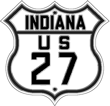
Today’s Road Trip, US 27. Indiana, in the beginning, only had three north-south US routes: US 27, US 31 and US 41. Part of this is simply the fact that Indiana is a lot taller than it is wide. The first one, US 27, skirted the eastern edge of the state. Today, US 27 has been decommissioned above Fort Wayne. That was a long time coming, since INDOT and MDOT (the Michigan counterpart) had agreed to move US 27 to multiplex with I-69.
When the final interurban was abandoned in 1941, one would have thought that, with the removal of all the rails and other facilities, any real traces of the old traction lines would have disappeared from the face of Marion County. But there are traces of these old routes. They exist in property lines that, for some reason, didn’t completely disappear. Today, I want to focus on some of these. In addition, there is at least one place in Marion County where, while it may not be directly related to the interurban, it does give a clue of what might have been.
1937 MapIndy aerial image of Acton, Indiana, in southeastern Marion County. Running from upper left corner to lower right corner is the New York Central (Big Four) Railroad through the town. Branching off to the east in the upper left, and then curving to the southeast in the lower right, is the line of the interurban through the town, which ran along Swails Street.
Acton. The interurban that ran from Indianapolis toward Shelbyville and Greensburg connected to this small village in the southeast corner of the county. The above 1937 photo shows the right-of-way still in place. It is clearly visible running through Acton after it left the right-of-way of the New York Central trackage that ran through the town. Once in town, it ran through the middle of Swails Street, which is typical of interurban lines at the time. The companies would get permission to actually run through town, instead of the possibility of bypassing it by following the steam railroad right-of-way. The two below Google Maps images show the property lines that are still in tact of that route.
Google Maps image of Acton, Indiana, at the west end of the old interurban cutoff into town. Image snipped 16 September 2019.Google Maps image of Acton, Indiana, at the east end of the old interurban cutoff into town. Image snipped 16 September 2019.
While the property had been sold to private parties after abandonment, for some reason, those property lines continued. Some of the adjacent properties were too small to do anything with. But once the right-of-way was disposed of, it didn’t take long for people to use two, or more, lots to build homes and other buildings that a few years earlier would have had interurban railroad tracks running through them.
Another old interurban right-of-way, not marked with property lines today, that was on the way to Acton was at Hickory Road. The interurban ran down the west side of Hickory Road. Before reaching the Big Four line, it crossed over Hickory Road in an arc to connect to the Big Four right-of-way. One thing that makes this site interesting is the fact that the property along the old traction line is now owned by the Indianapolis Power and Light Company, the local electric utility, as a substation. It makes one wonder if there was a power substation at that location providing power for the interurban line. Given the resolution of the 1937 image, it is hard to tell if there is a power generation station or just a house in that area at the time.
1937 MapIndy aerial image showing the interurban turn to the southeast at Hickory Road and the Big Four Railway. The red area shows the current property lines of the parcel, as well as the Indianapolis-Marion County property information available for that property.
On the west side of Indianapolis, around the area that the current Rockville Road separates from Washington Street, was the Danville line of the Terre Haute, Indianapolis & Eastern Traction Company. As shown in the below images, one from 1937, and two current Google Maps, the line is clearly visible in both the right-of-way, and the property lines. 1937 would have been right around the time of abandonment of this money losing line for the Indiana Railroad, the purchaser of the THI&E in 1930.
1937 MapIndy image of the Danville line of the Indiana Railroad, branching from (new) Rockville Road on the west and Washington Street on the east. This image also shows the new Washington Street bridge over Little Eagle Creek arcing away from the original structure, creating, as well, a new junction with (new) Rockville Road.Google Map image of the west end of the Indiana Railroad property lines from (new) Rockville Road east. Image snipped 16 September 2019.Google Map image of the west end of the Indiana Railroad property lines from Washington Street west. Image snipped 16 September 2019.
1937 MayIndy aerial photo of the Indiana Railroad traction line through what is now the grounds of both the Indianapolis Museum of Art and the International School near White River and Michigan Road.
The last area of the city that shows current property lines of old interurban routes, that I want to cover today, is the area of the Indianapolis Museum of Art and the International School on both sides of White River near Michigan Road. This line connected Indianapolis to Lebanon, and from there to Crawfordsville, Frankfort and Lafayette. A glance of Google Maps, in close up view, anywhere along Michigan Road from this point north shows multiple property lines that show the route of this traction line. (Here are four links to Google Maps that show what I am writing about: Here. Here. Here. Here.) The property lines across the IMA and International School are not available on Google Maps. But they are available on the MapIndy site, as shown in the images below.
MapIndy property line map of the area occupied by the current Indianapolis Museum of Art.
MapIndy image showing property lines in the area occupied by the current International School.
These are a few of the places that still hold a place in Indianapolis interurban history that, even though the infrastructure has been removed for many decades, still show where they were located. Other areas that still kind of exist are places where the old right-of-ways were paved over to expand roads (for instance, when old SR 431 [Madison Avenue] on the southside was expanded in the mid-1950s, the southbound lanes would use the old Greenwood line ROW from Shelby Street to Southport. There, the traction line crossed over the Madison Road to the east side of the road, to be replaced with the northbound lanes.) If you are interested in seeing more of these locations, in a 1937 context, I recommend checking out MapIndy, turning on the aerial photos of 1937 and turning down the current overlay. The 1937 photo is not complete, but it is a very good resource. MapIndy also has 1941 and 1956 aerials, just to name a few.
Before 1968, the second largest railroad company in Indiana was the New York Central. To most people that know railroads, especially in the Indianapolis area, know the New York Central from its 1930 acquisition of the Cleveland, Cincinnati, Chicago & St. Louis (Big Four), and the Peoria & Eastern (leased by the Big Four, but separate…at least heading west out of Indianapolis). The Big Four, covered here, covered a very large territory in Indiana. For all intents and purposes, Indianapolis was the center of that railway company. Six rail lines radiated from the Hoosier capital. But the New York Central itself had very extensive holdings in Indiana prior to 1930.
It is important to realize that the New York Central (NYC) itself was a consolidation of many railroads that officially came into being on 23 December 1914. That is the creation date of the corporation that, on 1 February 1968, became the “junior partner” in the merger with the Pennsylvania Railroad that became known as Penn Central. This is not to say that the NYC didn’t exist prior to that. The base part of the NYC, also called the New York Central, came into existence in 1853. But from 1 November 1869 to 23 December 1914, it was officially the “New York Central and Hudson River Railroad.” The NYC of 1914, and its constituent Indiana parts, are the primary focus of this post. The information included here comes from the ICC Valuation Reports Wiki of the NYC. To put it into perspective, this report shows 190 corporate entities that created the New York Central in 1914. This does not include railroads later added to the NYC along the way (that includes the Big Four).
Across northern Indiana, connecting Chicago to Detroit (among other places), was the Lake Shore and Michigan Southern (LS&MS) Railway. Entering Indiana along Lake Michigan from Chicago, the line crossed Lake, Porter and La Porte Counties before rumbling into St. Joseph County and South Bend itself. From there, line headed toward Elkhart, where the LS&MS split into two, one heading toward Michigan via Vistula, the other crossing Elkhart, Kosciusko, Noble and De Kalb counties before entering Ohio east of Butler, running along side what is now US 6.
The LS&MS that was part of the consolidation that created the NYC became a corporate entity of its own on 16 August 1869, with some of the constituent rail lines having articles of consolidation in Indiana as far back as 6 February 1835. This is the date of the creation of the Buffalo & Mississippi Rail Road company. The name was changed on 6 February 1837 to the Northern Indiana Rail Road company. Two companies of the same name (one in Indiana, one in Ohio) consolidated on 30 June 1853 to form a new company, of the same name. By this time, lines had been constructed between the Indiana-Michigan state line to South Bend (nearly 30 miles, 1851), between South Bend and the Illinois-Indiana state line (71.5 miles, 1852) and from Elkhart to Goshen (10.2 miles, 1852). The new company of 1853, its successor of, again, the same name, then its successor, the Michigan Southern and Northern Indiana Rail Road (created 19 May 1855) completed the line from Toledo to Goshen (122 miles) in 1857. This last company would consolidate with the Lake Shore & Michigan Southern Railway to create the LS&MS that would form part of the NYC.
Although there were predecessor companies, the Indiana, Illinois & Iowa (III) Railway of the State of Indiana came into being through consolidations on 9 January 1893. This company would build, in 1894, two lines: Knox to South Bend (33.4 miles) and a Michigan Central connecting branch at South Bend (2 miles). On 15 September 1898, the III of Indiana was consolidated with another company, just called the Indiana, Illinois and Iowa Railroad to form, again, the Indiana, Illinois and Iowa Railroad.
The Indiana Harbor Railroad Company was formed under the general laws of Indiana on 23 November 1901. This company built 100.8 miles of track in two sections: Indiana Harbor to Osborn, and Osborn to the Illinois-Indiana state line. The III and the Indiana Harbor were consolidated on 9 April 1906 to form the Chicago, Indiana and Southern Railroad Company. This would be another company that would be consolidated on 23 December 1914 to form the New York Central.
Two other companies became part of the New York Central during the period covered by the ICC Valuation reports (these were done for valuating the railroads that were taken over by the US Government during World War I). One started life as the Elkhart & Western Railroad Company on 5 June 1888. Although the date of the construction was not known, that company built a 12.1 mile line from Elkhart to Mishawaka. The other was the Canada & St. Louis Railway (formed through consolidation of the Indiana & Southwestern Railway and the Sturgis & State Line Railway on 17 November 1887). The Canada & St. Louis was sold at foreclosure, and reorganized as the Sturgis, Goshen & St. Louis Railway. Both of these companies were sold to the New York Central on 11 June 1915.
It should be noted that at the time of the ICC report, the New York Central consisted of a total of 3,718.73 miles of railroad lines (not including sidings and more than single track areas). The Big Four at that point consisted of 1687 miles. In addition to the Big Four, another Indiana property that would become, eventually, part of the NYC was the Michigan Central, which connected extreme southwestern Michigan to Chicago through LaPorte, Porter and Lake Counties, and a line that ran due north from South Bend to Three Rivers, Michigan.
Today’s trip back to 1926 covers SR 26, a route that connected US 31 south of Kokomo to Lafayette. Much of the original SR 26 still maintains that designation. This makes it one of the few highways in Indiana (mostly) unchanged from its commissioning to present day.
On 8 August 1933, the South Bend Tribune published a story about how many roads in the area were “excellent and pleasing concrete roads.” St. Joseph County was chuck full of them at the time. The paper had, in the article, posted five tours to make use of these great condition roads. Some of them would venture north of the border into Michigan. Those will be detailed here, as well, as they were a very important part of the transportation facilities of the area.
Each tour is directly quoted from the newspaper article.
Tour 1: “Drive on state road No. 31 (US 31) south to Lakeville, turn left on Quinn road, following it and Patterson road to the Bremen highway in Wyatt. Turn left on the Bremen highway, following this road into Mishawaka where pick up state road 2, turning left into South Bend.”
Today, the US 31 is now SR 931, or old US 31. Quinn Road in Lakeville is called Patterson Street. Quinn Road has also been cut off at the new US 31 when it was built. On the east side of new US 31, Quinn Road ends at Gumwood Road. Here, turning north, the next road to the east is Patterson Road. The Bremen Highway, at Wyatt, is now SR 331. This travels north until the US 20 bypass, where SR 331 turns east along the highway. The old SR 331 continues north to become Union and Church Streets to SR 933, also known as Lincolnway East. The return to South Bend from this point is very close to still extent, until the modern road travels across Monroe Street, since the original Lincoln Highway had been removed decades ago.
Tour 2: “Take state road No. 23, following it through North Liberty and Walkerton, continuing through Walkerton into Starke county where pick up state road No. 30 (US 30). Turn left and follow this road into Plymouth, the county seat of Marshall county. Turn left on state road No. (US) 31 and drive 24 miles into South Bend.”
SR 23 in Starke County connects directly to the old US 30, although it has been expanded over the years. Shortly east of the Starke-Marshall County Line, the new US 30 turns more directly east. This tour continues along the railroad on “Lincoln Highway,” the 1928 version of that venerable old road. Following this old road into Plymouth, the old US 31 is along Michigan Street in that city. Michigan Street north of the city has two names of historic importance: Michigan Road and Dixie Highway. Due to the construction of new US 31 near South Bend, the old road (at least the continually passable version) had been replaced and cut off north of Kern Road. But there is an interchange with the new US 31 at this point, allowing the traveler to, after entering the new US 31 north, to continue on into South Bend along the old road, now SR 933.
Tour 3: “Take state road No. 20, driving west to near New Carlisle, a distance of about 13 miles. Instead of passing through the underpass follow the concrete road a few rods straight ahead to Timothy road, turn right, following this highway to near Galien, Mich., where it intersects with Michigan road No. 60. Turn right on No. 60, which follow to Niles, Mich., picking up No. 31, turning right and following 31 to South Bend.”
The major change in this tour is at Galien, Michigan. Michigan SR 60 in this description had become US 12 (previously US 112). Just east of the St. Joseph Valley Parkway (now US 31), the old road turns onto Michigan SR 139 into Niles. After crossing the St. Joseph River in Niles, the old road follows Main Street to become Michigan SR 51. That road turns south toward South Bend. Here, while numbered 51, it was US 31 before it was moved to the current location. Michigan SR 51 turns into Indiana SR 933 at the state line. This continues past Roseland (as Dixie Highway) and Notre Dame (town named after the university of the same name located there) into South Bend proper.
Tour 4: “Take state road No. 31 to Niles where pick up Michigan road No. 60, turning right and following to Cassopolis, Mich. No. 60 enters the Cassopolis business district and makes a right hand turn. A short distance beyond this turn pick up Michigan road No. 62, turn right and follow No. 62 to the Indiana line, where pick up No. 23, which follow to South Bend.”
For this trip, return the way followed in trip 3 above along SR 933 and Michigan SR 51 into Niles. At Niles, the old road is called “Business Michigan 60.” Here, I will need some help from my Michigan roadie friends. Business 60 connects to what is now Michigan SR 60 east of Niles, also known as Detroit Road. I will have to have help in determining the original route of this SR 60 into Cassopolis. Current SR 60 connects to current SR 62 south of Cassopolis proper. It looks, to me anyway, that following the current 60 to O’Keefe Street, then south until that becomes Michigan SR 62. SR 62 travels through Edwardsburg before reaching the Indiana-Michigan State Line, where Michigan SR 62 becomes Indiana SR 23. The name of the road becomes Edwardsburg Highway and South Bend Avenue when it starts its southwesterly journey towards South Bend proper. The current road turns south on Eddy Street before crossing the St. Joseph River and the Lincoln Highway (SR 933) to become Sample Street to Business US 31/SR 931 at Michigan Street.
Tour 5: “Take state road No. 31 south to Ewing avenue. Turn left, following Ewing avenue to the city limits where the thoroughfare becomes the Dragoon trail, winding around the base of the hills, the highest point in St. Joseph county. Following Dragoon trail to Beech road, turn left, proceeding on Beech road to Lincoln trail or state road No. 2. Turn left, following No. 2 through Mishawaka to South Bend.”
The first several parts of this tour can still be followed today. Ewing Avenue turns into Dragoon Trail, which ends at Beech Road. Beech Road connects to Lincolnway East, which today is labeled SR 933. From there, the same description used in tour one above is followed.
And with that ends the article about touring the Michiana area on the concrete highways in place in 1933. Below is a copy of the article, edited into three columns to make it easier to post and to read.
On 7 January 1932, the Indiana State Highway Commission announced the plans to make the biggest expansion of the state highway system since its creation to date. The plan was announced in newspapers the next day. This particular post will be coming from the Richmond Palladium-Item of 08 January 1932. This particular expansion adds more than 1000 miles to the state highway system. According to Ralph E. Simpson, assistant director of the ISHC, this additional mileage will bring the state highway system to 10,000 miles.
Marion County, 1932, from the Indiana Official State Highway Map of the same year.
The new roads were called part of the “dotted line system,” due to the way they were depicted on the 1932 Indiana Official State Highway map (available here from the Indiana State Library). Most of the list below (which comes from the article in the Palladium-Item) is included on that map. Some roads, however, are not. The one that stands out the most is shown in the map to the left: a loop road around Indianapolis. This would be a forerunner, if it were built, of SR 100 built closer to both the route of the Dandy Trail (see Jim Grey’s posts here, here, and here) and the county lines than the ultimate plan of SR 100 (and as such, I-465, which replaced SR 100 officially) would be. I covered the beginnings of SR 100 here. Another standout is not because it is planned, but because it is under construction: the new US 31 (bypass) along North Meridian Street.
Without further ado, let’s cover the list as announced by ISHC:
Columbus to Bedford, via Norman Station. The number given to this project is definitely out of place. It was given the number SR 58 when it was completed. The road never did connect directly to Columbus, actually ending at US 31 (later SR 11) south of the city. When Interstate 65 was completed through the area, SR 58 would be moved even farther south.
Bloomfield to Worthington to Clay City to the Lewis Road west to Middletown. This project became two different state roads. First, SR 157 covered the section from Bloomfield to Worthington to Clay City. At Clay City, SR 246 completed the project from the Lewis Road west to Middletown. The section of SR 246 from Clay City (Martz) to Lewis is in place in 1932. The Middletown listed is now called Prairie Creek.
Willshire (Ohio) through Monroe and Bluffton to Peru. From SR 5 east to SR 527 and Ohio SR 54, this road was given the number SR 124. Ohio SR 54 and Indiana SR 527 would change its number with the arrival of US 33 to the two states. SR 124 is still in the same place, although it now ends at the state line suddenly.
Logansport north through Culver to US 30. SR 17 north out of Logansport is this project. It relates to another project mentioned later connecting Logansport to Kokomo, which started as SR 17, but ended up US 35.
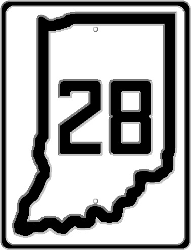
Union City to Ridgeville to Albany. Built as an extension to SR 28 from SR 67 (at Albany) to SR 32 (at Union City). It is still SR 28 to this day.
Kendallville north to state road 20. An extension of SR 3, which at the time ended at US 6. SR 3 would ultimately be extended to SR 120.
From SR 200 and SR 227, west through Lynn, Modoc and Springport to Pendleton. SR 200 is actually a continuation Ohio SR 200 on the Indiana side. The road in question would become the extension of US 36 from east of Indianapolis. More information about US 36 is covered here.
West of New Castle to McCordsville. This route became a daughter of SR 34, known as SR 234. More about SR 34 and “Daughters” here.
Warren on SR 5 west through Pleasant View to LaFontaine. The section from SR 105 and SR 9 was the only part of this plan built. It was, and still is, designated SR 218. Pleasant View is actually Pleasant Plain.
From SR 9 just south of Banquo, north through Andrews and Bippus to South Whitley. This project that relates to one above. This road became SR 105, which is where SR 218 ended.
Wheeling to Converse. Added as SR 21, this route is now parts of SR 18 and SR 19. SR 21 was completely decommissioned in Indiana, replaced by numerous state roads.
Markle to SR 3 south of Fort Wayne. This gets a bit complicated. In 1932, SR 1 existed in several places at once. One place it didn’t exist is from Fiat to Fort Wayne. SR 3 did, however, exist in that area…because in 1934, that road was changed from SR 3 to SR 1 when the subject road was added to the state highway system as SR 3. There was a four way intersection at Fiat involving three state roads: north, SR 3; west, SR 3 & 18; south, SR 1; and east, SR 18. What gets better is that at Roll, there was another four way intersection involving three state roads: north, SR 5; west, SR 18; south, SR 3; and east, SR 3 & 18. By 1934, Markle would be connected to Roll via the new SR 3, the SR 3 & 18 multiplex would be no more, SR 1 would take over SR 3 from Fiat north and SR 5 would end at SR 118.
Tipton to Noblesville. Added as SR 19, but not for more than a decade (at least in Tipton County). It wasn’t built in Hamilton County until 1953, and even then only to Cicero, with the portion from Noblesville to Cicero being under construction at that time. Since I have no maps available for 1954 and 1955, it is safe to assume that the road was completed in either of those years since it appears on the 1956 map.
Turkey Run to Danville through Russellville, Roachdale and North Salem. This road became the first “daughter” of US 36, being given the number SR 136. When US 136 was added to Indiana, this changed numbers to SR 236.
SR 15 east of Roann to SR 5. Built as an extension of SR 16. It still is to date.
SR 9 north of Columbia City past Tri-Lakes to SR 2 at Churubusco. Added as SR 205, this plan did not come into fruition until 1937.
Auburn east to Ohio SR 193 to Hicksville, Ohio. Added as an extension to SR 8. Ohio SR 193 would later become SR 18 in 1940.
From SR 1 north of Fort Wayne through Leo, St. Joe, Butler and Hamilton north to Michigan state line. This one is weird. It starts out as a road that connects to SR 1. By construction completion, it BECAME SR 1. Old SR 1 at that point became SR 427, a daughter of the now, non-existent, US 27 north of Fort Wayne.
Princeton to Union to SR 56. This project was an extension of SR 65. It still has that designation today.
Dillsboro, Cross Plains to Madison. This plan was to be the extension of SR 62 from Madison east to US 50 at Dillsboro.
Mitchell to Medora to US 50. This plan never came to fruition.
Linton to Sandborn. Extension to SR 59 south from Linton. Sandborn is located on SR 67.
Sunman to Harrison. This road would become a extension of SR 46 It wouldn’t last long, as it would be replaced with a more straight route between Penntown and New Trenton. The strange thing is that on the 1932 map, the dotted lines show both routes as additions…what is now SR 46 and what originally became SR 46. This road is no longer part of the state highway system.
Mooresville to Plainfield. The beginnings of the road that would become SR 267, which is covered more in depth here.
Bloomington to Helmsburg. A continuation of SR 45 that now ends at Bean Blossom. At the time, it ended at SR 35 (which actually used the SR 45 route from Bean Blossom to Helmsburg, then south on the Helmsburg Road to Nashville). SR 35 was rerouted, and renumbered as SR 135.
Washington to Haysville. A direct route was never built.
Brownstown, Uniontown, Dupont, East Enterprise. This road was never completely built, but its sections were all numbered SR 250. The two sections of SR 250 were shown to be connected by the dotted line on the 1932 map.
Bellmore to Waveland. This route became SR 59 when it was finally built in 1947.
Blocher to Austin. SR 256 would be the designation given this route.
Lexington to SR 62. According to the “dotted line map” of 1932, this road was to run due east (more or less) from Lexington to SR 62 near Chelsea. The road that was ultimately built connected more northeast as SR 356.
Bennettsville, New Albany, Elizabeth, Mauckport. This road, when construction started, would be designated SR 33. When US 33 expanded to Indiana, this road was renumbered SR 11.
From SR 62 south of Tennyson, through Selvin and Holland, to Huntingburg. This would be added as an extension of SR 161.
Rising Sun to Dillsboro. Became SR 262, which mostly still exists today.
Dana to Clinton. This road was never directly built. Dana is a town just north of what is now US 36 on the old B&O railroad. At US 36, going south, the ISHC added SR 71, connecting to SR 163, already in place, near Klondyke (Blanford). SR 71 was added north of US 36, connecting Dana to SR 63 near Newport.
Newburg to Boonville. The designation of this plan became SR 261. It connected SR 66 to SR 62 between those two towns. It still does, even though SR 66 now bypasses Newburgh.
Mishawaka, through Bourbon, to SR 25. When completed, this became SR 331. More recent information about SR 331 is covered here.
Kokomo to Logansport. This road, while ultimately built, wasn’t added until 1940. When US 35 was brought to Indiana, it followed (much like it still does for a while) SR 22. It would follow SR 22 across to SR 29, then north on SR 29 into Logansport. This route would be built as an extension of SR 17. Well, sort of. When construction was complete, it would be US 35.
Burlington to Lafayette. Planned as an extension to SR 22 that would connect Kokomo directly to Lafayette. It was never added to the state highway system.
Merrillville, through Shelby and Goodland, to Fowler. This road would become SR 55 north from Fowler to Crown Point, then SR 53 from Crown Point to US 30. SR 55 was built to the EAST of this section of SR 53 from Crown Point north. This lasted until 1941, when SRs 53 and 55 were swapped.
Shelbyville to Andersonville. This road became SR 244, connecting Michigan Road (SR 29/US 421/Old US 421) to US 52 at Andersonville. The 1932 plan, according to the Indiana Official State Highway Map of that year, involved the road that follows, as well.
1932 Indiana Official State Highway Map showing the future SR 244 and SR 121 from Michigan Road (SR 29) through Andersonville to Laurel and Connersville.
Connersville to US 52 via Laurel. This road would become, and still is, SR 121. According to the 1932 official map, this road actually was to connect to US 52 at Andersonville (see road above). The plan was to use what is now Old US 52 (which was never US 52, discussed here) to connect US 52 to Laurel. That never happened. SR 121 connected straight to US 52 along the Whitewater River.
Brookville to Penntown. This road was never built. A direct route would be replaced with a trip down SR 56 (now SR 1) from Cedar Grove to St. Leon then across what would become, when built, SR 46.
Leavenworth via Marengo to state road 150. Although this road is north-south, it was added as an extension of SR 66. It still is today.
Edinburgh to SR 35, via Trafalgar. This road, while originally not ever making it to Trafalgar, would become SR 252. The history of this road was covered here.
Morgantown to Martinsville. Another part of the route that became SR 252 mentioned above. Ultimately, SR 252 and SR 135 would multiplex between Trafalgar and Morgantown.
New Haven east to Ohio state line. This state road would begin, actually, near the point where US 24 and US 30 go there separate ways on their way to Ohio. When it was added to the ISHC system, it started as SR 230. This connected to Ohio SR 113. Between 1939 and 1941, the number was changed to SR 14. In 1986, Ohio changed SR 113 to SR 613. This portion of SR 14 would be removed in 1993 or 1994.
Crawfordsville via Wingate to Attica. This road would become part of SR 55. In 1934, SR 55 was added to the state highway system connecting Crawfordsville to Wingate at SR 25. This would survive until 1976.
Perrysville to Illinois state line near Danville. Using the Danville-Perrysville Road, this section would become, and is still part of, SR 32. In the beginning, this was an orphaned part of that state road. Eventually, it would be extended across the Wabash River to Crawfordsville, connecting to the rest of SR 32. The extension of SR 55 from Wingate to US 41 south of Attica, which still exists today, was completed in 1935.
Matthews north to SR 18. At the time, Matthews was on SR 21, a road that would later be completely replaced (eventually) by US 35. This road would become a daughter of SR 21, called SR 221. This road would also be part of SR 22, and later SR 26, where the 22 and 26 came together heading for Hartford City. SR 26 headed south from this intersection, SR 22 north. SR 221 would eventually be extended all the way to Huntington. The section of the road mentioned in this description, from Matthews to SR 18, was removed from the state highway system in 1972 as SR 221. From SR 22 north to SR 18 was added back into the system as SR 5 in 1986. Both the SR 22 and SR 26 portions still exist. At the junction of the two is where SR 22 now ends, where it has since 1977.
SR 5 extension: US 30, through Cromwell, to SR 2. Strangely, this road, which still exists with minor changes to improve traffic flow, connected the original Lincoln Highway (US 33, then SR 2) south of Ligonier to the replacement Lincoln Highway (US 30) north of Larwill. The one change in the road that is quite obvious is at the north end of the described section. At US 33, the road was curved to the northeast to make an intersection with a gentler curve on the original Lincoln Highway.
Maxville to Santa Claus to state road 162. This one would be hard to place if someone is looking through Google Maps for Maxville. The Maxville mentioned in this description is an unincorporated community in Spencer County. It is located along SR 66 near the place where the Anderson River enters the Ohio River. The town is shown on maps from the ISHC and its successors. The direct route mentioned in this article would become SR 245 when it was built. 1951 would see an addition/extension to SR 245 from SR 70 west of Newtonville south to Grandview. Between 1953 and 1956, SR 245 was rerouted due south from Lamar, removing the section directly to Maxville from the state highway system.
Azalia to Elizabethtown. This addition would end up with several designations in its history. Today it’s part of US 31. More information can be found on my US 31 at Columbus post of 26 April 2019.
When both US 50 and US 150 came into being in October 1926 in Indiana, both roads connected at Shoals. There, US 150 ended its journey from New Albany at its mother road. From there, US 50 would connect to Loogootee on its way to Vincennes. But the current road that connects Loogootee to Shoals didn’t come into being until the early 1930s. And as such, this became one of many reroutes on one of the most bypassed state roads in the entirety of Indiana.
Google Maps image of the area between Loogootee and Shoals, Indiana. Scale of image is to take into view both current US 50/150 and the original route of US 50. Image was snipped on 07 September 2019.
Looking at a map of the area, there are two routes, more or less, between the two towns. First is the current route of US 50 (and US 150…which would come later). The other is the original route of US 50, using SR 550 and Spout Springs Road (marked on the map above with the 63 inside a square). The current route of US 50 was a large construction project that was mostly completed in 1930.
An article in the Jasper Herald of 24 April 1931 explains that “highway bids will be open on May 5th.” The part of the article that applies here is the “6.7 miles of 18-foot pavement” on US 50. It is noted that the new pavement “will be laid on a heavy fill completed last year.” The fill was created from a “70-feer deep (cut) through solid rock, said to be the deepest cut ever made on an Indiana highway.” The cut and fill lead to a hilly, be it somewhat more gradual, travel across this section of the highway.
The newspaper also points out that the paving of this section of the road will complete US 50 paving between the Illinois-Indiana State Line (on the bridge over the Wabash at Vincennes that connected to Main Street in that town – not the current Vigo Street bridge) and Shoals. But there were three things that had to be completed before this contract came up for building. First, the fill had to settle. Second, a bridge over the Baltimore & Ohio Railroad was built. And third, a bridge over Boggs Creek needed to be built.
This project helped make US 50 “probably the most expensive road work ever undertaken in Indiana.” This was mostly due to the fact that US 50 traverses some hilly country. The hills and valleys of that area of the state created flooding problems in the low lying areas. It is reported that “the new pavement will be above the maximum flood limit.”
1932 saw the completion of the new US 50 between Loogootee and Shoals. The old route of US 50 through the area was completely removed from the state highway system. It would stay that way until the designation of SR 550 in 1949. The multiplex of US 50 and US 150 between Shoals and Vincennes would be created in 1935, when it was decided that US 150 would continue to Vincennes and Terre Haute. From Terre Haute, it would replace SR 46 out of town and into Illinois.
Today, we look at the third (numerically) United States road in Indiana: 24. The road crossed Indiana on its journey from Michigan to Colorado.
Entering Indiana from Illinois west of Kentland, the road made its way via Logansport, Huntington, and Fort Wayne temporarily ending at New Haven. This was because the route hadn’t been decided upon when it came to connecting to the continuation of the road in Ohio heading towards Toledo.
1908: Indianapolis was already an electric traction, or interurban, center. Four years earlier, seven interurban railroads completed the largest interurban state in the world, the Indianapolis Traction Terminal. Also, a new interurban line was being constructed to connect Indianapolis to New Castle, then ultimately (according to the plan) to Toledo. This traction line was to run along side the Cleveland, Cincinnati, Chicago & St. Louis (Big Four) Railway Springfield Division tracks that almost make it into New Castle proper. It would become known as the “Honey Bee line.” At the same time, a line was proposed connecting the Terre Haute, Indianapolis & Eastern line at Greenfield with the Honey Bee line at Maxwell.
But things weren’t that smooth for what became the Indianapolis, New Castle & Toledo (INC&T) Traction Company. A subway was built by the traction company under Rural Street on the northeast side of Indianapolis, at the company’s cost, in 1905. Then, the company fell into receivership for two years. In 1909, surveyors started working again on the line. At the New Castle end, most of the track had already been put in place. “When the track was laid in the city proper no curves or “Y’s” were put in, and these will now be placed so that cars can be run around the public square on a loop.” More track was put in place by the Indiana Union Traction Company, ultimate owner of the Honey Bee line. The new company gains three blocks of track free of charge, as it was put in place by the Indiana Union before that company lost its franchise rights in New Castle. (Source: Indianapolis News, 15 September 1909, pp 7)
This was after a protest of residents of Brookside Avenue to the placement of wooden poles for the purpose of trolleys and interurbans along the recently opened street. The Indianapolis City Board of Works insisted that the then Indianapolis, New Castle and Winchester (INC&W) recommended that the line be installed on Brookside Avenue instead of the company desired Massachusetts Avenue. The company stated that the wooden poles were a temporary thing, since the board would insist on iron poles. (Source: Indianapolis News, 08 October 1904, pp 24)
26 January 1910 saw the first train to be run on the Honey Bee line. The construction of the line started at New Castle, working its way west. At 1000 that morning, the first train left New Castle rumbling its way along to the end of the line at Shirley. This trip consisted of Chief Engineer White and eighty business and professional men. About 500 people gathered in downtown New Castle to witness the first train. The newspaper article ends with the mention “no regular schedule will be maintained for some time.” (Source: Indianapolis News, 26 January 1910, pp 4)
“The New Castle traction line is at last a reality.” This is the first line of an article that appeared in the Hancock Democrat of 07 July 1910. The completion of the Honey Bee line would bring the total of interurban lines at Indianapolis to 13. Work on this line took over half a decade from granting the franchise to beginning of operation.
One of the benefits of the coming of the INC&T to the small towns along the line was the coming of electrical service. According to the Indianapolis News of 18 August 1911, the town of Shirley “is now enjoying electric street lighting.” Twenty 250-watt Tungston lamps, with current provided by the INC&T, were place in the town. But, “owing to the improvement having assumed large proportions the city has been compelled to defer until next year the construction of what is termed ‘Bowery sewer.'” I guess a typical case of “you gain some, you lose some.”
Construction was not smooth sailing, either. In May 1912, a subcontractor that built 18.5 miles of the track on this line was suing the contractor for whom he was doing the work for nonpayment. Francis E. Seagrave, of Toledo, was giving the contract to build the track from New Castle to Indianapolis. The contract called for Seagrave to provide material and prepare the roadbed. Some work was subcontracted to William Love, who was to be paid $380 a mile, plus more for installing switches. Love also claims to have done some excavating and grading. According to the traction company itself, it would not be involved in the suit, since the company paid Seagrave for the work. Love claims that Seagrave owes him $8,308.60, including six percent interest, from the time that the INC&T entered its first receivership, under the Union Trust Company, on 5 November 1907. Another $2,070.16 for grading and other work was requested. That brought the suit total to $13,000. (Source: Indianapolis News, 04 May 1912, pp 2)
As is typical with the interurban lines in Indiana, the INC&T spent quite a bit of time in receivership. In February 1926, a suit was filed in Muncie asking for the traction company to be placed under a receiver, and that Arthur W. Brady, president and receiver of the Union Traction Company be that person. But, by this time, the word Toledo had been changed in the name to “Eastern,” making the Honey Bee line the INC&E. This suit was filed by the Fidelity Trust Company, a trustee and owner of bonds of the company to the tune of $1.5 million. The suit was moved from the Delaware circuit to the Madison circuit, at Anderson, to other Union Traction company suits were being heard. (Source: Indianapolis News, 08 February 1926, pp 28)
In 1930, the INC&E, along with all other Union Traction lines, the Terre Haute, Indianapolis & Eastern lines, an other traction lines in the state, fell under the control of Midland United Company (also known as Midland Utilities Company) as the Indiana Railroad. Midland, and hence the Indiana Railroad, were owned by Samuel Insull, a Chicago business man that made his fortune (and lost it) in electrical utilities and railroads. One of the few lines that were owned by “Insull interests” still exists today: the Chicago, South Shore and South Bend Railroad. The Great Depression did great harm to Insull, and the electric traction companies that he owned.
1931 saw the use of this line expanded as the THI&E Indianapolis to Dunreith section was abandoned. Law arguments before the abandonment, by the city of Greenfield, were made that the Indiana Railroad was rerouting all freight traffic through New Castle, whether it be through Muncie or Richmond. This caused, according to the argument, that traffic counts and revenue on the Indianapolis to Richmond line were artificially lowered to encourage the abandonment of the section to Dunreith. I covered this in another post here.
Less than 30 years after it was constructed, the Honey Bee line was abandoned by the Indiana Railroad. It was reported on 7 June 1937 that the line had been “abandoned recently.” Even though the Big Four line ran basically along the same right-of-way, the Indiana State Highway Commission did show some interest in the rail route. “A new direct highway connecting Indianapolis and Newcastle over the right-of-way of the abandoned traction line of the Indiana Railroad is being considered by the state highway commission, Earl Crawford, chairman, said today.” (Source: Indianapolis News, 7 June 1937, pp 4) However, due to the Indiana Railroad’s financial condition, title of the right-of-way would have to be acquired from the receiver of the line, Bowman Elder. In the end, that did not occur. And ultimately the entire right-of-way for both railroads (electric and steam) would fall into the hands of the property owners along the routes when the Big Four line was abandoned, as well.
The last of the line would be abandoned by the Indiana Railroad, approved by the Interstate Commerce Commission and the Indiana Public Service Commission, in July 1940. This section would be from Muncie to New Castle. “The abandonment will become effective as soon as the Indiana railroad is in a position to substitute truck and bus service over the interurban route.” (Source: Richmond Sun-Telegram, 6 July 1940, pp 2) As of the writing of the source article, IPSC action on the request to run motor vehicles had not been taken.
Back in February 2019, I did a blog entry about the fact that the most of the original state roads in Indiana were turned over to toll road companies for their maintenance. That post is available here. In the late 1880s to the late 1890s, each of the 92 counties had the right to have their citizens vote on whether or not those counties would take back the toll roads. This would make them free county roads. Well, sort of. Today I am going to focus on a newspaper editorial piece from the Hagerstown Exponent of 02 April 1890 making the case for the county buying the roll roads.
And it all starts with the line “next Monday the regular township election will be held, and in addition to the election of regular officers the question of buying the toll roads is to be voted upon.”
The preliminary work necessary for the purchase had already been done. In order for the county to buy the toll roads, there had to be an appraisement of the road property. The sum of money to be paid by the county had to be agreed upon by both the county and the shareholders of the toll road company. This, in itself, was never a guarantee. After all, let’s face it. Even the National Road was privately owned at this point. This was not a case of eminent domain. These were companies to be purchased and, basically, put completely out of business for the sake of free transportation.
The next point made is that the money used to buy the toll roads would be paid for by a tax on all the people of each governmental township. It is also mentioned, in the editorial, “that it will not cost the average property holder as much to help buy the roads as it will to pay toll.” The argument is made that for the people of Hagerstown, this expense is a no brainer. “And so far as the interests of Hagerstown are concerned, there can be no doubt as to which way would be best. Nearly all the people who live around us a few miles out, can go to other towns free of toll, while if they come here they must pay toll of go a considerable distance out of their way, and often over bad roads.” With the removal of the tolls, the argument is that an increase in trade will follow.
Hagerstown is in Jefferson Township, Wayne County. In 1890, at the time of this editorial, the taxable property of the township comes to $1 million. The estimated cost of the toll roads in the township comes to $4,000. This puts a tax increase for the purchase at four mills, or 40 cents for each $100 of assessed value. But, according to the article, that cost is paid over a five year period. So each year, the tax paid for the roads would not by 40 cents yearly, but eight cents yearly. This value is far below the cost of paying the toll road for use. For farmers, with more taxable property, and hence more tax, the estimated cost of the tax increase over five years is less than the cost of using the toll road at only one toll gate. And that is without bringing any kind of freight, or even livestock, along for the trip.
The case is then made that Jefferson Township has to vote for the purchase, if for no other reason than the fact that the surrounding townships in Wayne County also have the right to vote for the buying of the toll roads. (Those townships: Dalton, Perry, Clay, Harrison, and Jackson [in Wayne County], and Liberty Township in Henry County.) If, for some reason, Jefferson Township residents vote not to buy the roads, but another connecting township does, then people will simply go around Jefferson Township. This takes trade away from Hagerstown, and money away from the township. Also, because the tax to pay for the toll roads will be assessed county-wide, Jefferson Township will be paying a tax for free pikes surrounding them, and still paying a toll to use the local roads.
Not only would the township be responsible for the upkeep of the newly purchased roads, the incorporated towns along the route would be as well. This allows the farmers along the route to not be the only ones responsible for the upkeep of the roads if they stay toll roads. “Under present law farmers must keep up their roads without any help from towns, cities or railways, and if they travel on the pikes, they must pay toll.” So, not only are the residents along the road responsible for maintenance, they are responsible for paying to use the very road they keep up.
Images of a street sign west of Hagerstown, Indiana, at SR 38 and Turn Pike Road, the original Richmond-Crawfordsville State Road. Image courtesy of Google Maps.
Needless to say, the editorial staff of the Hagerstown Exponent is all for the purchase of these roads. The major road connecting Hagerstown to the rest of the state was the Richmond-Crawfordsville State Road, connecting Richmond, Hagerstown, New Castle, Pendleton, Noblesville, Westfield, Lebanon and Crawfordsville. Part of this road was covered from a Pendleton point of view here. To this day, the road west of Hagerstown is still called “Turnpike Road.”
Starting in the early 1930’s, the Interurban era was beginning to come to an end. This coincided, yes, with the start of the Great Depression. This was especially brutal to the electric traction companies in Indiana, as most of them became part of one entity: the Indiana Railroad. Since the Indiana Railroad was classified as a utility, any changes to the routes of the traction lines had to be approved by the Indiana Public Service Commission (IPSC). This is the tail of one such IPSC commission hearing.
As reported in the Indianapolis News of 18 September 1931, there were plans put before the IPSC to abandon the Terre Haute, Indianapolis & Eastern (THI&E) line from Indianapolis to Richmond between Indianapolis and Dunreith. Trains going from Indianapolis to Richmond would take the “Honey Bee” line (which ran next to the Big Four Springfield Division line) through Mount Comfort, Maxwell, Wilkinson, Shirley, and Kennard to New Castle. From there, the plan was to use the THI&E New Castle branch line that connected New Castle to the Indianapolis-Richmond line at Dunreith.
One community was really not wanting any part of this plan: Greenfield. Lawyers for the city were hoping that service could be continued using the “new” one man cars. The Indiana Railroad, owner of a great number of interurban lines in Indiana, argued for the pan detailed above. According to Greenfield’s lawyers, the abandonment plans were in place in early June, according to an “off-the-record” letter written by the Executive Vice President of the Midland United Company, operator of the Indiana Railroad. At the time, the Indiana Railroad was technically in the charge of a receiver, having filed for bankruptcy in 1930. As such, the plan could not be acted upon without permission of the courts.
Lawyers for the Indiana Railroad were arguing that the earnings from the Greenfield section of the line (Indianapolis to Dunreith) were far below profitability. William A. Hough, Special Counsel for the City of Greenfield, asked specifically for earning numbers for Indianapolis-Dunreith segment and the Indianapolis-New Castle line. The railroad could produce the numbers for the former, but responded “we never broke up our accounts between these points” for the former. Hough responded “you did it from Indianapolis to Greenfield.”
Freight service on the Indiana Railroad was brought into question, as well. The railroad was accused of rerouting freight through New Castle, using the pending plan, in an effort to cut the earnings numbers for the section being planned for dismantlement. Hough asked “was there any reason for sending that freight twenty miles out of the way?” Railroad officials couldn’t answer the question to Hough’s expectations. But the auditor for the railroad testified that “he had ‘so many figures’ to handle that he was not able at the moment to say how much freight from New Castle had been ‘split up,’ as suggested by Hough.
The Indiana State Highway Commission was also involved in this particular hearing. William J. Titus, ISHC Chief Engineer, testified that the “widening of the National Road east of Cumberland had been postponed partly because of the fact that some of the right-of-way was occupied by the traction.” Although, he also admitted that discussions about building materials helped cause the delay in the expansion of US 40. Titus also admitted that there were no current plans for the ISHC to do anything with the National Road from Greenfield and Richmond.
The hearing for this plan would end up being continued to 24 September 1931. I couldn’t find any information, so far, about that hearing. Suffice it to say that, according to the Indianapolis News of 05 February 1932, lawyers for the railroad had approached the City of Greenfield about disposition of the “tracks, poles, lines in Main Street, real estate and a high tension line which crosses Greenfield east and west.” According to the charter allowing the original traction company to build through Greenfield, that property would revert to the city should the service be discontinued for a period of thirty days. This was a “plan B” pending the appeal of the IPSC decision ordering the abandonment of the line.
Of the original renumbered state roads, one of the shortest was SR 22. It stretched from US 41 at Boswell to US 52 at Montmorenci. What was unique about this particular state road segment is shown in one of its segments current road number. The entire route of SR 22 was the original US 52. In 1926, the ISHC was already in the process of replacing the US route with a new build. The original SR 22 segment from Boswell to US 52 just north of Templeton is now called SR 352.
In the early 20th century, Indiana, and Indianapolis in particular, was the center of electric traction, or interurban, railroad activity. This was culminated with the building of the largest traction terminal in the United States on Market Street west of Illinois Street. The Traction Terminal acted as a Union Station for interurban trains. But little is known today, without being a serious researcher, about where the traction tracks were and where they went. The source of this information comes from a 1917 map of Marion County available here from the Indiana State Library Digital Collections online.
Along with each map and description, a list of some of the stops is included. It is commonly misunderstood that all stops were numbered. They weren’t. A prime example is on the south side of the city, where it is obvious where the stops were by the names of the roads. Stop 8 Road (now Edgewood Avenue) is 1/2 mile north of Stop 9 (now Banta), which is 1 mile north of Stop 10 Road. Between Stops 9 and 10 was Southport, which had no number.
The most extensive traction company in the central part of Indiana was the Terre Haute, Indianapolis & Eastern Traction Company (THI&E). This company owned trackage that ran from Indianapolis (and Terre Haute) to multiple destinations. The THI&E would ultimately end up owning, in Marion County, the Traction Terminal and the Indianapolis Street Railways, or the city trolley system that ended up, much later, a bus system taken over by Metro, now IndyGo.
THI&E: DANVILLE LINE
The Danville Line used Indianapolis street car lines to a point near what was Central State Hospital. From there, it basically went “cross country” to a point where it connected to the old Rockville State Road (Rockville Road today), close to the survey line that the old state road follows. Keep in mind that the old road connected to the National Road, Washington Street, at what is now the intersection of Holt Road and Washington Street. What is now Rockville Avenue is the original Rockville Road. Stops included Lynnhurst, Statefarm, Stop 4 at High School Road, Stop 6 at Girls School Road, Stop 8 at Country Club Road, and Stop 9 at the Hendricks-Marion County Line.
1937 Aerial photograph of the THI&E Danville Line from Fleming Street to Washington Street. The straight line running across the photo is the location of the trackage. Photo courtesy of the City of Indianapolis-Marion County website MapIndy application.
THI&E: INDIANAPOLIS, CRAWFORDSVILLE & WESTERN LINE
This traction line followed the West Michigan Street railway line until it met the Big Four/Peoria & Eastern Railway line. The traction company then ran along the northern edge of the right-of-way of that steam railroad. West of what is now Speedway, it would be placed between the P&E and the old Crawfordsville Road (which, in 1917, was also part of the Dixie Highway). Stops included Stop 4 known as Olinville, Stop 5 across the Crawfordsville Road (now 16th Street) from the Indianapolis Motor Speedway, Stop 9 (Rancks) at High School Road, Stop 11 at Girls School Road, and Stop 13 at Country Club Road.
THI&E: LEBANON LINE
This traction line left the city at 38th Street along the Michigan Road, also known as Augusta Road. It ran along the western edge of that road. Stops included Mount Pleasant at Grandview Avenue, Stop 5 near 62nd Street, Stop 6 at Westlane Road, Stop 7 at 79th Street, Stop 8 at 86th Street, and County Line at 96th Street.
INDIANA UNION TRACTION COMPANY: LOGANSPORT LINE
The Indiana Union Traction Company’s line ran north out of Indianapolis, turning north-northeast through Carmel, then turning to eventually reach Logansport.
The line used street car stops along Massachusetts and College Avenues to 63rd Street in Broad Ripple, which at the time was the northern end of the City of Indianapolis.
Stops on the interurban part of the line included Lilley’s at 71st Street, Williams Creek at 75th Street, Nora at 86th Street, Whitsels at 91st Street and County Line at 96th Street.
INDIANA UNION TRACTION COMPANY: ANDERSON LINE
The IU Traction company also owned the interurban line connecting Indianapolis to Anderson and points northeast of there. This line would serve Fort Benjamin Harrison. It ran along the northern edge of the right-of-way of the Big Four’s Cleveland main, or “Bee Line.” It would follow 38th Street until it met the Bee Line. Stops included Thompsons at Emerson Avenue, Shadeland at the mid point between Shadeland Avenue and 46th Street (roughly 42nd Street), Days near 56th Street, Siding at Fort Harrison (the station at this point still exists as a Mexican restaurant), Oaklandon, and Riley which was less than 1/2 mile from the Hancock-Marion County Line.
INDIANAPOLIS, NEW CASTLE & TOLEDO ELECTRIC RAILWAY
The INC&T line ran along the Big Four’s Springfield Division tracks towards its named cities. Stops included Stop 4 at Arlington Avenue, Stop 5 at Shadeland Avenue, Stop 6 at Franklin Road, Stop 7 at 30th Street, Hunters Station at Post Road, and Stop 10 also known as County Line.
THI&E: RICHMOND LINE
This line connected Indianapolis to Richmond along the National Road (Washington Street). In cooperation with a company in Ohio, service from Indianapolis could reach Dayton and Columbus (Ohio). It was the failure of the Dayton connection that cost most of this road’s traffic counts. Because the National Road from Irvington east had been built up from the early years of the state, the six mile stretch from Irvington to the Hancock-Marion County line contains more stops than any other traction line in the county. Cumberland, for instance, is basically Stop 18. Other stops included Stop 2 at Edmondson Avenue (Warren Park), Stop 6 at Franklin Road, Stop 9 at Post Road, Stop 13 at Mitthoeffer Road, and Stop 15 (called German Church) at German Church Road.
INDIANAPOLIS & CINCINNATI: CONNERSVILLE LINE
The Indianapolis & Cincinnati owned two lines out of Indianapolis, both sharing the same right-of-way along Prospect Street to Stop 1 at Sherman Drive. The Connerville line continued along the line of Prospect Street through the southern edge of the Pennsylvania Railroad’s Hawthorne Yards, following the eastern line out of those yards to the northern right-of-way of the Baltimore & Ohio Railroad that parallels Brookville Road. Stops, other than Stop 1 listed above, included Stop 2 at Emerson Avenue, Stop 3 at Arlington Avenue, Hawthorne at Fisher Road, Fenton at Franklin Road, Stop 5 at Post Road, Stop 6 at Bade Road, Stop 7 at German Church Road, and Julietta near the Hancock-Marion County Line.
INDIANAPOLIS & CINCINNATI: CINCINNATI LINE
The other I&C line split from the Connersville line at Michigan Road. It then followed the Michigan Road to Hickory Road. Traveling south on Hickory Road, the traction line turned to follow the northern right-of-way of the Big Four Cincinnati Division. Stops included Stop 3 at Minnesota Street, Stop 4 at Raymond Street, Five Points, Stop 10 at Franklin Road (then known as Wanamaker), New Bethel (now known as Wanamaker), Stop 12 at Thompson Road, Hittle at Edgewood Avenue, Stop 15 at Southport Road, Acton Park, Acton, and Stop 16 at the Marion-Shelby County Line.
PUBLIC SERVICE COMPANY: GREENWOOD LINE
The first interurban line to branch from Indianapolis was the Greenwood line. Following Shelby Street from the city limits at Troy Avenue, south to Madison Avenue. It then paralleled Madison Avenue to the Johnson-Marion County Line. This line has two other interesting points: 1) when the Federal government ordered the separation of the power plants supplying the traction lines and the traction lines, the owners kept the electric company. It became Public Service Indiana, which is now part of Duke Energy. 2) In addition to the first interurban to Indianapolis, it was also the last. That story can be read here. Stops along this route were located, at least from Stop 8 south, generally at roads of the same name. This is true today with Stops 10, 11, and 12. Other stops included Stop 1 at Perry, Stop 4 at University Heights, Stop 5 at Longacre, Stop 6 at Thompson, and Stop 7 at the town of Edgewood which is now Epler Avenue. The current Stop 13 Road is actually located 1/4 mile north of the actual Stop 13, which was at the Johnson-Marion County Line.
Across the county line, as an aside, at Stop 14 (Frye Road) was a very large picnic ground and recreation park. It was called Greenwood Park. It is still called that, but it includes the word “Mall” in its designation.
THI&E: MARTINSVILLE LINE
The Martinsville line shared the right-of-way with the Pennsylvania Railroad’s Indianapolis & Vincennes Railroad. Stops included Maywood (at Tibbs Avenue), Stop 3 at Mann Road, Stop 4 at Lynhurst Drive, Stop 5 at Hanna Avenue, Stop 7 at High School Road, Valley Mills (originally called Northport – because it was north of Southport!), Stop 9 at Mendenhall Road, and Camby.
THI&E: TERRE HAUTE LINE
The original line of the Terre Haute, Indianapolis & Eastern. The line followed Oliver Avenue until it reached the Pennsylvania Railroad’s St. Louis mainline, which started life as the Terre Haute & Richmond. Stops included Stop 1 at Warman Avenue, Stop 3 at Morris Street, Indianapolis Heights at Lynhurst Drive, Gun Club at Minnesota Street, Ben Davis, Stop 7 at Girls School Road, Stop 8 at Hoffman Road, Bridgeport, and Stop 10 at the Hendricks-Marion County Line.
Thus covers the entire interurban network radiating from Indianapolis.
When the Indianapolis Southern Railroad was authorized to enter the city, the company built their railroad yards on land south of Wisconsin Street along the east bank of the White River. The White River, at that time, included an oxbow channel that curved east of the current channel. This oxbow also caused what is now West Street south of Wisconsin Street to ends at the river. This also shows the reason for the curving route of Senate Street south of Wisconsin Street, as well.
Map of the White River, and pending plans to straighten the channel, from the Indianapolis News, 16 May 1925.
When the Indiana State Highway Commission added SR 22 to its inventory, around 1923, the road would enter Marion County along the old Bluff Road from Waverly to Meridian Street near where the Indianapolis Belt Railway crossed the old roads. At the time, due to the course of White River, the West Street connector did not exist (the section from Wisconsin Street south to where it becomes Bluff Road). With the Great Renumbering, this route would become SR 37. In 1930, the northern end of the Bluff Road (at one point named Bluff Avenue) joined SR 35 as Meridian Street became part of the state highway system.
In 1925, the Indianapolis Board of Works laid out a plan to move the channel of the river, straightening it to match the current channel. As shown in the Google Maps image below, the river was moved 1/4 mile to the west. (Notice that how the old channel of the river can be seen by the route of the railroad tracks and location of the Indiana Railroad yard.)
Indiana Railroad yards and White River. Image courtesy Google Maps, snipped on 27 August 2019.
Indianapolis Union (Belt) Railway bridge over White River’s old channel. Image courtesy of the Indianapolis News, 16 May 1925.
When the Indianapolis Belt Railway was built in 1873 from the Jeffersonville, Madison & Indianapolis west, it was a low level track, at grade from the JM&I to connect to railroads on the west side of the city. The bridge over the old channel was closer to the river, height wise, than the current routing of the Belt.
The City of Indianapolis was also in the midst of a track elevation to allow better road traffic. Between 1916 and 1921, the tracks entering Union Station were elevated, finally allowing better access to the south side of the city. (With 200+ trains arriving at Union Station daily, getting south of the station required the use of a tunnel, on Illinois Street, or a high level bridge on Virginia Avenue. The traffic situation was also complicated at the Belt, especially, again, on the south side.
The Indianapolis Union Railway, owner of both Union Station and the Indianapolis Belt, planned a track elevation project for the belt. With the plans of the new White River channel, that elevation would start west of White River east to between Meridian Street and Madison Avenue. The length was to allow for elevation of the tracks and to keep grades at a relative low number.
The bridge over the new channel would be extended a bit to allow a new West Street connector to be built under the railroad, allowing West Street to be extended from the old river channel to at least Raymond Street. As an aside, the original plan for this elevation would have only built a bridge over Meridian Street, but not Bluff Road. The ISHC would come to have a problem with this. In the end, it didn’t happen that way.
In the end, the state would take over the West Street connector, removing the odd angle intersection at SR 35 (135) and SR 37 (Meridian Street and Bluff Road). The Belt was elevated for over a mile, allowing a higher crossing of the river and access to the now landlocked Illinois Central (now Indiana Railroad) yard.